| Photographs of Perth, Western Australia | |||
Cadoux Cadoux is a small and neat community located on the Dowerin - Kalannie Road in the northern wheatbelt district and is about 211 kilometers north east of Perth. The town is famed for its 1979 earthquake. It is named in memory of Donald Cadoux, an early settler who died in Word War 1. When a railway siding was constructed here in 1927, the name Cado was proposed by a local administrator who mis-spelt the name Cadoux. The town was gazetted in 1929 |
|||
| West to Wongan Hills | South to Ejanding | ||
| East to Koorda | |||
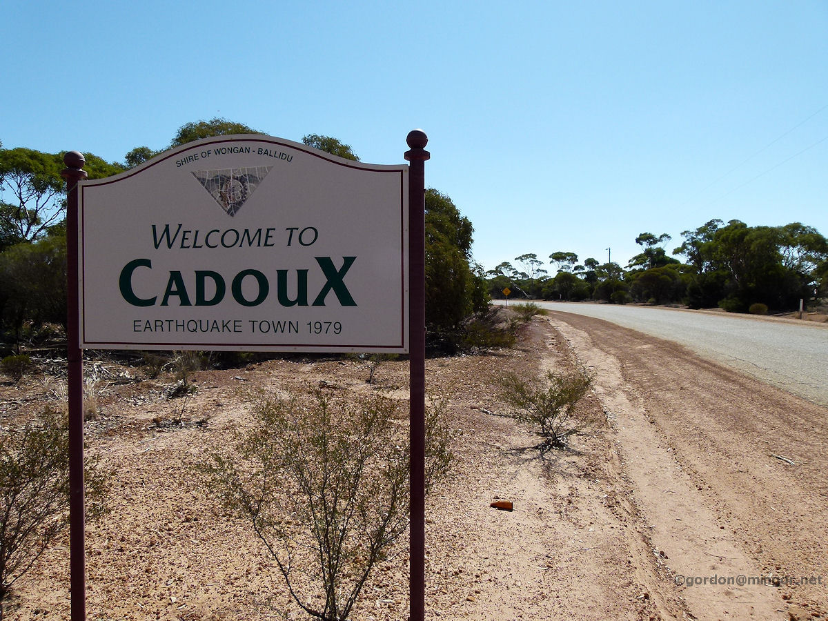 |
Cadoux - Welcome Sign Cadoux was established around 1927 when a rail siding was constructed here. It is mainly surrounded by wheat farming land. Cadoux came to prominence in 1979 when the epicentre of an earthquake was very close to town. Here is one of the welcoming signs greeting motorists to the town. April 2012. Photos Ref: CADX001 |
||
 |
Cadoux - Cadoux Traders The Cadoux Traders situated on the main road. Typical of such stores in small country towns, they supply just about everything. April 2012. Photos Ref: CADX002 |
||
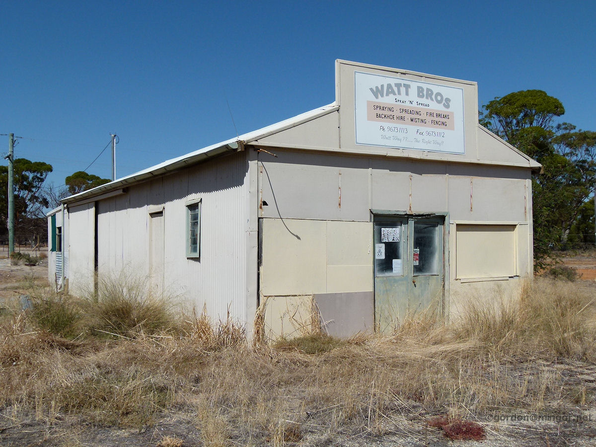 |
Cadoux - Watt Bros. Spray and Spread The old Watt Bros Spray and Spread business premises. The building looks in reasonable condition but it appears the business has disappeared. April 2012. Photos Ref: CADX003 |
||
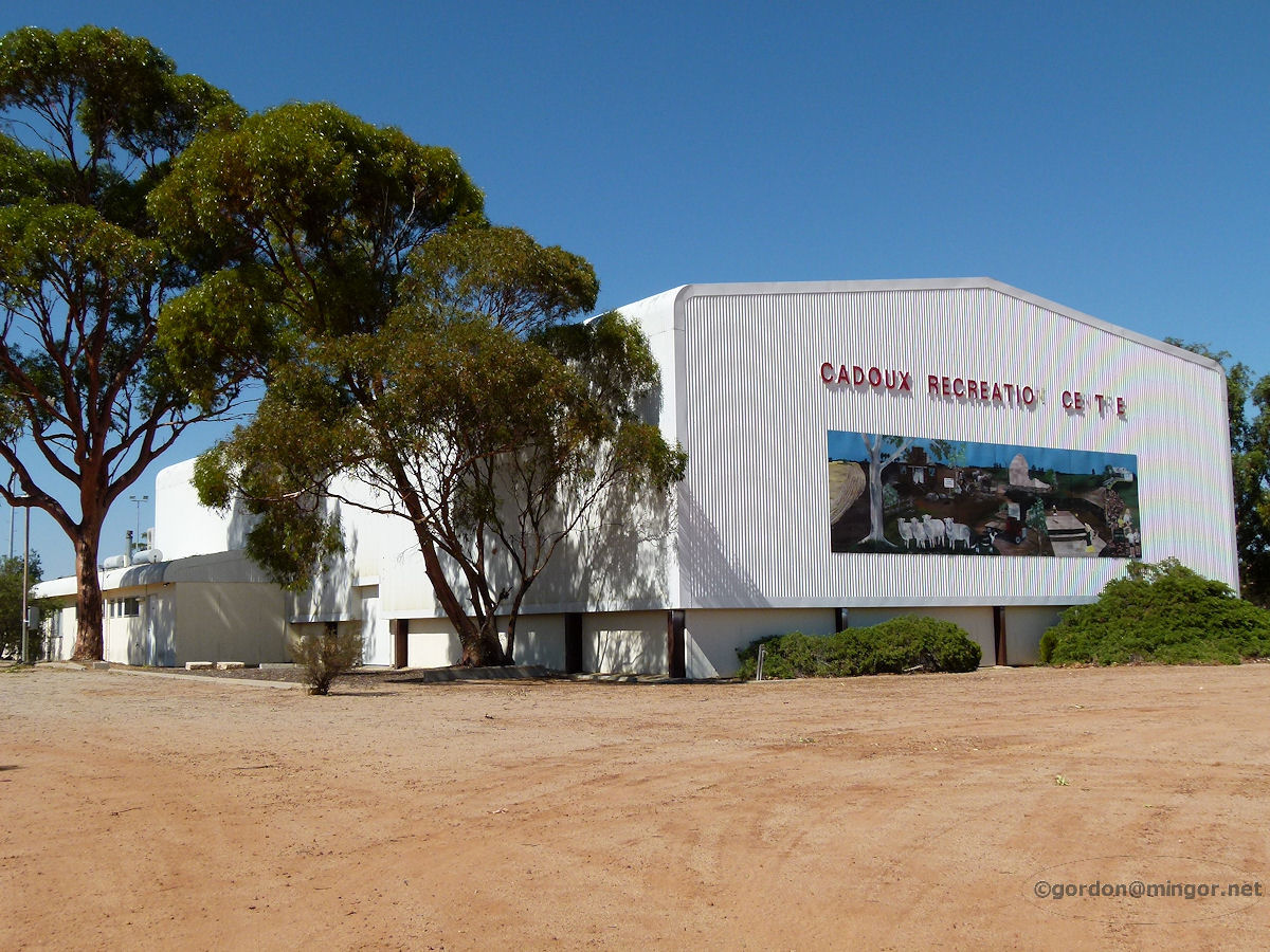 |
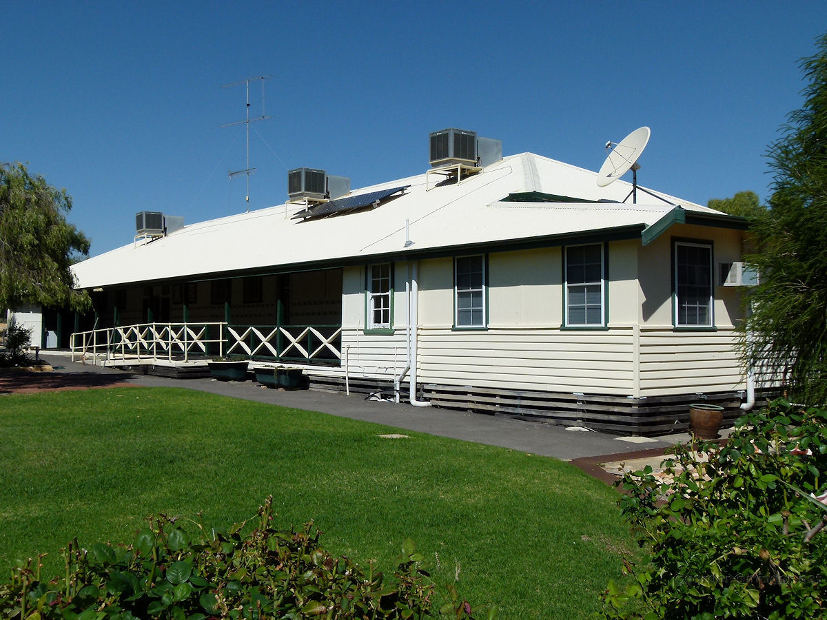
Cadoux - Recreation Centre A rather surprising building considering the size of the town although I expect this is used for functions which include surrounding farmers and their families. This is the Cadoux Recreation Centre and would be the social hub of the town. April 2012. Photos Ref: CADX004 |
||
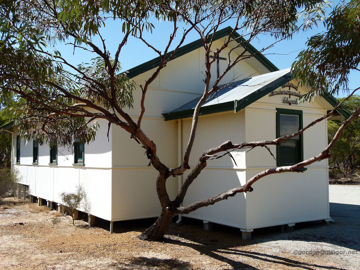 |
Cadoux - Church The Cadoux Nondenominational Church is located across the road from the primary school. This was built in 1959 and opened on April 17th of that year. It was erected through the cooperation of the local Methodist, Anglican and Salvation Army congregations. After the 1979 earthquake, the church was used as a temporary school room. April 2012. Photos Ref: CADX005 |
||
 |
Cadoux - Primary School It is pleasant to find a functioning primary school here and it looks a picture. Beautifully maintained. The school as it is today was mostly built and opened in 1948. The original 1933 school room is perhaps used as the school library now. April 2012. Photos Ref: CADX006 |
||
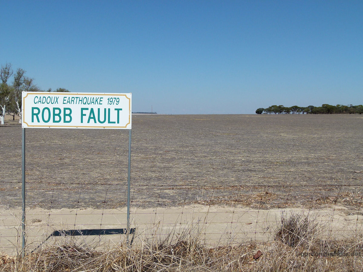 |
Cadoux - Robb Fault Line A few kilometres east of the townsite, on the Koorda Road, is this sign indicating the site of the Robb Fault which was caused by the 1979 earthquake. Nothing of the earthquake is evident here now. The earthquake struck at 9.48am on 02 June 1979. It was of magnitude 6.1 and located at a depth of 6km. It caused considerable building damage in the area. April 2012. Photos Ref: CADX007 |
||
All images published on this website are copyright © of the webmaster. See About section for clarification and special schools permission |
|||