| Photographs of Perth, Western Australia | |||
Karragullen - Photographs of Western Australia This locality is a quite large fruit-growing region situated on Canning Road between Kalamunda and Roleystone. There is a small town centre off Canning Road, north of the Brookton Highway. Karragullen is an Aboriginal term originally used for the Cannington area. In this district was the site of the terminus of the Upper Darling Range Railway which was constructed to cart timber products off to market. The town was gazetted in 1913 |
|||
| West to Pickering Brook | South to Roleystone | ||
| East to The Dale | |||
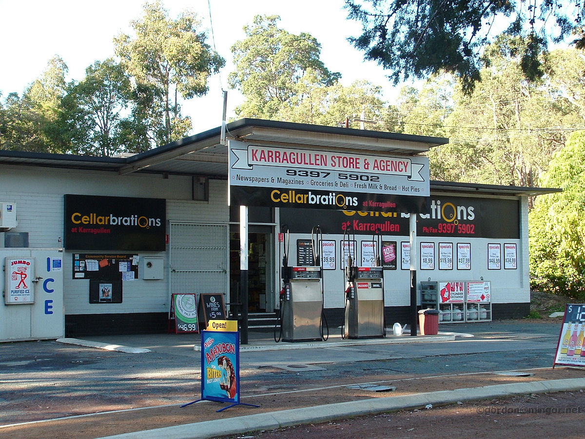 |
Karragullen - General Store and Roadhouse Up in the hills, on Canning Road between Kalamunda and Roleystone, is Karragullen. This is mainly a fruit growing district. Here is the Karragullen general store and roadhouse. May 2010. Photos Ref: KGLN001 |
||
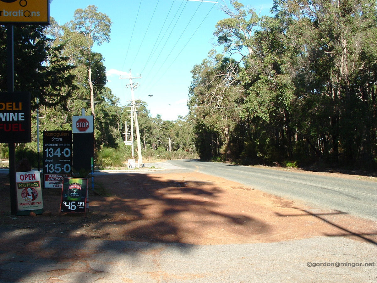 |
Karragullen - Canning Road This is a view looking south along Canning Road, outside the roadhouse. May 2010. Photos Ref: KGLN002 |
||
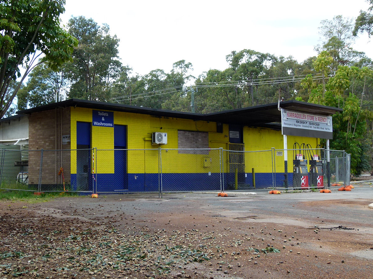 |
Karragullen - General Store and Roadhouse Alas the General Store and Roadhouse is no more. Another good business gone. Pity. Or is it just being remodelled? October 2017. Photos Ref: KGLN003 |
||
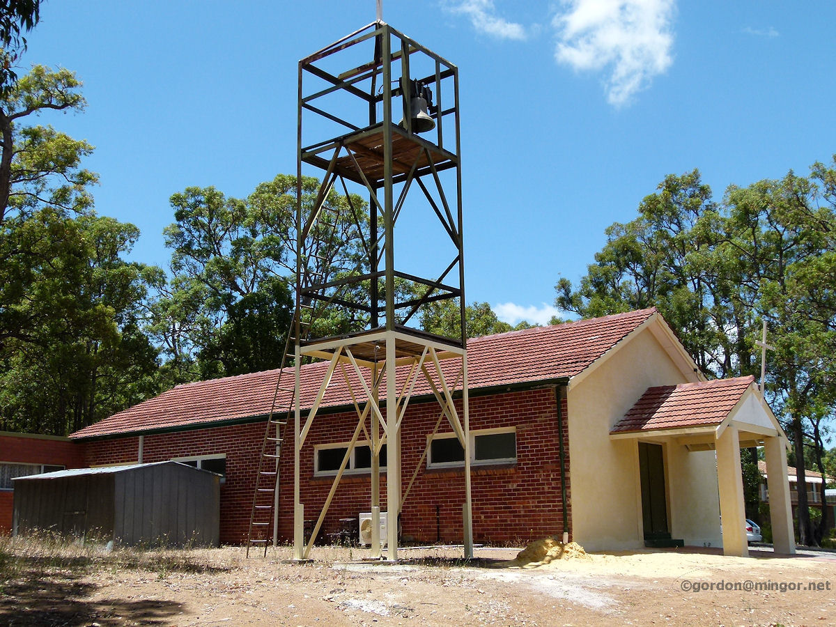 |
Karragullen - Catholic Church The Sacred Heart Catholic Church of Karragullen and Roleystone. It's located a couple of hundred metres south of the townsite on Canning Road, at the junction of Rokewood Way. The church was built in 1954 by Mr Silio Di Marco (with others), an Italian migrant and long-time local resident. See Links page - Pickering Brook. January 2012. Photos Ref: KGLN004 |
||
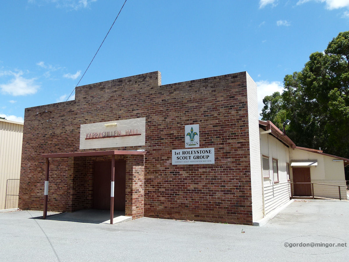 |
Karragullen - Hall The Karragullen Hall on Old Station Road near the oval. This is now the home of the local scout group. The hall was built in 1959. At earlier hall was erected on this site in 1921 but was relocated elsewhere obviously before this one was constructed. January 2012. Photos Ref: KGLN005 |
||
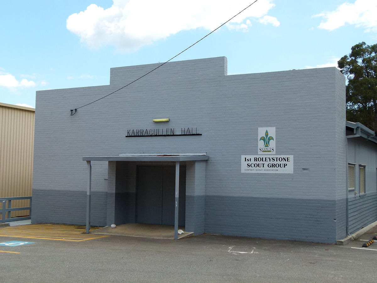 |
Karragullen - Hall An update of the Karragullen Hall showing off its new paintwork. October 2017. Photos Ref: KGLN006 |
||
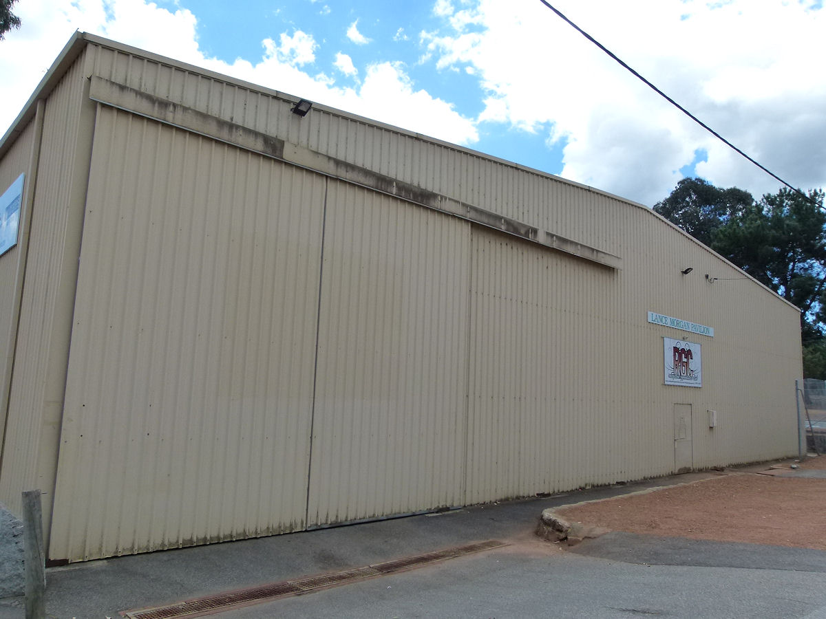 |
Karragullen - Lance Morgan Pavilion Next to the Hall is the Lance Morgan Pavilion. This is on Old Station Road. Mr Morgan was a founding member of the Hills Orchard Improvement Group (HOIG). October 2017. Photos Ref: KGLN007 |
||
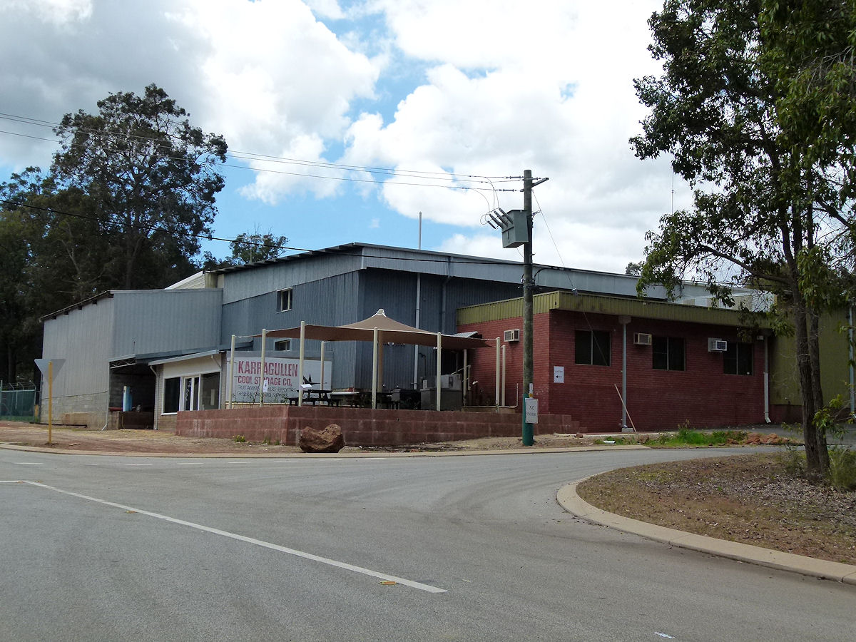 |
Karragullen - Karragullen Cool Storage Co Across from the Lance Morgan Pavilion is Karragullen Cool Storage Co. October 2017. Photos Ref: KGLN008 |
||
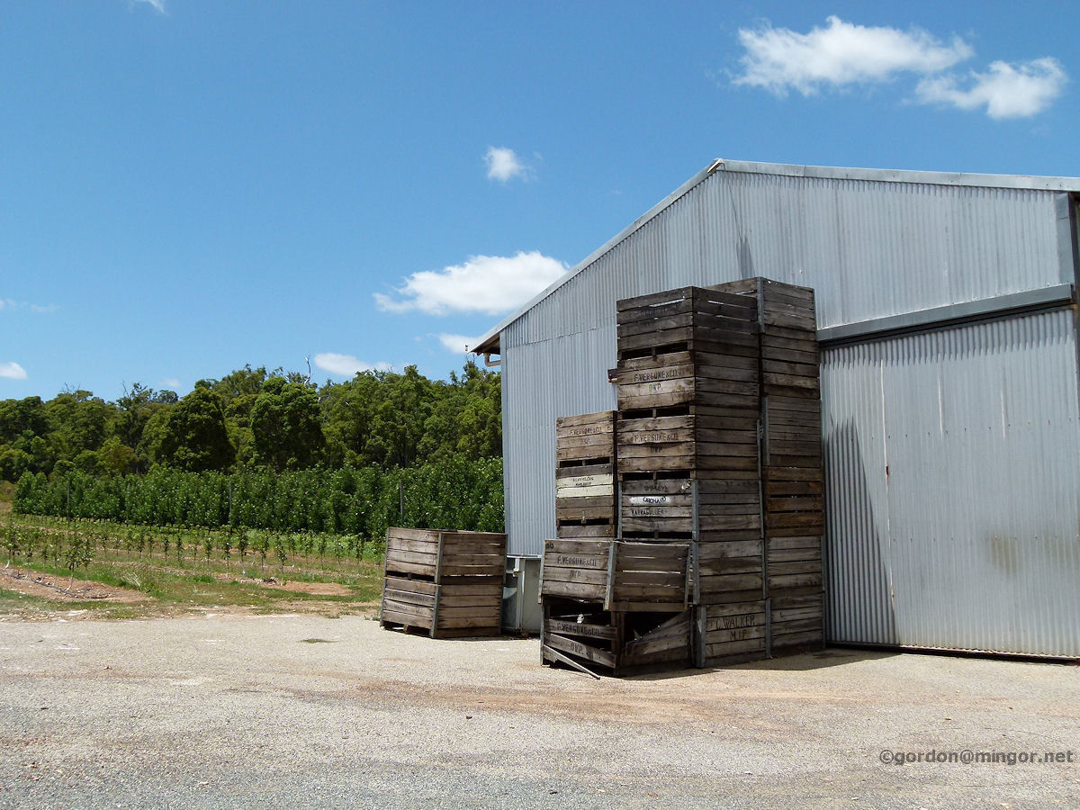 |
Karragullen - Growing Fruit Fruit growing is the predominant industry in Karragullen. Many storage sheds and crates can be seen along the roads. Here is an example of such with fruit trees thriving in the background. January 2012. Photos Ref: KGLN009 |
||
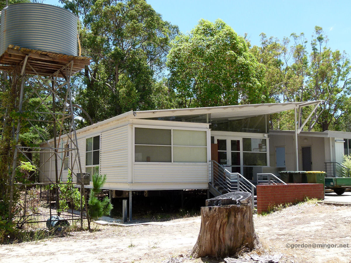 |
Karragullen - Mamarapha College Office The Mamarapha College on School Road. This is a tertiary bible college for mainly indigenous people and is an arm of the Seventh Day Adventist Church. This appears to be the administration office. On this site previously was the Karragullen primary school. January 2012. Photos Ref: KGLN010 |
||
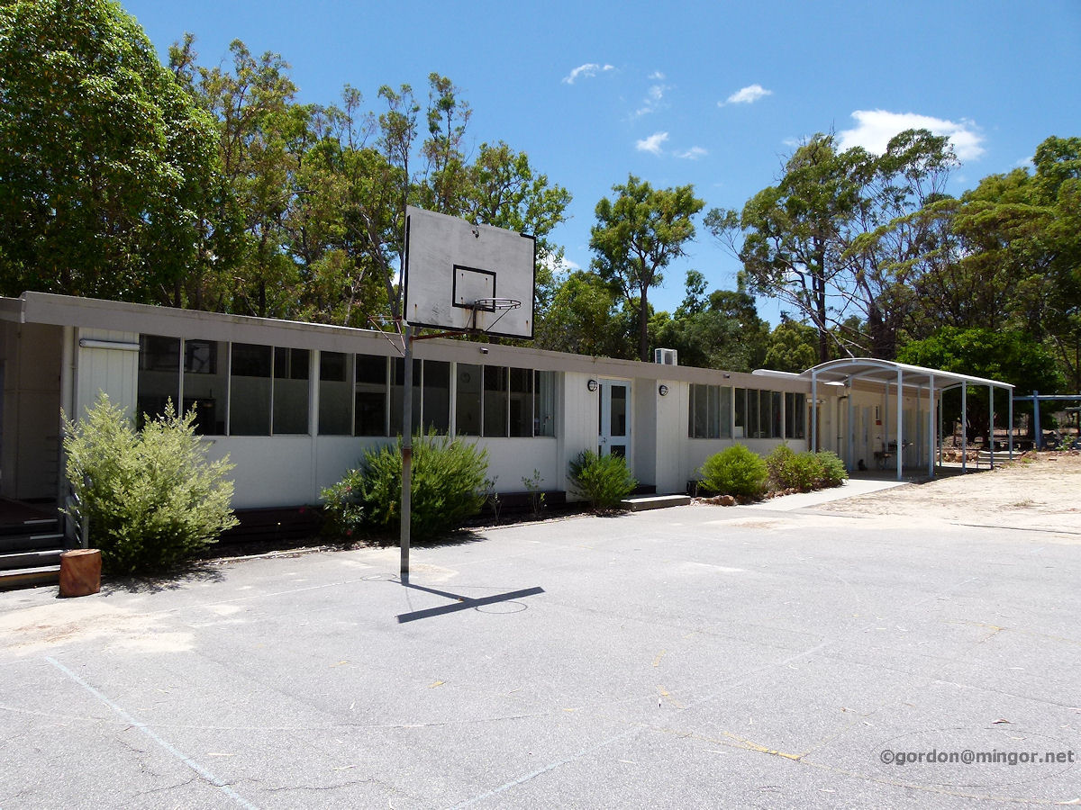 |
Karragullen - Mamarapha College Classrooms The College classrooms and further up ablution block. It looks very attractive and is located in an extremely peaceful locale, set in the bush complete with the distinctive smell of gum trees. January 2012. Photos Ref: KGLN011 |
||
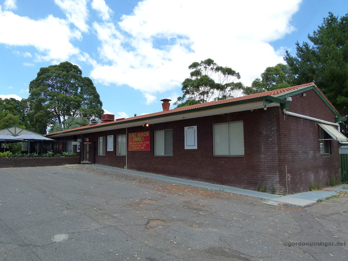 |
Karragullen - Rock Inne Tavern On Brookton Highway on the corner of Herbert Road is the Rock Inne Tavern. This is a few kilometres east of the Canning Road intersection. Not sure when it was built but certainly was here in the 1980's with the same name. Famed for live music shows. January 2012. Photos Ref: KGLN012 |
||
All images published on this website are copyright © of the webmaster. See About section for clarification and special schools permission |
|||