| Photographs of Perth, Western Australia | |||
Lathlain - Photographs of Western Australia The suburb of Lathlain is south-east of Victoria Park and is bounded by Great Eastern Highway, Orrong Road, Roberts Road and the Armadale railway line. The suburb gets its name from the football ground which was named after Sir William Lathlain who was Mayor of Perth between 1918-1923 and again in 1930-1932. He was also an MLA between 1926-1932. Lathlain was cut from parts of Rivervale and Victoria Park and was only recognised by the City of Perth as such as recently as 1981 |
|||
| North to Rivervale | South to Carlisle | ||
| West to Victoria Park | |||
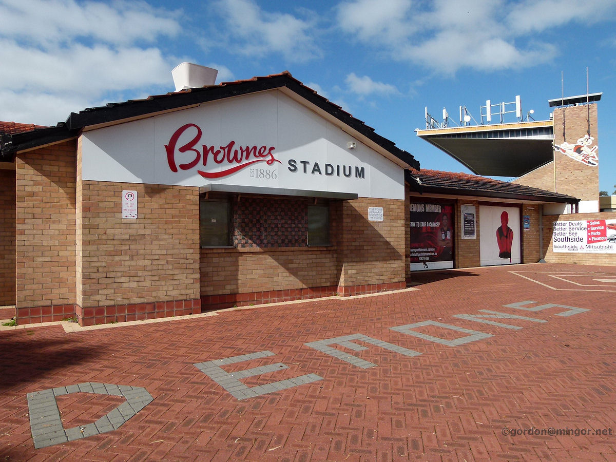 |
Lathlain - Football Oval Here is the Lathlain Park football ground which was established 1886 and at present is named Browne's Stadium. This is the main entrance where admission tickets can be purchased. July 2013. Photos Ref: LATH001 |
||
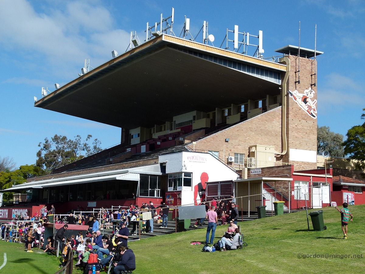 |
Lathlain - Football Oval Saturday is Football, but not for these kids who are out having a kick and a hotdog midweek. Lathlain Park is the home of the W.A.F.L. club the Perth Demons. This is the E. W. Jones - P .J. Fogarty Stand. July 2013. Photos Ref: LATH002 |
||
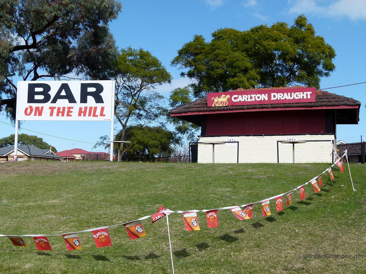 |
Lathlain - Football Oval On the southern side of the oval is the bar. A bit of a wander from the grandstands. This facility is probably there to cater for those sitting on the grass nearby. July 2013. Photos Ref: LATH003 (Since removed to make way for new Eagles HQ) |
||
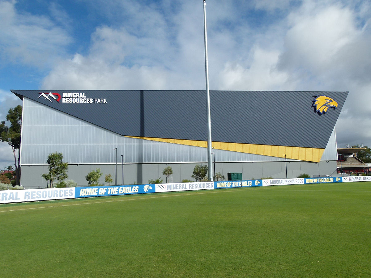 |
Lathlain - Football Oval The new Eagles headquarters on the southern side of Lathlain Oval which is also known as Mineral Resources Park. This is the eastern flank. May 2021. Photos Ref: LATH004 |
||
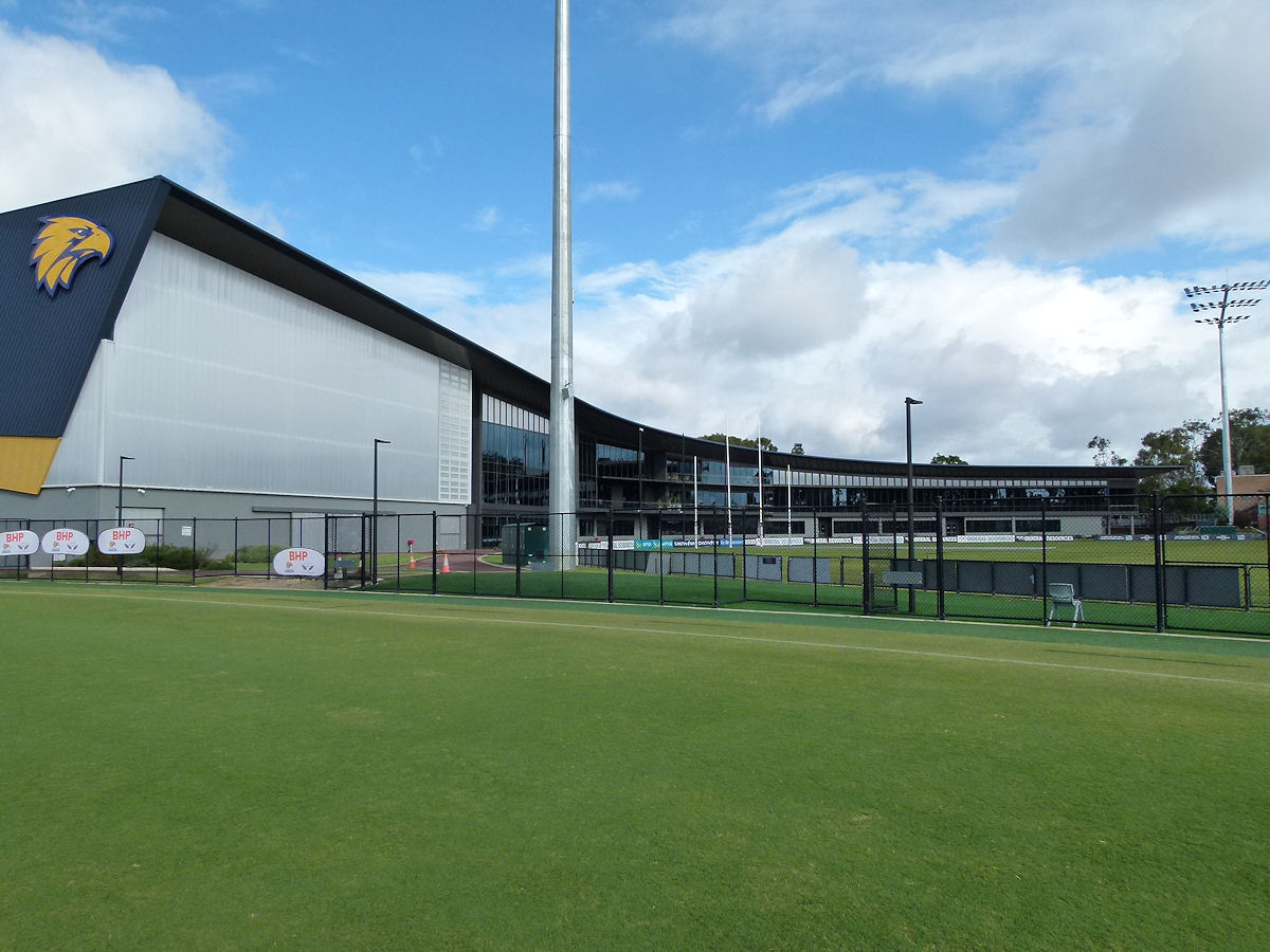 |
Lathlain - Football Oval A more southerly view taking in more of the complex. This was opened in June 2019. May 2021. Photos Ref: LATH005 |
||
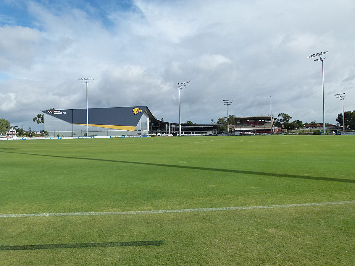 |
Lathlain - Football Oval Looking across the Eagles training over. Beyond to the right you can see the old grandstand and WAFL oval. The perimeter fences have mostly been taken down. May 2021. Photos Ref: LATH006 |
||
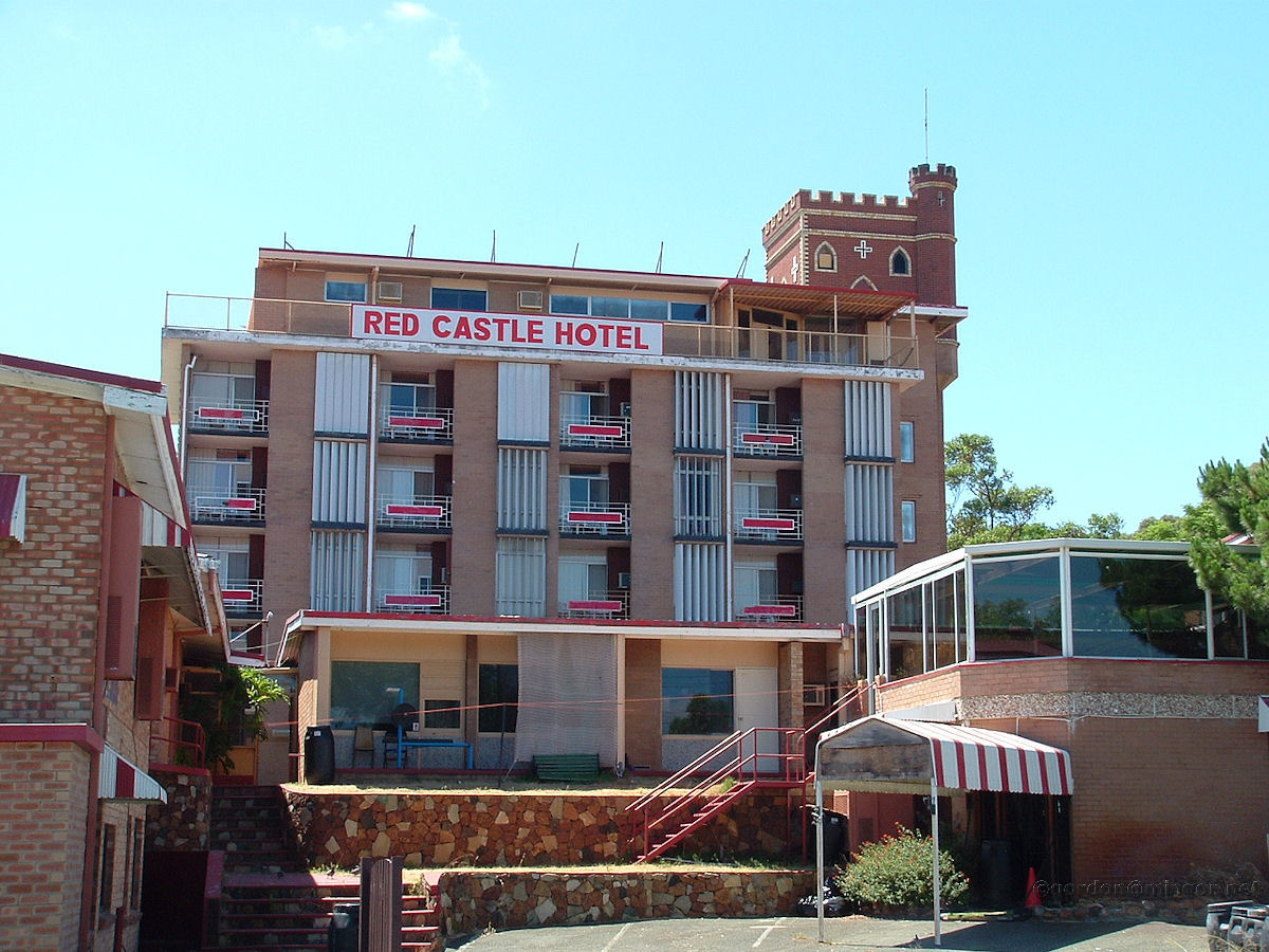 |
Lathlain - Red Castle Hotel Constructed in 1968 is the Red Castle Hotel in Lathlain, here viewed from the back-end near the foot bridge over Great Eastern Highway. Update: There was a fire here today (11 Sept 2012). Interesting that Peter Newman of Curtin Radio said that this site used to be a brewery when he was young. The sweet smell of hops wafting down the street. So much history being lost but for people like Peter - thanks. Photo January 2009. Photos Ref: LATH007 (Since destroyed by fire) |
||
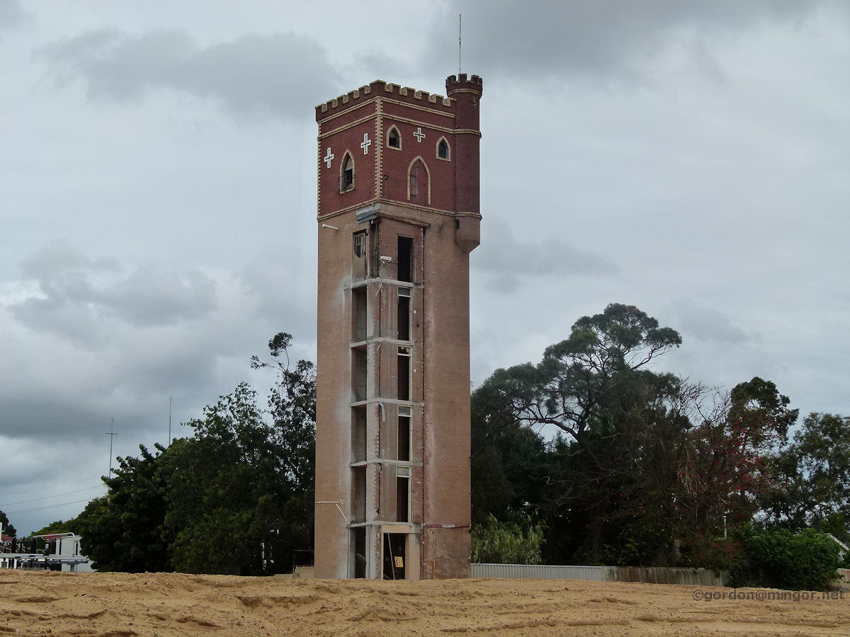 |
Lathlain - Red Castle Hotel Passing along the Graham Farmer Freeway many times I assumed all was well with the Hotel despite the fire as I could always see the castle top. Recent curiosity made me pass close by and I was astounded to see that just the central lift shaft with the castle topping was all that remains. A loss of an icon. September 2014. Photos Ref: LATHOO8 |
||
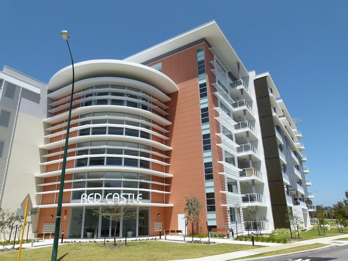 |
Lathlain - Red Castle Apartments The Red Castle Apartments built on the site of the former Red Castle Hotel. This view is taken from near the Great Eastern Highway pedestrian overpass. The old castle and lift shaft are still there (and tidied up a bit), now a courtyard feature at the rear of the complex. That wing you see going off to the right is equalled by another going off to the left, out of picture, so this place is quite big. October 2017. Photos Ref: LATH009 |
||
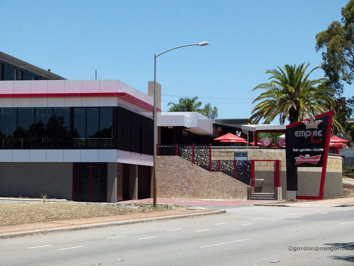 |
Lathlain - Empire Bar The old Rivervale Hotel on Great Eastern Highway and Cornwall Street has recently undergone a considerable transformation to re-emerge as the Empire Bar. It is undoubtedly really good inside but the exterior charm that the old hotel offered has gone. This hotel is actually in Lathlain, not Rivervale. December 2012. Photos Ref: LATH010 |
||
All images published on this website are copyright © of the webmaster. See About section for clarification and special schools permission |
|||