| Photographs of Perth, Western Australia | |||
Mosman Park - Photographs of Western Australia Mosman Park lies between the Swan River and the Indian Ocean, just north of Fremantle. The suburb was originally called Buckland Downs in 1832, named after geologist William Buckland. The highest hill here still bears his name. When the railway station opened in 1895 it was called Cottesloe Beach. The area became Mosman Park in 1937 and takes the name from the 1907 named Mosman Bay on the Swan River. "Mosman" comes from the Sydney suburb |
|||
| North to Cottesloe | South to North Fremantle | ||
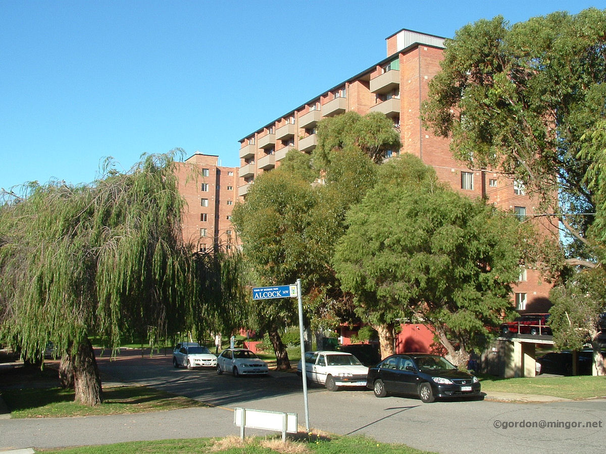 |
Mosman Park - Old Battle Street These flats are on what used to be called Battle Street which, at the time, were very aptly named. In the 1970's the blocks almost qualified for their own police station. Now the road is blocked off from the highway, the name "Battle" has gone and they are most likely fairly up-market apartments. The street is now called Murray Avenue. June 2008. Photos Ref: MSPK001 |
||
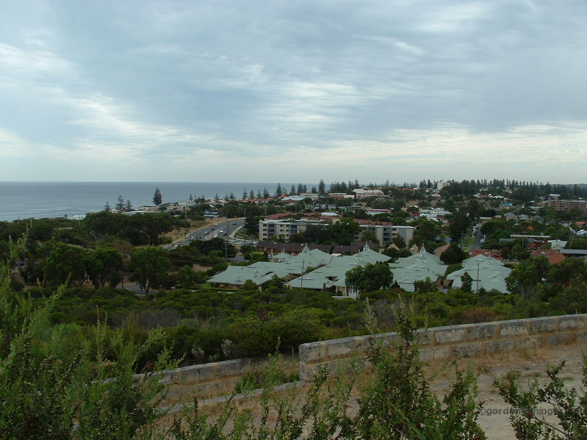 |
Mosman Park - View from Buckland Hill Mosman Park from Buckland Hill. You can see the intersection of Stirling Highway and Wellington Street. If you look closely you may be able to see a train leaving Mosman Park station. February 2009. Photos Ref: MSPK002 |
||
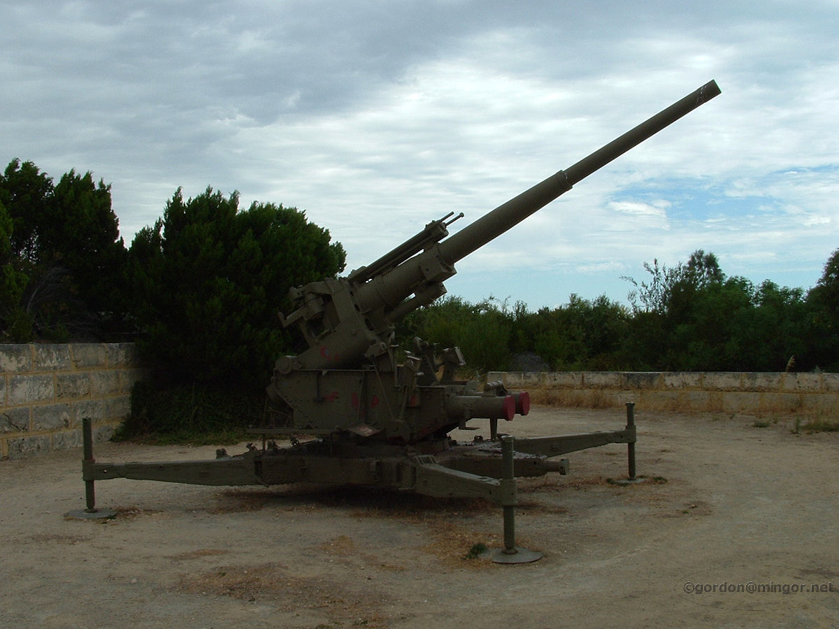 |
Mosman Park - Buckland Hill Guns Buckland Hill was for ages a restricted military zone. These days it's open and indeed some of the land has been sold for housing. Here's one of the guns placed during WW2 to help protect the region. February 2008. Photos Ref: MSPK003 |
||
 |
Mosman Park - Buckland Hill Sea Level Sign Given the current talk about rising sea levels, this sign makes interesting reading. Rhodes Fairbridge undertook many geological surveys on Rottnest when doing his research on varying sea levels over time. The information on this sign might well have come from his observations and conclusions. February 2010. Photos Ref: MSPK004 |
||
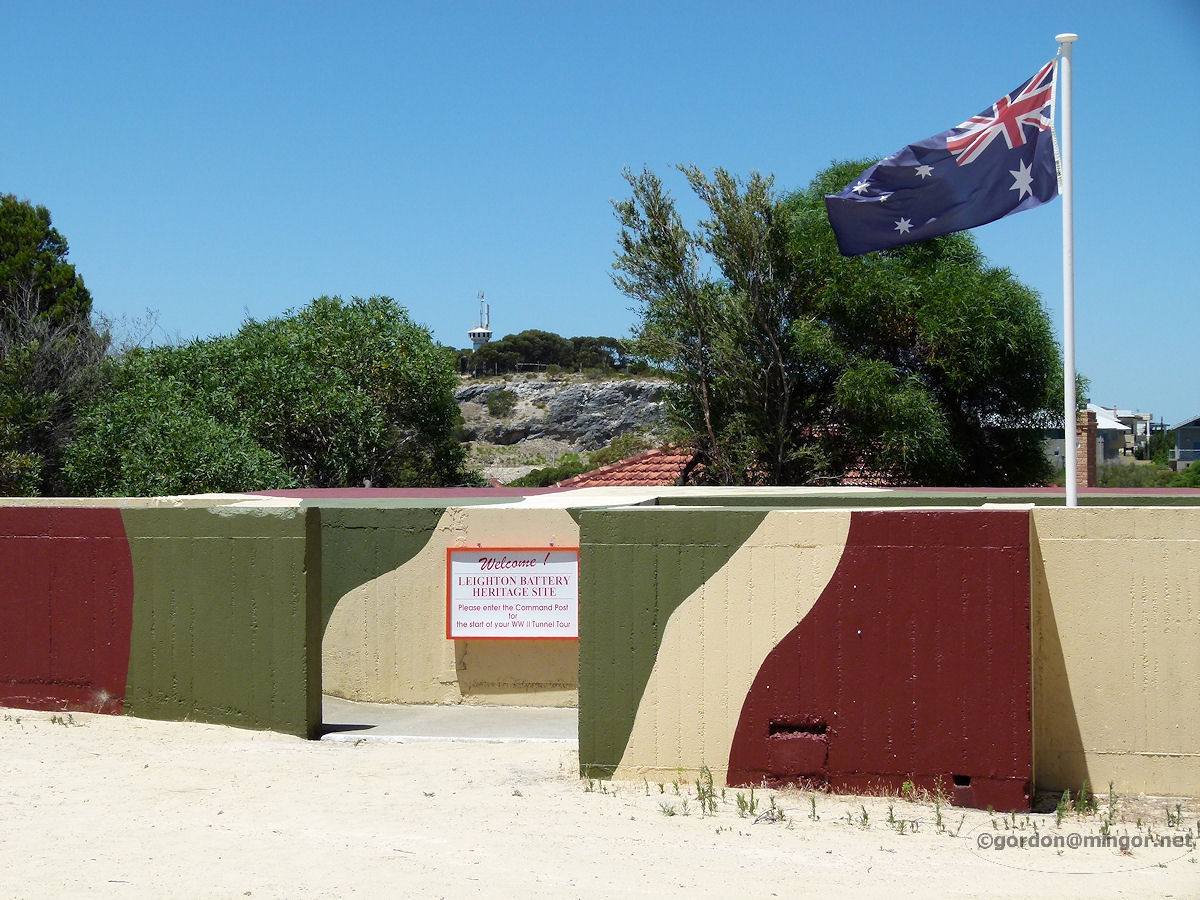 |
Mosman Park - Buckland Hill Command Post Up on Buckland Hill, this is the Command Post. Underground is the HQ of the old military post. You can tour the extensive tunnels and rooms dating back to WW2. It is open each Sunday from 10.00 to 3.00pm. The tours start half-hourly and today's rates are adults $7 and children just $2. Pretty good value. January 2013. Photos Ref: MSPK005 |
||
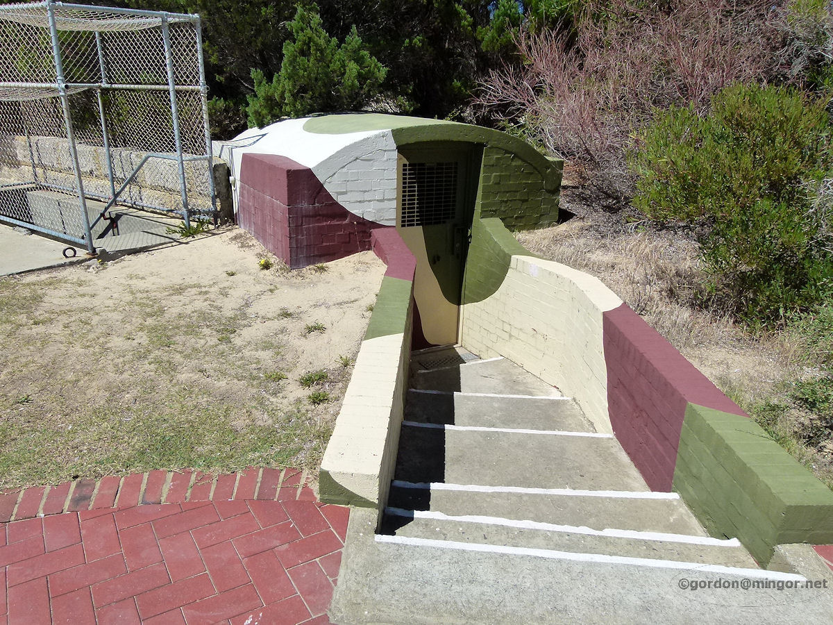 |
Mosman Park - Buckland Hill Tunnels Entrance Steps and shelter over the entrance to the tunnels painted in a manner typical of military camouflage. January 2013. Photos Ref: MSPK006 |
||
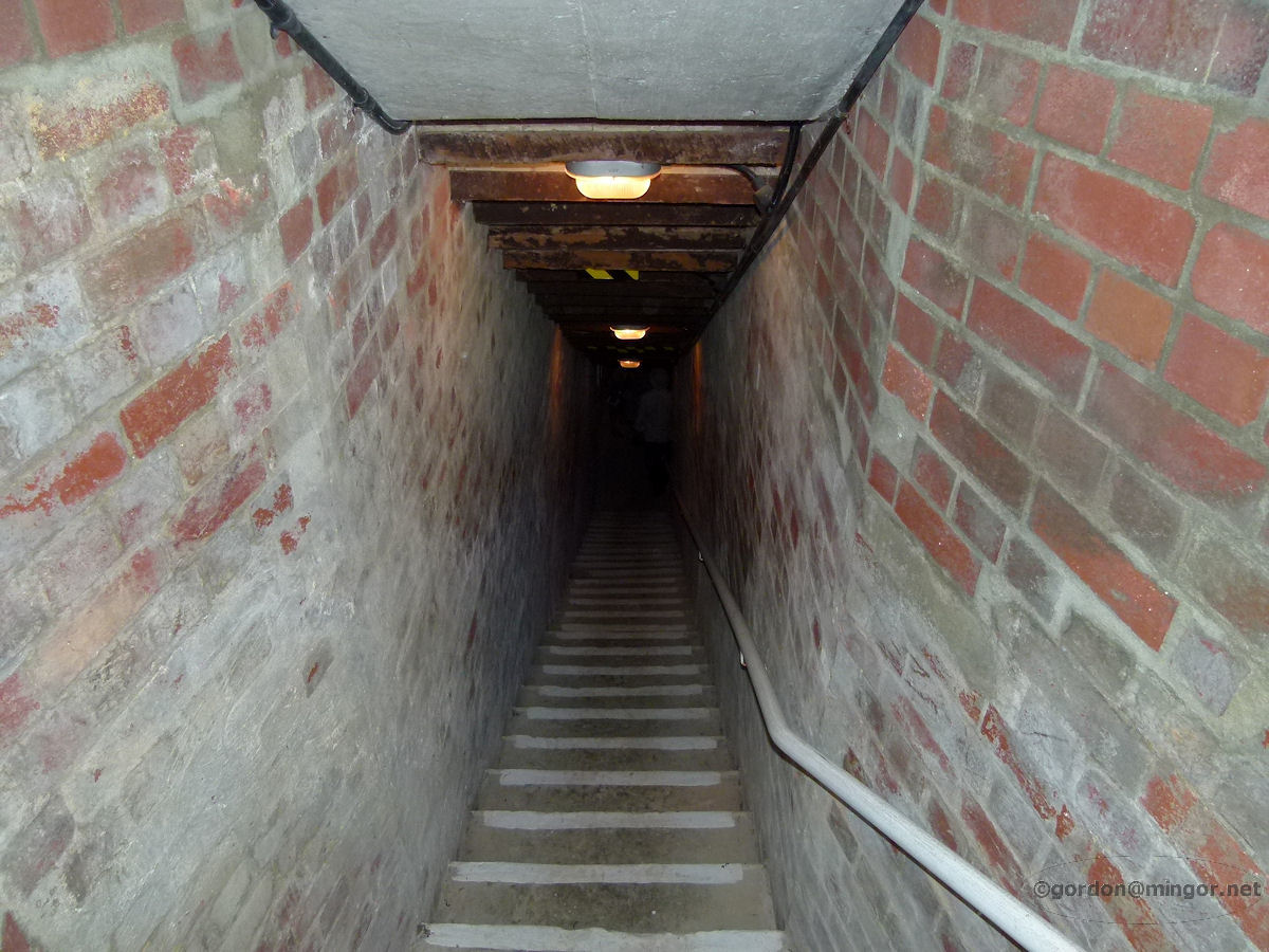 |
Mosman Park - Buckland Hill Tunnel Steps Go down through the camouflaged entrance and then negotiate these steps down through to the seventy-odd year old tunnels. If you want to see more then you'll simply have to take the tour. January 2013. Photos Ref: MSPK007 |
||
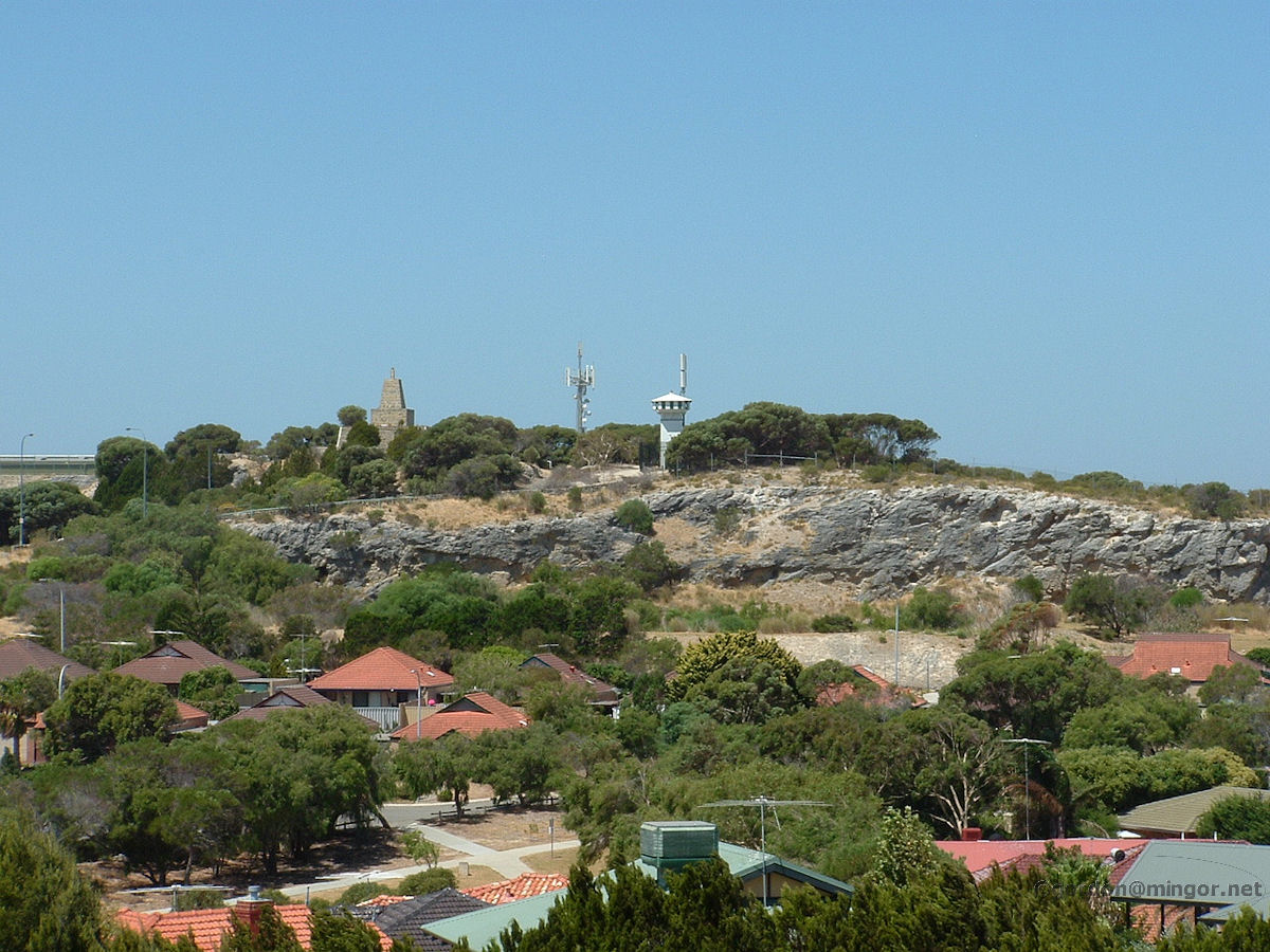 |
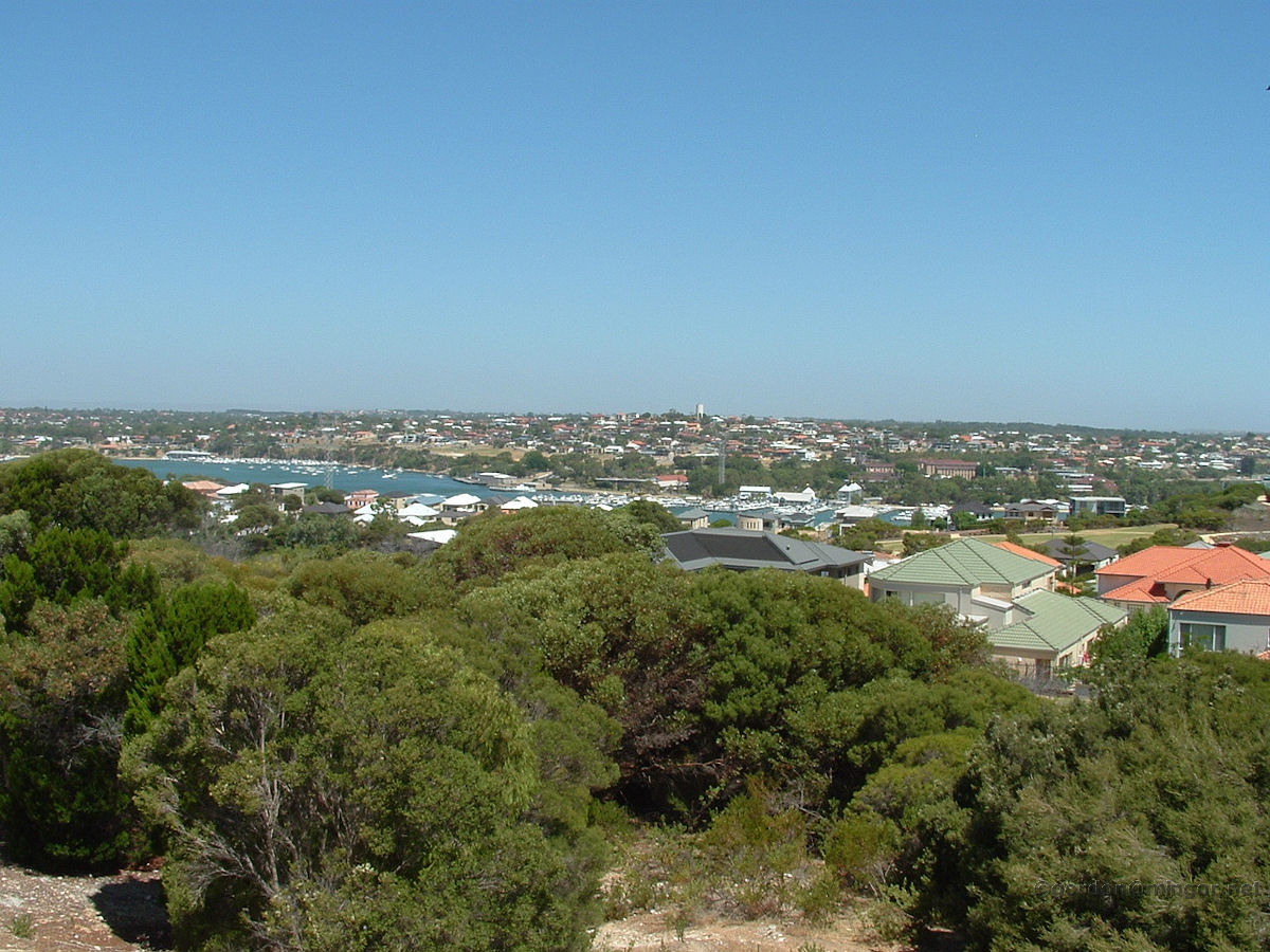
Mosman Park - Monument Hill From Buckland Hill looking across towards Monument Hill. You can get up there by driving along the extension of Boundary Road. February 2010. Photos Ref: MSPK008 |
||
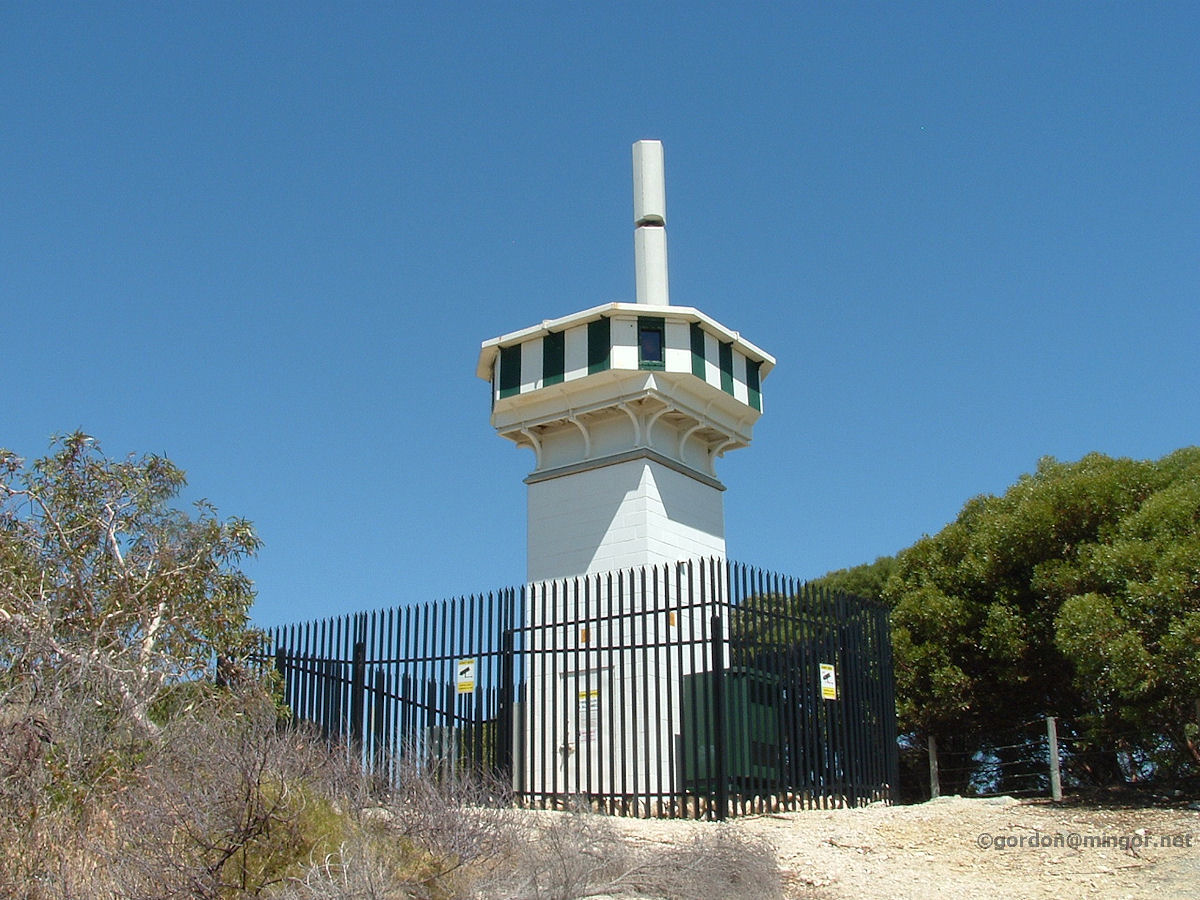 |
Mosman Park - Monument Hill Atop Monument Hill is this. It looks very much like a shipping navigation aid. February 2010. Photos Ref: MSPK009 |
||
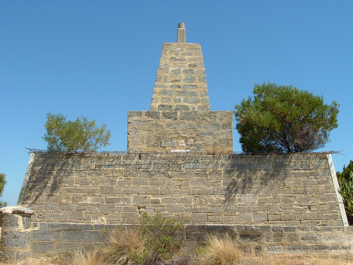 |
Mosman Park - Monument Hill This is the Mosman Park Monument. This is one of two original survey points for Perth dating from back in the early days and that was the purpose of this structure. The other survey point was at West Perth, at or near the former Observatory. February 2010. Photos Ref: MSPK010 |
||
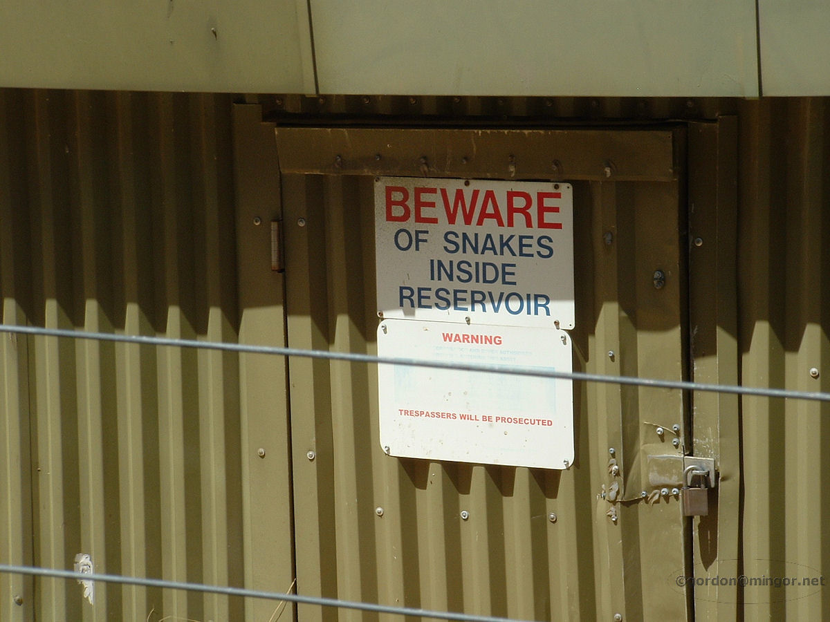 |
Mosman Park - Reservoir Snakes If you're walking around the Monument (which is right next door to the local reservoir), don't get tempted to go in there through the fence. Is it worse being prosecuted or being bitten by a snake? February 2010. Photos Ref: MSPK011 |
||
 |
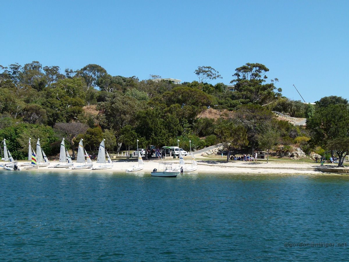
Mosman Park - View to East Fremantle A view across the Swan River to East Fremantle. February 2010. Photos Ref: MSPK012 |
||
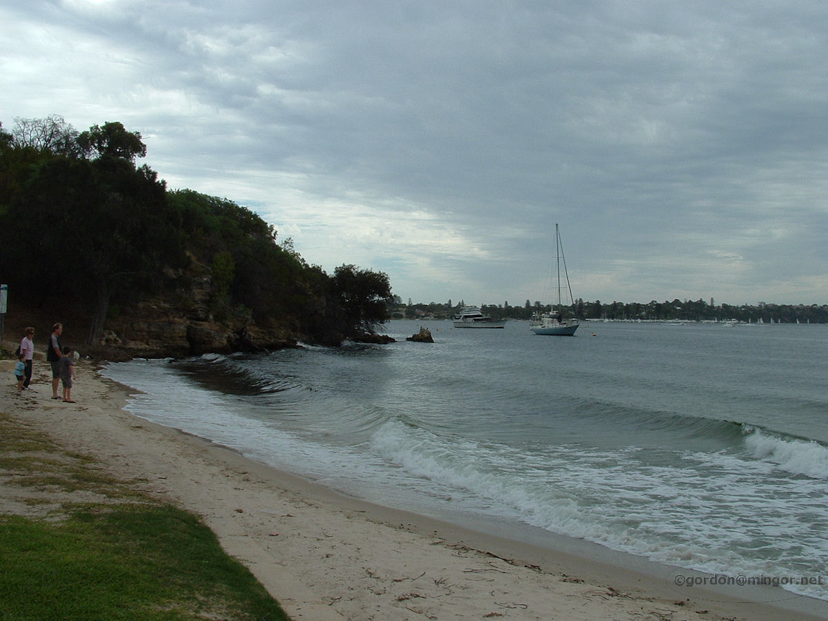 |
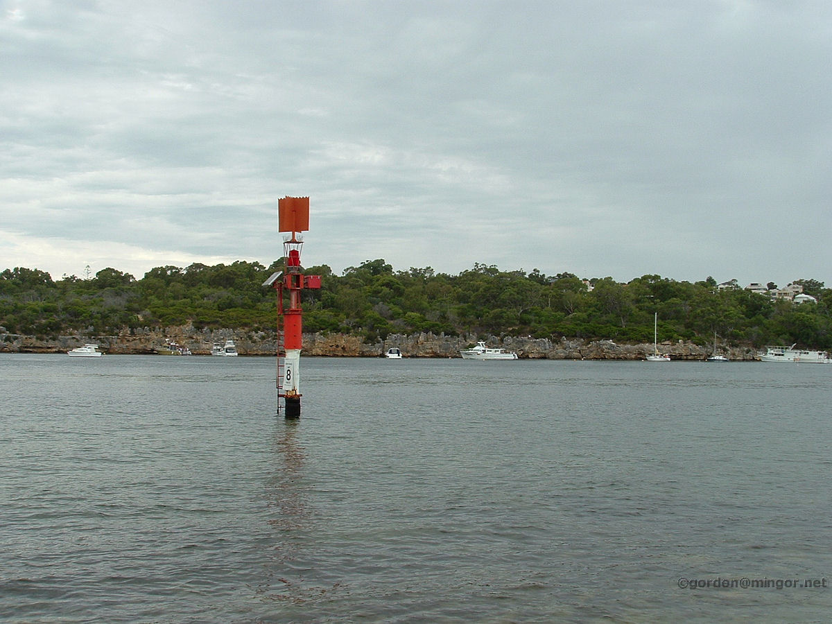
Mosman Park - Chidley Point Down at the Swan River at Chidley Point which is right at the end of Wellington street. On an overcast February day this is part of the coast-line and river. February 2009. Photos Ref: MSPK013 |
||
 |
Mosman Park - Chidley Point Still at Chidley Point, this is looking across the part of the river known as Blackwall Reach over to Bicton. February 2009. Photos Ref: MSPK014 |
||
 |
Mosman Park - Chidley Point This time passing Chidley Point on a Captain Cook river boat. This is looking back at the small beach at the Point. October 2010. Photos Ref: MSPK015 |
||
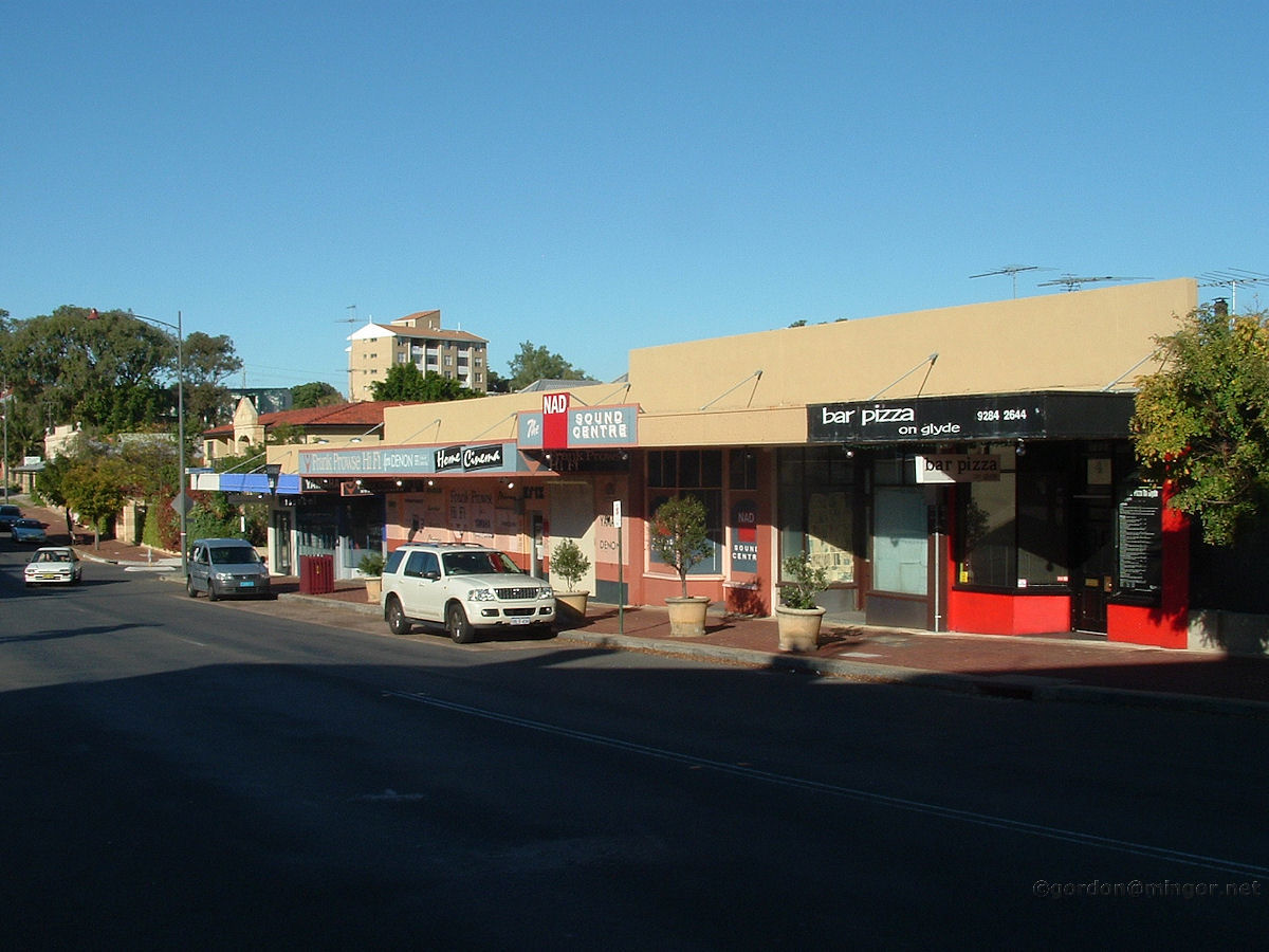 |
Mosman Park - Glyde Street Shops Businesses on Glyde St. That hi-fi shop has been around for many years. June 2008. Photos Ref: MSPK016 |
||
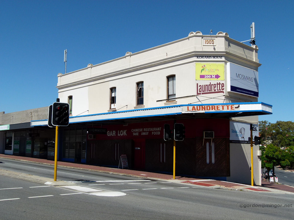 |
Mosman Park - Koranis House On the corner of Stirling Highway and Glyde Street is the 1909 Koranis House. It must have had a chequered history. These days a launderette and a Chinese restaurant occupy the ground floor of the building. January 2013. Photos Ref: MSPK017 |
||
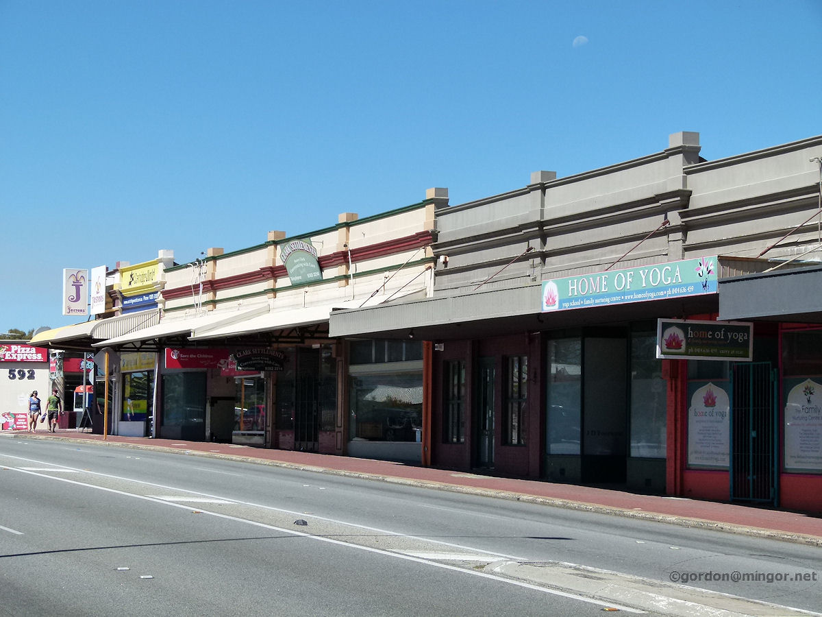 |
Mosman Park - Stirling Highway Shops Businesses on the main shopping strip in Mosman Park. No deli, fruit shop or newsagency anymore. Offices and discretionary spending establishments only in these very specialised businesses. Not many people here today. January 2013. Photos Ref: MSPK018 |
||
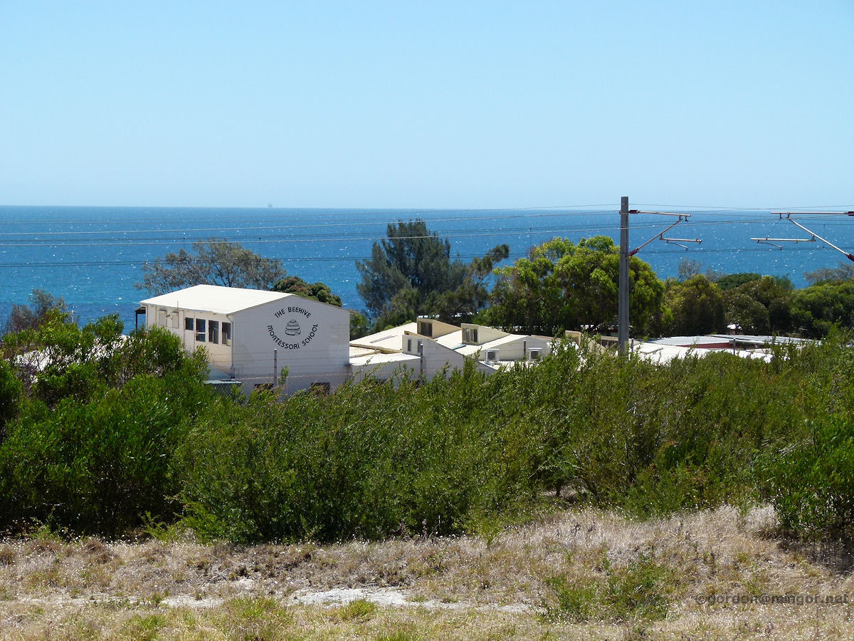 |
Mosman Park - Beehive Montessori School The Beehive Montessori School is accessed from Curtin Avenue but its most photogenic face is that from the east as shown here. This school was established in 1977 at which time it operated out of a former church hall. January 2013. Photos Ref: MSPK019 |
||
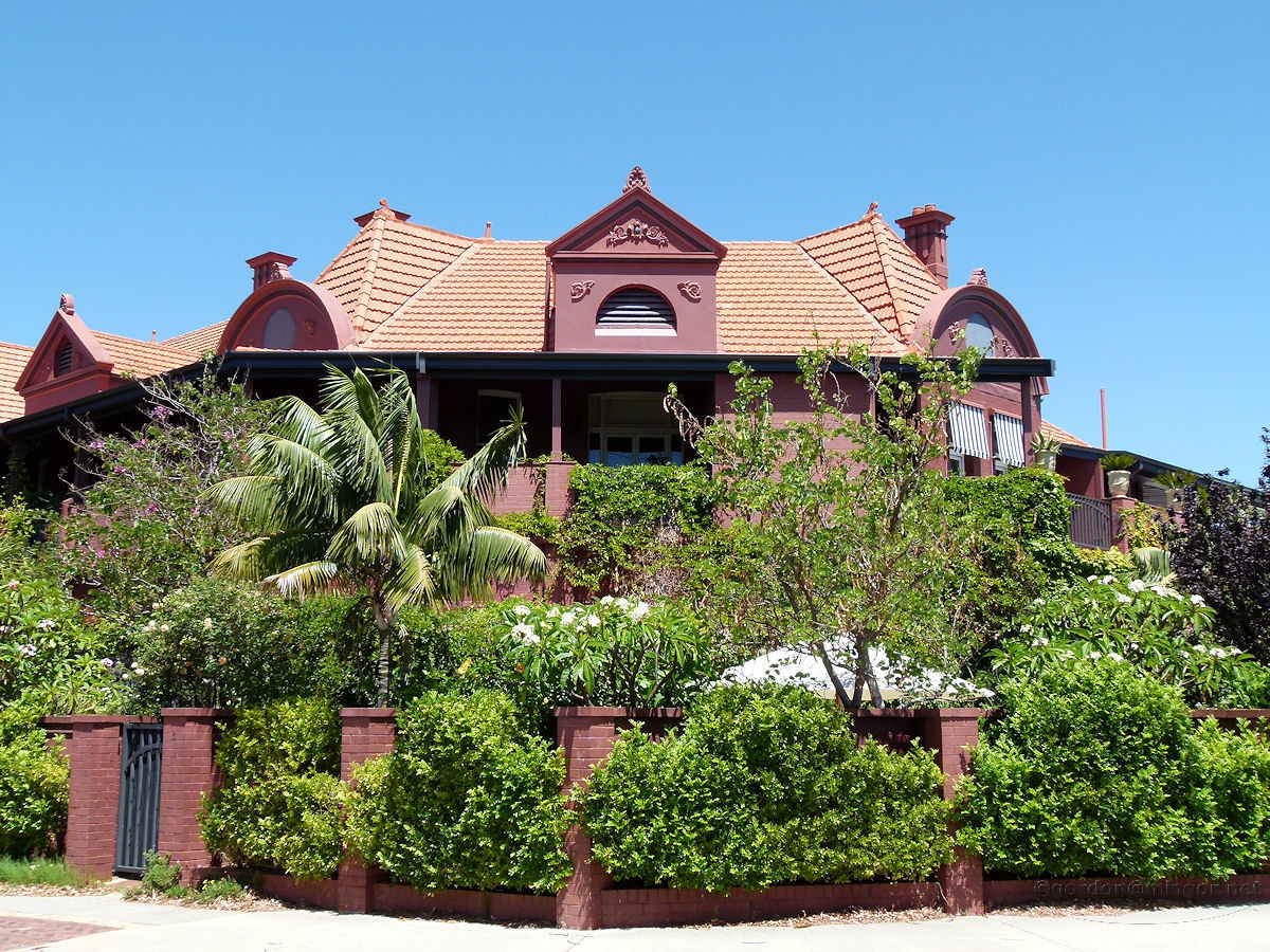 |
Mosman Park - Mosman Park Hotel The Mosman Park Hotel as such ceased trading a number of years ago but the building remains shrouded in cool greenery and here it is. Now a fine set of apartments, it is on Glyde Street, on the corner of Monument Street. January 2012. Photos Ref: MSPK020 |
||
 |
Mosman Park - Riverside Properties A view of river-front houses from a boat on the way to Fremantle. October 2010. Photos Ref: MSPK021 |
||
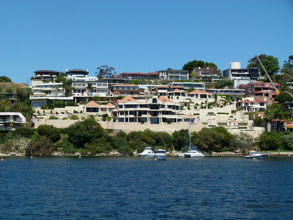 |
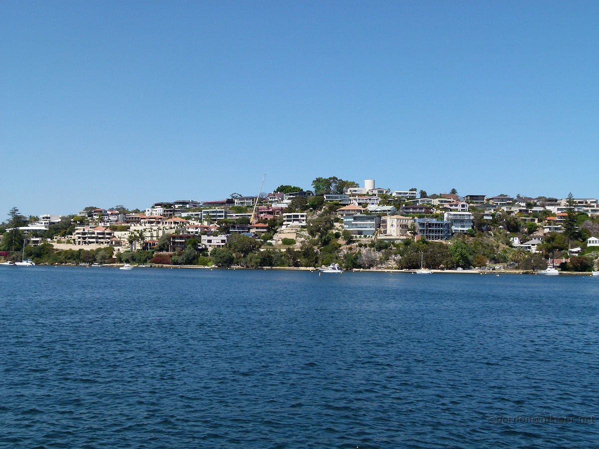
Mosman Park - Riverside Properties A closer view of river-front properties. Here is some of the most expensive real-estate in Australia. October 2010. Photos Ref: MSPK022 |
||
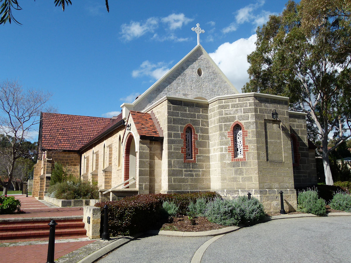 |
Mosman Park - Anglican Church St Luke's Anglican Church on Monument Street, Mosman Park. The original part of the church facing Monument Street (the rear in the photo) was built in 1887. The rear section, this end, was added in 1997. A slab was placed on the wall of the church on December 17th, 1904, by Rt Rev. C.O.L. Riley, Bishop of Perth. August 2016. Photos Ref: MSPK023 |
||
 |
Mosman Park - Anglican Church Alexandra Hall Adjacent to the church is the Anglican Alexandra Hall. This is a weatherboard building with an iron roof and was erected in 1903. August 2016. Photos Ref: MSPK024 |
||
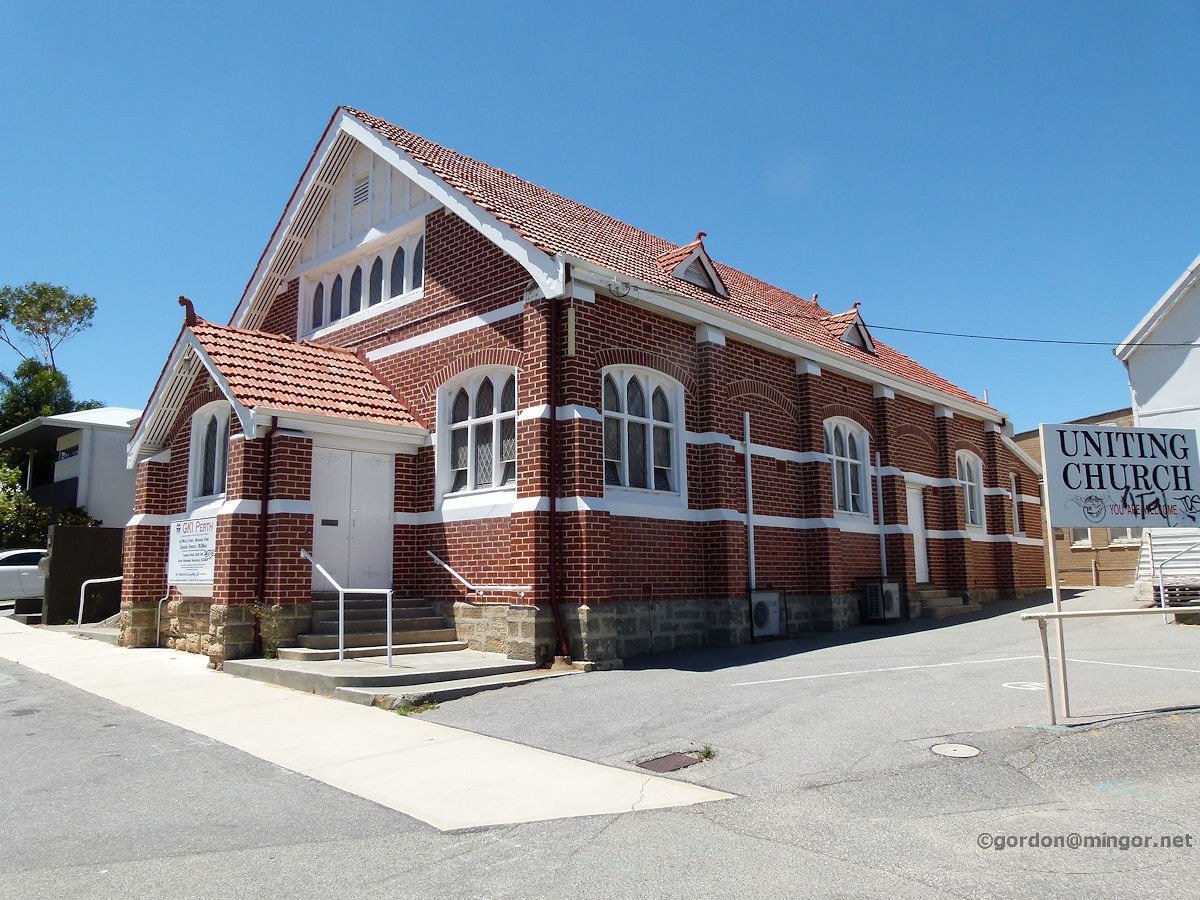 |
Mosman Park - Uniting Church The Uniting Church on Willis Street, Mosman Park, just off Stirling Highway. It was constructed in 1929-1930. Next door is the Old Wesleyan Church which was the earlier Methodist Church. Photo - January 2011. Photos Ref: MSPK025 |
||
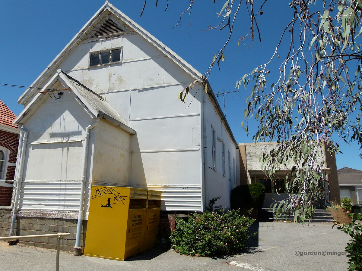 |
Mosman Park - Old Wesleyan Church Next to the current Uniting Church is the Old Wesleyan Church which pre-dates the brick church by over 30 years. This building operates these days as the Church hall. Construction is mainly of weatherboard and fibro and was built in 1898. Photo - January 2011. Photos Ref: MSPK026 |
||
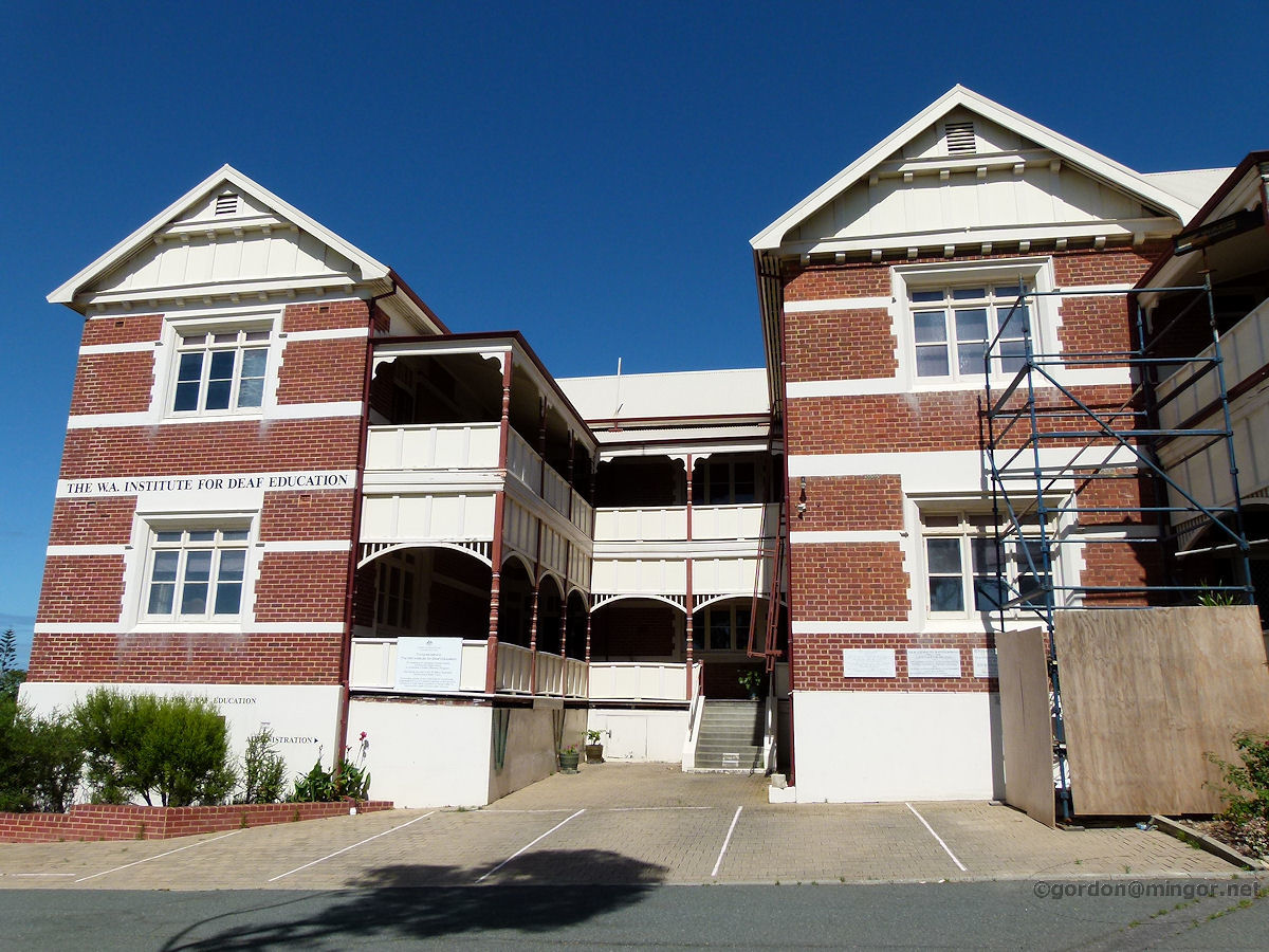 |
Mosman Park - School for the Deaf On Curtin Avenue near Warton Street is the W.A. Institute for Deaf Education. It was originally the W.A. Deaf and Dumb Institute and was founded in 1896. The Foundation Stone was laid (In Accordance with Masonic Rites) by Sir Gerard Smith, the then Governor of Western Australia, on 2nd November 1899. December 2011. Photos Ref: MSPK027 |
||
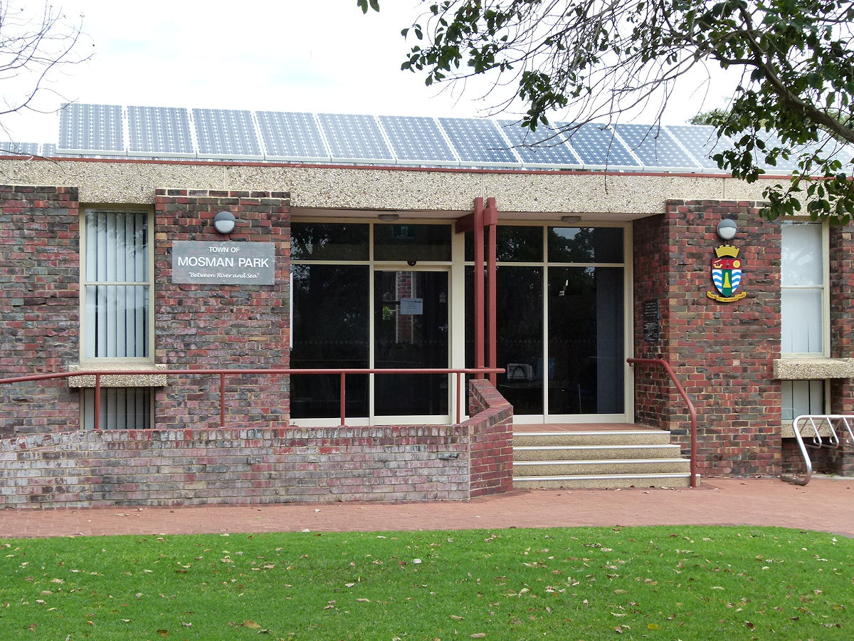 |
Mosman Park - Town Office The Town of Mosman Park set down near the river but high on a hill. Very pleasant surroundings. October 2018. Photos Ref: MSPK028 |
||
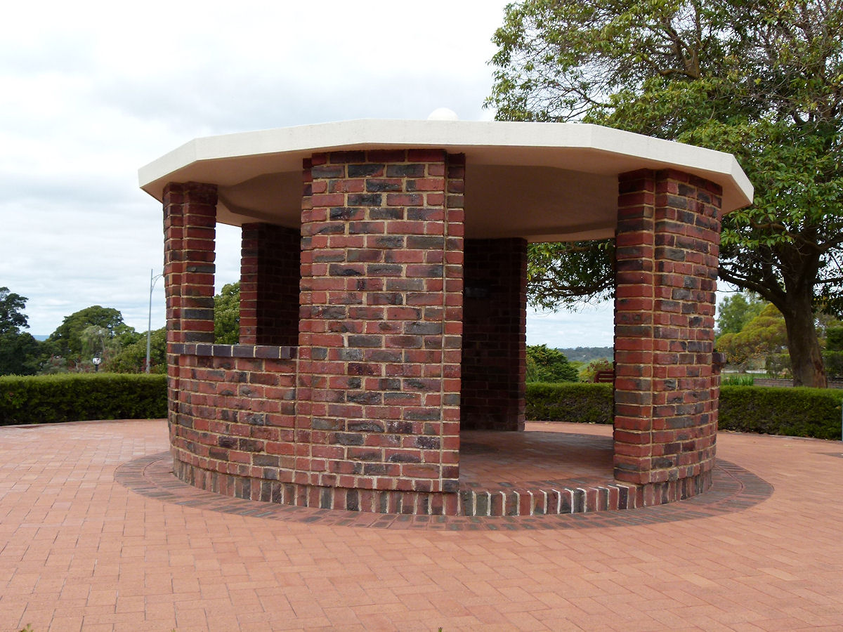 |
Mosman Park - War Memorial Sitting to the front of the Town of Mosman Park is this brick rotunda, the local War Memorial. October 2018. Photos Ref: MSPK029 |
||
All images published on this website are copyright © of the webmaster. See About section for clarification and special schools permission |
|||