| Photographs of Perth, Western Australia | |||
Mundaring Weir - Photographs of Western Australia Mundaring Weir is within the suburb of Mundaring but separated from the main town via 6 or 7 kms of road. The Weir is in the hills and is approximately 35 kilometres from Perth. The Mundaring Weir was constructed by damming the Helena River thus creating the Helena River Reservoir. Sometime in the last 30 years the reservoir was renamed to Lake C.Y. O'Connor in remembrance of engineer O'Connor who designed and built the Kalgoorlie water scheme |
|||
| North to Mundaring | |||
| West to Kalamunda | |||
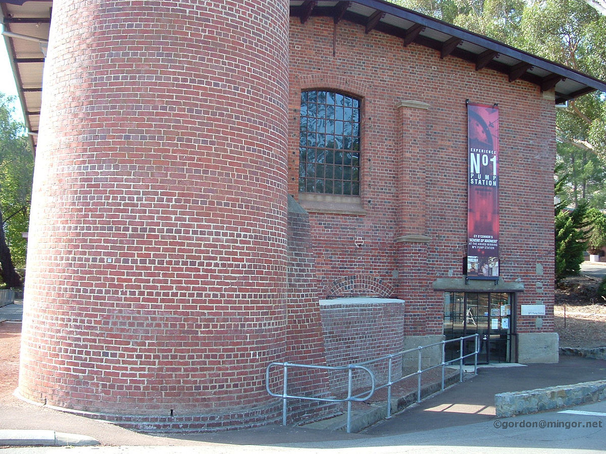 |
Mundaring Weir - C.Y. O'Connor Museum The entrance to the C.Y. O'Connor museum. That brickwork on the left is the base of the chimney stack. This is the No.1 Pumping Station of the Goldfields water pipeline. Construction of the Helena River dam was completed in 1902, the objective being to collect drinkable water and then pump it 650 kilometres to Kalgoorlie via a pipeline. This was successfully achieved, the first of the water arriving in Kalgoorlie in January 1903. April 2009. Photos Ref: MDGW001 |
||
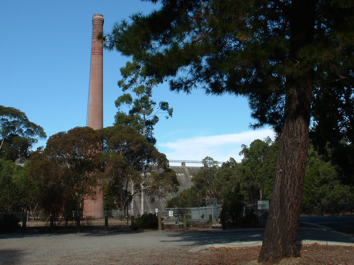 |
Mundaring Weir - C.Y. O'Connor Museum A view of the C.Y. O'Connor museum complete with that imposing chimney stack. You can see the dam wall in the background. Engineer, Mr Charles Yelverton O'Connor, turned the Kalgoorlie water scheme from a notion into reality. During the scheme planning and construction, O'Connor was openly derided by political opponents of the then Premier John Forrest, the press, and anyone else who thought they knew better about the scheme. Mr O'Connor committed suicide at Coogee Beach before the pumped water arrived at Kalgoorlie. April 2009. Photos Ref: MDGW002 |
||
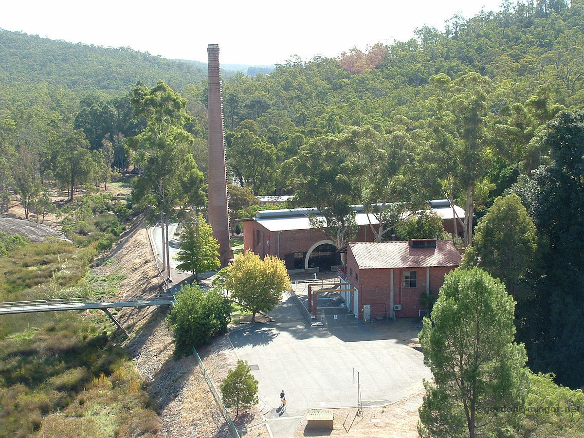 |
Mundaring Weir - C.Y. O'Connor Museum Looking down from the walk-way on top of the dam wall, onto the C.Y. O'Connor museum, pumping station etc. You can see on this website photos of other pumping stations at Grass Valley and Cunderdin. There are also photos of the pipeline passing through Mount Helena, Wooroloo, Bakers Hill and Cunderdin. A commemorative statue of Mr O'Connor is featured on the Coogee locality page, situated in the ocean where he died. April 2009. Photos Ref: MDGW003 |
||
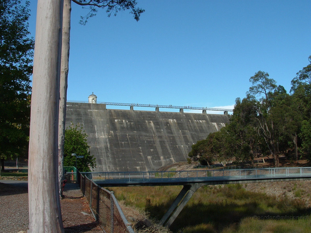 |
Mundaring Weir - Dam Wall The dam wall viewed from over near the C.Y. O'Connor Museum. The dam wall was increased in height by nearly ten metres in 1951. Dam levels all around Perth are perilously low and have been dropping for years. It remains to be seen how long the Goldfields water scheme out of Perth can remain viable. April 2009. Photos Ref: MDGW004 |
||
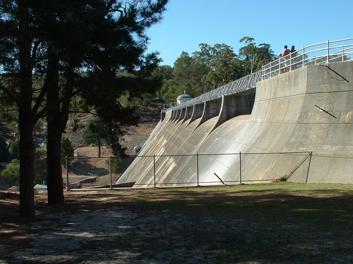 |
Mundaring Weir - Dam Wall A good view of the 'dry' side of the dam wall. It has stayed dry for years. The last time the dam has overflowed was in 1974 or 1975. April 2009. Photos Ref: MDGW005 |
||
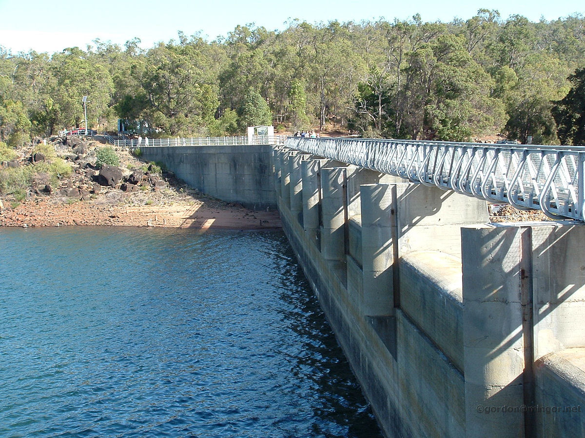 |
Mundaring Weir - Dam Wall This is the walk-way traversing the top of the dam. You can see the low water level. This is April, however, after a long and dry summer, so hopefully soon the water level will rise. April 2009. Photos Ref: MDGW006 |
||
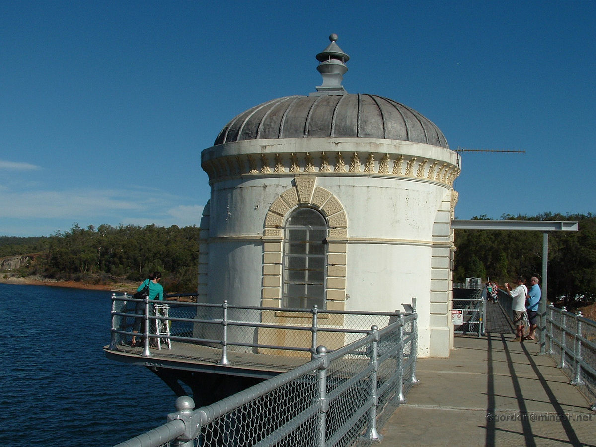 |
Mundaring Weir - Control Station Over towards the north end of the dam wall is this building. It's a popular landmark up here. I suspect this may be an old pump house or control station for the spillways? April 2009. Photos Ref: MDGW007 |
||
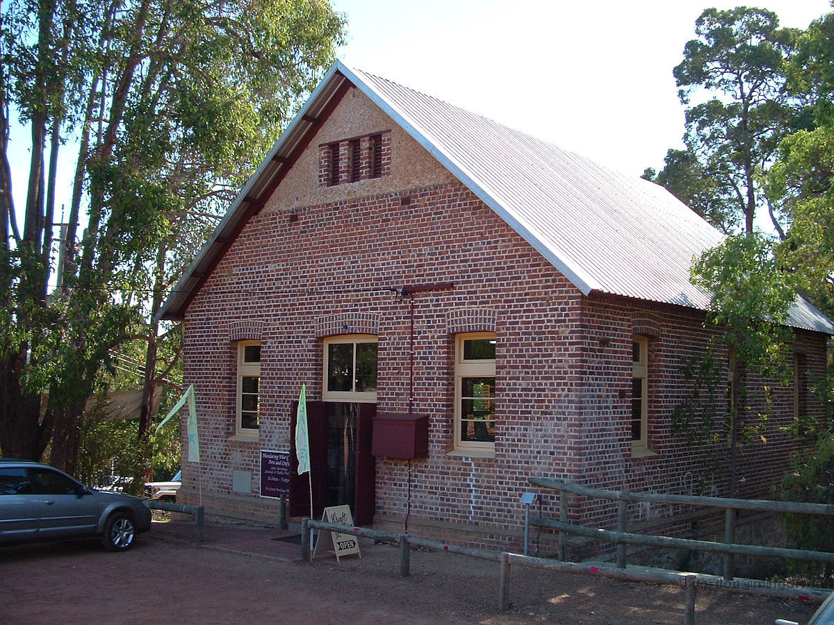 |
Mundaring Weir - Hall Mundaring Weir Arts & Crafts Centre occupies what was once the Mundaring Weir Hall. This was built in 1908 and was formerly the Mechanic's Institute. April 2009. Photos Ref: MDGW008 |
||
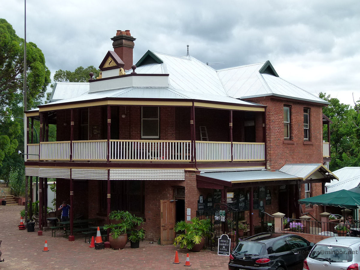 |
Mundaring Weir - Weir Hotel The Weir Hotel in the Weir Village area, just off the Kalamunda - Mundaring road. There is a substantial amphitheatre at the rear, today filled with chairs so some entertainment must be forthcoming. The hotel was erected in 1898 and has also been known as the Goldfields Reservoir Hotel and the Weir Lodge Hotel. January 2012. Photos Ref: MDGW009 |
||
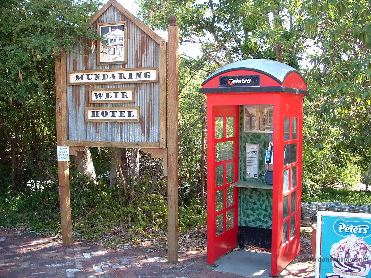 |
Mundaring Weir - Hotel Phone Box Outside Hotel I wonder how many functional old red phone boxes remain in existence. Even though this one is minus the door? It adds to the charm of the area. April 2009. Photos Ref: MDGW010 |
||
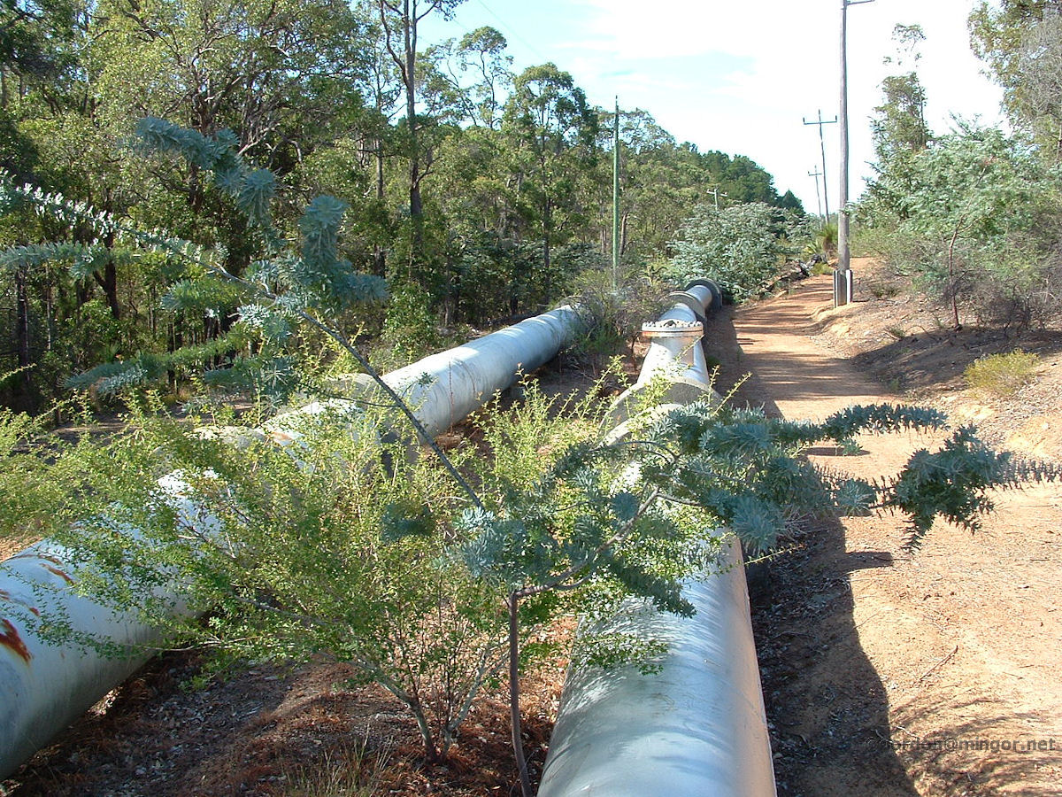 |
Mundaring Weir - Pipelines to Kalgoorlie A few kilometres from Number One Pumping Station the water pipelines start their long 650km journey to Kalgoorlie wending through the Darling Scarp. April 2009. Photos Ref: MDGW011 |
||
All images published on this website are copyright © of the webmaster. See About section for clarification and special schools permission |
|||