| Photographs of Perth, Western Australia | |||
Wooroloo - Photographs of Western Australia A small settlement east of Chidlow and west of Wundowie and north of the Great Eastern Highway. Wooroloo is some 60 kms east of Perth. In 1841 a townsite was proposed here with the name of Worriloo. This did not eventuate. The area was first settled by the Byfield brothers in the 1870's (who became saw-millers). In 1893 a rail siding opened called Byfield's Mill. In 1897 the town, the rail siding and the school all adopted the name Wooroloo |
|||
| West to Chidlow | South to The Lakes | ||
| East to Wundowie | |||
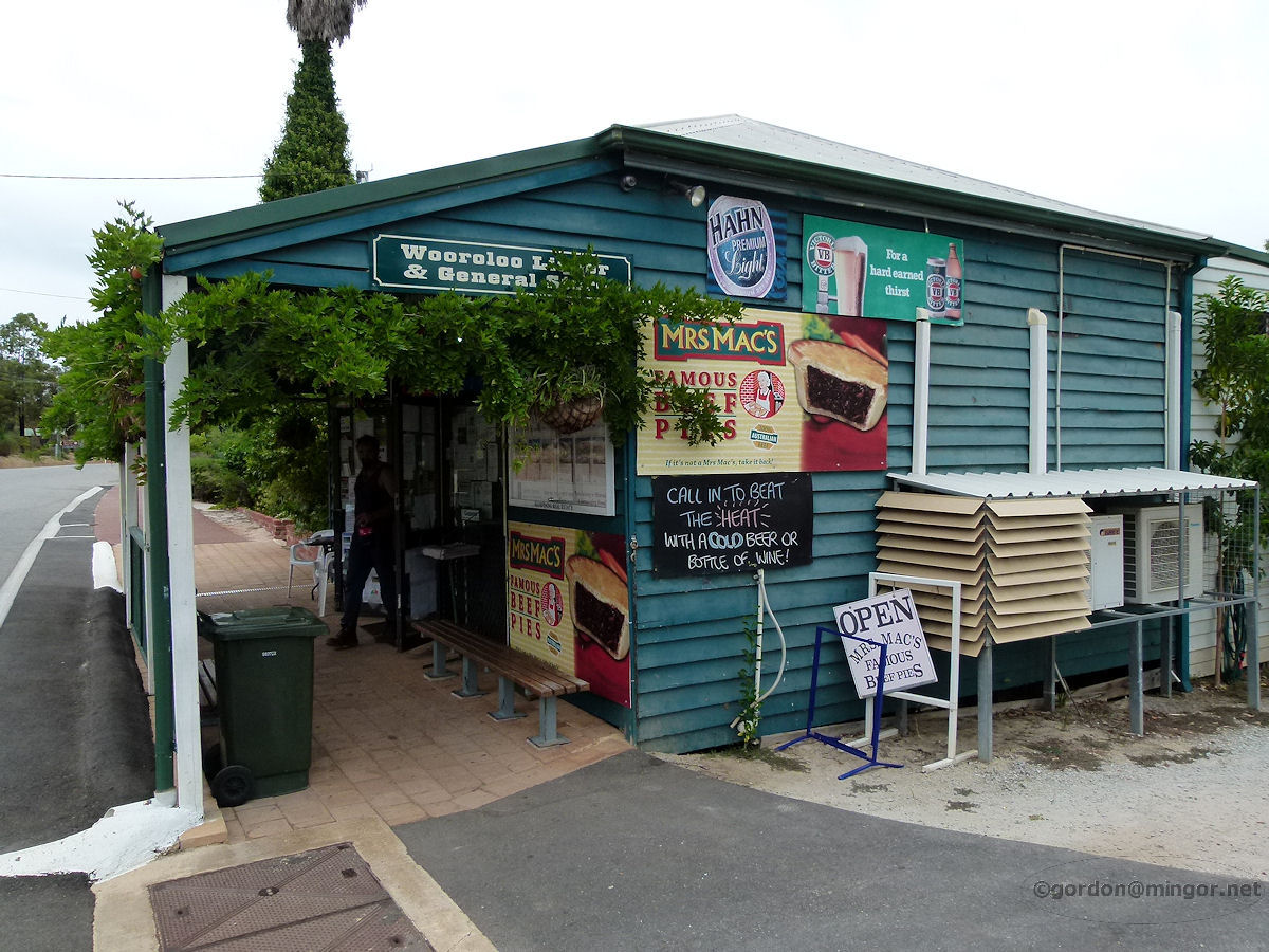 |
Wooroloo - Store This is one of those country stores where you can buy anything from knitting needles to a carton of beer. They even have there own brand of local food produce cleverly branded as 'Wooroloo Escape'. February 2011. Photos Ref: WOOR001 |
||
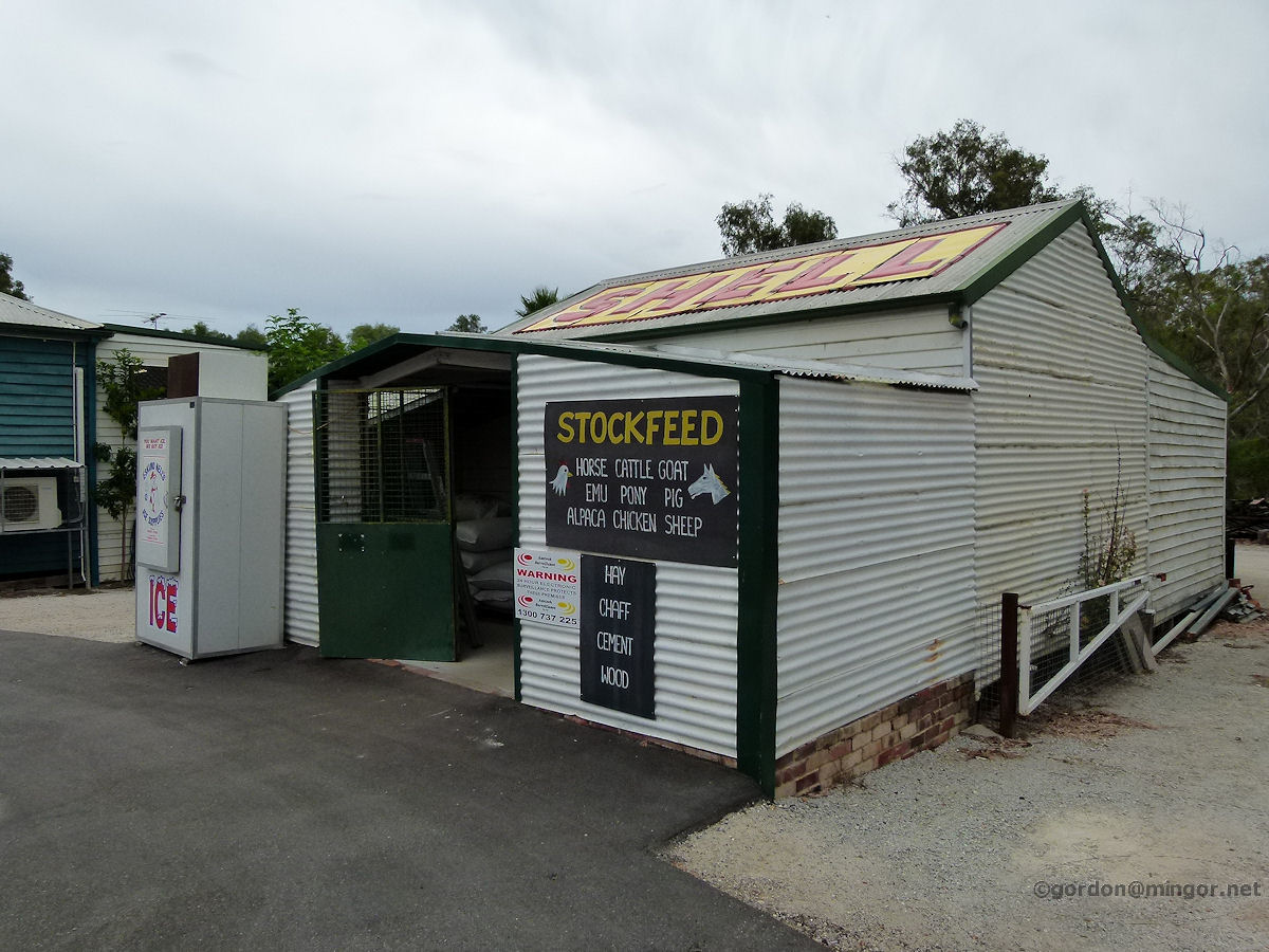 |
Wooroloo - Stockfeed Merchants This is the stock feeds business which may have once been a garage (the 'Shell' on the roof) in earlier years. It's right next door to the store. February 2011. Photos Ref: WOOR002 |
||
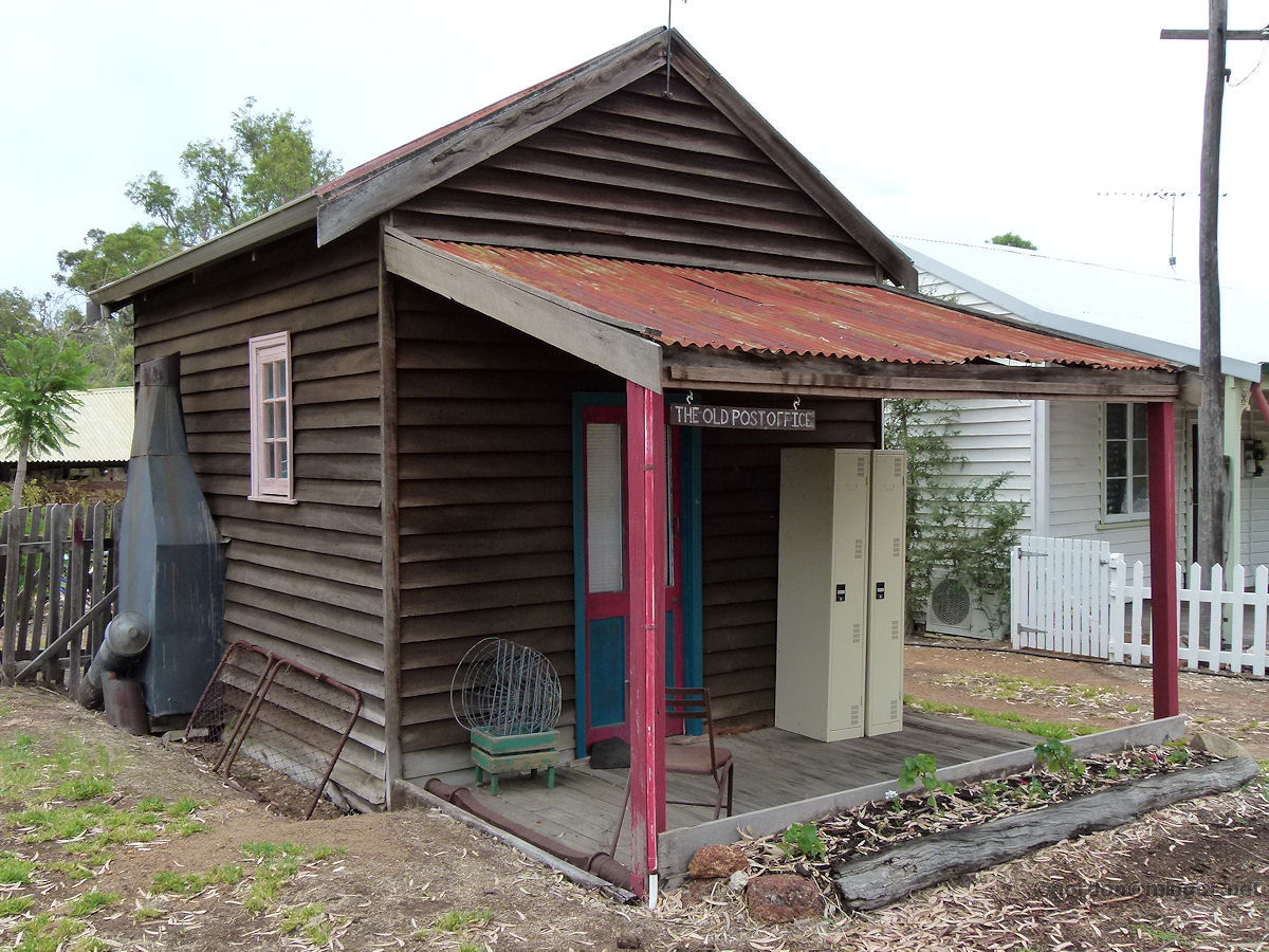 |
Wooroloo - Old Post Office The Old Post Office on Werribee Road, Wooroloo. This looks remarkably like the old bank building in Shackleton. February 2011. Photos Ref: WOOR003 |
||
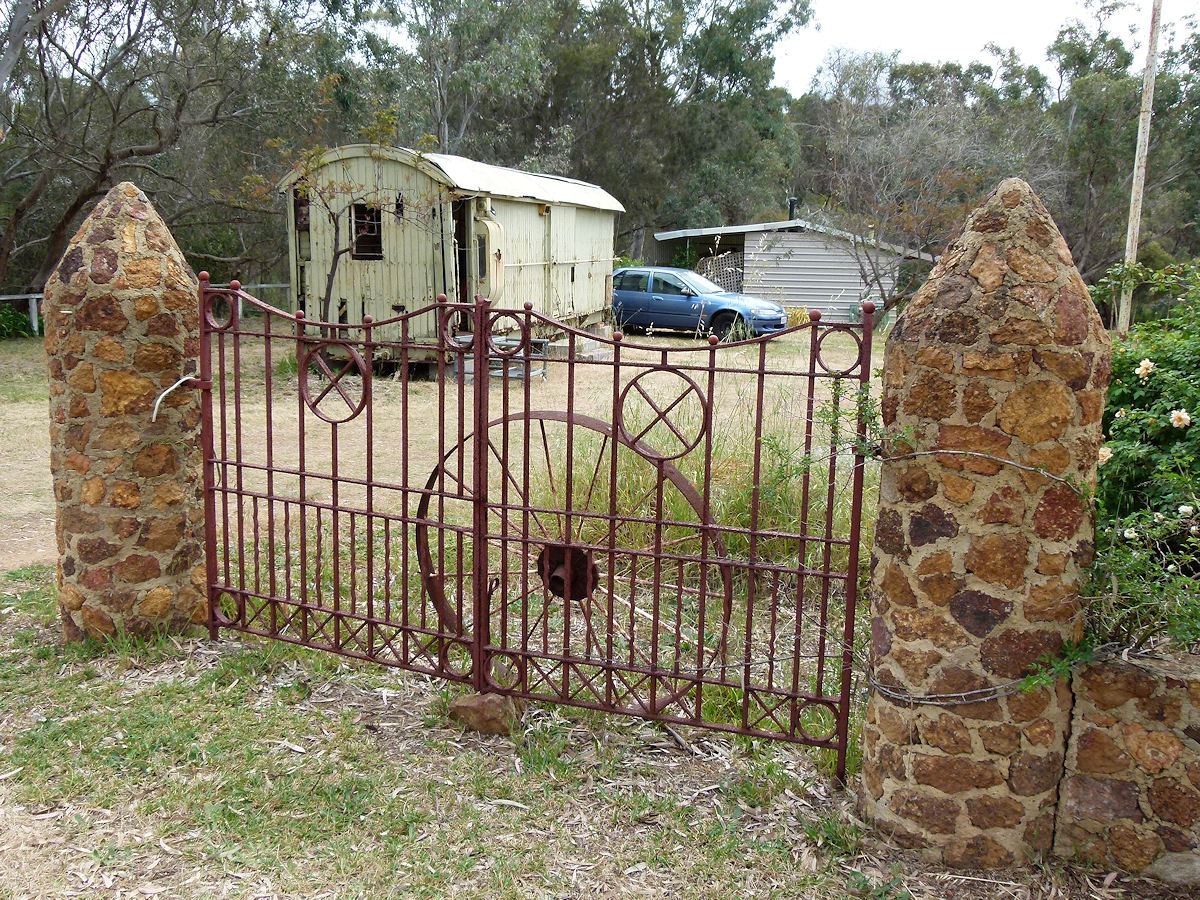 |
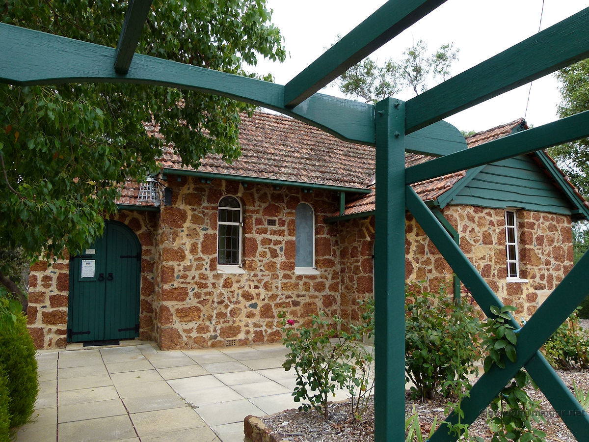
Wooroloo - Stone Gates Next door to the Old Post Office and indeed it looks like to be on the same property are these sturdy stone gates, built of similar materials to the local Anglican Church. October 2015. Photos Ref: WOOR004 |
||
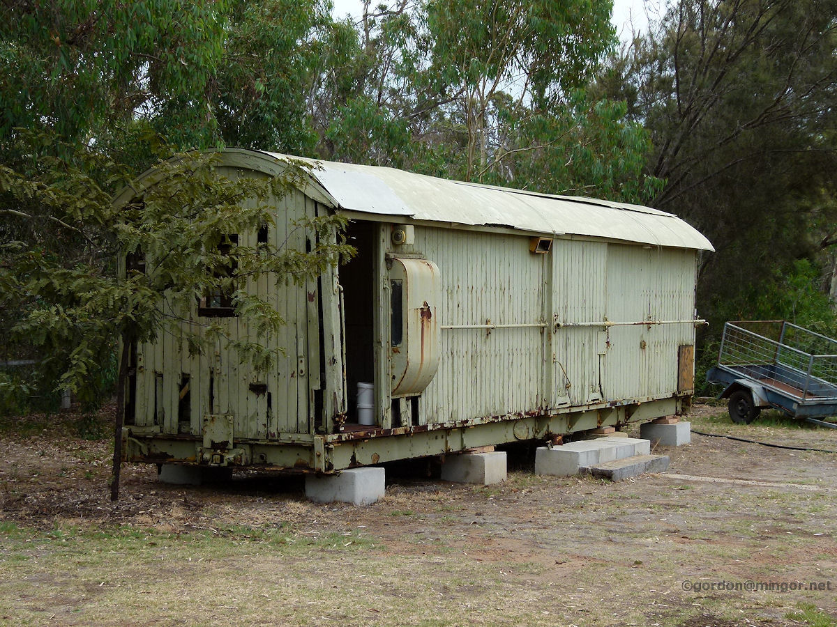 |
Wooroloo - Old Carriage This is an old railway guards van sitting in the yard adjacent to the Old Post Office. February 2011. Photos Ref: WOOR005 |
||
 |
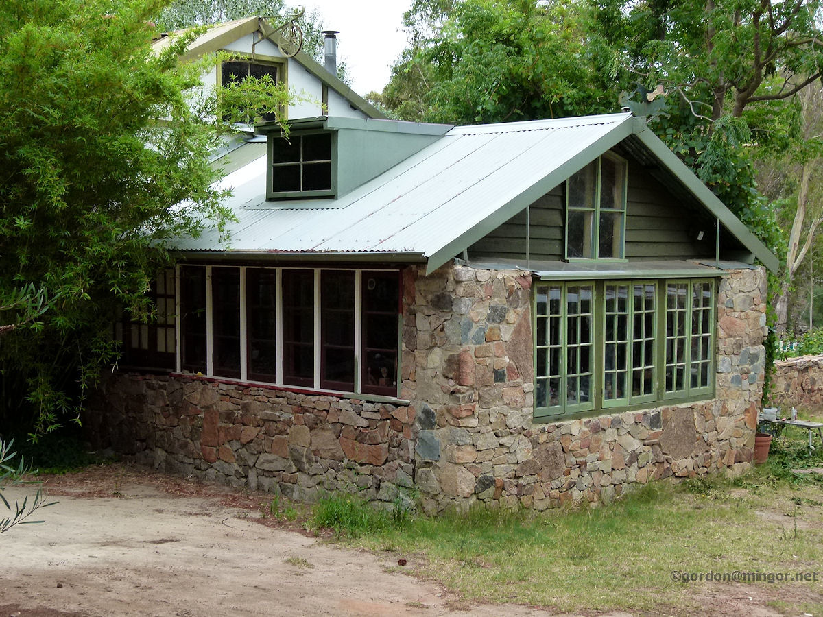
Wooroloo - Alyward Studio Close to the Old Post Office is the Alyward Studio. This is the home and studio of famed Perth artist T. Brian Alyward. February 2011. Photos Ref: WOOR006 |
||
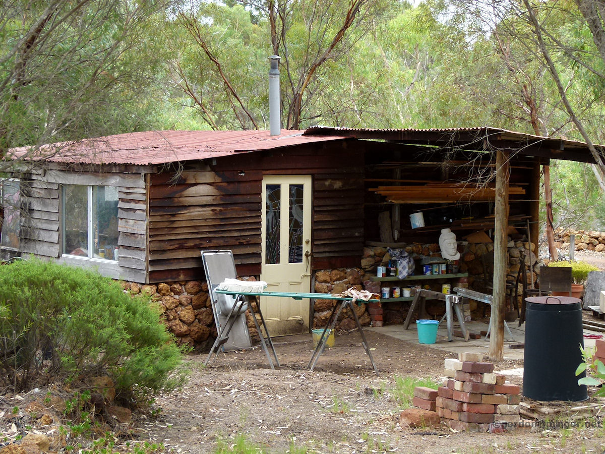 |
Wooroloo - Alyward Studio The Alyward studio on Werribee Road. This section looks like a workshop. The place is apparently periodically open to visitors. February 2011. Photos Ref: WOOR007 |
||
 |
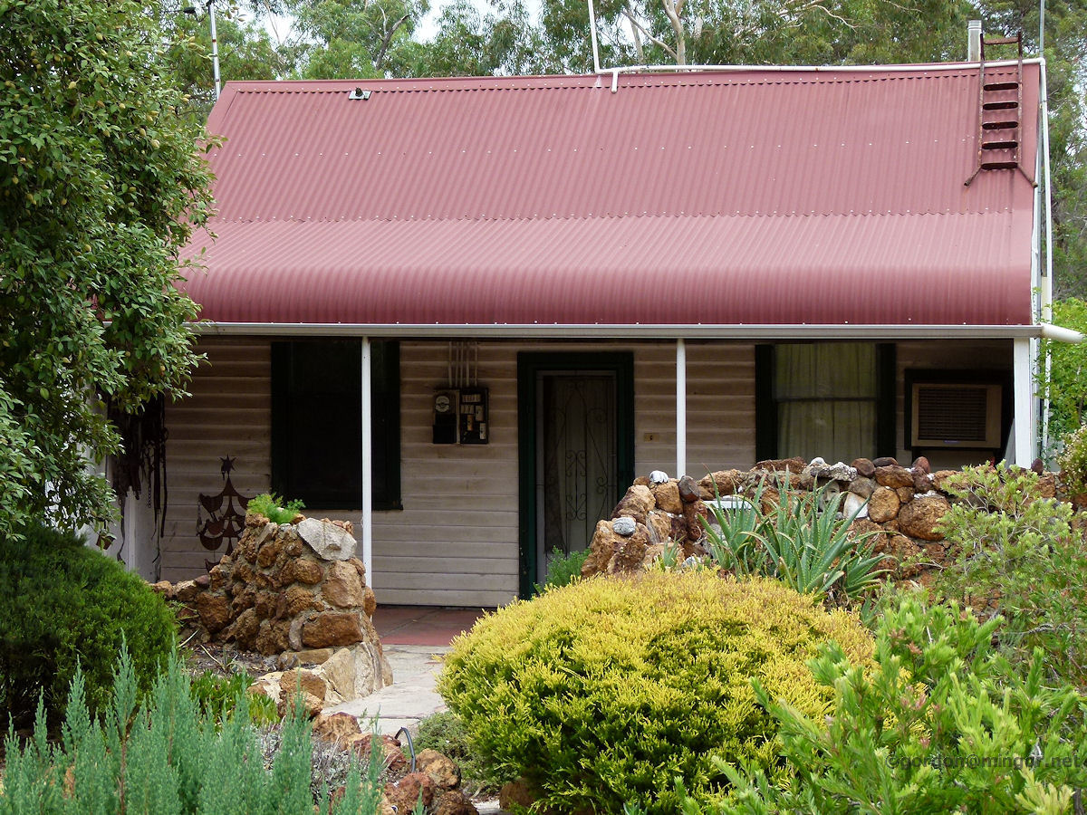
Wooroloo - House A private dwelling in Wooroloo. Old world country-style charm. February 2011. Photos Ref: WOOR008 |
||
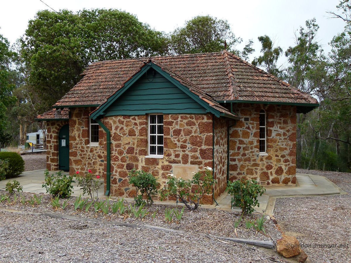 |
Wooroloo - Anglican Church The local Anglican Church was built in 1940. The Foundation Stone was laid by the Hon. L. Thorn MLA on 8th December 1940. The church was built by R. J. Davies. February 2011. Photos Ref: WOOR009 |
||
 |
Wooroloo - Anglican Church Another view of the church. This is the Anglican Church of Australia, Parish of Mundaring, St Francis, Wooroloo. The stone-work looks very similar to that of St Swithun's Anglican Church in Lesmurdie. February 2011. Photos Ref: WOOR010 |
||
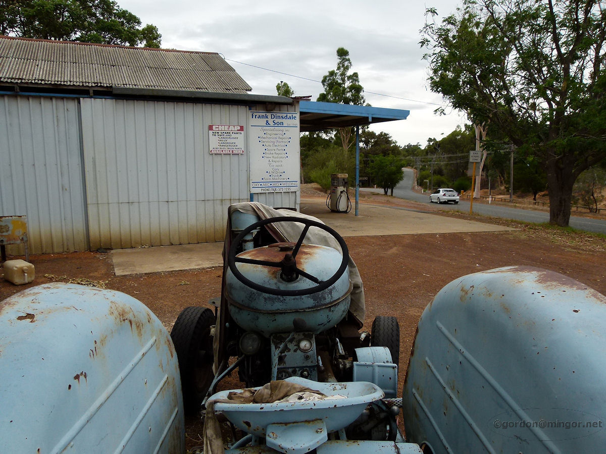 |
Wooroloo - Frank Dinsdale and Son Garage Frank Dinsdale & Son, local garage and mechanical repairs. This is a tractors-eye-view of the premises. February 2011. Photos Ref: WOOR011 |
||
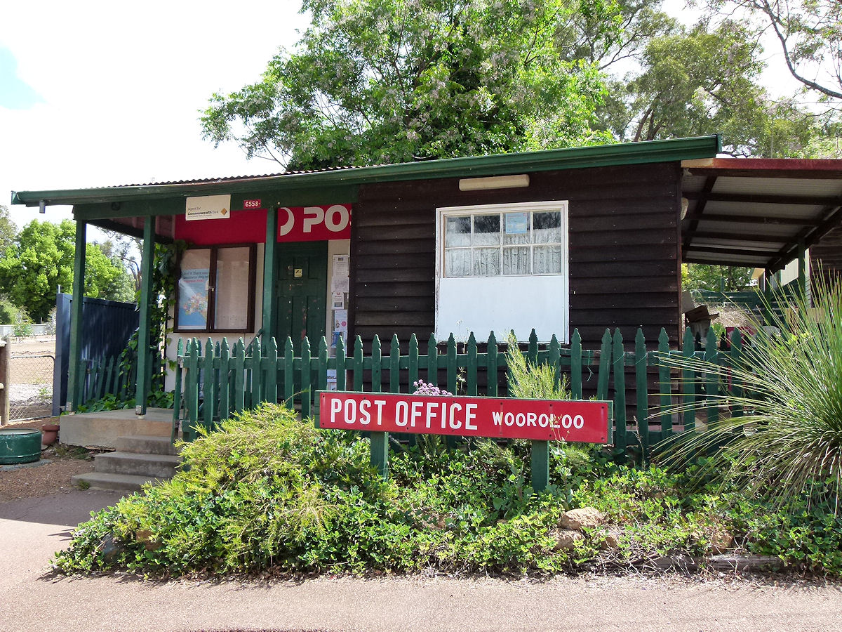 |
Wooroloo - Post Office On Orchard Road is the operating Wooroloo Post Office. It doesn't look that much newer than the Old Post Office building. October 2015. Photos Ref: WOOR012 |
||
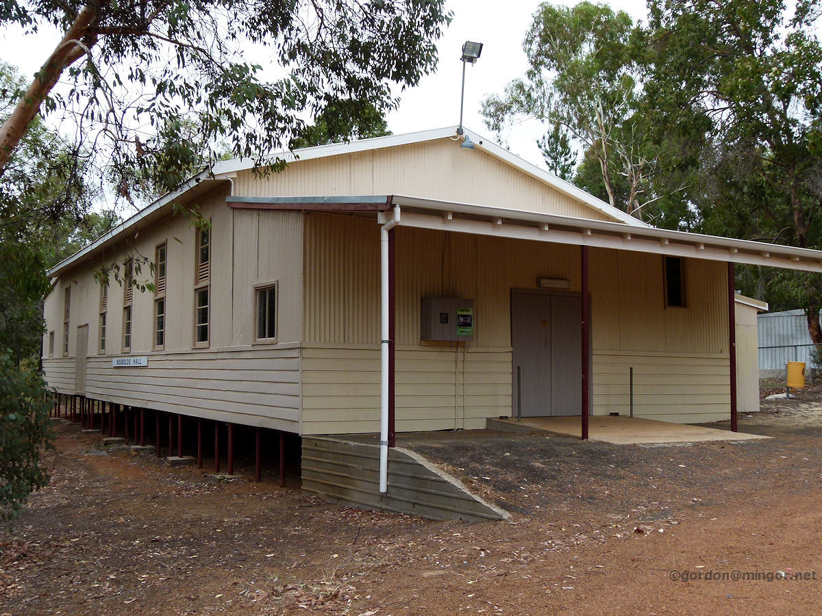 |
Wooroloo - Hall On the outskirts of town is the Wooroloo Hall. This was built in 1904 and has been extended and modified a few times over the years. February 2011. Photos Ref: WOOR013 |
||
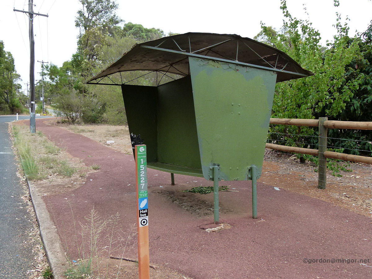 |
Wooroloo - Bus Stop Well I'm not sure how far the Perth bus routes extend but this must be on the very edge. This old iron bus shelter was seen on one of the local streets. Not too many of these around anymore. February 2011. Photos Ref: WOOR014 |
||
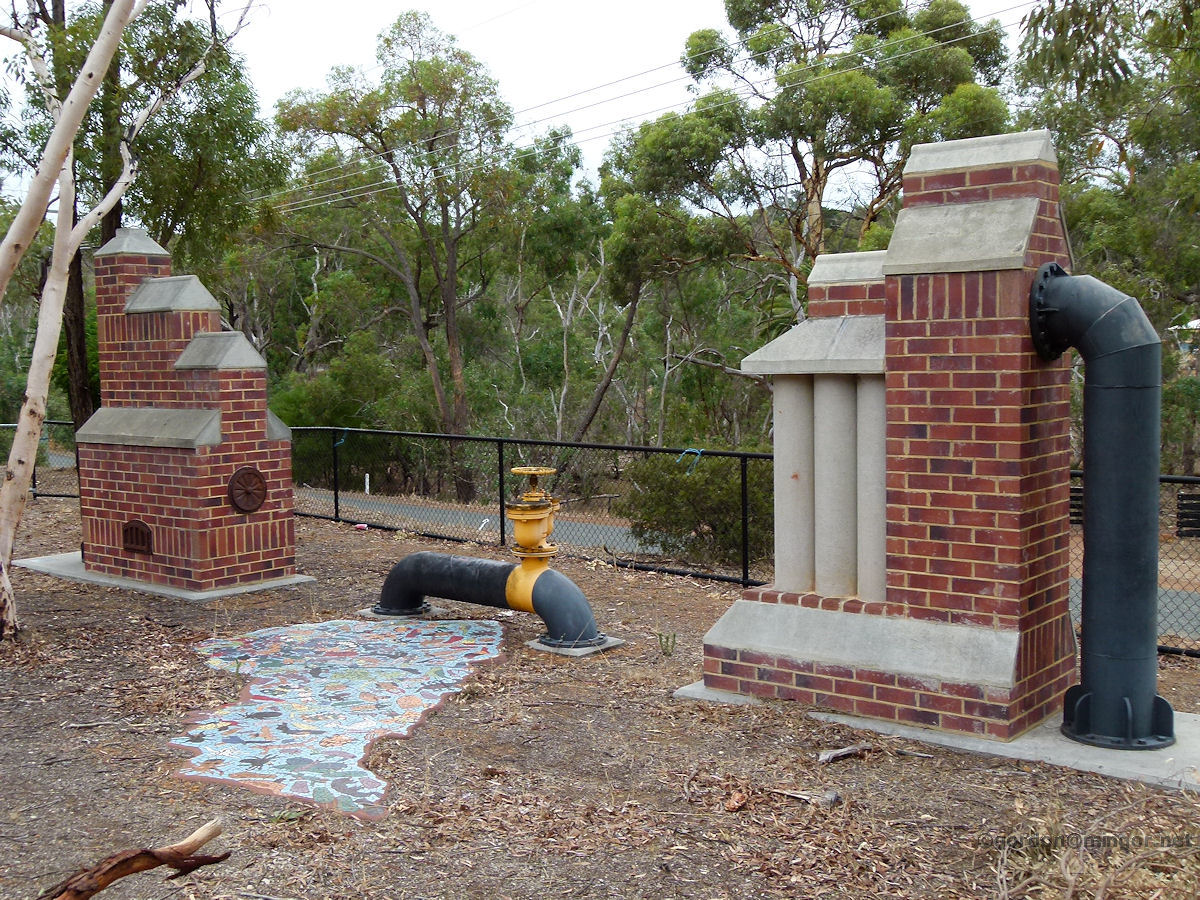 |
Wooroloo - Water Supply Pipes and Pump This is a set of pipes and valves that provide the town with water which comes from the passing Mundaring - Kalgoorlie pipeline. February 2011. Photos Ref: WOOR015 |
||
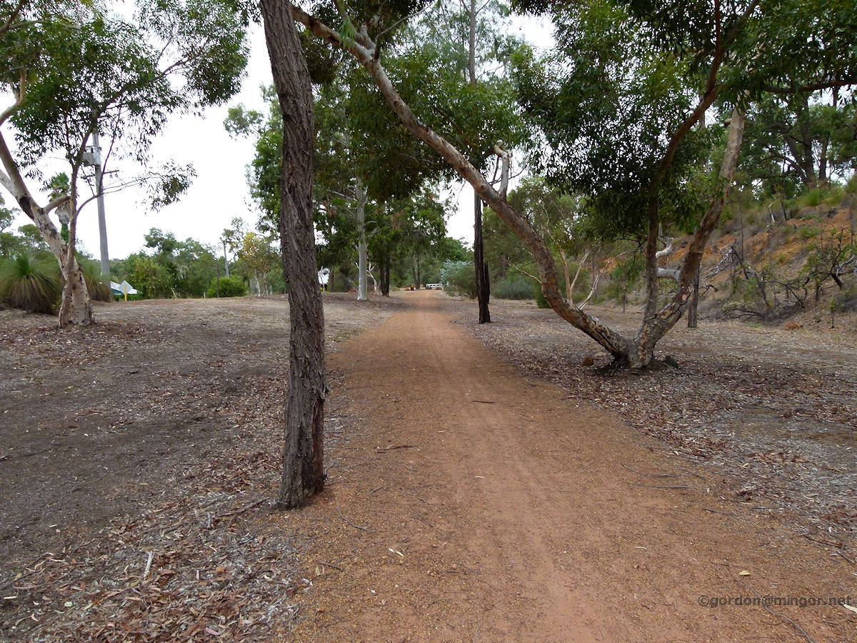 |
Wooroloo - Old Railway Easement The railway line used to run through here. From Midland through Mundaring and on to Bakers Hill, Clackline and Northam. The tracks have gone but the easement is still here providing a walking trail for those inclined. The track here passes through Wooroloo. February 2011. Photos Ref: WOOR016 |
||
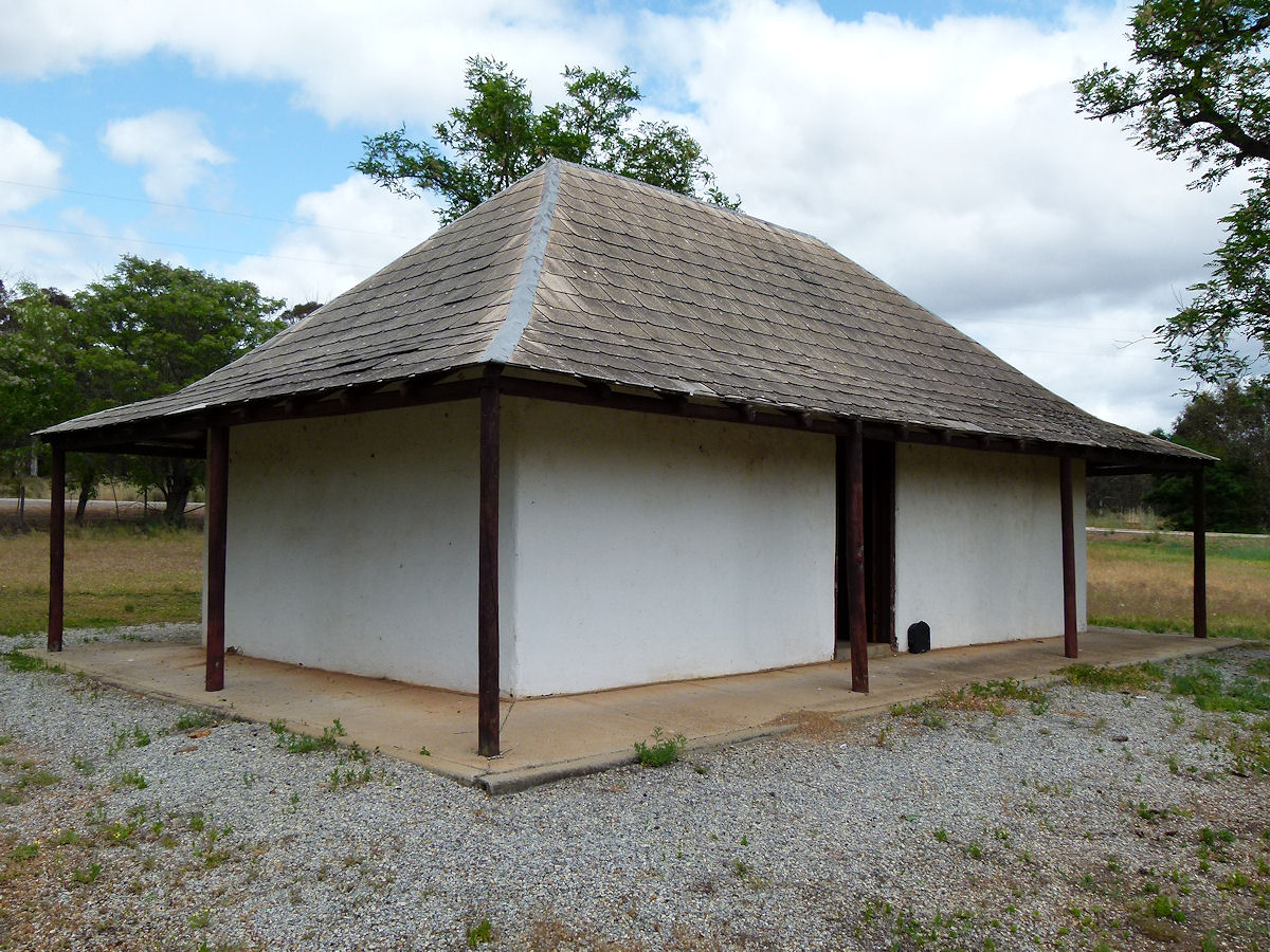 |
Wooroloo - Station Master's House Away from the main townsite but still classified as being in Wooroloo is the old Station Master's House sitting alongside the Great Eastern Highway just a few hundred metres east of El Caballo. This cottage was built pre-1852. Station in those days didn't mean railways. It was a staging post for horse-drawn carriages moving from Guildford to places further east. The staging posts were spaced at eight mile intervals which was the limit that the horses could travel in a single journey. October 2015. Photos Ref: WOOR017 |
||
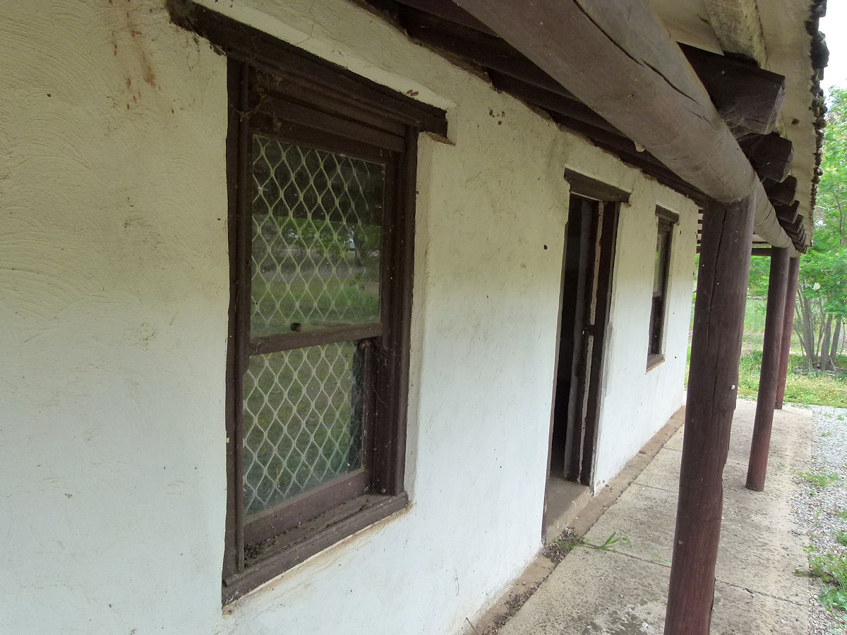 |
Wooroloo - Station Master's House A look down a side of the old Station Master's House. Inside is small. Just two rooms. October 2015. Photos Ref: WOOR018 |
||
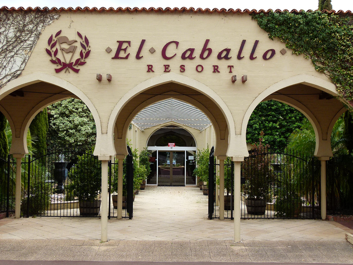 |
Wooroloo - El Caballo El Caballo, previously known as El Caballo Blanco, is on the Great Eastern Highway within the town of Wooroloo, and is located between The Lakes and Bakers Hill. This is a resort built along Spanish lines and was established by businessman and horse breeder Mr Ray Williams in 1974. This is a picture of the main entrance. October 2015. Photos Ref: WOOR019 |
||
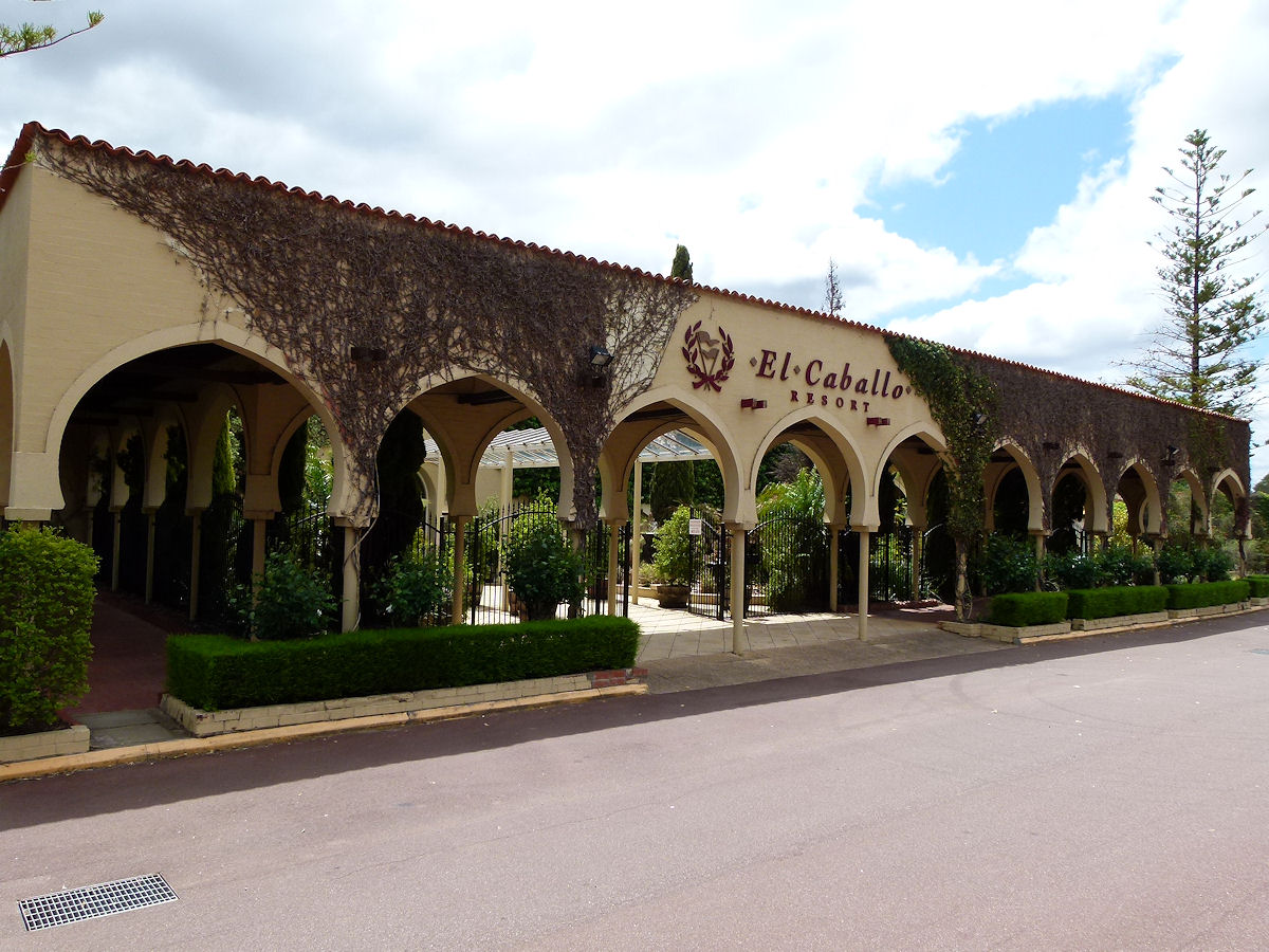 |
Wooroloo - El Caballo Another view of the main entrance of El Caballo, this time taking in the whole front facade. October 2015. Photos Ref: WOOR020 |
||
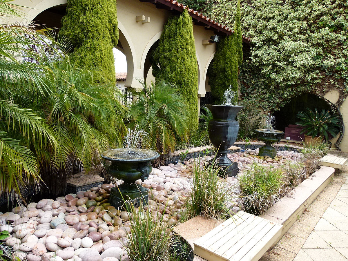 |
Wooroloo - El Caballo A look at part of the gardens within the guest's entrance area of El Caballo. This is just inside the main entrance. October 2015. Photos Ref: WOOR021 |
||
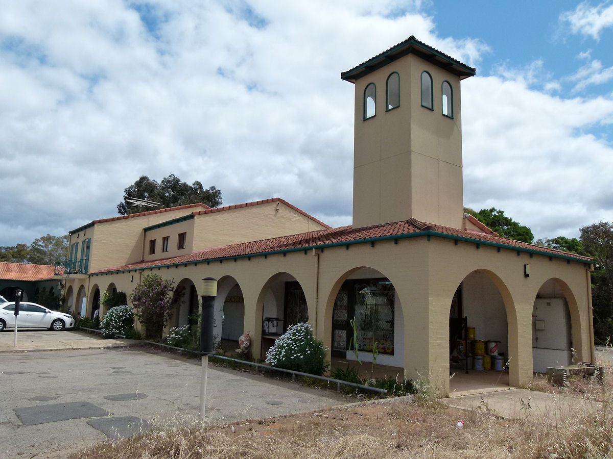 |
Wooroloo - Service Station Shops A couple of hundred metres east of El Caballo is a large service station. Behind the service station is this building built seemingly along similar lines as El Caballo itself. This building houses a few shops, a laundry, a clothing and bric-a-brac store, and what looks like was an antiques shop. Upstairs is the El Caballo Art Gallery. October 2015. Photos Ref: WOOR022 |
||
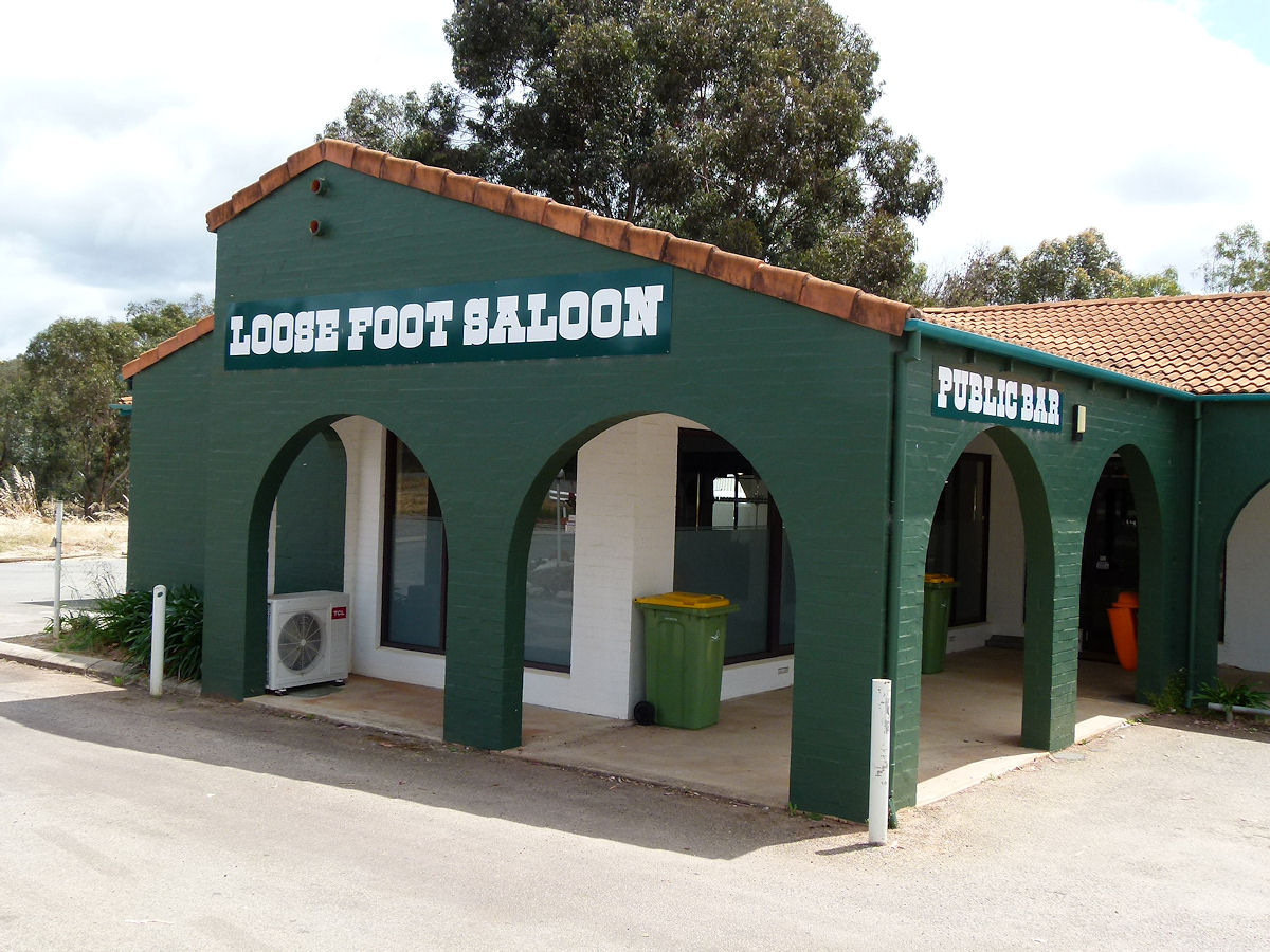 |
Wooroloo - Loose Foot Tavern Also behind the roadhouse is the Loose Foot Tavern. October 2015. Photos Ref: WOOR023 |
||
All images published on this website are copyright © of the webmaster. See About section for clarification and special schools permission |
|||