| Photographs of Perth, Western Australia | |||
Climate & Nature Experienced in Western Australia Climate and forces of nature in Western Australia. Here are a few photographs extracted from various pages to illustrate to some natural phenomena. These includes weather and measuring the weather, cloud formations, precipitation and even a few pictures illustrating the Meckering earthquake of 1968. Be sure to visit the main locality pages, particularly Meckering if you're interested in seeing more |
|||
| Cloud Formations | |||
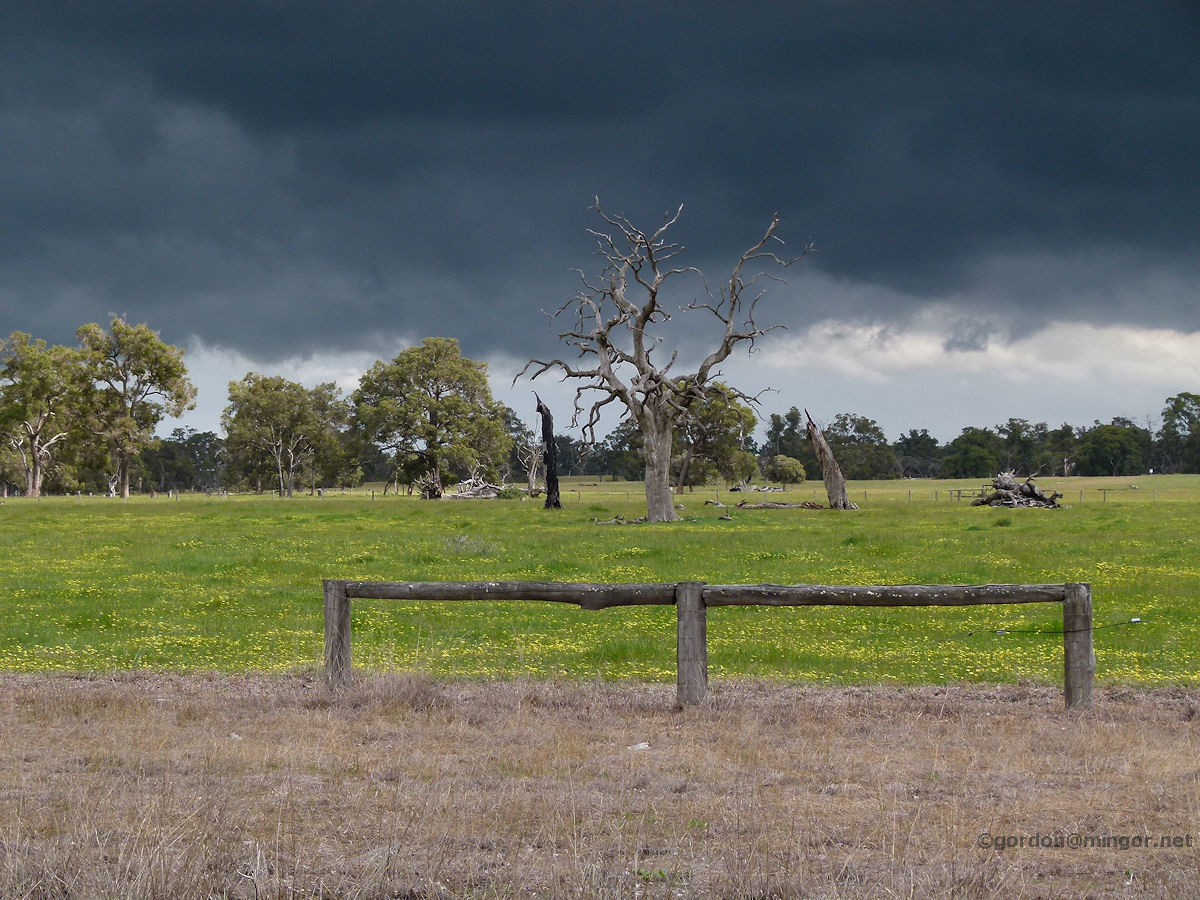 |
Thunder Clouds at North Dandalup Leaden thunder clouds roll in from the Mandurah area threatening this paddocks and the dead tree. Shortly after this picture, the heavens opened including some hail falling. Photo - October 2011 |
||
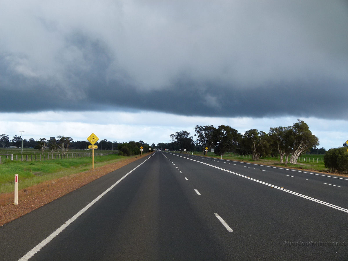 |
Heavy Clouds near Burekup Very heavy clouds form a blanket across the sky. The road is the South Western Highway and this is taken looking south, from near Burekup. Photo - July 2015 |
||
| Earthquakes | |||
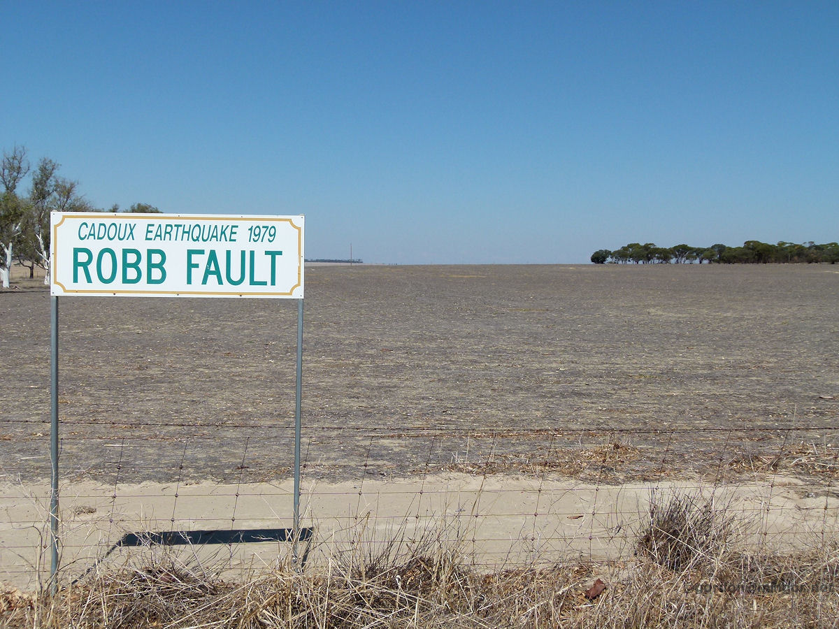 |
Robb Fault Line at Cadoux A few kilometres east of the townsite, on the Koorda Road, is this sign indicating the site of the Robb Fault which was caused by the 1979 earthquake. Nothing of the earthquake is evident here now. The earthquake struck at 9.48am on 02 June 1979. It was of magnitude 6.1 and located at a depth of 6km. It caused considerable building damage in the area. April 2012. Photo - April 2012 |
||
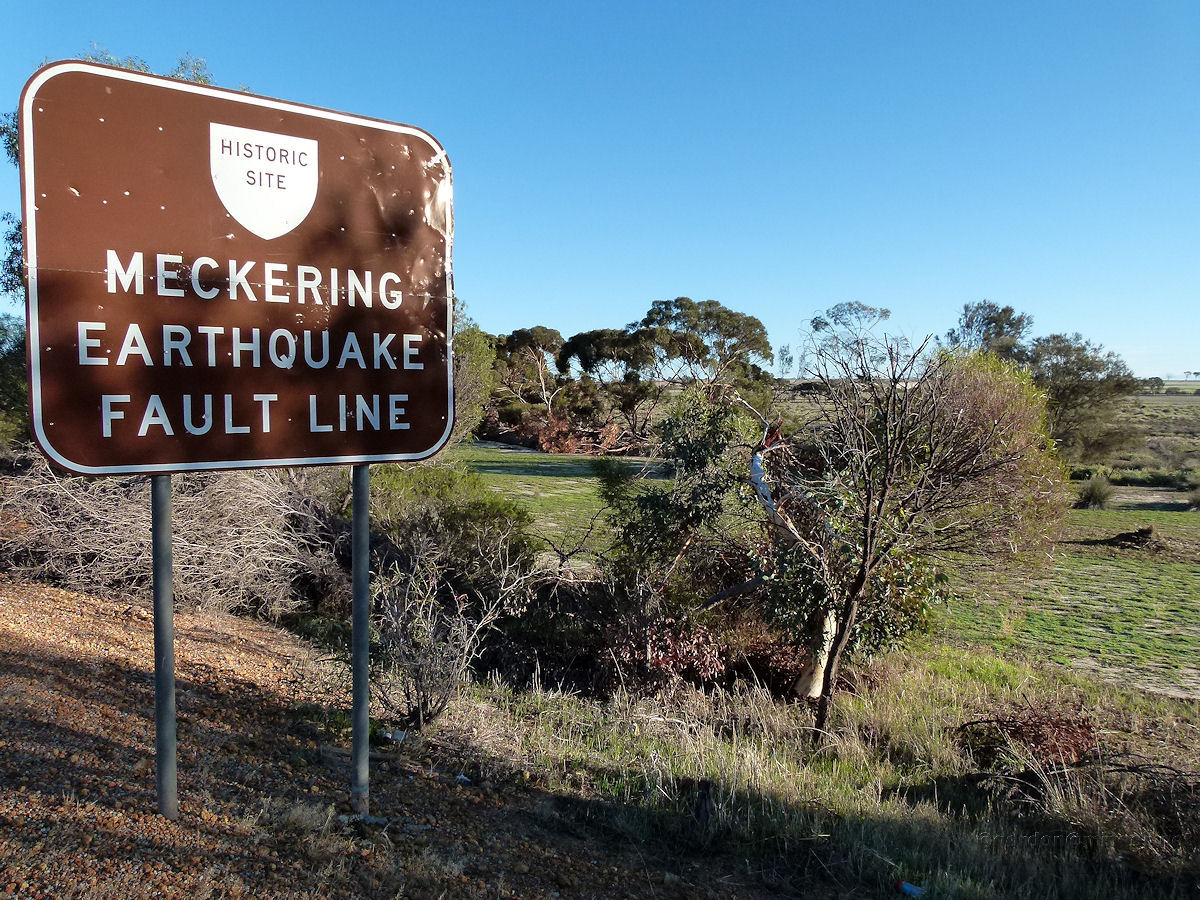 |
Earthquake Fault Line Sign near Meckering On October 14th, 1968 an earthquake with a magnitude of 6.9 struck Meckering, destroying just about all of the town. This is the fault line, where it crosses the Great Eastern Highway a few kilometres to the west of town. Perhaps a lesser known fact is that Meckering was rocked by earth tremors on 9th December, 1916. Photo - June 2011 |
||
 |
Earthquake Display at Meckering Buckled rail lines show the might of the event. However, photos taken at the time, in the display, show remarkably more buckling of the rail tracks at the site. Photo - June 2011 |
||
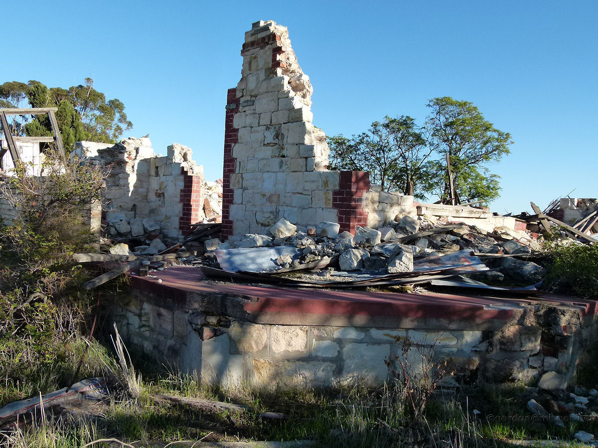 |
Earthquake Destroyed Farm House at Meckering A couple of kilometres north of the present townsite is this farm house wreckage which has been preserved as an earthquake memorial. Photo - June 2011 |
||
| Erosion | |||
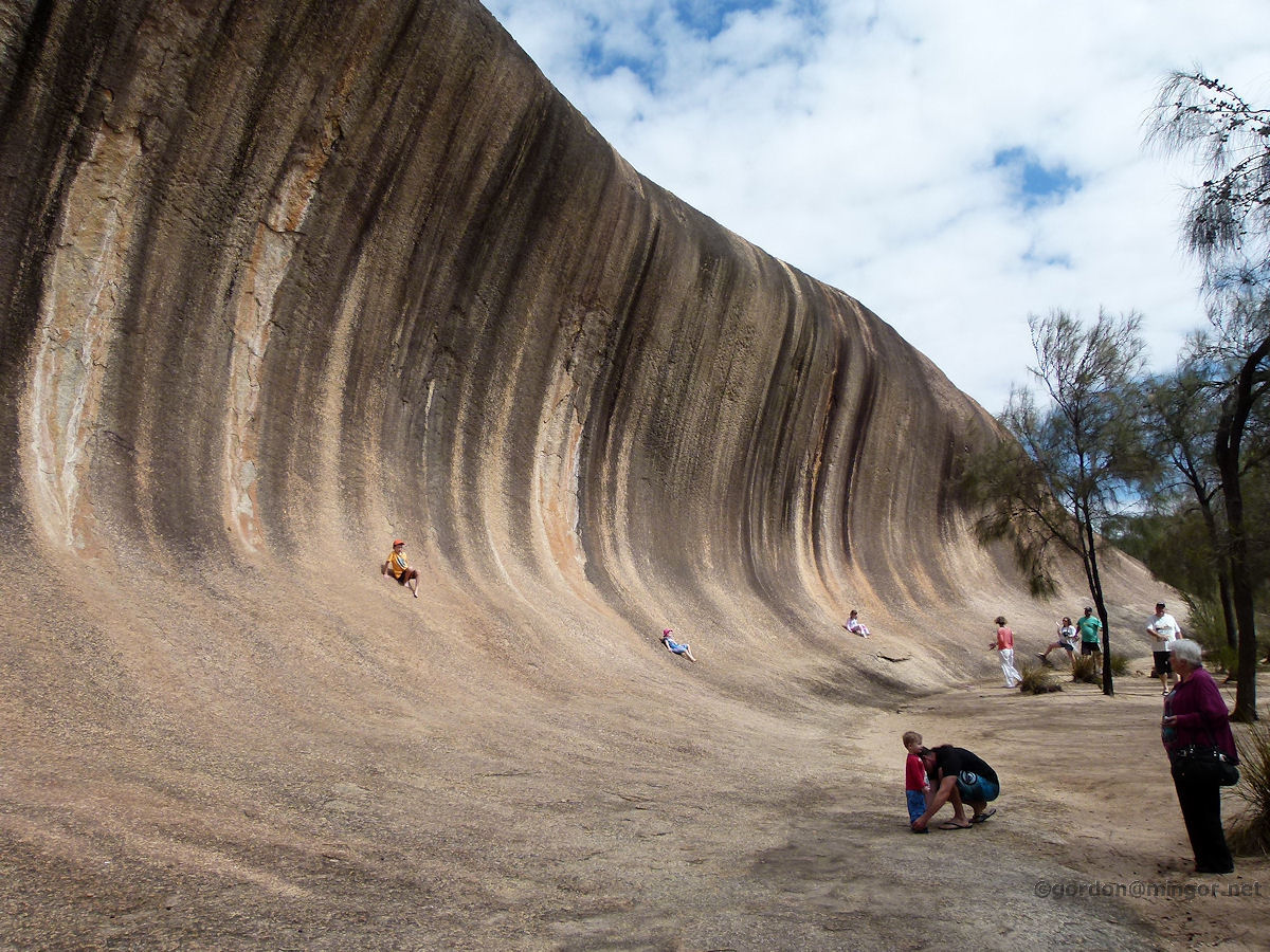 |
Underground Rock Formation at Hyden Wave Rock. A rather incredible rock formation and well-known tourist attraction. Children on the rock face might help show some size perspective. The rock is some 15 metres high and 100 metres long. It is thought to be about 60 million years old and was formed underground. The rock stratum is vertical. Softer soil and rock would have been washed away over the aeons leaving this spectacle. Photo - April 2015 |
||
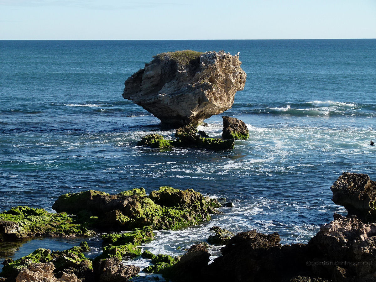 |
Rock Erosion at Rockingham Towards to end of the Cape Peron in Rockingham is this island that looks a little thin around the bottom. One day, one wave too many will cause this to tumble into the sea. This is called Mushroom Rock. Photo - June 2011 |
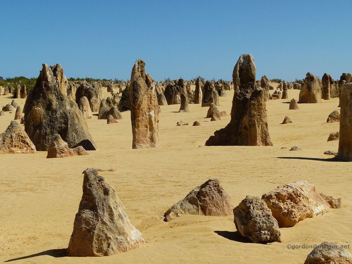 |
The Pinnacles near Cervantes The Pinnacles are limestone obelisks formed tens of thousands of years ago as shells and other marine debris were deposited here from the nearby ocean, probably by wind and wave, which eventually coalesced and grew higher in the massive sand dunes. Thousands of years later, the dunes blew away thus exposing the structures to how we see them today. Another theory is that these are simply calcified tree remnants spiked with sand and shells. No-one seems to be really sure. Photo - January 2013 |
| Optical Illusions | |||
 |
Mirage at Bunbury Looking out to sea. Off to the right is the Casuarina Lighthouse. Cape Naturaliste is visible on the horizon. A mirage effect distorts the cape image with the landmass seemingly being inverted and placed above what is real. You can see some top sections of the image jutting back so that what looks like cliffs are just an optical illusion. December 2013. Photos Ref: BUNB052 |
||
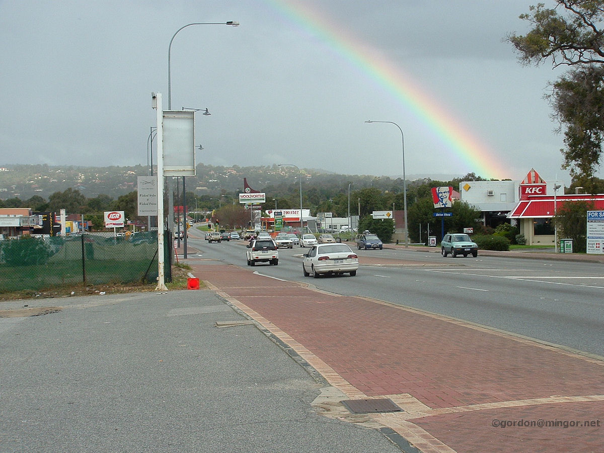 |
Rainbow at Kelmscott Albany Highway looking south, The rainbow arcs over the rain falling in perhaps Armadale or Roleystone, or even closer. The Darling Scarp is in the background. July 2008. Photos Ref: KELM001 |
||
| Rain, Hail and Mist | |||
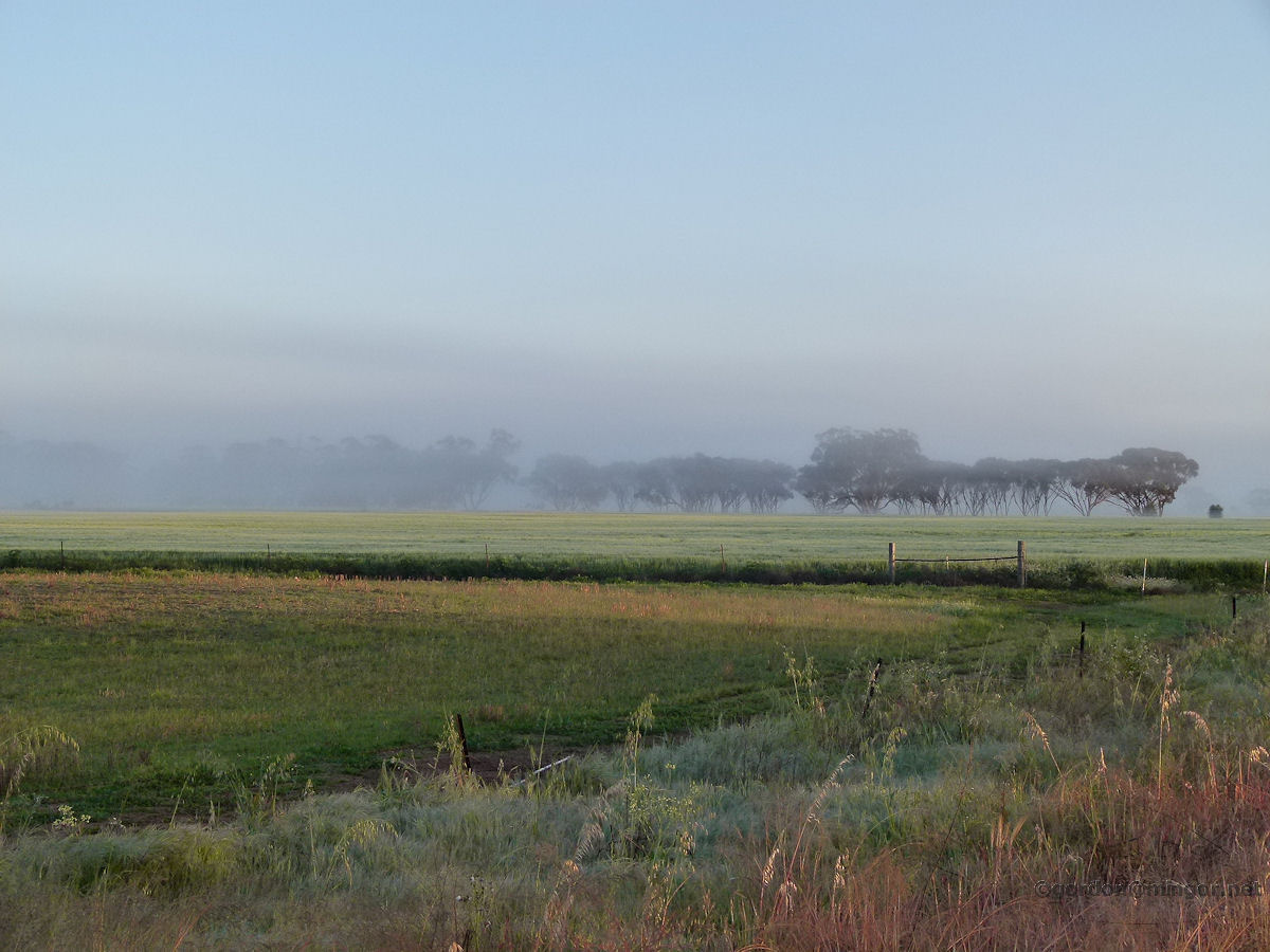 |
Coomberdale - Trees in Mist A line of trees appears to fade away into the morning fog. Photo - September 2014 |
||
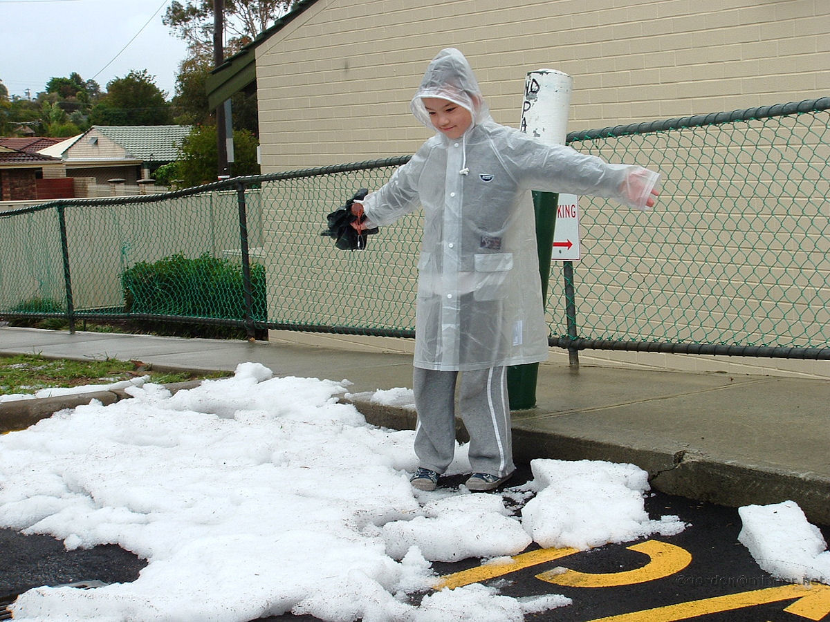 |
Duncraig - Hail and Sleet Hail or sleet is rare in Western Australia. One afternoon in June 2010 a hail storm moved through Duncraig whitening the ground. This boy marvels at the ice seen in the Glengarry Shopping Centre carpark some time after the storm had passed and still piles of ice remained. Photo - June 2010 |
||
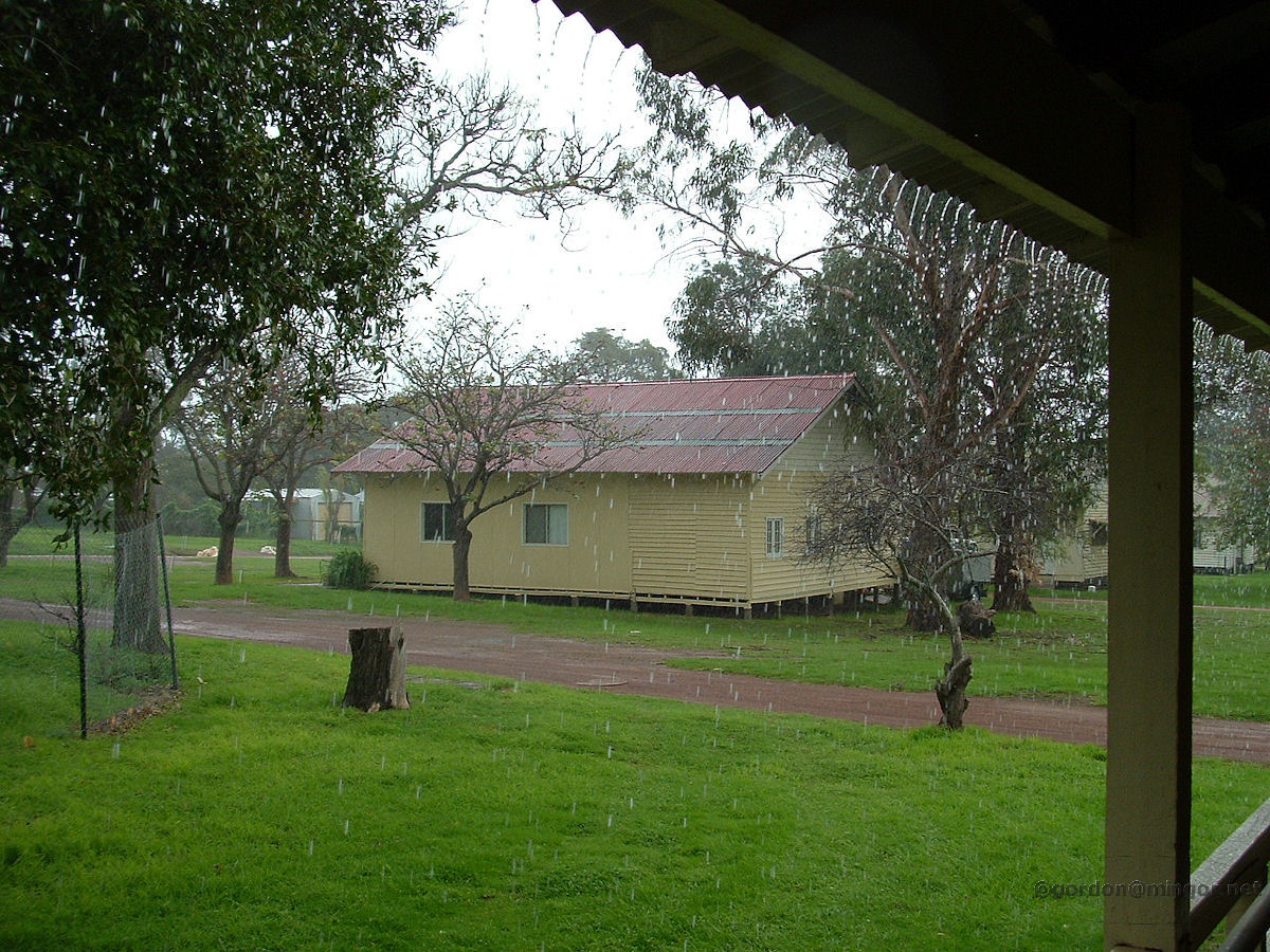 |
Fairbridge - Rain Rain tumbles off the roof of Hudson Cottage at Fairbridge Farm near Pinjarra. Photo - July 2009 |
||
| Sea Levels | |||
 |
Mosman Park - Buckland Hill Sea Level Sign This sign is located at Buckland Hill in Mosman Park and illustrates how the sea level has risen so much in the last 10,000 years that whereas once upon a time you could have walked to Rottnest however these days you'd get your feet a little wet if you tried. Photo - February 2010 |
||
| Weather - Observing and Measuring | |||
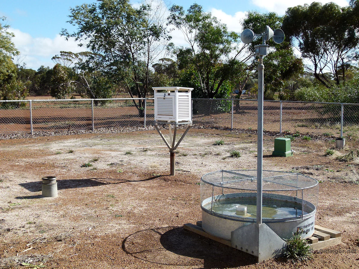 |
Weather Station at Corrigin The Corrigin weather station measures maximum and minimum temperatures, wind speeds and evaporation rates. This is right next to the footpath on Watson Street. Photo - June 2013 |
||
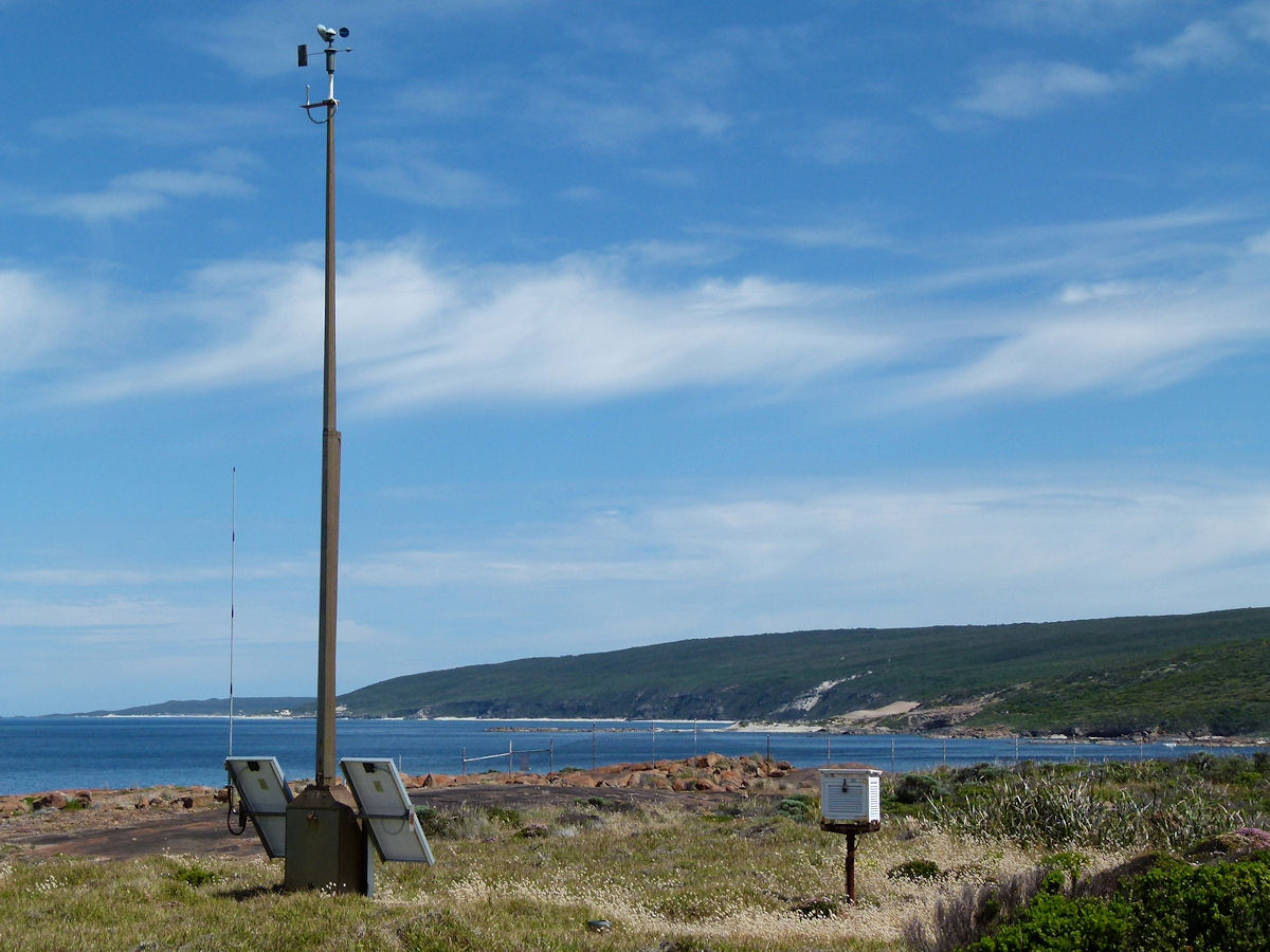 |
Weather Station at Cape Leeuwin The Cape Leeuwin weather station on a rather exposed place over-looking the ocean. I'd bet some decent wind speeds are recorded here during the winter. Photo - December 2013 |
||
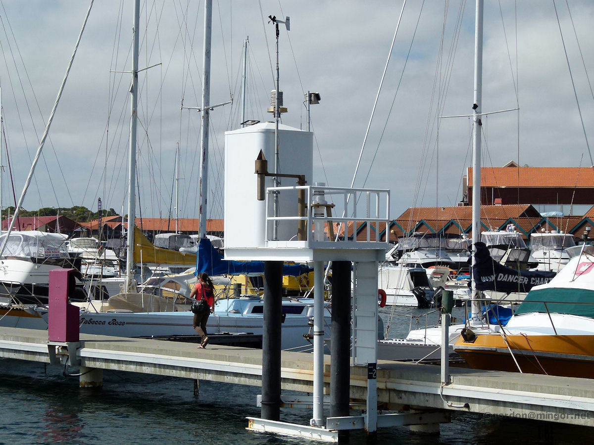 |
Weather Station at Hillarys Boat Harbour A rather unobtrusive weather station at the head of one the the boat harbour jetties at Hillarys. Anyone considering heading out to sea would take special note of the wind speed and direction plus the prevailing barometric change trend. Photo - December 2013 |
||
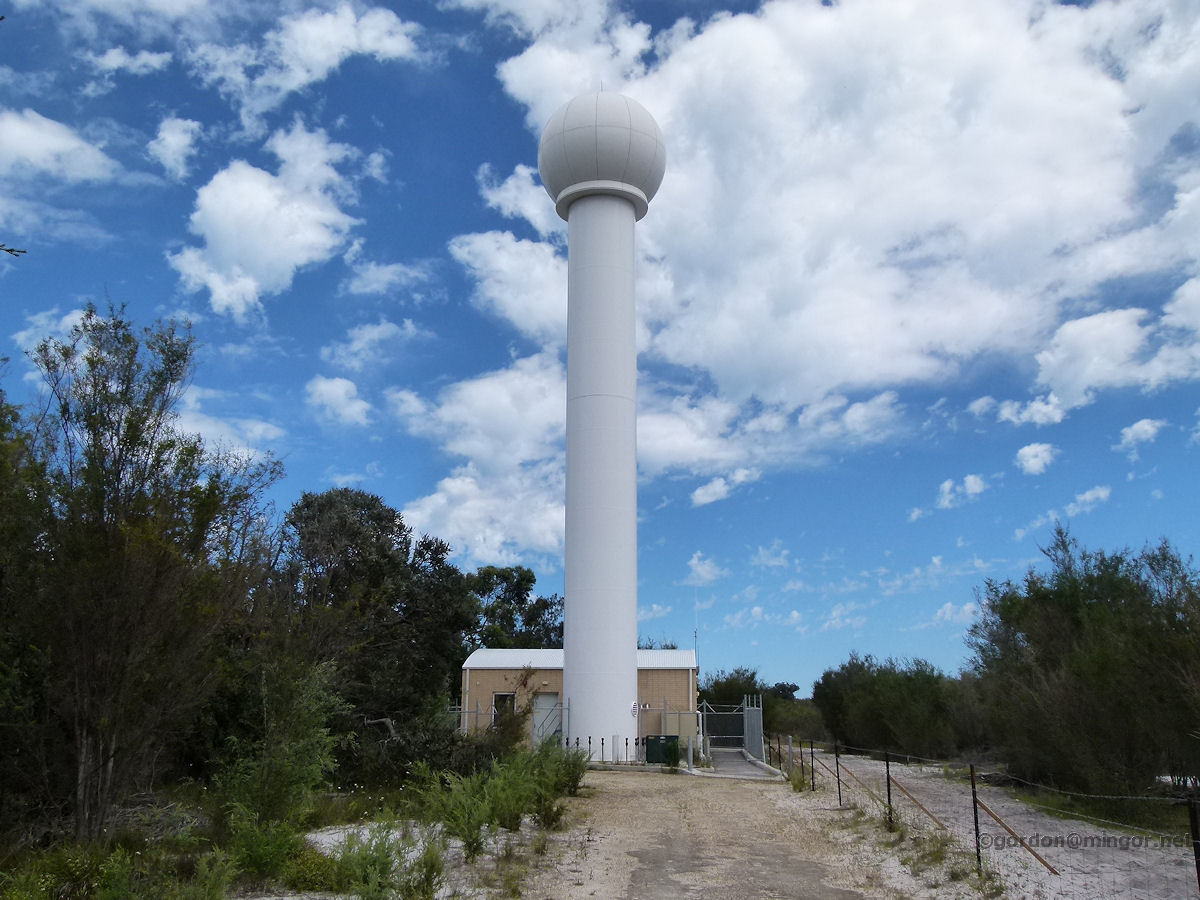 |
Weather Radar at Serpentine Up a track behind the Serpentine Airfield is the Bureau of Meteorology weather radar which services a radius of some 256 kilometres including the Perth Metropolitan area. This is what tells us rain is coming. Photo - October 2013 |
||
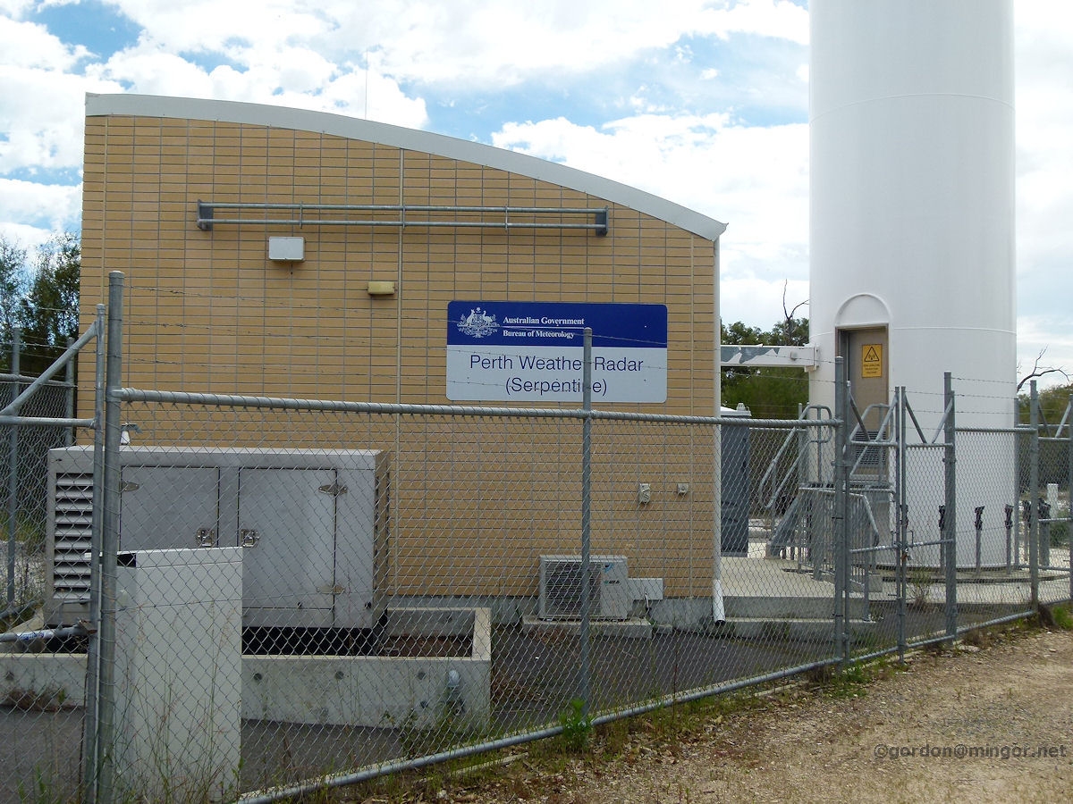 |
Weather Radar at Serpentine This is the base station and base of the radar tower. Warning signs advise of a potential radiation hazard. The radar tower resembles a lighthouse with that doorway at the bottom. Photo - October 2013 |
||
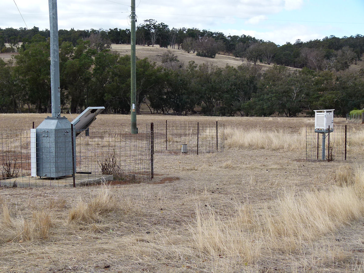 |
Wandering Weather Station The local weather station sits alongside the highway in the north end of town. That little white box is famous for recording many low temperatures. Photo - April 2019 |
||
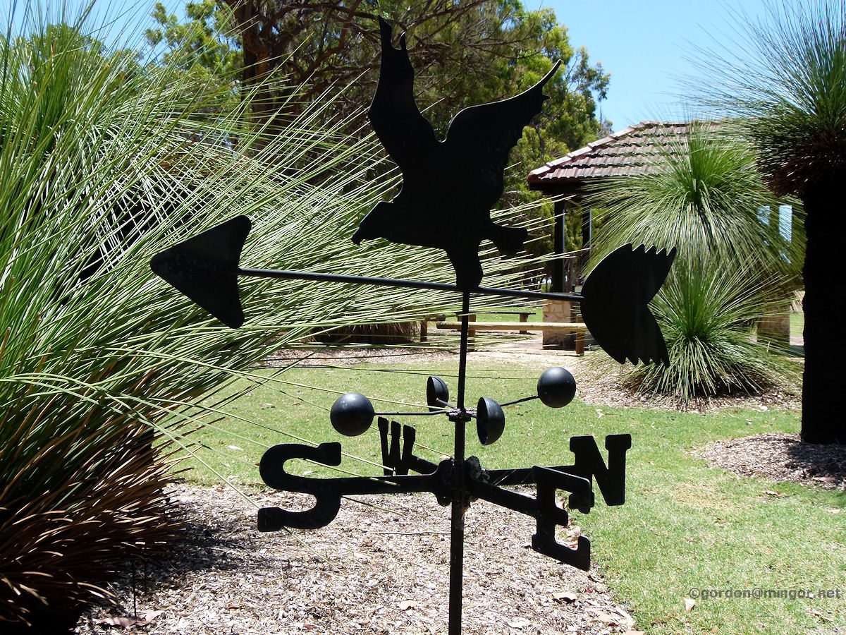 |
Weather Vane at Yanchep Here is a weather vane which is situated outside the golf club in Yanchep National Park. Photo - December 2013 |
||
All images published on this website are copyright © of the webmaster. See About section for clarification and special schools permission |
|||