| Photographs of Perth, Western Australia | |||
Lakes visited in Western Australia Western Australia contains a diverse collection of lakes. Many lakes in Perth originate from the area, or chain of lakes, known as the Great Lakes District, stretching from around Wanneroo down to Northbridge. Lakes can be fed by ground-water, by natural streams, by feeds from the storm-water drain system, manually being topped-up, or simply from rain. Some country lakes are perennial whilst others are seasonal. A number of country lakes are quite salty |
|||
 |
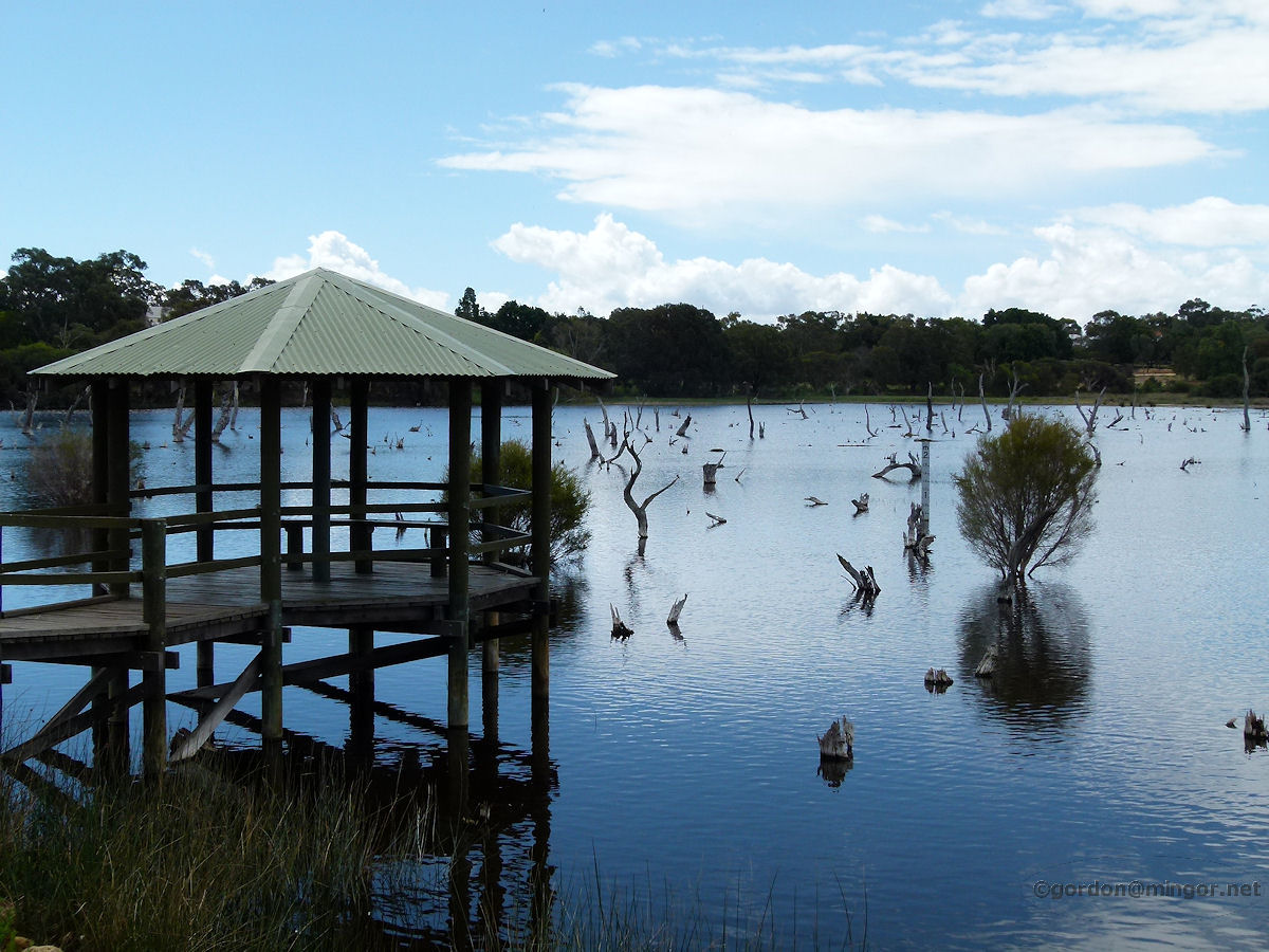
Bedfordale Below the Wungong Dam wall in Bedfordale is the Recreation Lake. This lake appears to be permanent and may be fed from dam water during the dry season. Photo - March 2012 |
||
 |
Carine Here is one of the Carine lakes. This is the one closest to Beach Road. Water levels fluctuate significantly throughout the year. The water is topped up by the rain and also via the storm-water drain system. Photo - April 2010 |
||
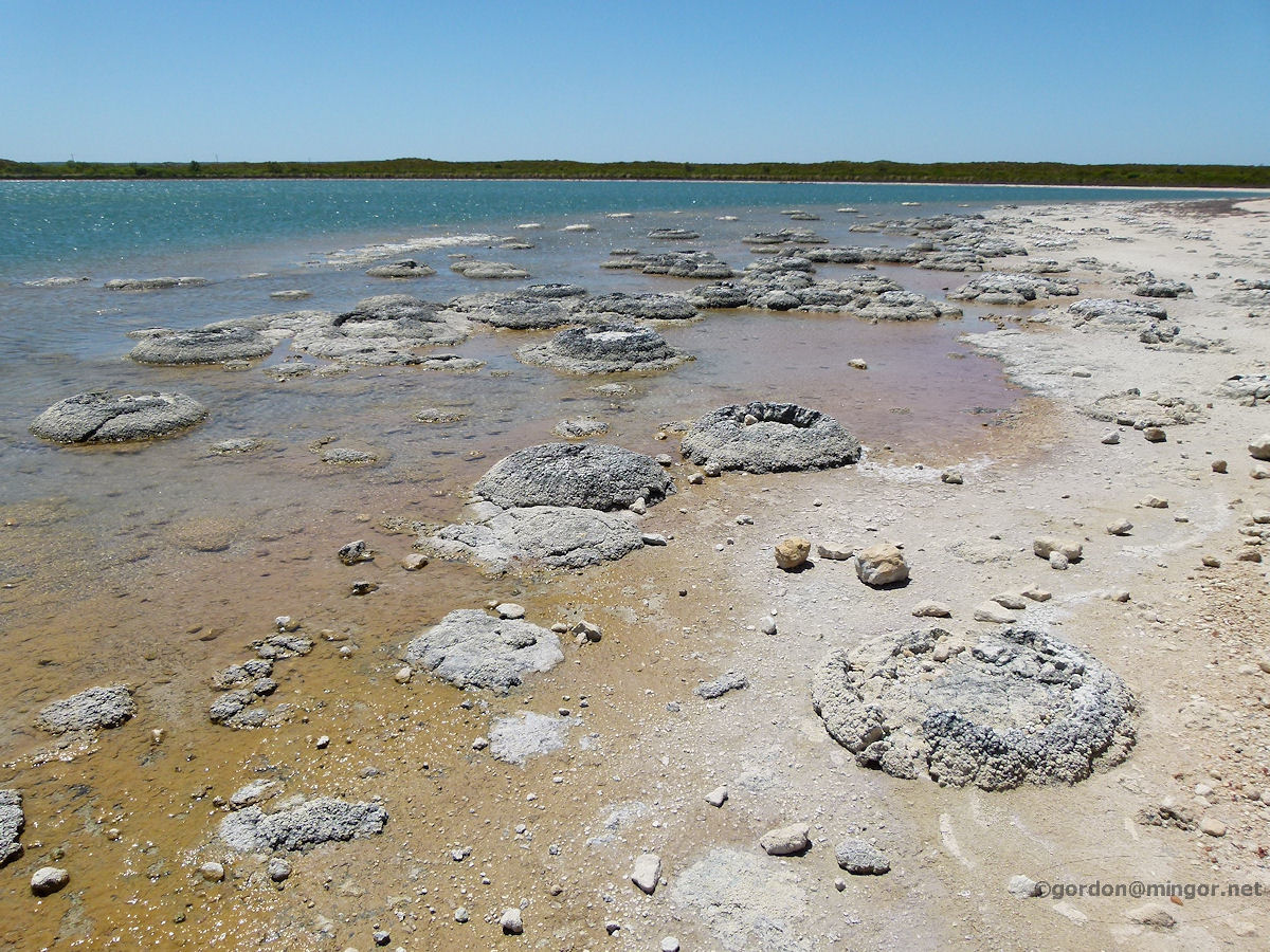 |
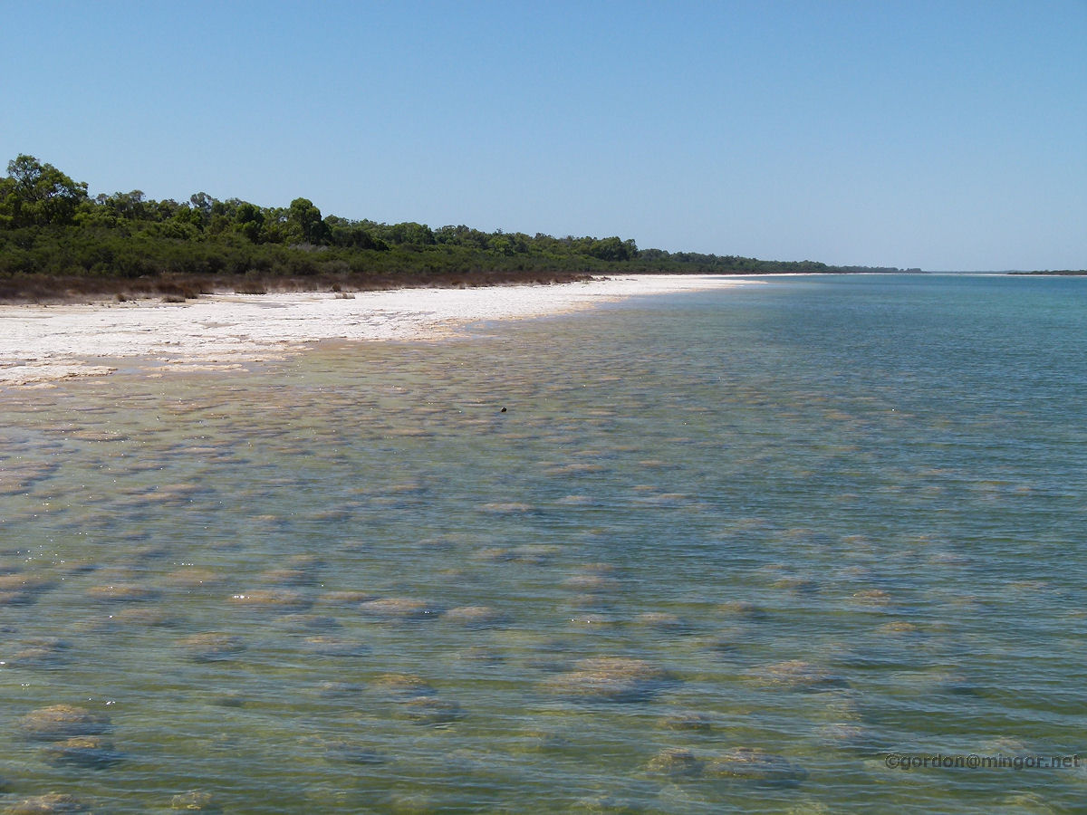
Cervantes Near Cervantes is this rather remarkable lake. This is Lake Thetis. The lake is 1.5 times saltier than the ocean and is renowned for its crop of stromatolites. Whereas other sites in W.A. boast fossilized stromatolites, Lake Thetis is one of only a couple of sites in the state where the structures are still living. You can see many of them in the picture. Photo - January 2013 |
||
 |
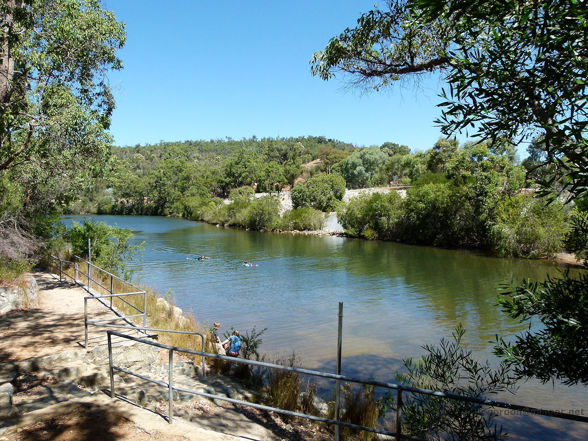
Chidlow Lake Leschenaultia at Chidlow. This is a man-made lake which was formed when the Cookes Brook was dammed in 1897 to provide water for steam locomotives on the passing railway. Now it is a popular picnic and swimming spot. Photo - December 2011 |
||
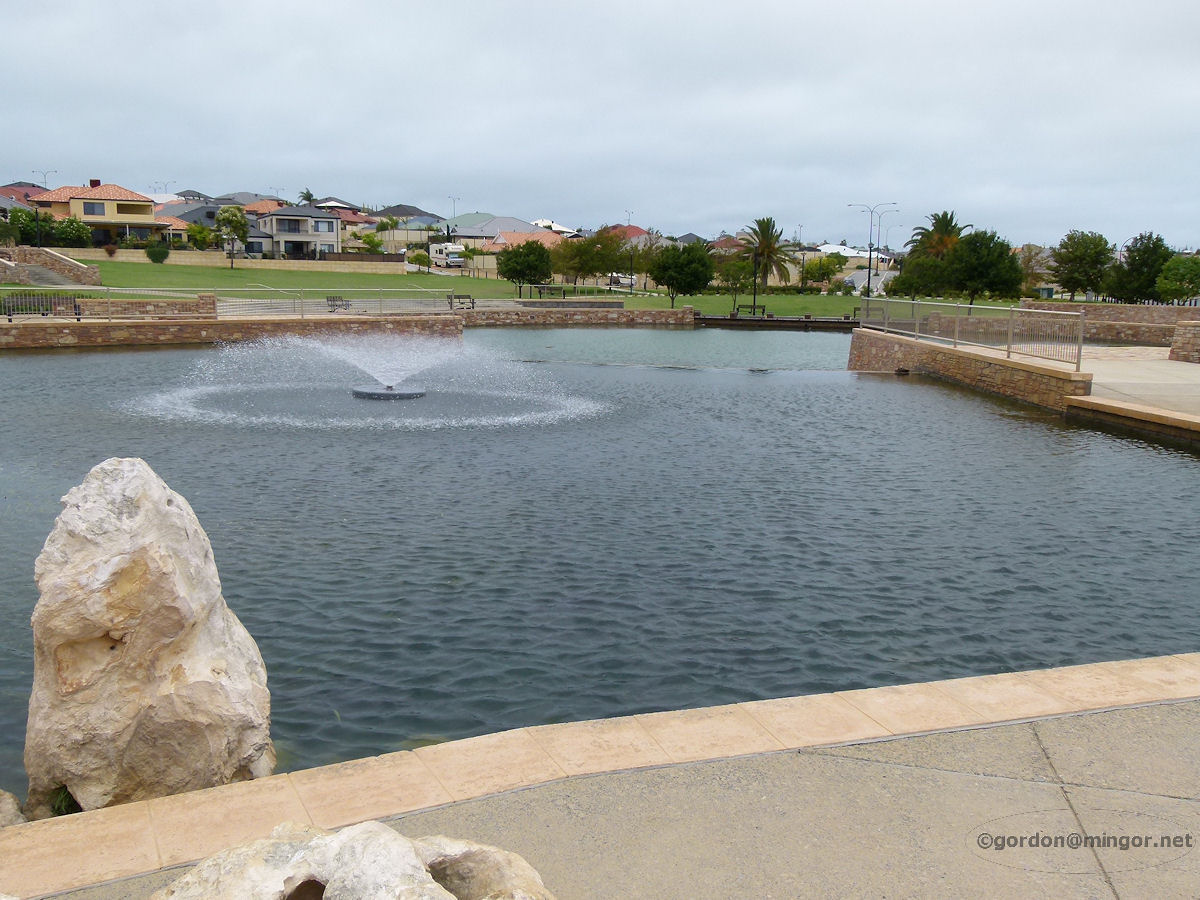 |
Clarkson Here is a rather pleasant lake system and fountain off Ocean Keys Boulevard in Clarkson. This is an artificial lake designed to enhance community living. Photo - January 2013 |
||
 |
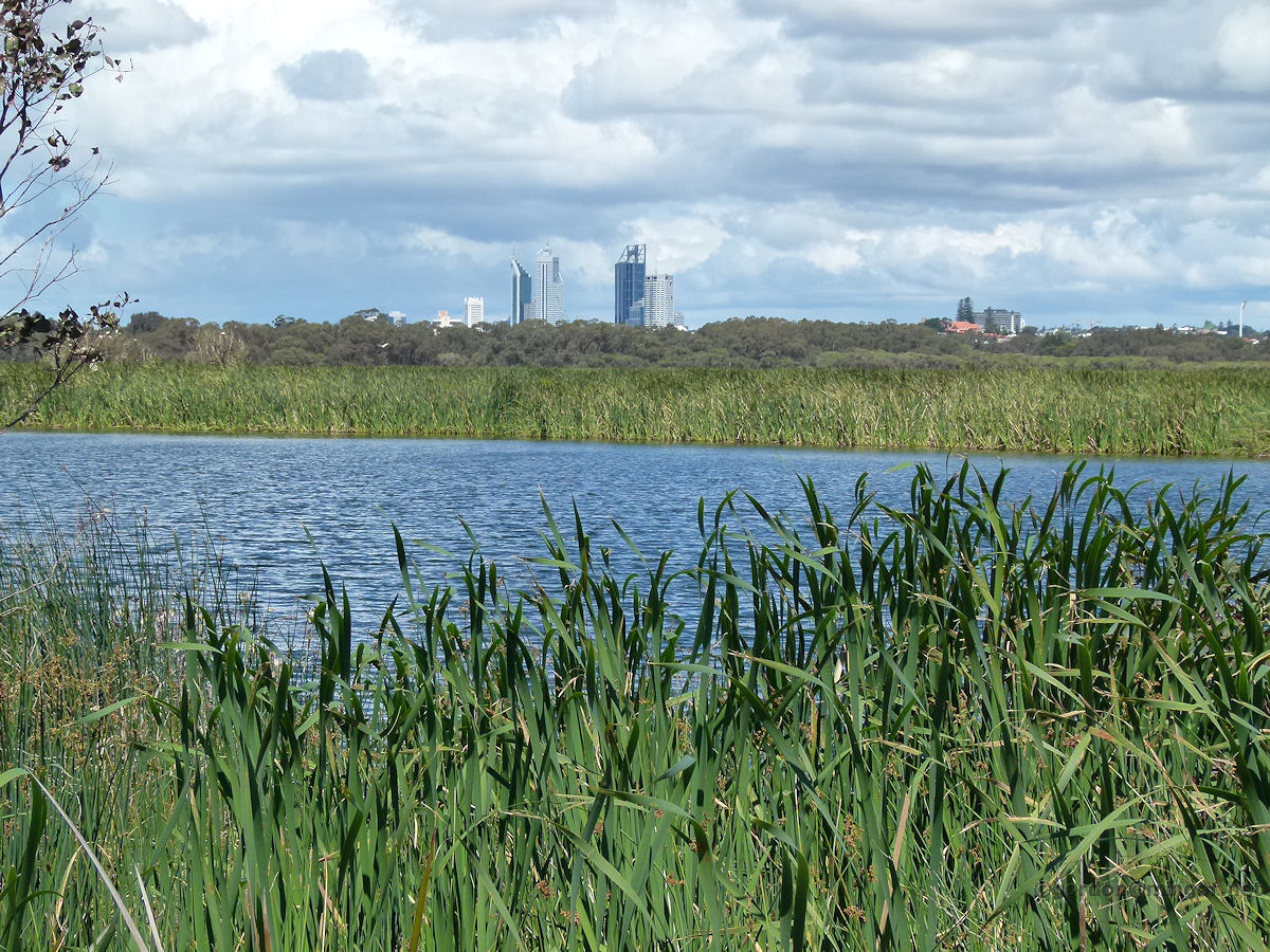
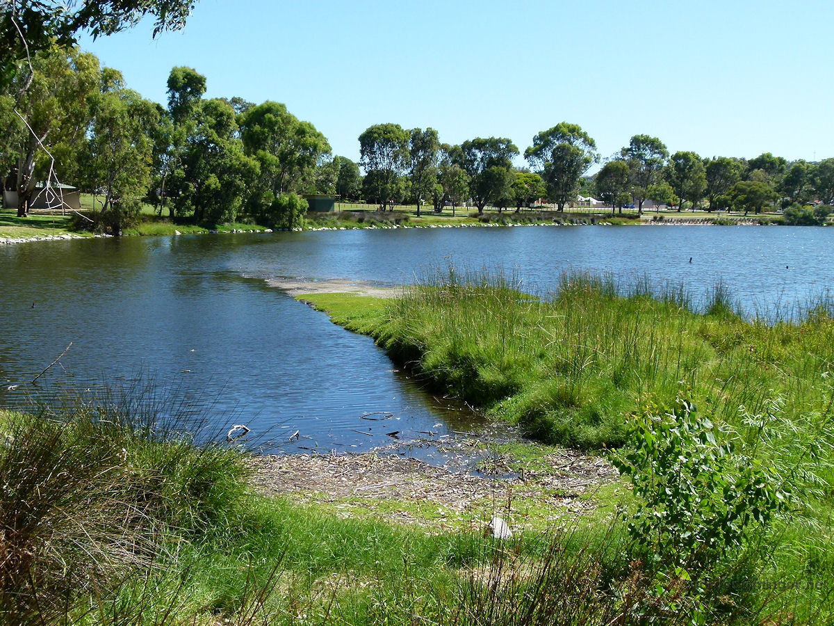
Como McDougall Lake in McDougall Park, Como. This is a look west from the Ley Street side. This is a natural lake. Storm-water helps to top up the lake. Much of Perth's storm water flows out to sea. Perhaps a waste of fresh water but if all of it were diverted to lakes then severe flooding could occur in times of very heavy rain and freak storms. Photo - October 2012 |
||
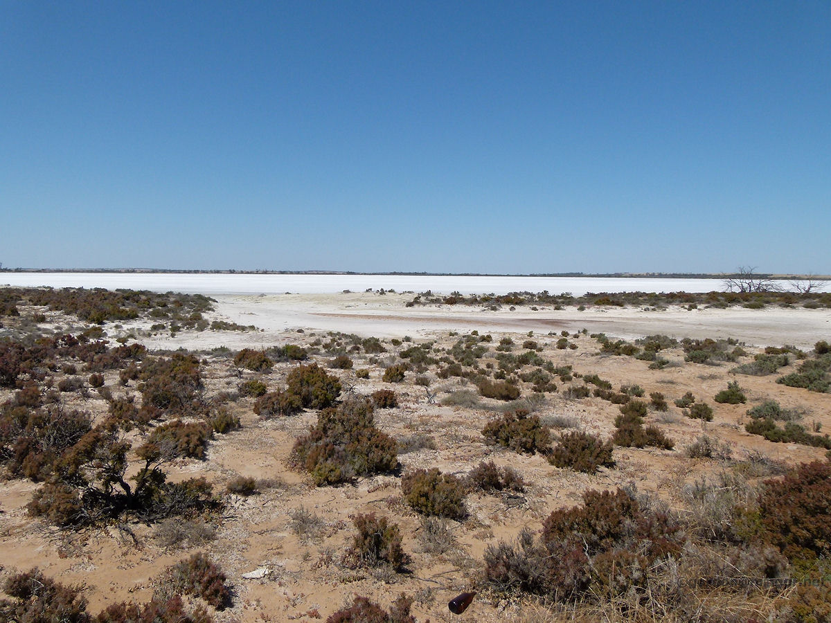 |
Damboring Damboring is located between Pithara and Ballidu in the wheatbelt, north-east of Perth. This area is well known for its salt lakes. This is one of the lakes situated on the west side of the Pithara - Ballidu road. Photo - November 2014 |
||
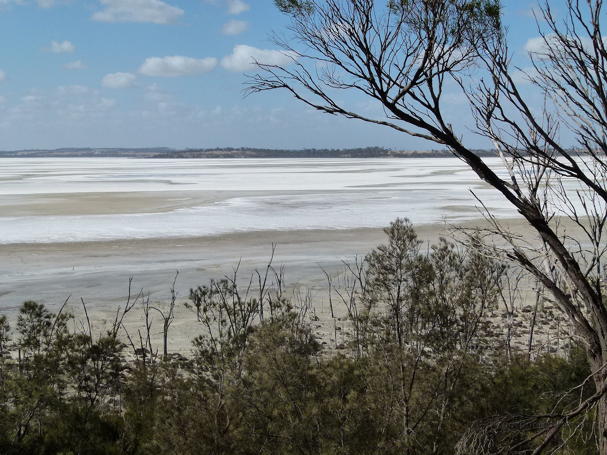 |
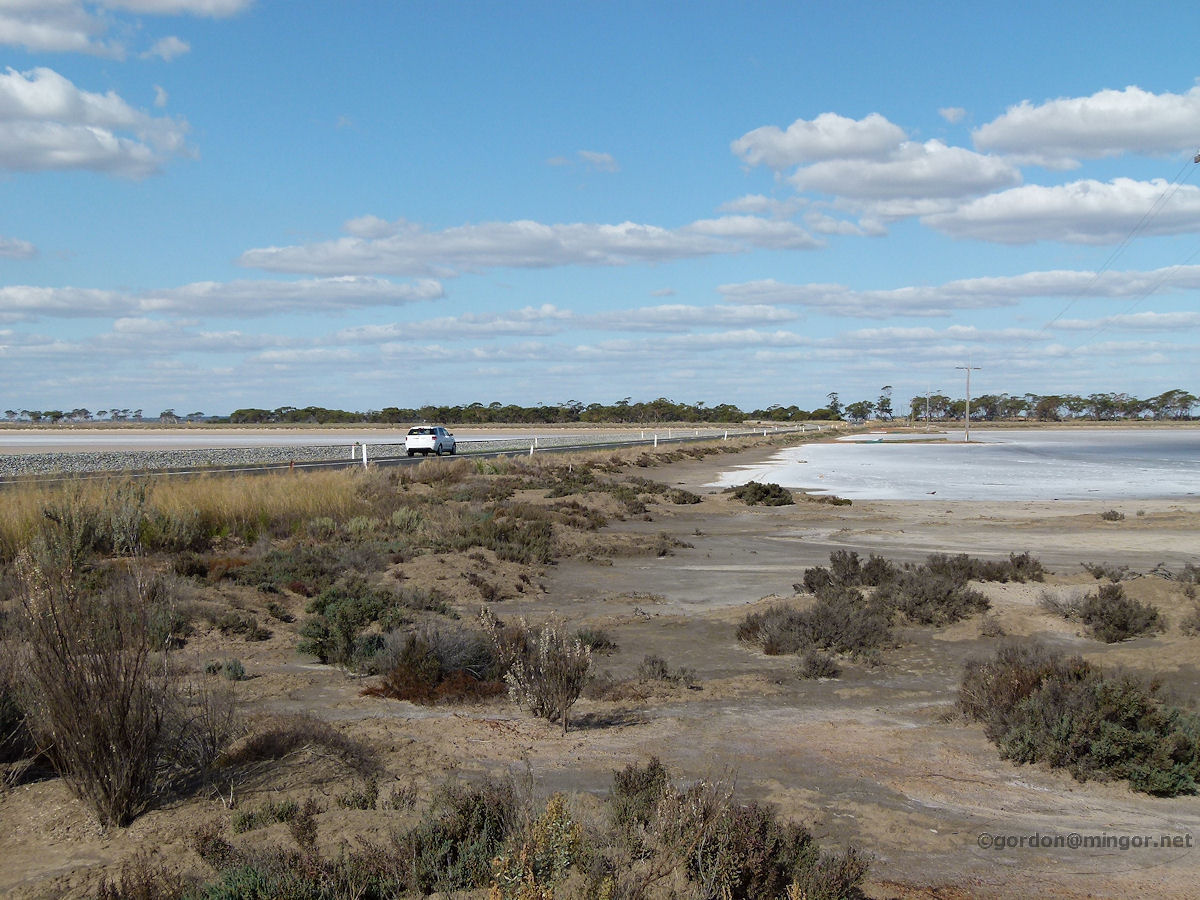
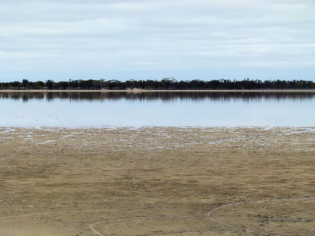
Dumbleyung A few kilometres west of Dumbleyung is Lake Dumbleyung, a vast salt lake made famous by Sir Donald Campbell and his "Bluebird" water-speed exploits in 1964. Water levels are extremely variable. This photo as taken well into summer so most of the lake appears to be dry. Photo - February 2013 |
||
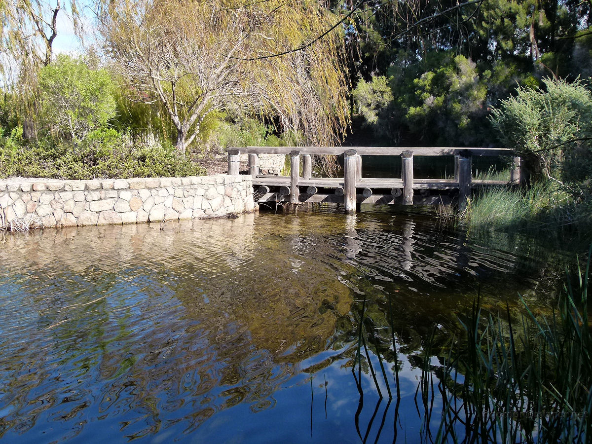 |
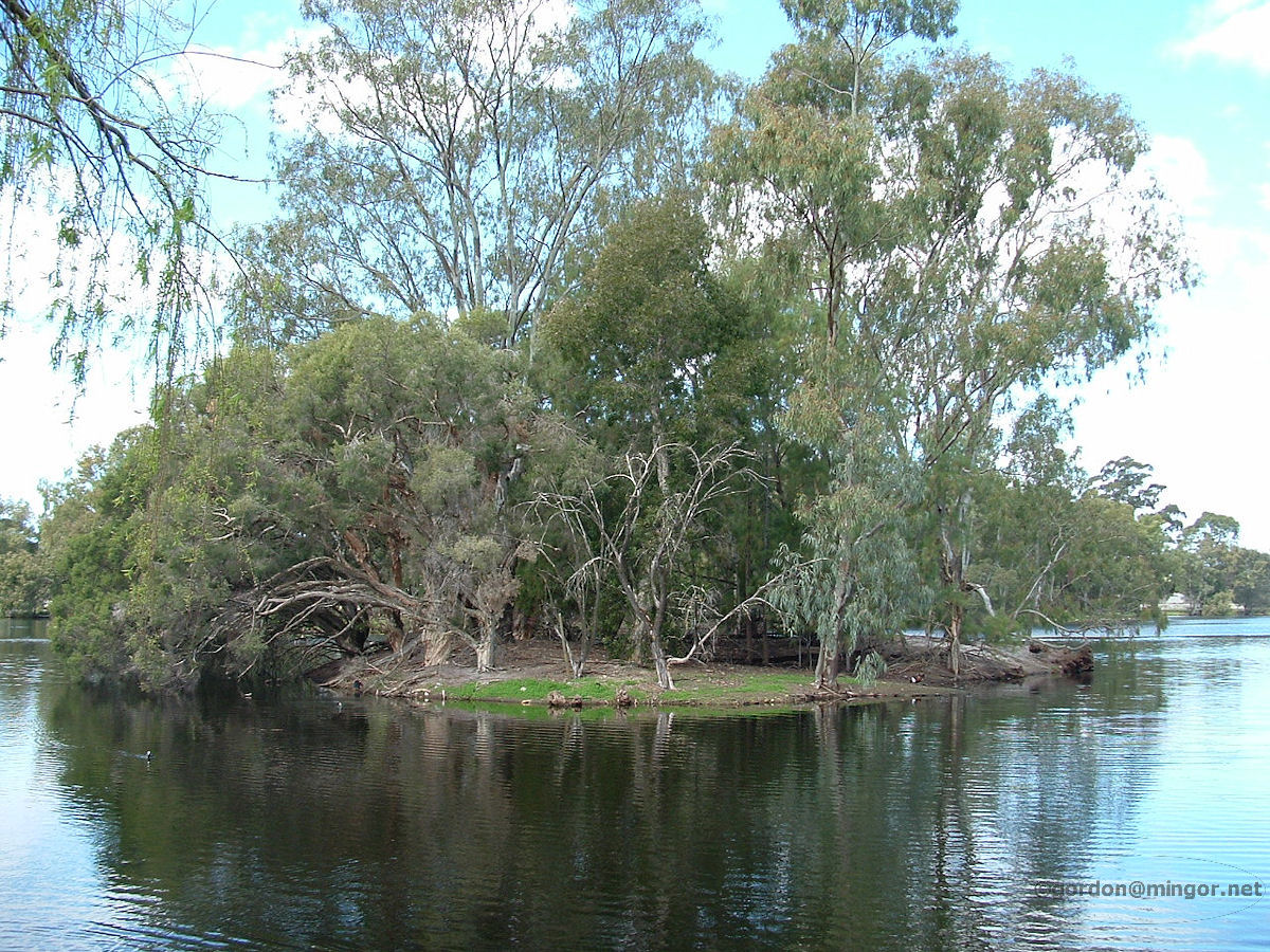
Ellenbrook Wood Lake in Ellenbrook has many a small gazebo around the shore, an island duck-haven, and this bridge which connects to a small island which offers great lake views. This appears to be the remains of a wetland that existed here before the suburb was established. Photo - July 2011 |
||
 |
Floreat Park Perry Lakes in Floreat Park. The lakes here have certainly seen better days. Only one of the original lakes still contains water but the level can decrease significantly during the summer. These lakes are mainly replenished by ground water however the water table in this district has dropped. Photo - September 2012 |
||
 |
Gosnells Pioneer Park in Gosnells is located right next to the Council offices. The lake appears to be artificial. It is adjacent to the Canning River so may be fed from there although this section of the river is dry most of the time. Photo - May 2011 |
||
 |
Heirisson Island Heirisson Island is in the centre of the Swan River towards to eastern end of Perth City. The island used to be two islands surrounded by mudflats. Reclamation created a single island and the lakes on the island are probably artificial or the remains of low-lying mudflats. The lakes are fed by subterranean soaks from the Swan River. Photo - December 2012 |
||
 |
Herdsman Herdsman Lake is located between Osborne Park and Churchlands. It is one of the largest wetlands in the former Great Lakes District of Perth. In the mid 1800's this was known as "Great Lake" and was the source of Perth's drinking water. Four deep lakes exist today - Popeye Lake, Powis Lake, Floreat Lake and Floreat Waters. The lake in the picture is Popeye Lake, a curious name. Photo - October 2013 |
||
 |
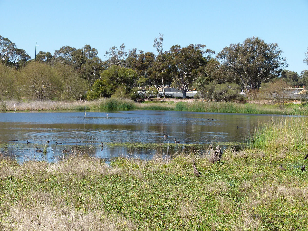
Jolimont At the end of Peel, Roseberry and Lansdowne Streets is Mabel Talbot Park. Apparently long-necked tortoises live in this lake. During the summer months they dig mud hollows under the dry surface and manage to survive until the lake refills next season. Photo - November 2015 |
||
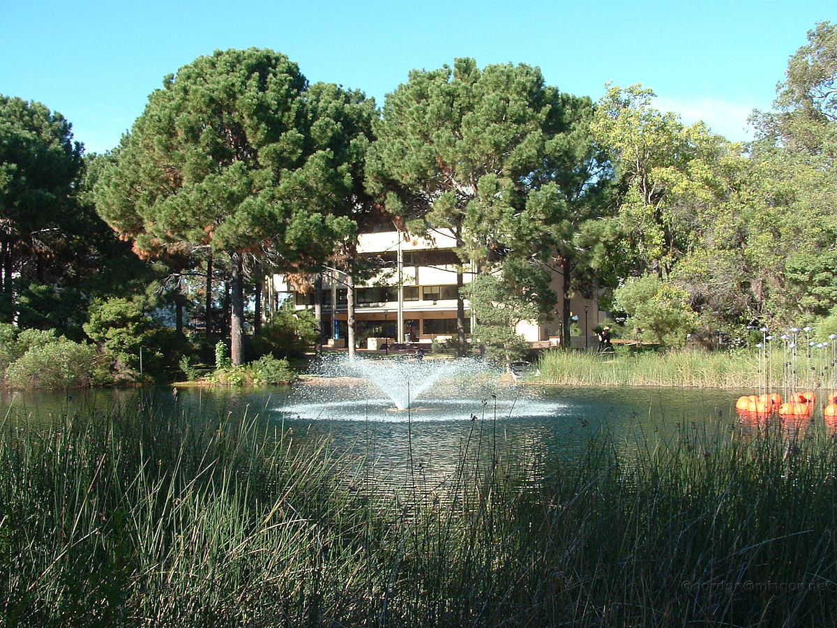 |
Joondalup On the Joondalup campus of Edith Cowan University is an artificial lake which is a landscaping focal point. Photo - June 2008 |
||
 |
Kewdale Here is an island in the middle of Tomato Lake which is a safe haven for bird-life. Tomato Lake is just off Oats Street in Kewdale. The lake is natural and contains water all the year round. Photo - October 2008 |
||
 |
Lake Clifton This is a view looking south along the eastern edge of Lake Clifton from the Thrombolite viewing area. Many thrombolites can be seen in the water. They are the mounds resembling rocks just under the water. Go to the Lake Clifton locality to see much more of the thrombolites. January 2014. Photos Ref: LKCL011 |
||
 |
Lake Grace Heading east, the Dumbleyung to Lake Grace road and rail cross this causeway which is towards the northern end of Lake Grace North. This is around 10 kilometres west of the Lake Grace townsite. Photo - April 2015 |
||
 |
Lake Monger Lake Monger is the largest perennial lake in Perth. Back in 1829-1830, the shape of Lake Monger didn't resemble its current triangular shape at all. The boundary was rather ragged and it was also connected to Herdsman Lake. Land reclamation expanded the ground water lake boundary to its present shape. Photo - October 2013 |
||
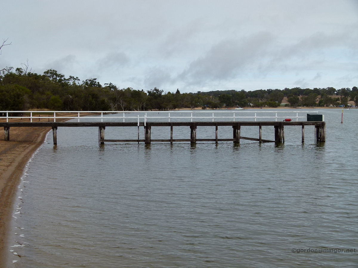 |
Moodiarrup Just north of Moodiarrup on the Duranillin road is Lake Towerrinning. Water is diverted from Cordering Creek to fill the lake. There was a major diversion project undertaken back in 1992 at achieve this. Pictured is one of two jetties on this side of the lake. Photo - April 2012 |
||
 |
Perth In Hyde Park there are two lakes each containing an island. These lakes are the remnants of what used to be swamp lands which extended from the Lake Monger area through to Claisebrook. The lakes rely mostly on rainwater for replenishment. In recent summers the water levels have become so low they had to be partially filled from scheme water to preserve the quality of the park and prevent water toxicity. Photo - June 2010 |
||
 |
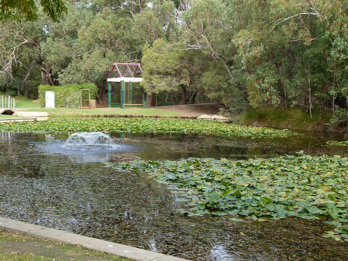
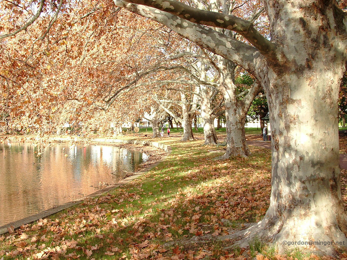
Perth Queens Gardens, on Hay Street East, was established in 1899. It is located on the north side of Hay Street between Plain Street and the WACA ground. Here is a view across a section of lake looking south. The lake is artificial. Indeed, many years ago on this site was a brickworks. Photo - March 2013 |
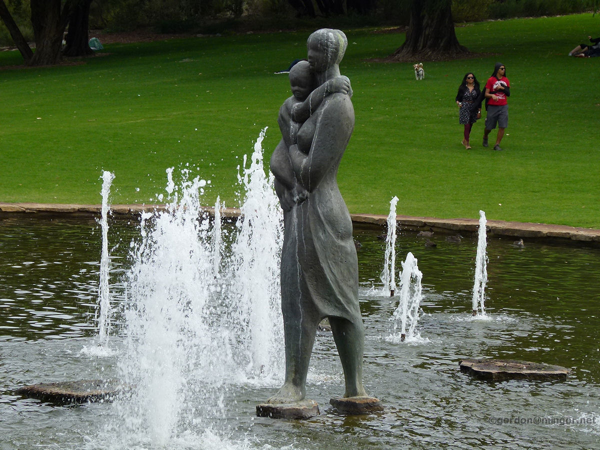 |
Perth Mother and child, the Pioneer Women's Memorial statue in Kings Park in the centre of a lake, surrounded by fountain jets which periodically spray up in a set sequence. Opened by Lady Kendrew in January 1968. Photo - June 2012 |
 |
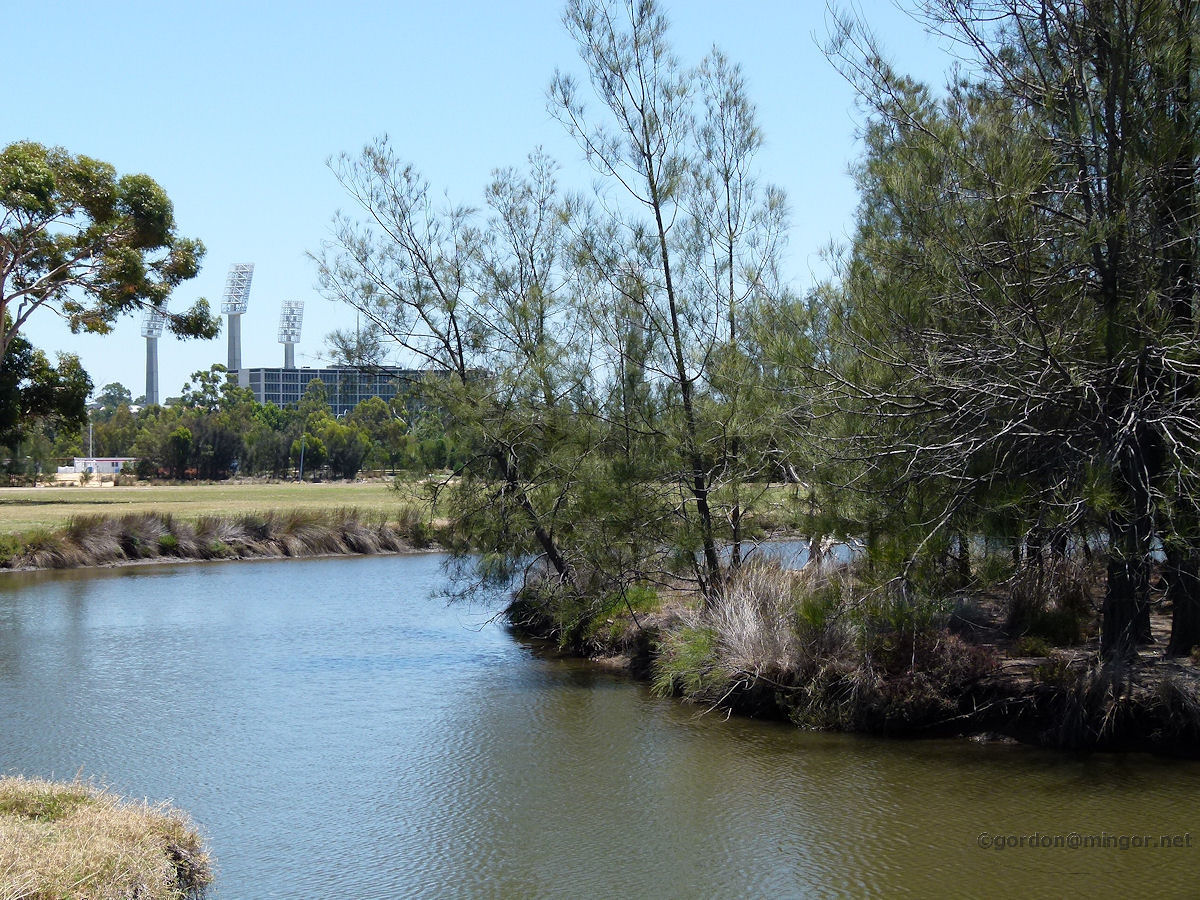
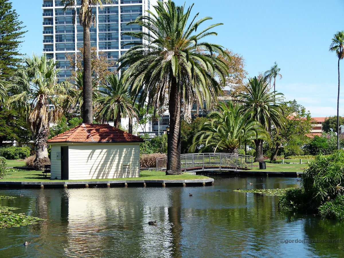
Perth John Oldham Park is a man-made water and green feature which is located to the south of Mounts Bay Road, between that and the Kwinana Freeway, north of the Narrows interchange. This is a view looking back across one of the lakes towards Mounts Bay Road with Malcolm Street apartment blocks in the distance. Photo - July 2013 |
||
 |
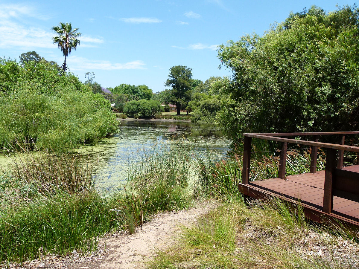
Pinjarra The Old Fairbridge Farm site at South Pinjarra occupied by Fairbridge 1913-1920. Although there are a number of seasonal water holes, many disappear during the summer. This one is generally perennial so it's highly probable that this is the swimming hole used by the Fairbridge children during their 7-8 year period of residence. Photo - November 2012 |
||
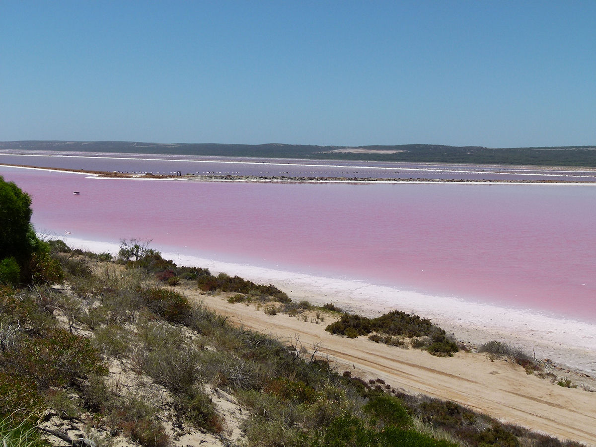 |
Port Gregory Adjacent to town and running inland, up and down the coast, is the Hutt Lagoon, popularly known as the Pink Lake. This is a salt water lake and the pink hue is natural. It is caused by resident bacteria merging with salt particles. The lake can appear from milky pink to quite dark purple depending upon the weather conditions and the time of day it is viewed. December 2015. Photos Ref: PTGG006 |
||
 |
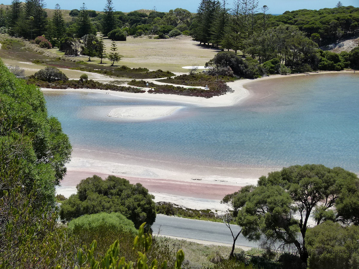
Rottnest A two minute walk through trees from Rottnest Island's Settlement Station takes you to Government House Lake. This is a salt lake and the water level is always healthy as is it replenished through the subterranean limestone from the sea. The lake water level may therefore drop at low tide. Photo - January 2009 |
||
 |
Rottnest Garden Lake on Rottnest. A view from the Vlamingh Lookout looking north across Garden Lake. You can see Digby Drive below. That road extends all the way to Cape Vlamingh at the island's western extremity. Photo - January 2013 |
||
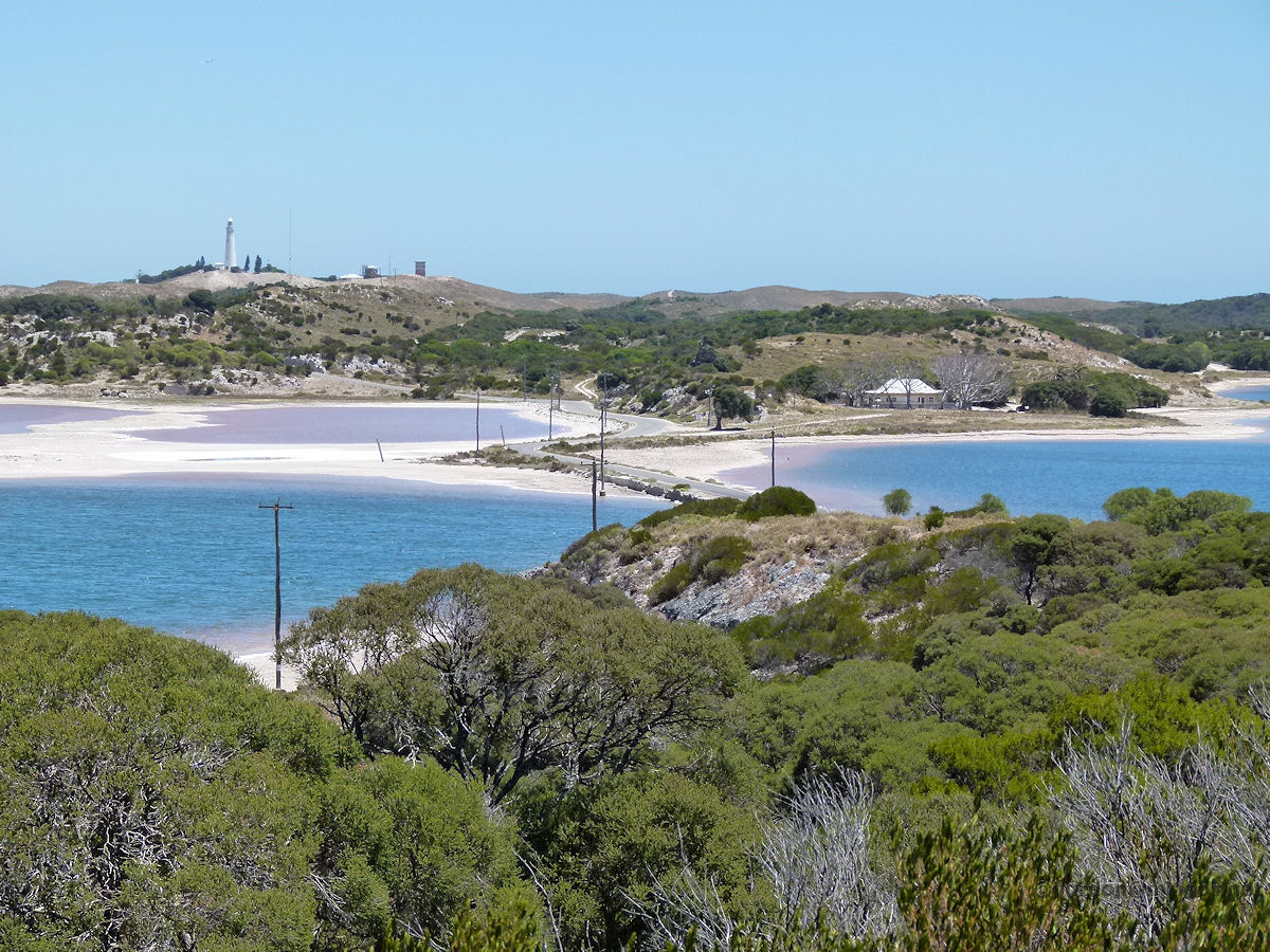 |
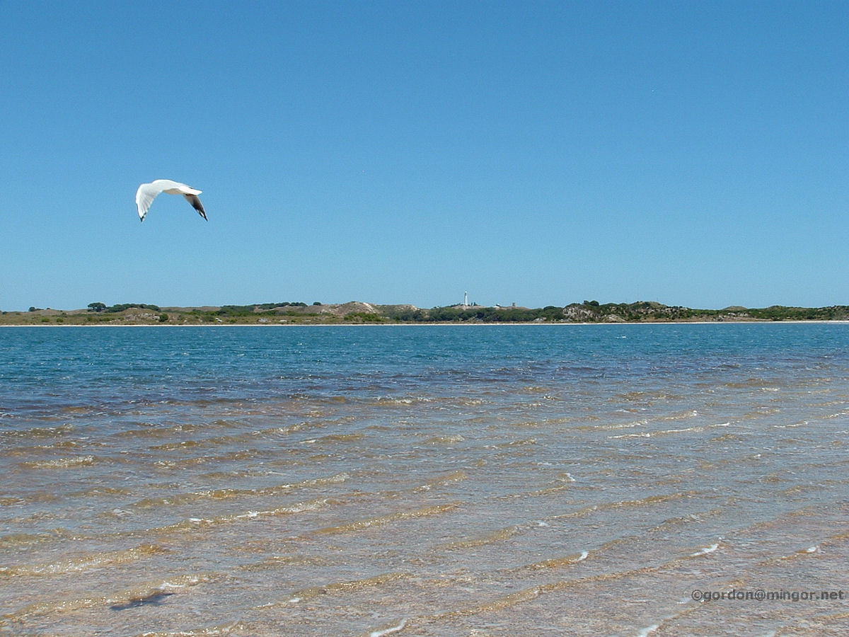
Rottnest Pearse and Herchel Lakes on Rottnest viewed from the Vlamingh Lookout. This is looking west, the road causeway splits Pearse Lake on the left with Herchel Lake on the right. Although there are a number of lakes on Rottnest, they all contain seawater. There is no free freshwater on the island. In the distance is the Wadjemup Lighthouse. Photo - January 2013 |
||
 |
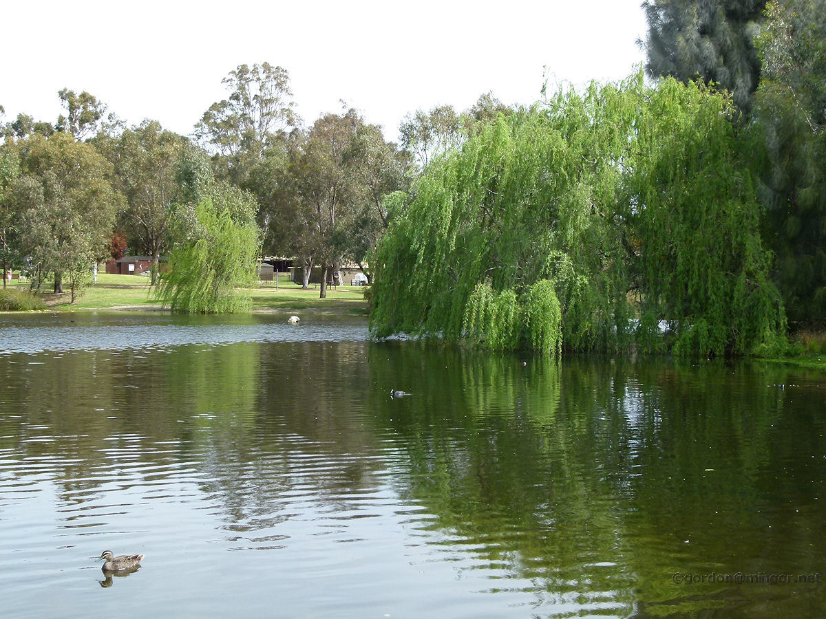
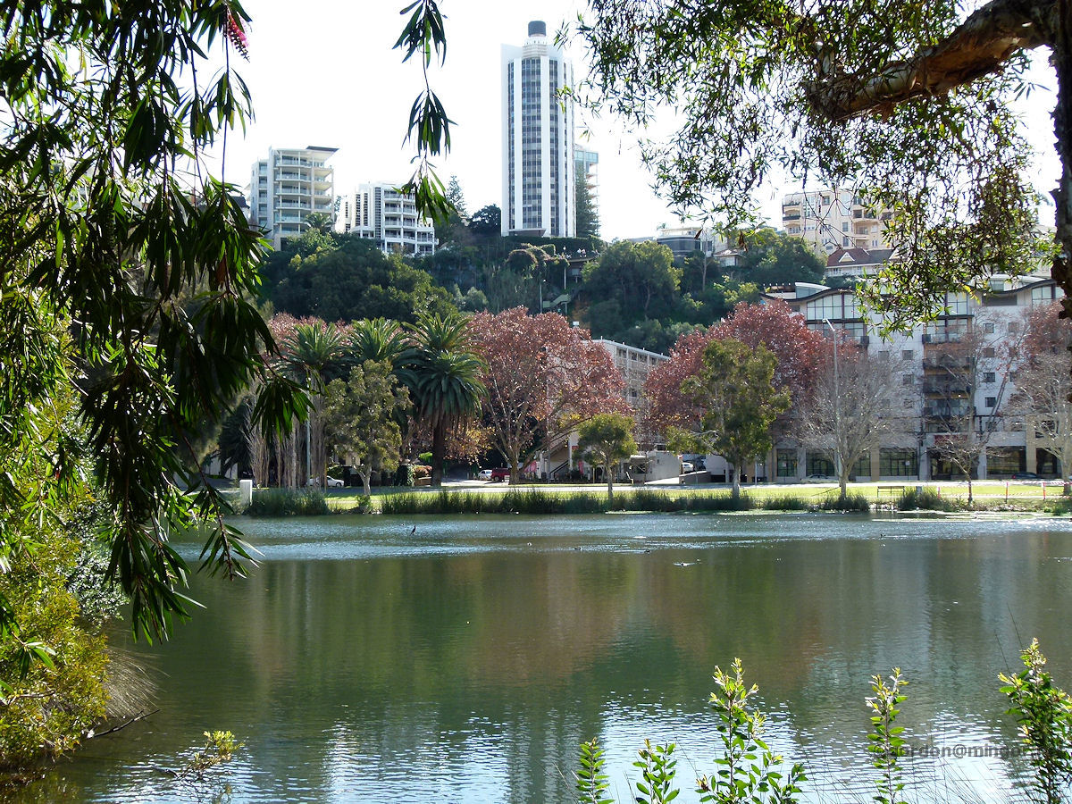
Swanbourne Lake Claremont is at the rear of the Scotch College. Pre-European settlement, this was a water source and fishing area for the Noongar people. Post settlement, the lake became known as Butler's Swamp named after Mr John Butler, an early settler in the area. Photo - October 2012 |
||
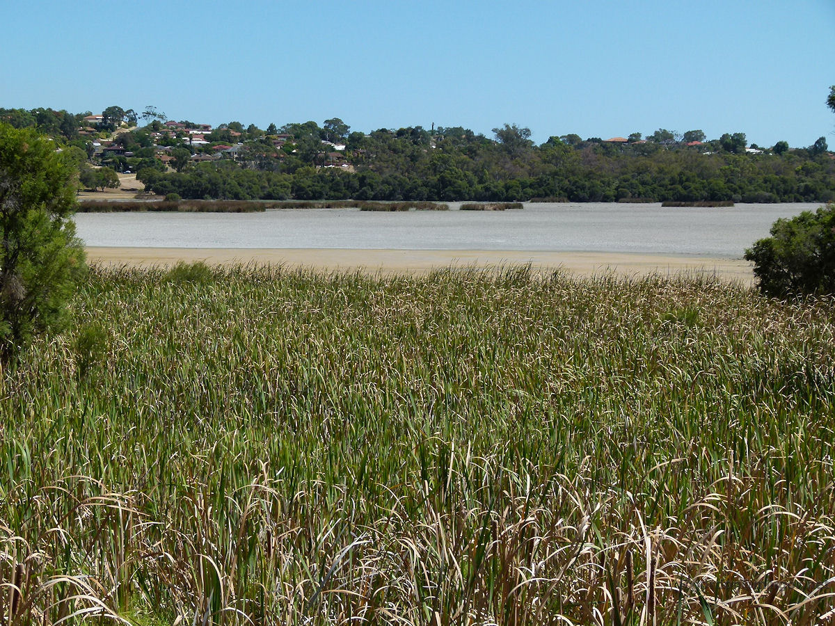 |
Wanneroo Lake Joondalup is a freshwater lake bounded by the suburbs of Joondalup, Edgewater and Wanneroo. The water level is apt to recede during the dry months hence all the exposed reeds and sand as you can see here. Beware of snakes in the reeds, the signs along the bank warn. Photo - March 2011 |
||
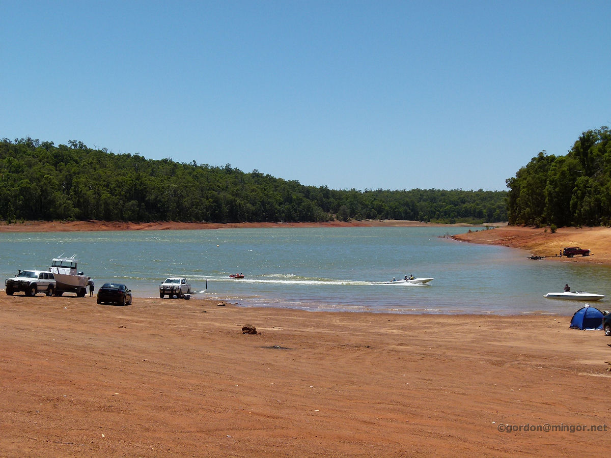 |
Waroona Lake Navarino is the reservoir created when the Drakes Brook was dammed in 1966. Since water from the dam is mostly used for agricultural irrigation, the lake can be used for recreational activities such as boating and water-skiing. The lake is around 8 kilometres east of Waroona, up in the Darling Range. Photo - January 2014 |
||
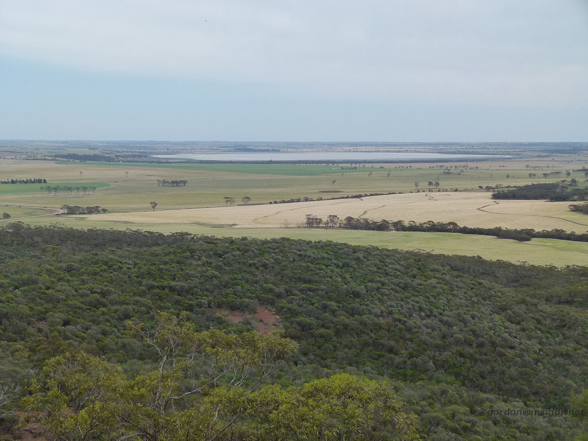 |
Wongan Hills Atop the summit of Mount O'Brien near Wongan Hills and looking west. From here is a good view of Lake Hinds which would be 5-6 kilometers away at its nearest point. The lake covers around 2,000 hectares and is fed by local streams and creeks. Since European settlement, the lake has only over-flowed three times - in 1917, again in 1963, and most recently in 1999. The whole area is a nature reserve. Photo - October 2011 |
||
 |
Woodlands Set in the heart of Woodlands is the perennial Jackadder Lake. The lake is one of a chain of wetlands which include Lake Gwelup, Herdsman Lake and Lake Monger. Here you can see a small bar stretching out into the lake. Off to the right is a bird sanctuary island. Photo - January 2013 |
||
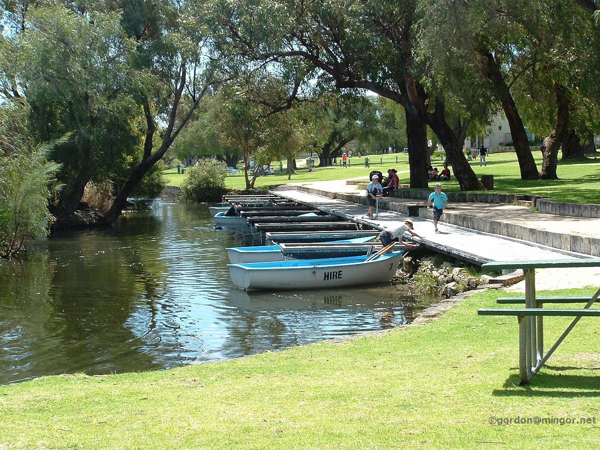 |
Yanchep Rowing boats for hire on the Yanchep National Park Lake, Loch McNess. When we visited here early in 2014, the lake was all but dry. Photo - September 2009 |
||
 |
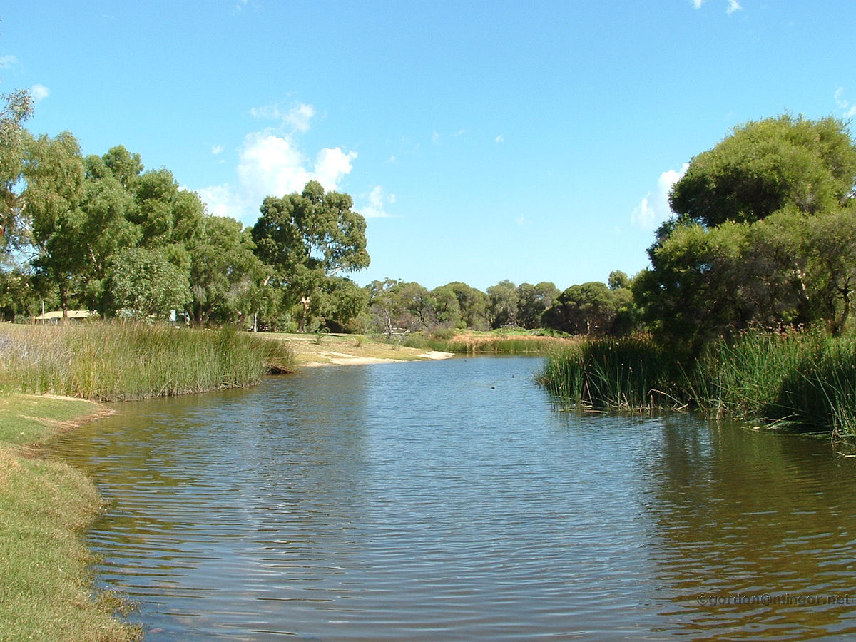
Yealering The lake at Lake Yealering, about 220 kms south-east of Perth. This is a freshwater lake and its water level is highly dependent upon district rainfall. It is fed via a number of streams and creeks and then the lake feeds out as the source of the Avon River. Here is a view across the lake itself. Yonder trees reflect into the water. Photo - June 2013 |
||
All images published on this website are copyright © of the webmaster. See About section for clarification and special schools permission |
|||