| Photographs of Perth, Western Australia | |||
Water Supply Facilities in Western Australia Fresh water in Western Australia is becoming an increasingly scarce resource. The Water Supply Board manages an intricate system of collecting and storing water, treating water for consumption, and distributing water to properties. However, this is only half of their responsibility. Then comes the task of effective drainage of excess rainwater, and removal of waste water from homes and businesses. Here are some photos relating to our water supply |
|||
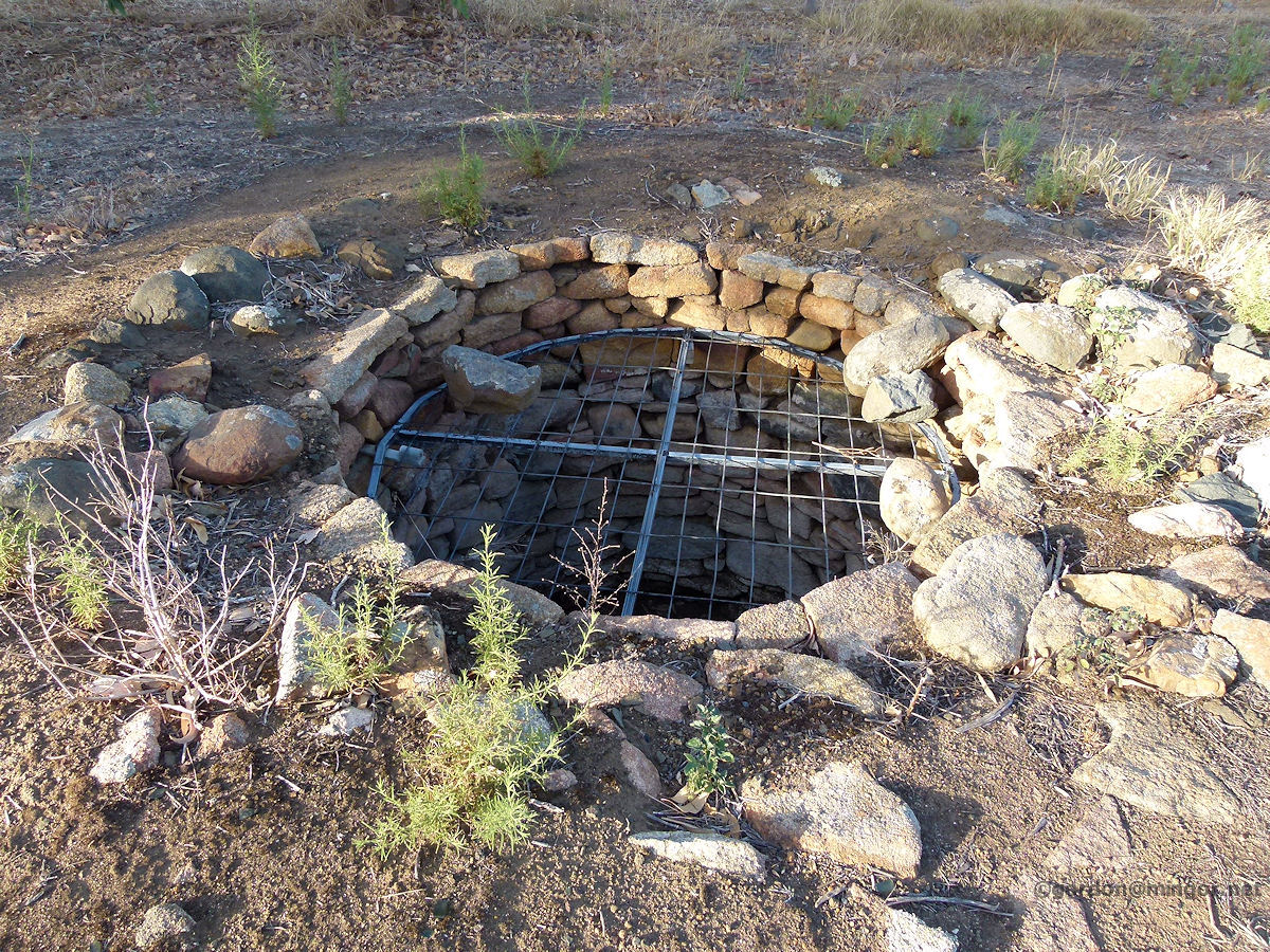 |
Arthur River In the old days, some towns and properties relied on drawing water from the ground. This disused well is at Arthur River close to the old historic inn. The Inn host and guests would have drawn their own water from the well and then carry it back to the inn. Photo - February 2013 |
||
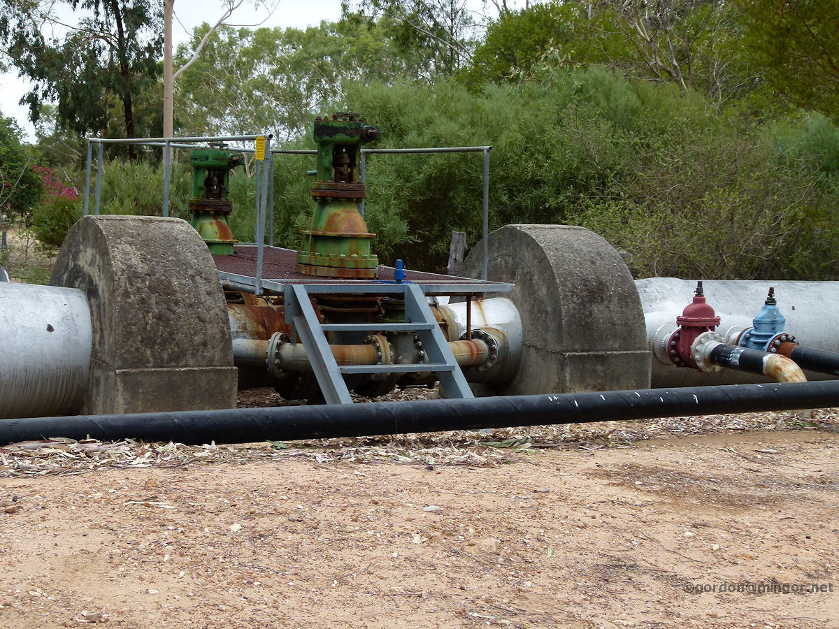 |
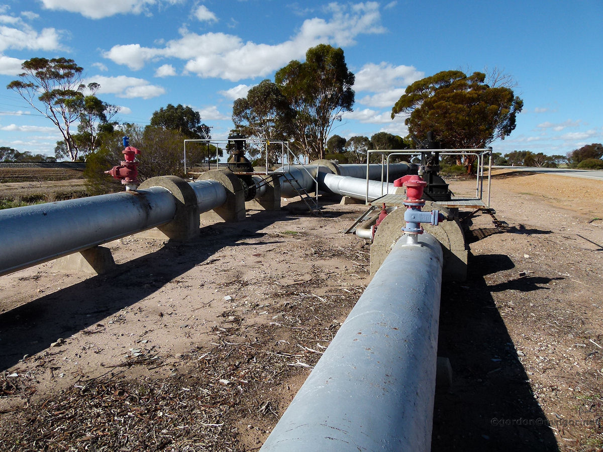
Bakers Hill Pictured is a section of the Mundaring - Kalgoorlie goldfields pipeline at Bakers Hill. Valves and pipes allow water to be drawn from the pipeline for this town's use. Photo - February 2011 |
||
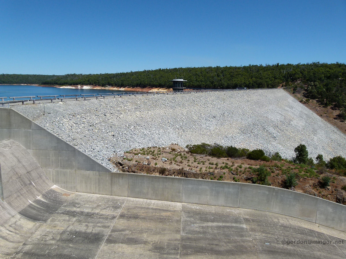 |
Bedfordale The Wungong Dam was created by damming the Wungong River. This is a view of the dam wall at the end of Springfield Road in Bedfordale. A section of the spillway is in the foreground. This dam is one of a series in the Perth hills area that collect water for use in Perth and in the south-west. Photo - March 2012 |
||
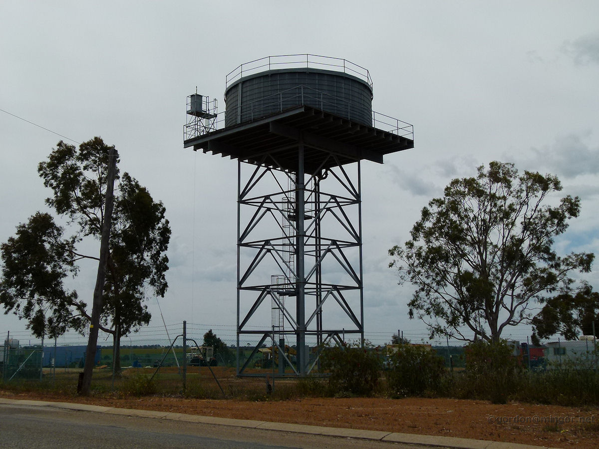 |
Calingiri A water tank which undoubtedly stores and delivers the town's water supply is flanked by a couple of trees in its position on the edge of the Calingiri townsite. Water would be drawn from a bore set beneath the tank. Photo October 2011 |
||
 |
Cervantes Many coastal towns are constructed on sandhills and have no free water unless there is a river nearby. This is Cervantes water supply. Water is pumped from underground, below the water table. The tanks on the towers are high so that gravity provides adequate pressure through the town's water pipes. Photo - January 2013 |
||
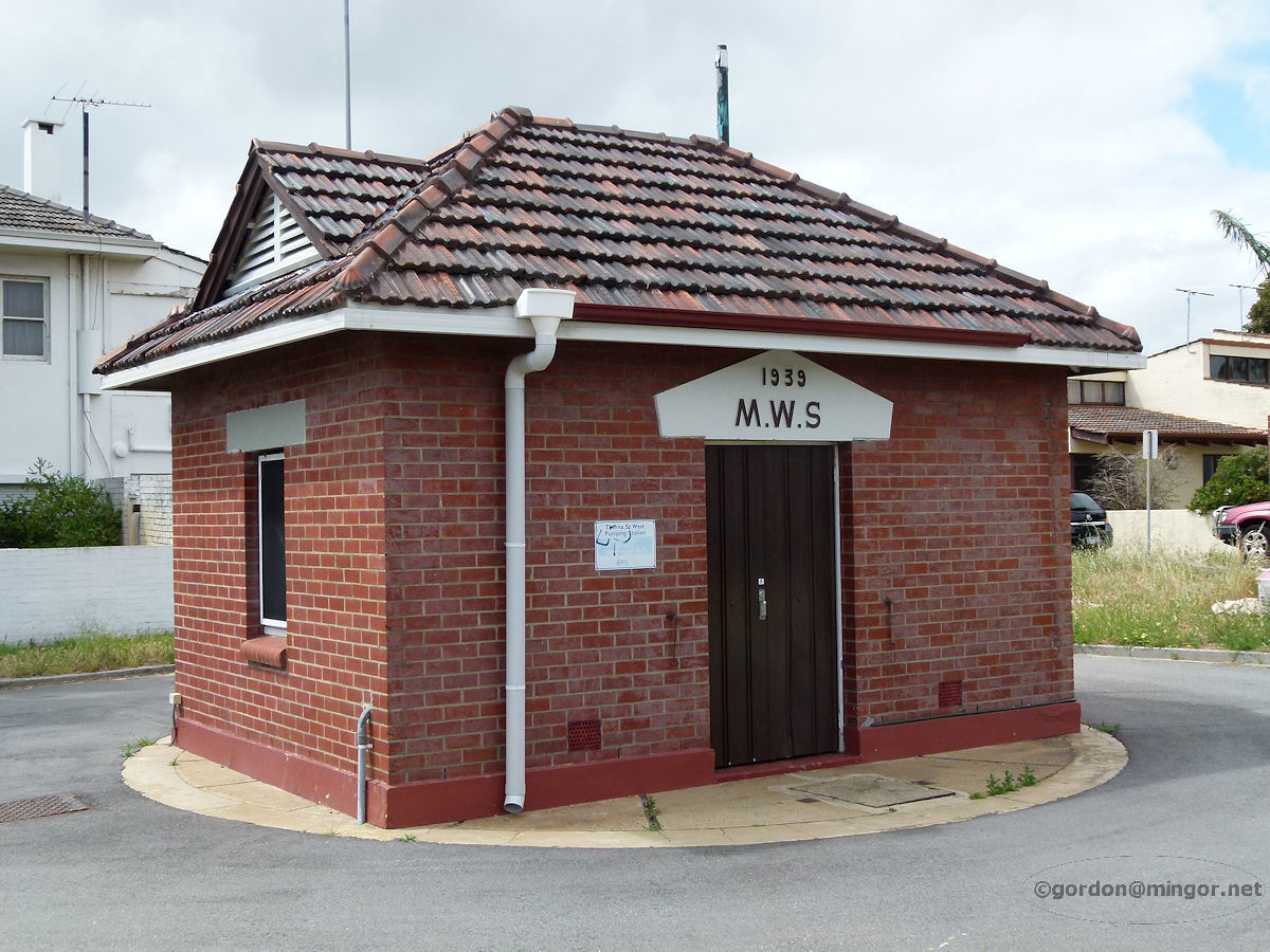 |
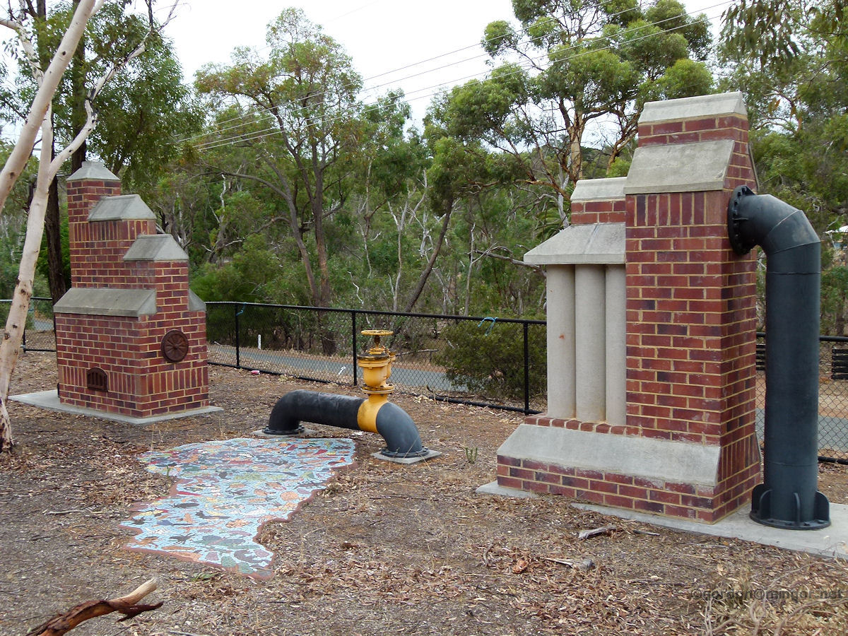
Como These tiny little pump houses are dotted all over Perth. This one in Como is a Metropolitan Water Supply facility built in 1939. It probably houses a storm pump to assist in drainage during times of heavy rain. Photo - October 2012 |
||
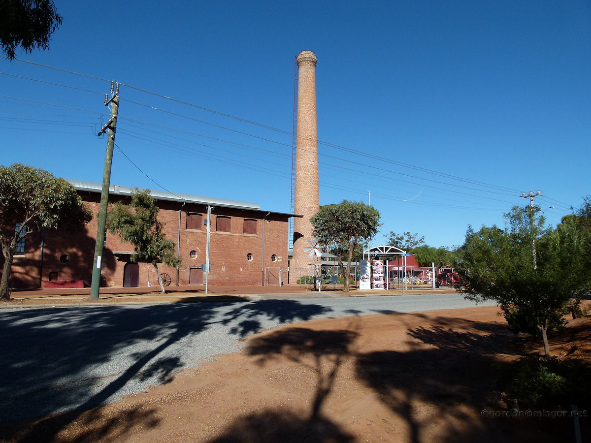 |
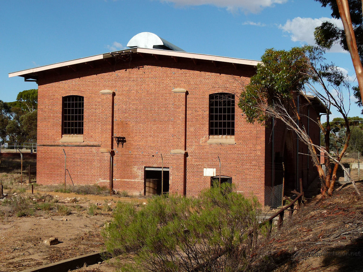
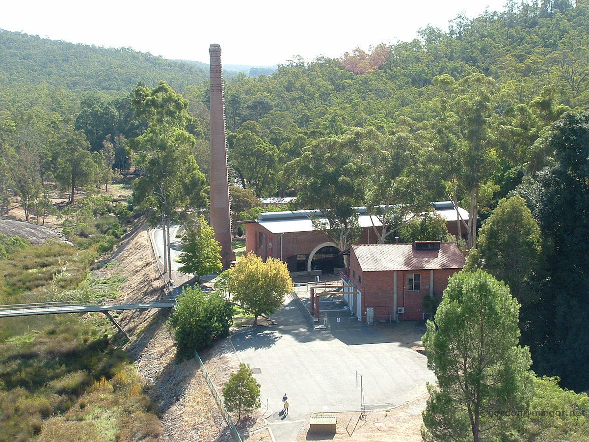
Cunderdin The tall chimney stack and orange brickwork of the Goldfields Water Supply Number 3 pumping station dominates the streetscape in Cunderdin. This is now a museum. The old pumps were steam driven. This pumping station in now number 6 in the chain between Mundaring and Kalgoorlie and is still operational. Photo - June 2011 |
||
 |
Cunderdin And about seven kilometres west of Cunderdin is this point where the two smaller Goldfields pipelines coming up from Perth converge into one. Originally there was a single small pipe which was later duplicated. Now the dual pipe is being replaced by a single pipe of much larger diameter and therefore capacity. Photo - June 2011 |
||
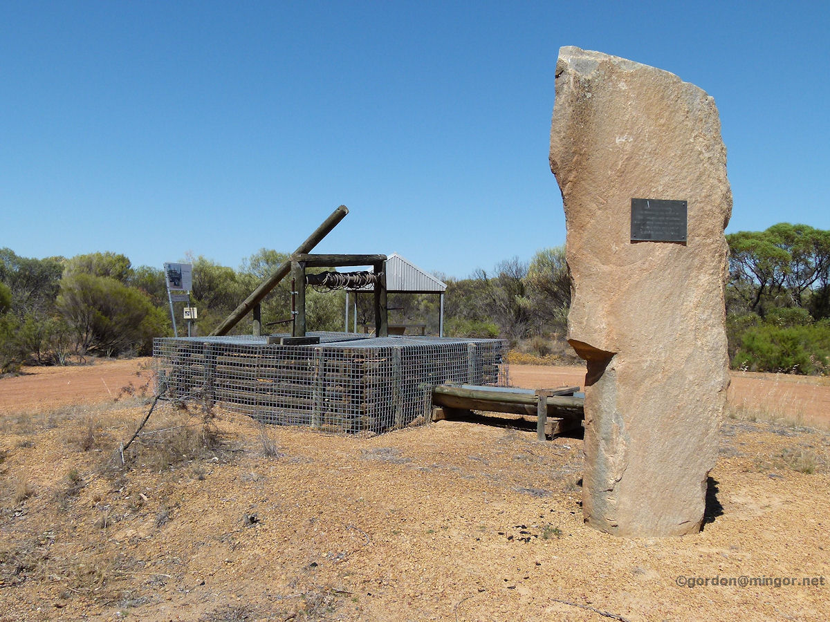 |
Dalwallinu On the southern side of town, just off the main road, is the old town well. The well was sunk by Ellison Brothers in 1909. The plaque on the rock serves to commemorate the Dalwallinu Pioneers, many of whom camped at this site in those early days. Photo - November 2014 |
||
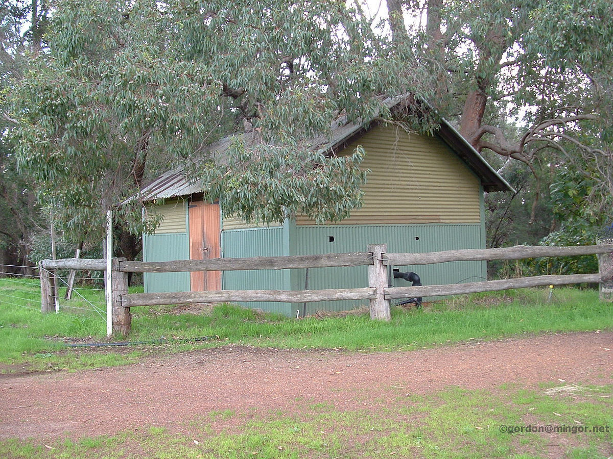 |
Fairbridge Until scheme water was connected, Fairbridge Farm near Pinjarra used to draw its water from the South Dandalup River. This pump house was constructed in the 1920's. The pump provisioned all domestic water needs including the cottages, the orchard and the vegetable gardens. The river has since been dammed upstream and now this part of the river is dry for most of the summer. Photo - July 2005 |
||
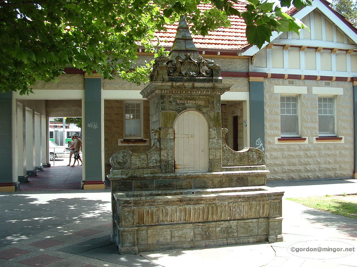 |
Fremantle Across the road from the Fremantle railway station and also the post office is the old number three pumping station. Right next to it is this watering trough build in 1905 as a memorial to two West Australian pioneering sons from their Dad. This was erected by John Taylor of London, in memory of his sons Ernest and Peter. Photo - November 2008 |
||
 |
Fremantle This fine pump house is on Marine Terrace In Fremantle, on the edge of the Esplanade Reserve. Photo - July 2010 |
||
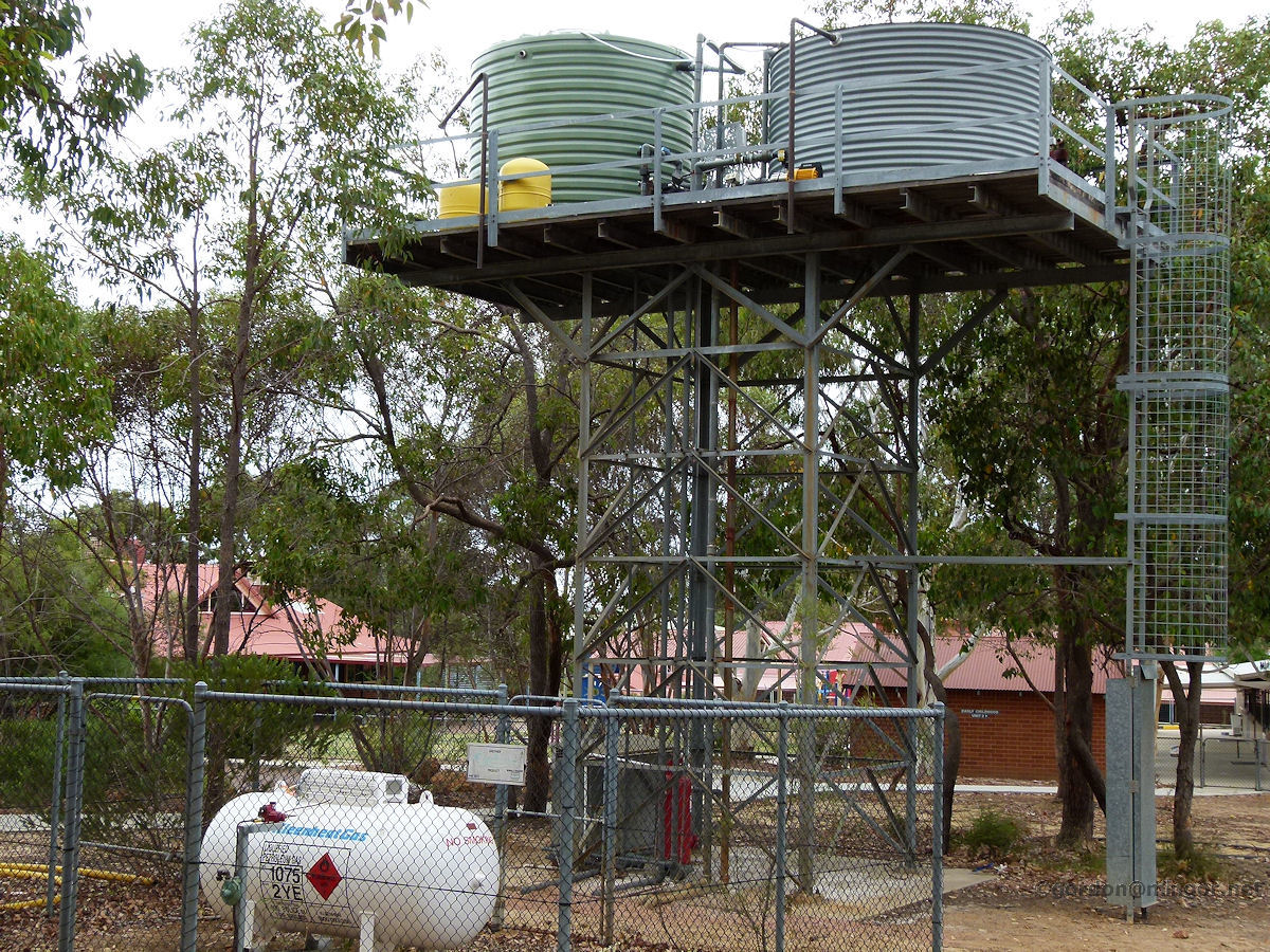 |
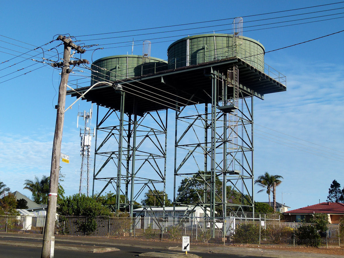
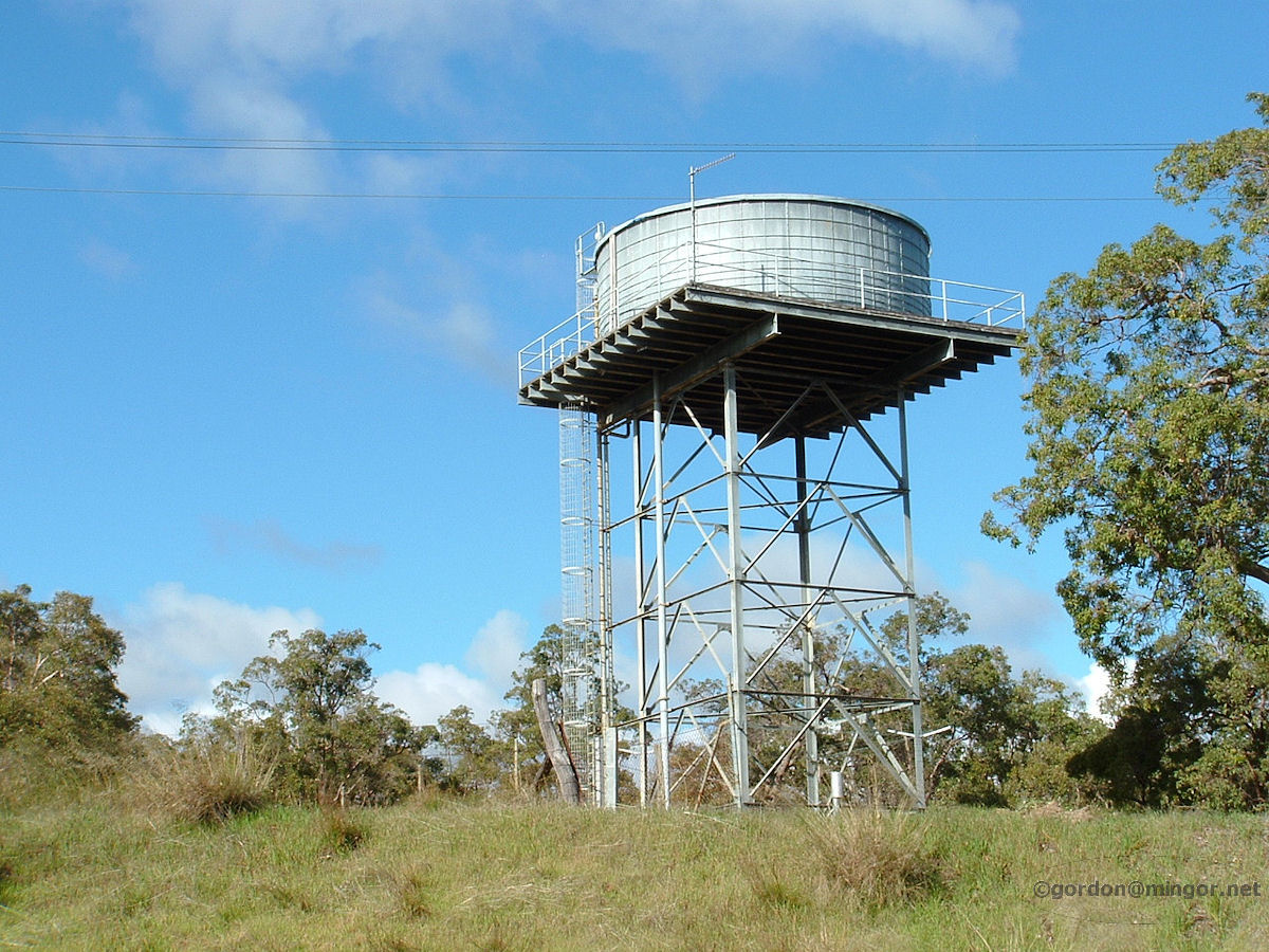
Gidgegannup Outside the Gidgegannup school (you can see the school in the background) are these two water towers which would provide the town water supply. Up nice and high to increase the water pressure. Photo - February 2011 |
||
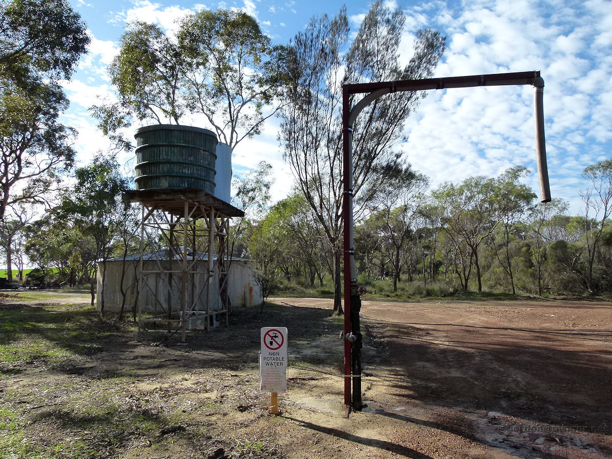 |
Gillingarra A part of the Gillingarra water supply with storage tanks and pumping equipment. Water in these tanks is non-potable - i.e. not drinkable. It may be that the water has simply not been treated or that the underground supply is too full of minerals or has been contaminated in some way. Photo - July 2012 |
||
 |
Grass Valley This is one of a number of stations used to pump the water along the Mundaring to Kalgoorlie pipeline. It is located between those at Wundowie and Meckering. This is a water flow booster station and is operated only when needed. The original numbers 2 and 3 pumping stations were at Mundaring and Cunderdin. This Grass Valley station came later. Photo - June 2011 |
||
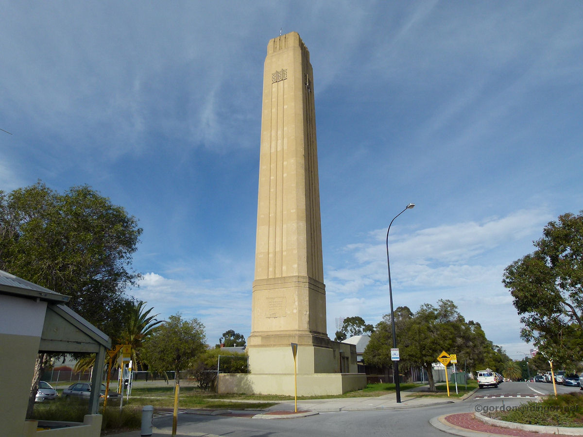 |
Highgate A Highgate landmark. This is the Metropolitan Water Supply tower built in 1935 as a vent for removing gases from the sewerage system. Apparently it did this so 'successfully' that under certain weather conditions the gases wafted down over and into nearby houses and the police station. The tower vent was sealed in 1941. The tower is on the corner of Lincoln and Smith Streets. It is now heritage listed. Photo - July 2013 |
||
 |
Hovea Here is the Glen Brook dam situated in the John Forrest National Park. This place is a resting and feeding/watering area for wildlife. The water is not for swimming or drinking. The water level is pretty low after lean winter rainfall. A spillway down the side runs off water (when available) into the National Park pool. Photo - October 2010 |
||
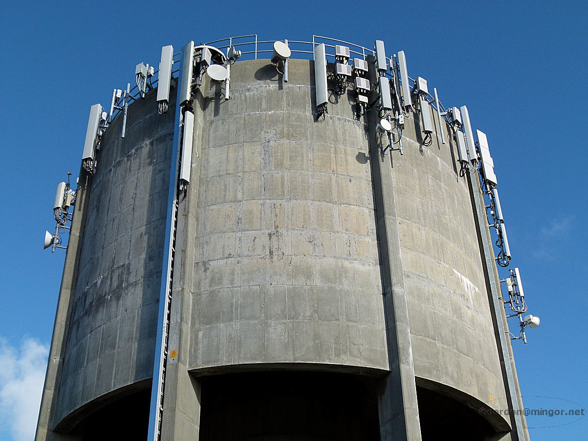 |
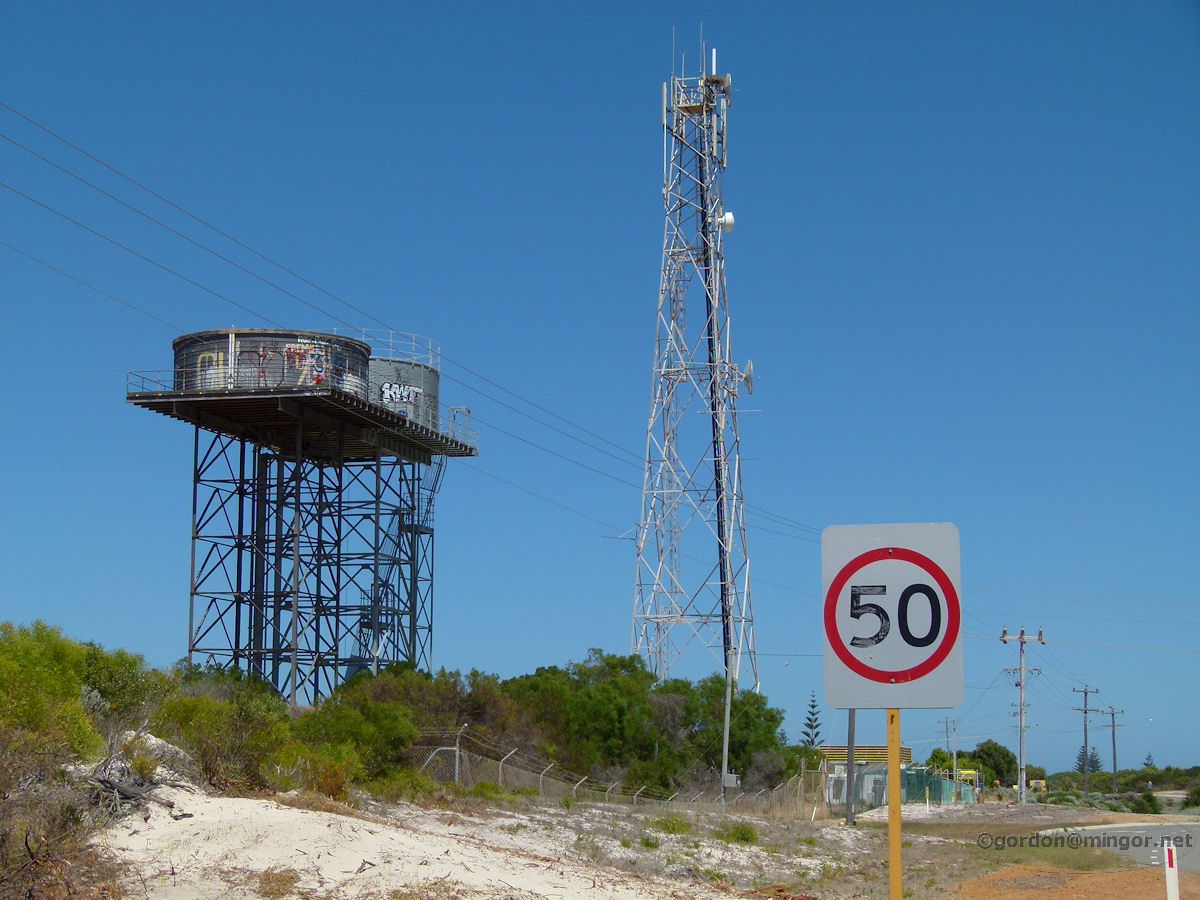
Karrinyup Looking atop the Karrinyup water tower. Practical use is made of the tower's elevation through the installation of quite a vast array of telecommunications transmitters, receivers and the like. Photo - May 2014 |
||
 |
Margaret River Water towers on Willmott Avenue in Margaret River. This would be the source of the town's scheme water supply. Photo - December 2013 |
||
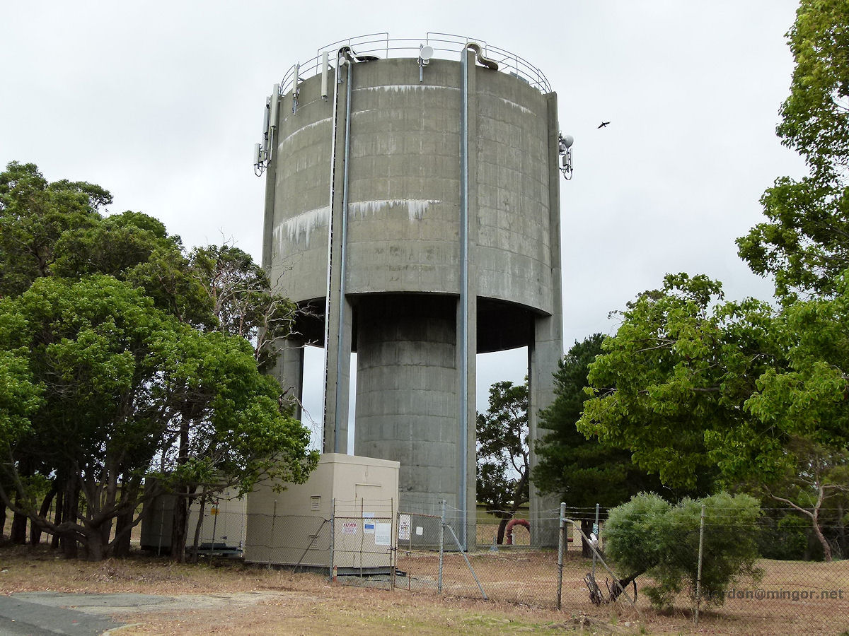 |
Melville At many high points around Perth are reservoirs. There is one here at Melville, others at places such as Mount Eliza, Yokine, Karrinyup, Mosman Park etc. Water is pumped from the Perth dams and stored in the reservoirs. Water is then moved from the reservoirs into high towers such as this to provide added water pressure for consumers. Photo - November 2013 |
||
 |
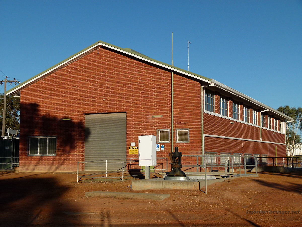
Merredin - Pumping Station On the western outskirts of town is the former number 4 pumping station of the goldfields water scheme. This was commissioned circa 1902. It has been superceded by more modern equipment. Photo - March 2015 |
||
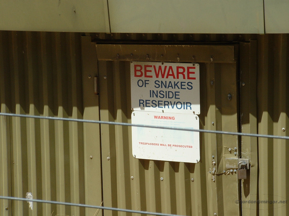 |
Mosman Park The Mosman Park reservoir on top of Monument Hill. If you're walking around the Monument (which is right next door to the reservoir), don't get tempted to go in the reservoir through the fence. Is it worse being prosecuted or being bitten by a snake? Photo - February 2010 |
||
 |
Mount Helena The Goldfields pipelines wend there way through the hills in Helena Valley on their way to Kalgoorlie. Photo - September 2010 |
||
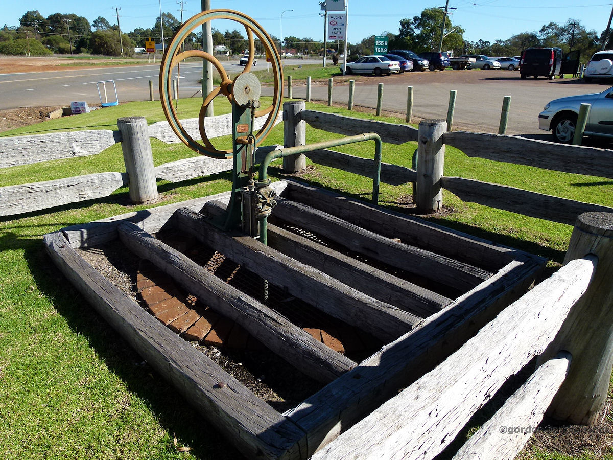 |
Muchea In front of the Muchea garage and adjacent to the highway is this old well. Not used now, but in past times this was an important watering stop for horses. It has been nicely preserved and is well-presented. Photo - July 2011 |
||
 |
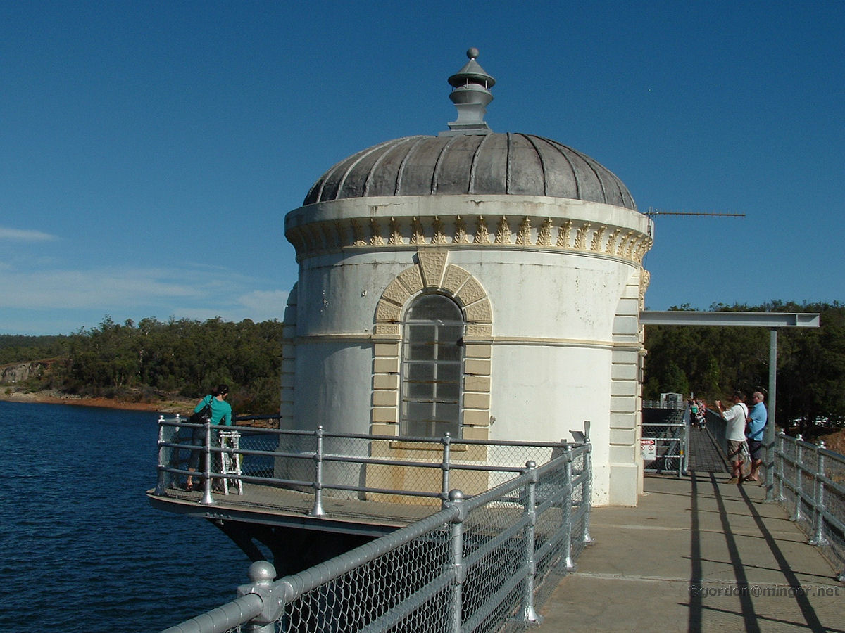
Mundaring Weir Looking down from the walk-way on top of the Mundaring Dam wall, here is the C.Y. O'Connor museum, pumping station etc. This is the Number 1 pumping station for the Goldfields water supply scheme. Mundaring Weir was created by dammed the Helena River. The upside is collecting fresh water. The downside is the destruction of the river between here and Guildford along with the loss of native flora and fauna along the river's former path. (See lots more at the Mundaring Weir locality page). Photo - April 2009 |
||
 |
Mundaring Weir Mundaring Dam is used as a water collection facility for the Goldfields Water Supply Scheme on the Helena River. Over towards the north end of the dam wall is this building. It's a popular landmark up here. I suspect this may be an old pump house or control station for the spillways. Photo - April 2009 |
||
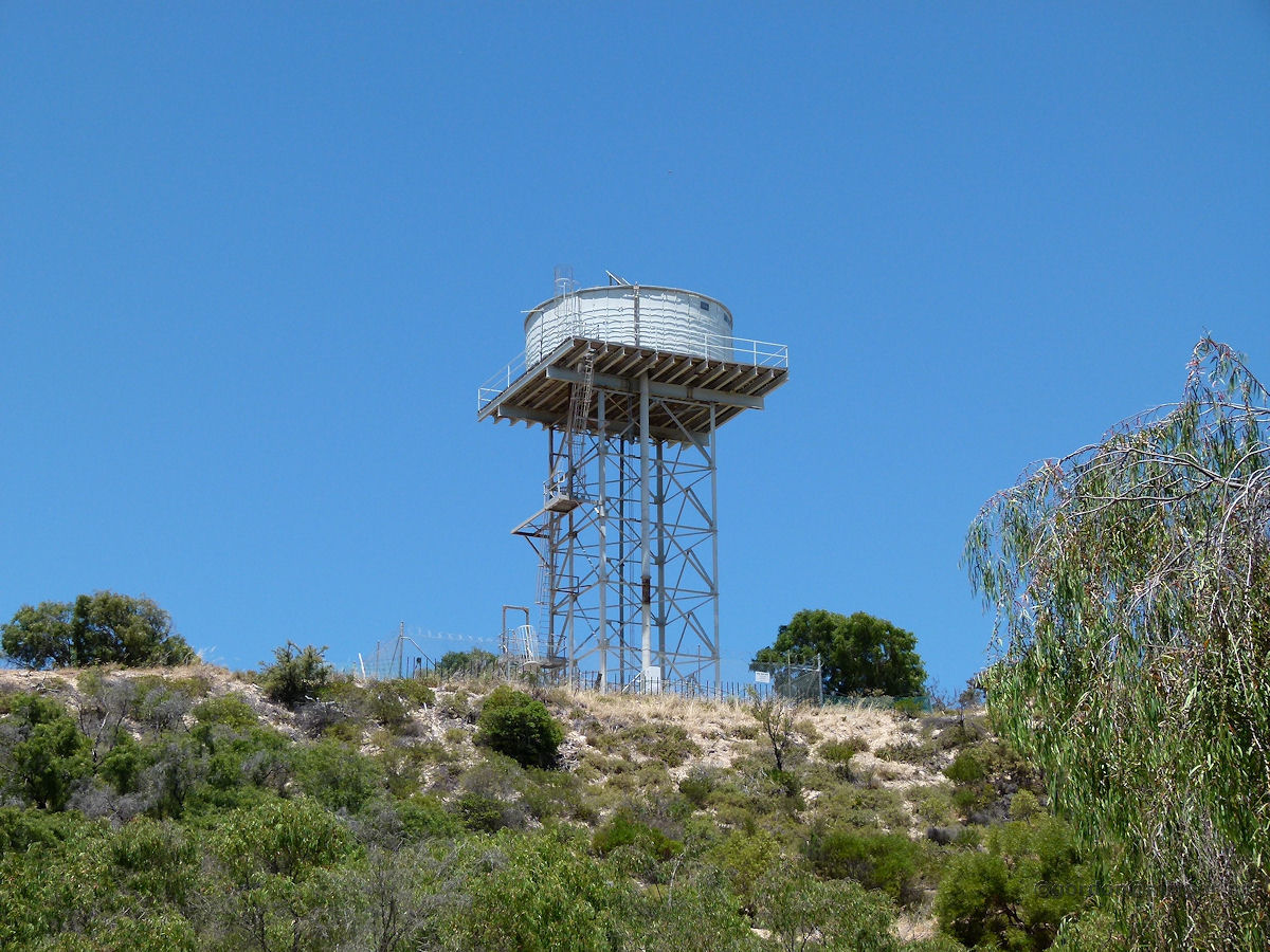 |
Myalup Keeping an eye on the caravan park below is this tower holding up the town's water supply. January 2012. Photos Ref: MYAL003 |
||
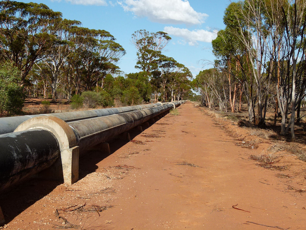 |
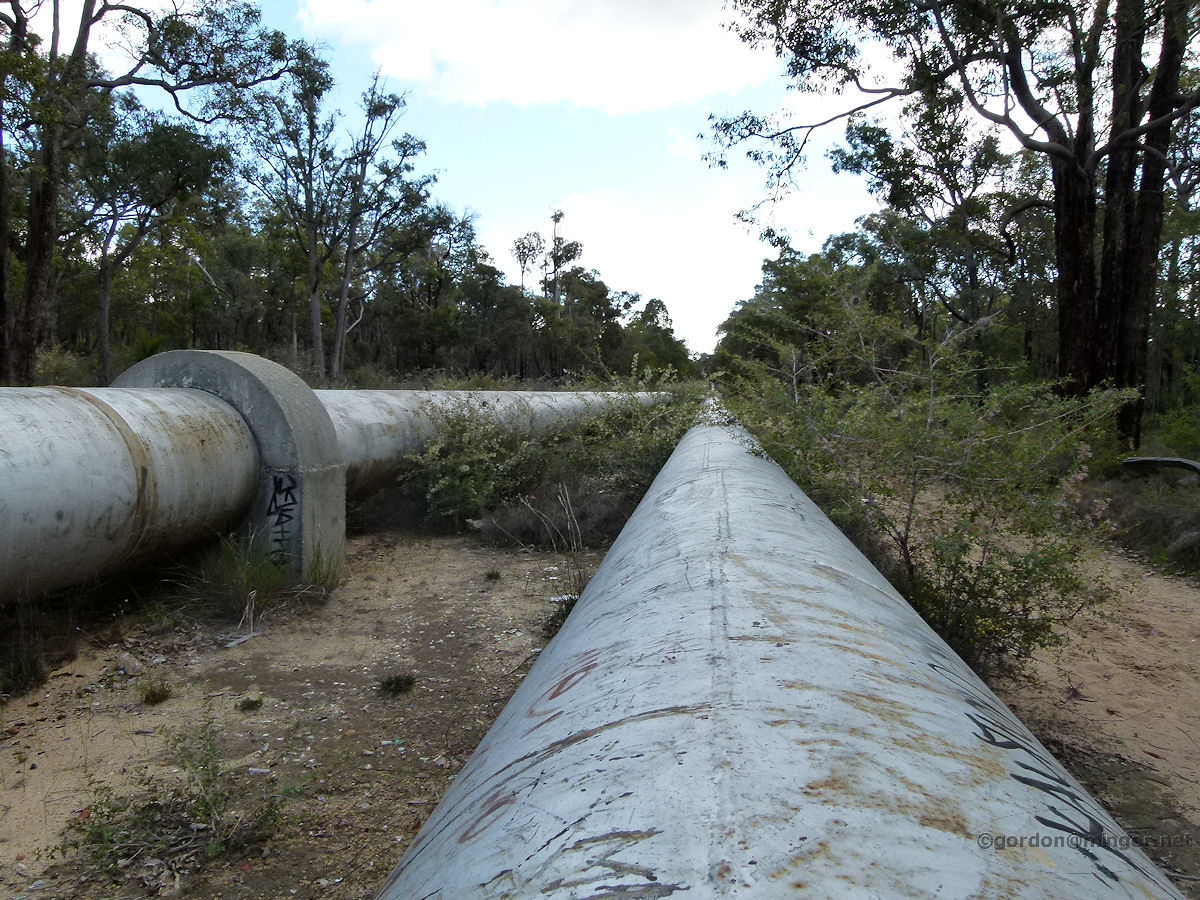
Nangeenan The Perth - Kalgoorlie pipeline follows the Great Eastern Highway for much of its journey. This is just west of Merredin. Photo - March 2015 |
||
 |
Naval Base The Naval Base desalination plant tanks all lined up with the chimneys of the Kwinana power station looming up in the background. The plant was constructed to supplement dwindling dam water in Perth. A second plant has been built at Binningup. Desalination of seawater is achieved by a filtration process. Photo - October 2013 |
||
 |
North Dandalup The North Dandalup water supply. This tank is probably replenished from water from the North Dandalup reservoir. The stand used to be made of wood. Photo - July 2010 |
||
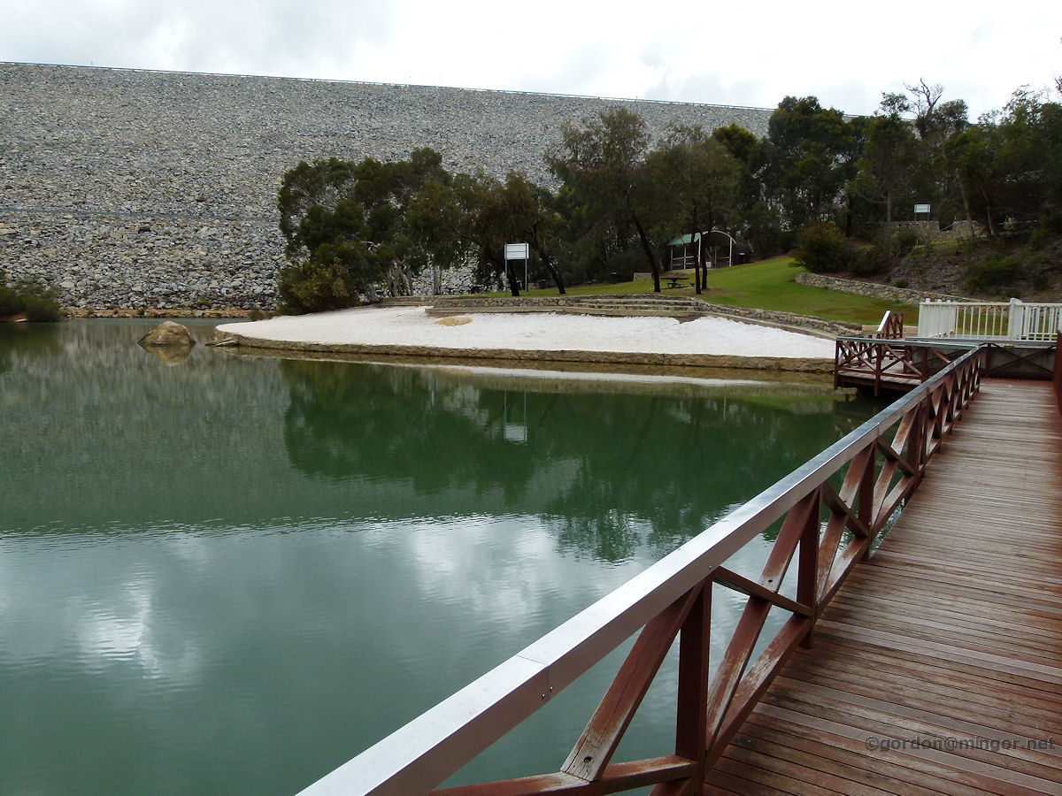 |
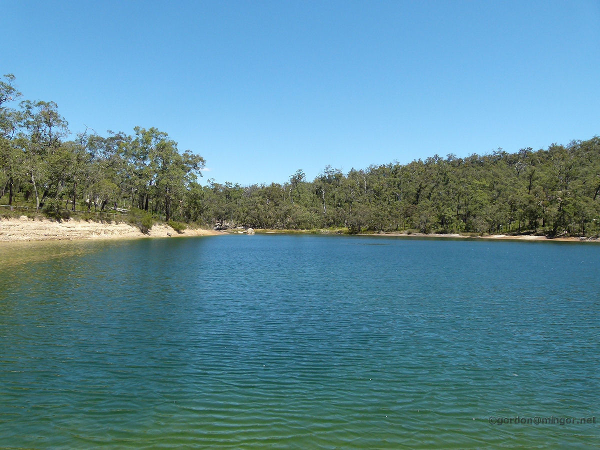
North Dandalup The North Dandalup reservoir sits in the foothills above the town of North Dandalup. Water is collected from the North Dandalup River and a couple of hills brooks and creeks. This is underneath the 'second' dam wall where there is a park, water and a small beach. That dam wall is huge. You may see the road coming down to this point about a third of the way up the wall, plus there is a road across the top. October 2011 |
||
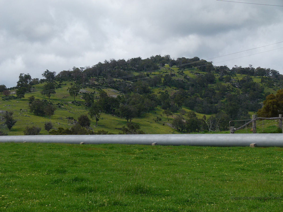 |
North Dandalup A pipeline running across paddocks east of the North Dandalup reservoir. Nice and green for early October. Photo - October 2011 |
||
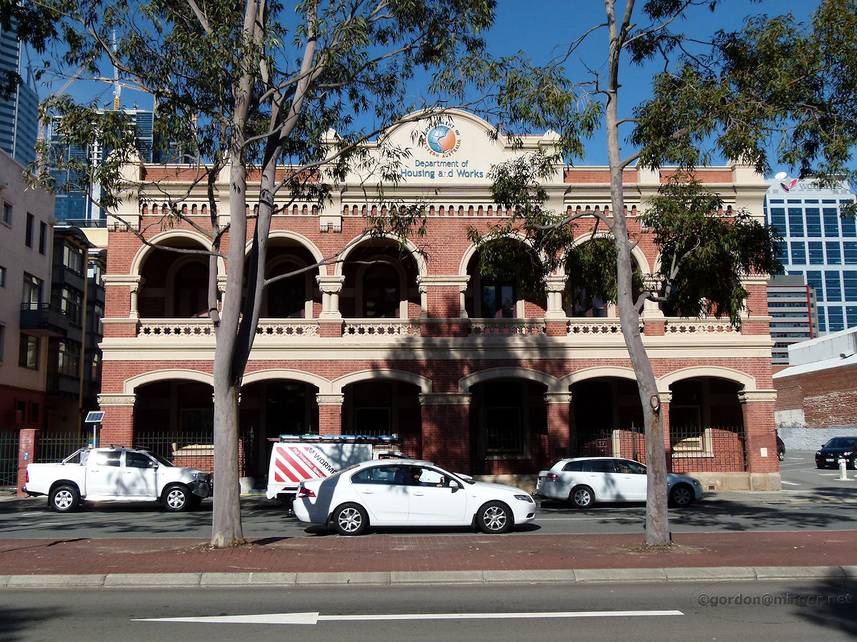 |
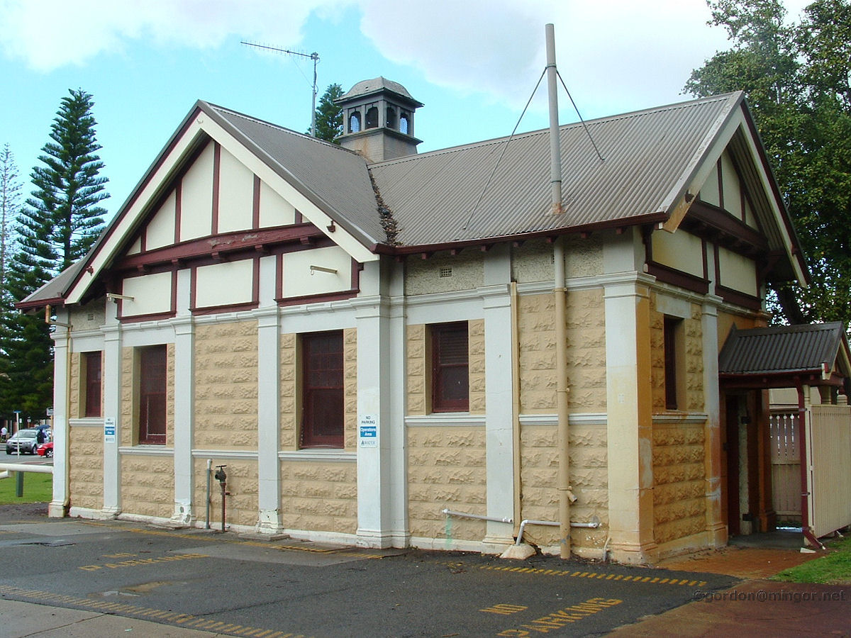
Perth On Wellington Street is the Department of Housing and Works Building. Originally this was the Works Board and the site of the number 2 water bore for Perth water supply. Later the building was used as the Railway Institute (for which it is better remembered). It was built in two stages - the first section in 1903 with additions in 1910. Photo - August 2011 |
||
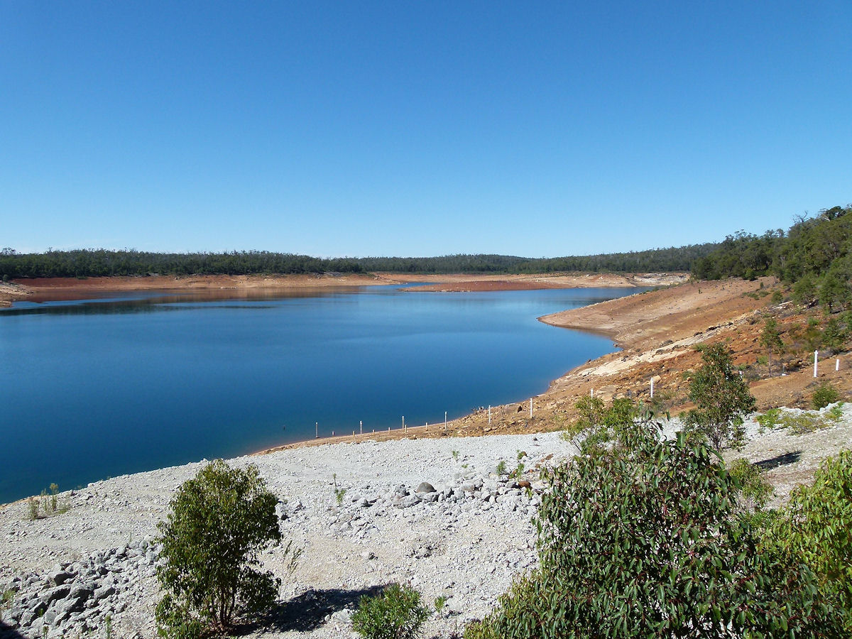 |
Roleystone About seven kilometres south of Roleystone is the Canning Dam. The water level at Canning Dam, which supplies the bulk of Perth domestic water, is depressingly low when this picture was taken. Still I suppose it is right at the end of summer. Construction of the dam was completed in September, 1940. Photo - March 2013 |
||
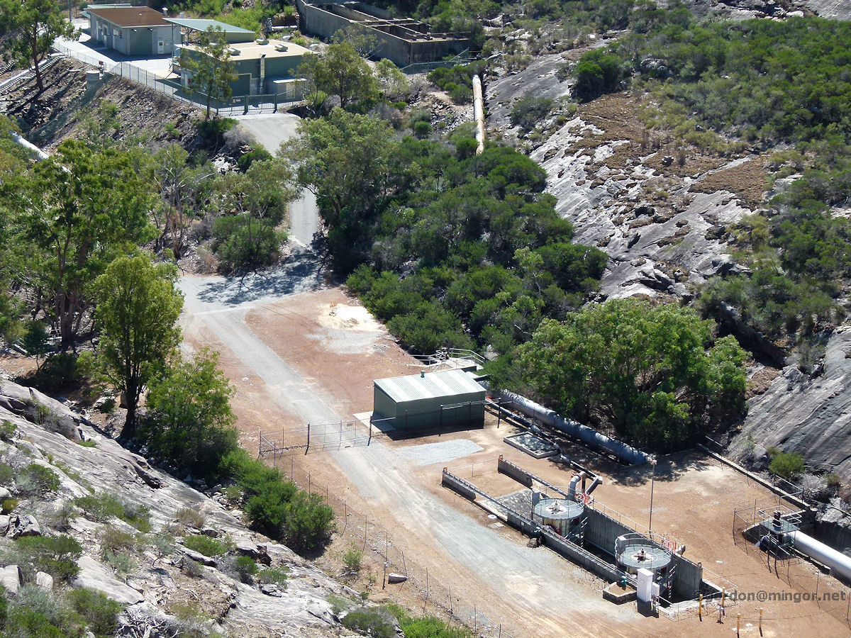 |
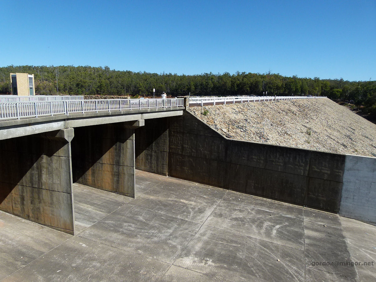
Roleystone Looking down from the top of the Canning Dam wall is the bottom of the spillway and pumping equipment. Water levels permitting, from time to time water from the dam is released into the Canning River to reinvigorate pools in the former river and to flush out bacteria, algae etc. Photo - March 2013 |
||
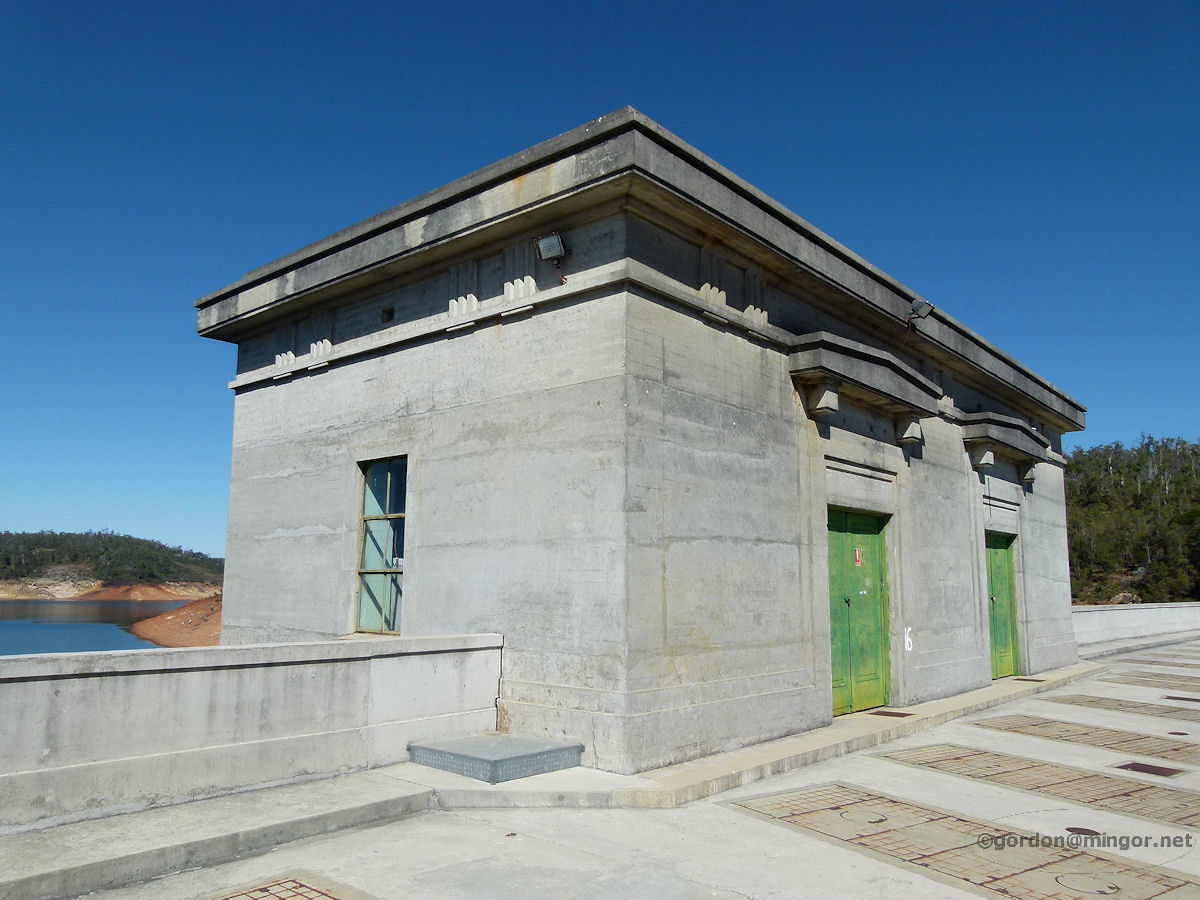 |
Roleystone On top of the Canning Dam wall is this old building, probably used as a control centre for measuring the water level and opening up spillways. Photo - March 2013 |
||
 |
Serpentine The Serpentine Dam is reportedly only 22% full at present (31 million litres) - you can get an idea here of where the "normal" water level should be. The dam was constructed in 1960 and 1961 and was officially opened by the then Premier, The Hon. David Brand MLA, on 20th October 1961. Photo - April 2011 |
||
 |
Serpentine The main spillway for an over-flowing Serpentine Dam. This reservoir forms part of the Perth water supply. In 1975 the dam was connected to the metropolitan water scheme via the Canning Tunnel. Photo - April 2011 |
||
 |
Wooroloo An intricate set of pipes and valves extract water from the goldfields water supply pipeline for the requirements of the town of Wooroloo. Photo - February 2011 |
||
All images published on this website are copyright © of the webmaster. See About section for clarification and special schools permission |
|||