| Photographs of Perth, Western Australia | |||
Dawesville - Photographs of Western Australia A thriving suburb of Mandurah, to the south of the town, situated on a strip of land situated between the Indian Ocean and the Harvey Estuary, on the Old Coast Road. Whereas the word "suburb" is used, Dawesville was established as an independent locality but the growth of the City of Mandurah has almost swallowed up this area. Fifty years ago a few houses were here. Popular then and today is the scenic drive detour along the Harvey Estuary |
|||
| North to Mandurah | South to Lake Clifton | ||
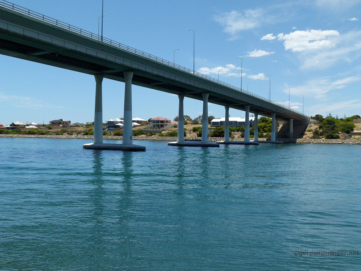 |
Dawesville - Port Bouvard Bridge The Port Bouvard Bridge spans the Dawesville Channel which forms the boundary between Dawesville and Wannanup. The channel was constructed 1990-1994 in an attempt to cleanse the estuary of nutrient run-offs etc by additional sea water flowing in and out. December 2011. Photos Ref: DAWS001 |
||
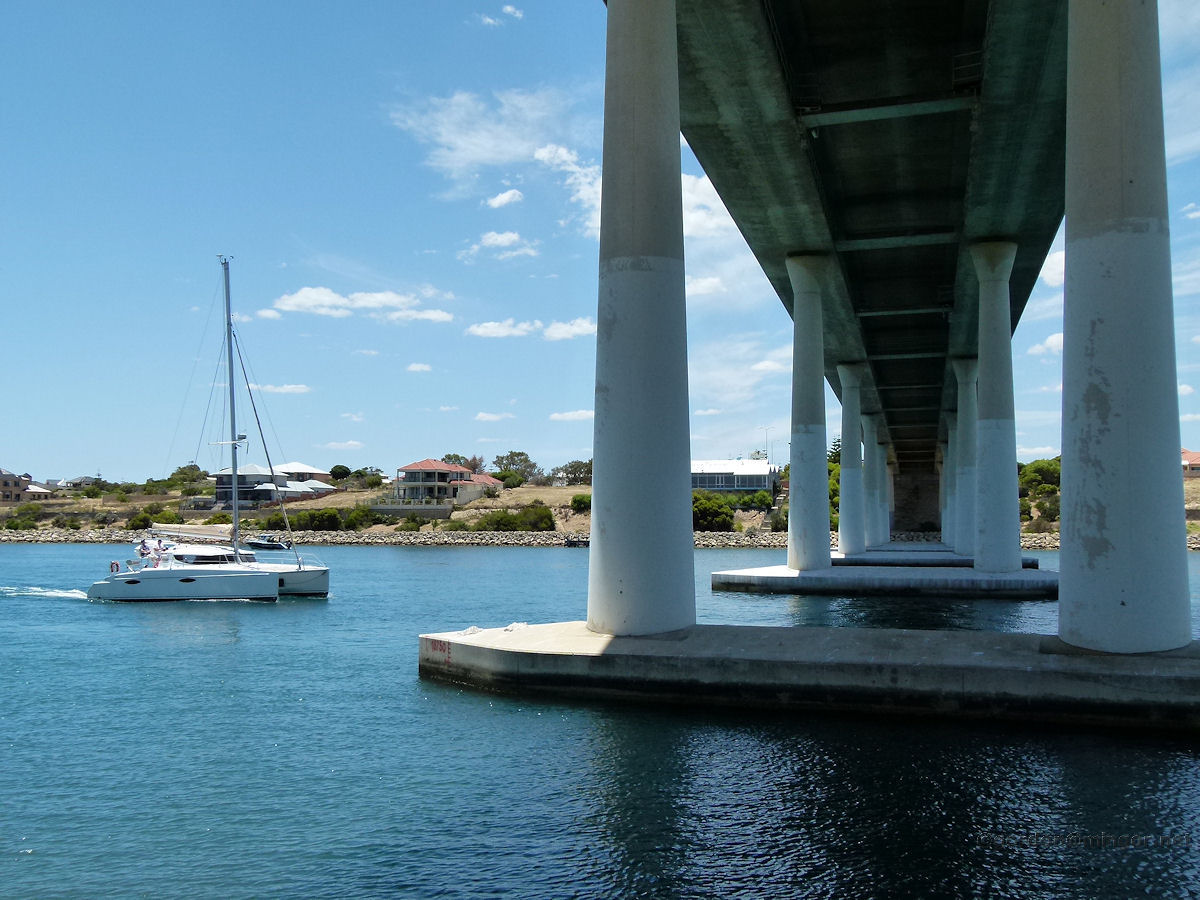 |
Dawesville - Port Bouvard Bridge A boat passes under the Port Bouvard Bridge. The channel is around 200 metres wide and is 2.5 kilometres in length. The depth is usually a little over 6 metres. December 2011. Photos Ref: DAWS002 |
||
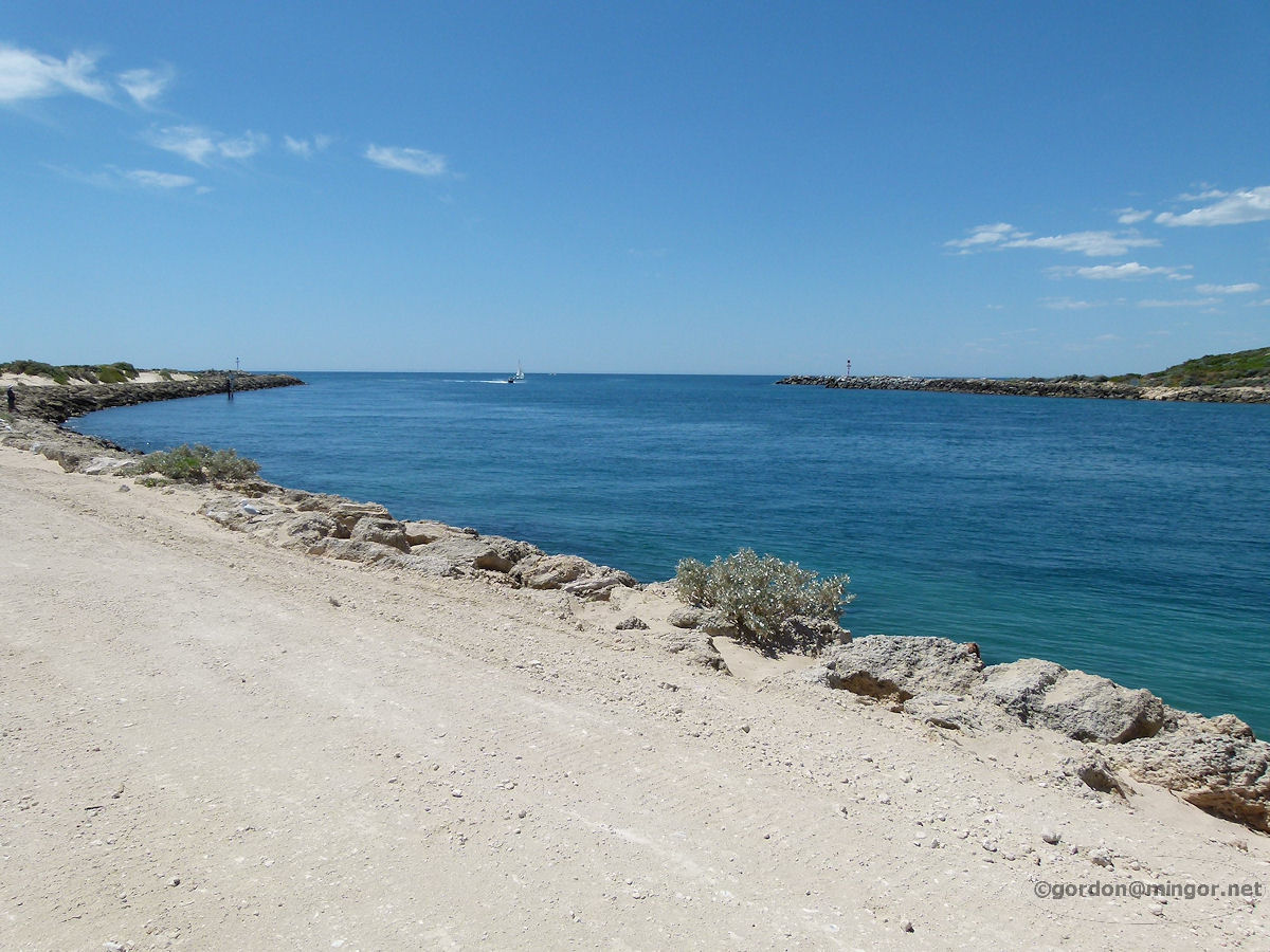 |
Dawesville - Ocean Entrance to The Channel A view along the channel on the south side looking towards its Indian Ocean entrance. December 2011. Photos Ref: DAWS003 |
||
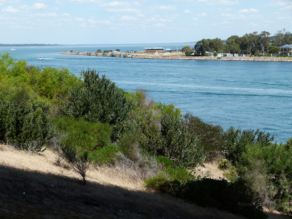 |
Dawesville - Estuary Exit of The Channel And looking east, this is a view of where the Channel meets the Harvey Estuary (which is an extension of the Peel Inlet), this time from the north side. December 2011. Photos Ref: DAWS004 |
||
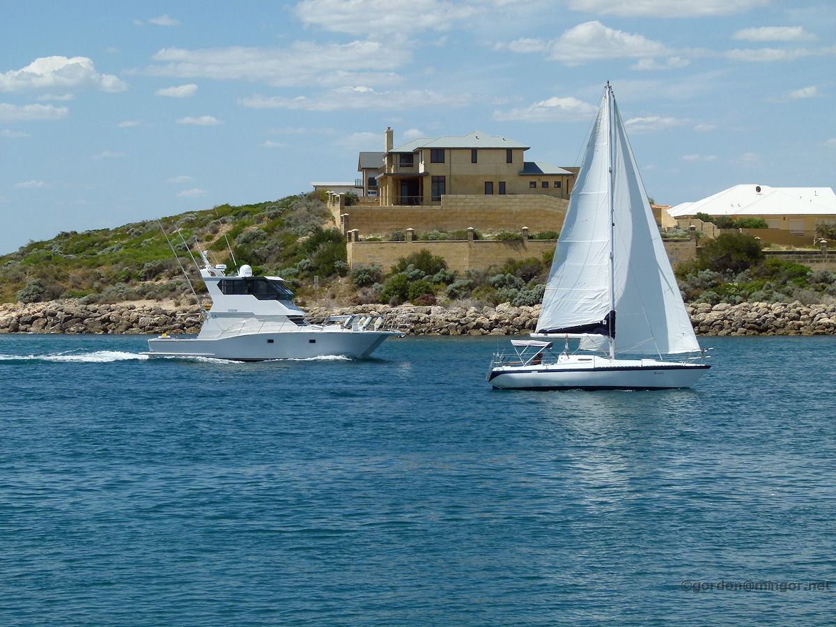 |
Dawesville - House on The Channel A fine house sits high up on the north bank of the Channel, this day seemingly flanked by two boats passing by. December 2011. Photos Ref: DAWS005 |
||
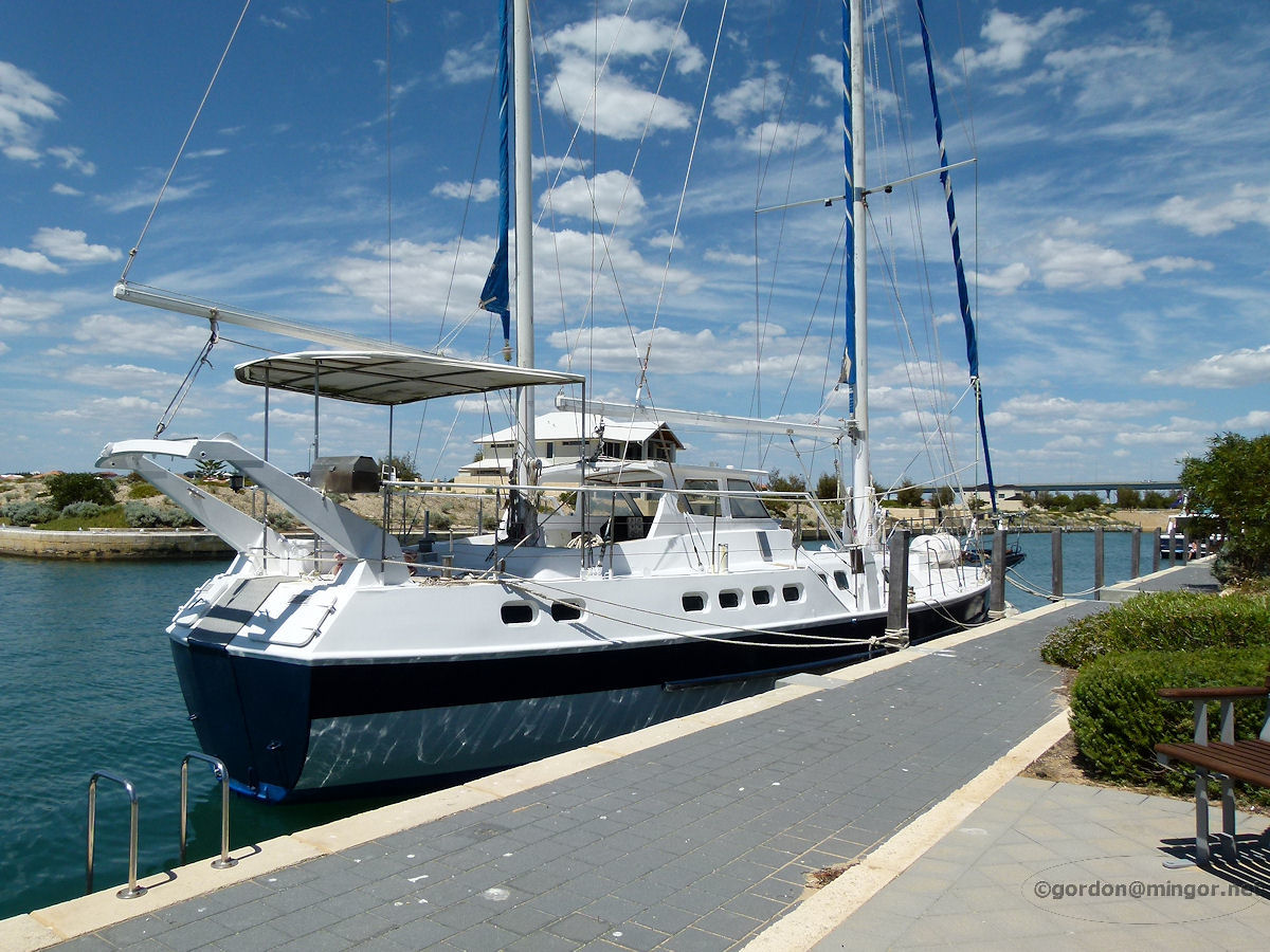 |
Dawesville - Boat on Canal A small canal cutting in from the south side of the Dawesville Channel provides a safe haven for boats such as this. It's off Southport Boulevard. December 2011. Photos Ref: DAWS006 |
||
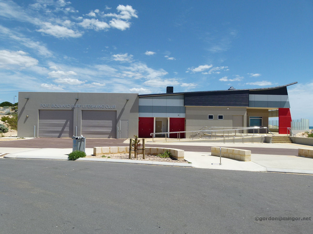 |
Dawesville - Surf Club The Dawesville Surf Club overlooks and keeps an eye on swimmers at the popular Pyramids Beach. December 2011. Photos Ref: DAWS007 |
||
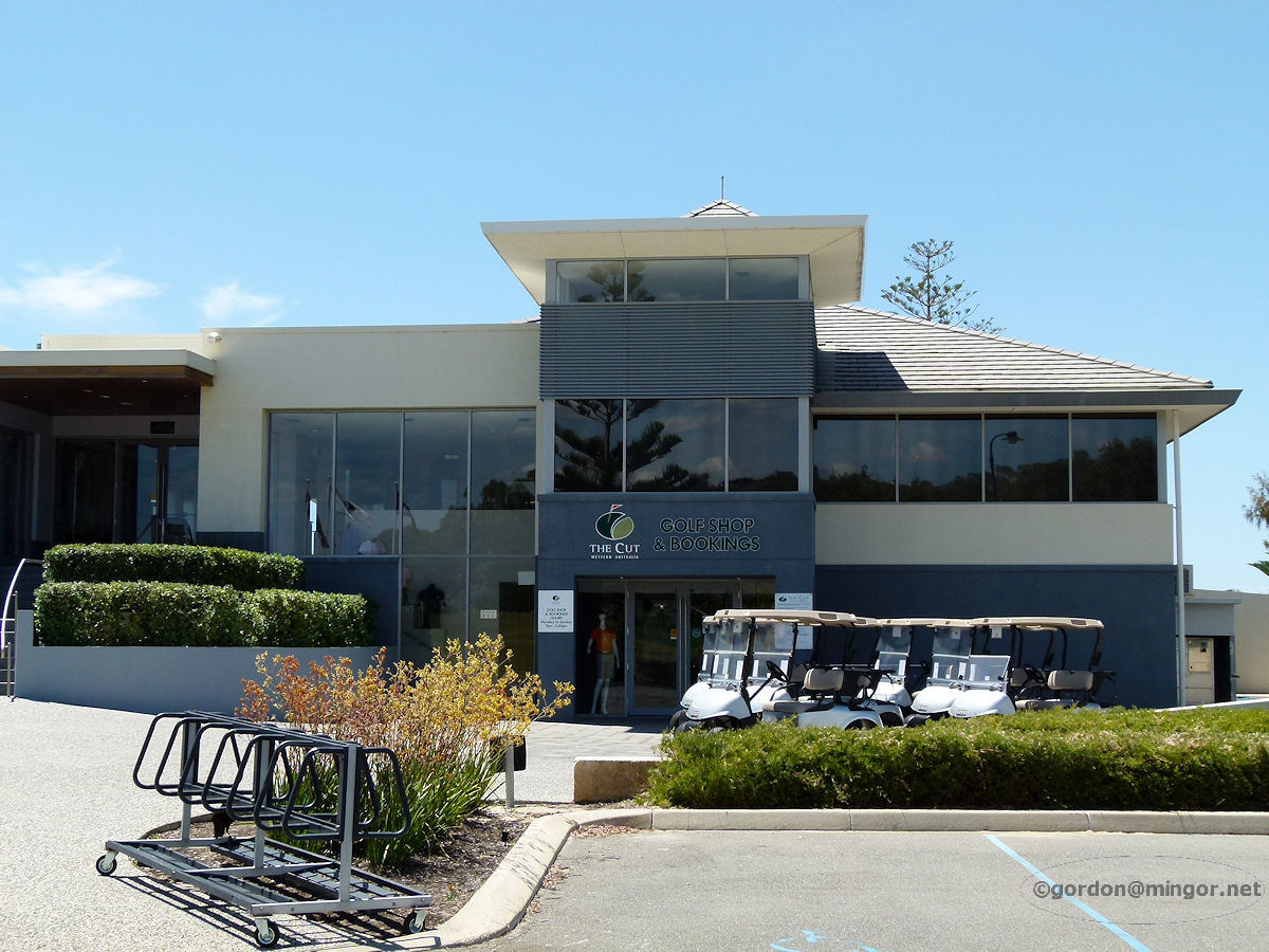 |
Dawesville - Golf Club A little south of the Channel (also known at 'The Cut') is this rather fine "The Cut Golf Course". It's off Country Club Drive. This is part of the clubrooms. December 2011. Photos Ref: DAWS008 |
||
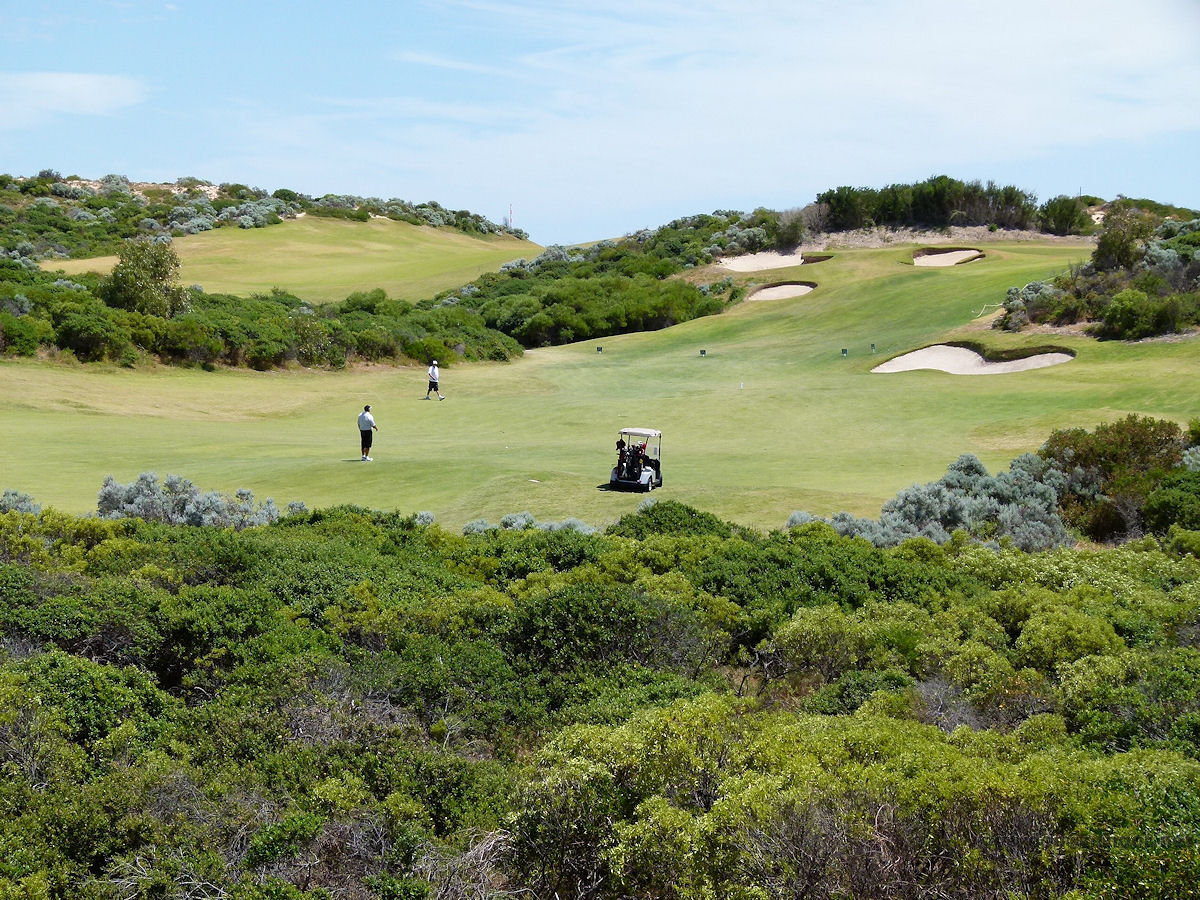 |
Dawesville - Golf Course A tricky looking fairway at The Cut Golf Course. The flag is up there at the top of the hill, past those treacherous sand traps. December 2011. Photos Ref: DAWS009 |
||
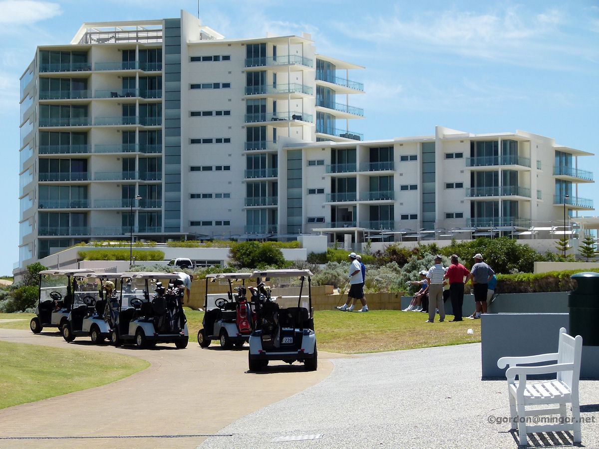 |
Dawesville - Oceanique Apartments Golfers wait to take out their buggies for a round and in the background the new Oceanique apartments have a bird's eye view of the golf course on this side and the ocean on the other. December 2011. Photos Ref: DAWS010 |
||
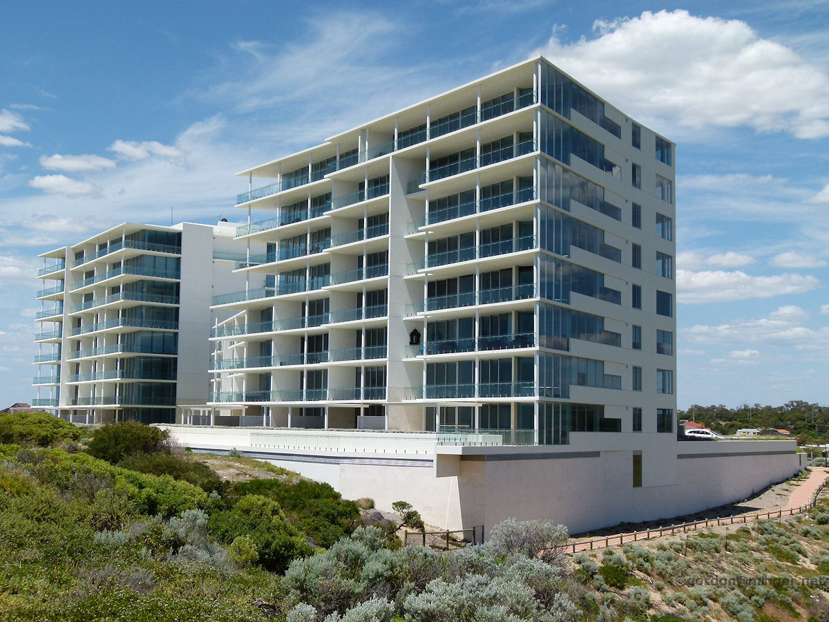 |
Dawesville - Oceanique Apartments The Oceanique apartment's ocean face. Not many seem occupied yet but they will sell. Be a great place to live if you are a beach and/or golf buff. December 2011. Photos Ref: DAWS011 |
||
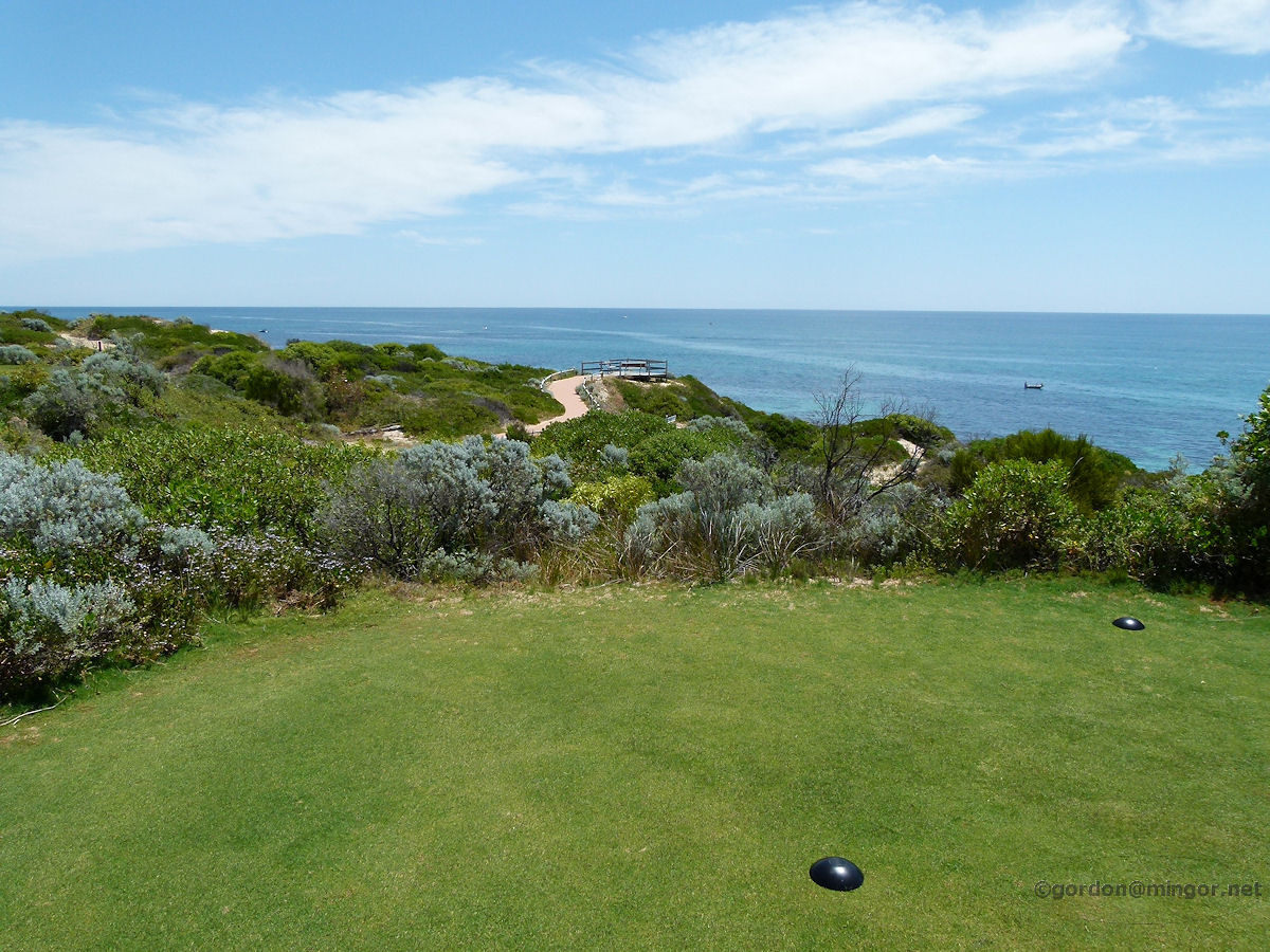 |
Dawesville - Ocean Lookout Walking past the Oceanique apartment blocks on the path up to the beach. There is a golf course crossing (between holes). At the end is a lookout which you can see off at the end of the pathway. Foreground is the tee-off point for this hole. December 2011. Photos Ref: DAWS012 |
||
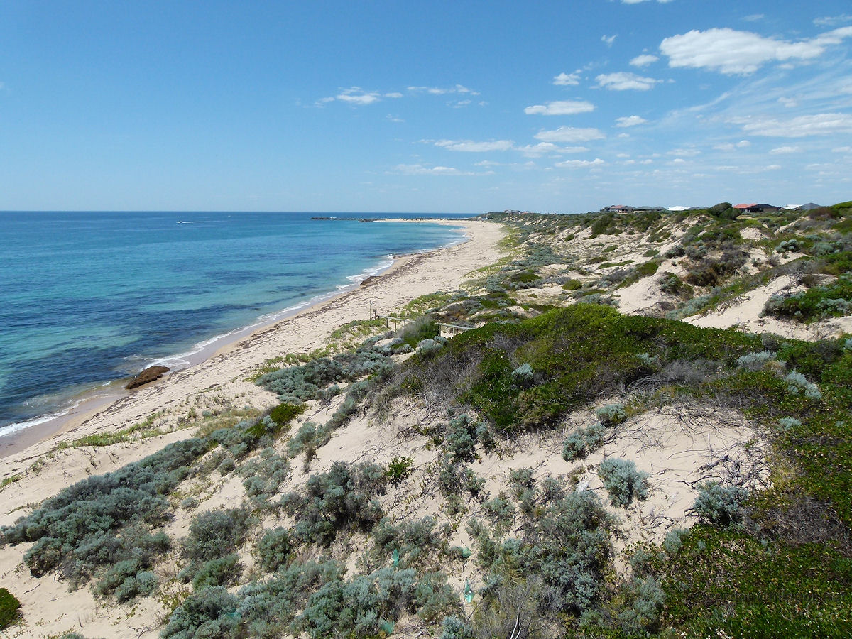 |
Dawesville - Beach Now we've made it to the ocean lookout. This is a view looking north along the beach. In the distance next to the breakwater is Pyramids Beach and the surf club. December 2011. Photos Ref: DAWS013 |
||
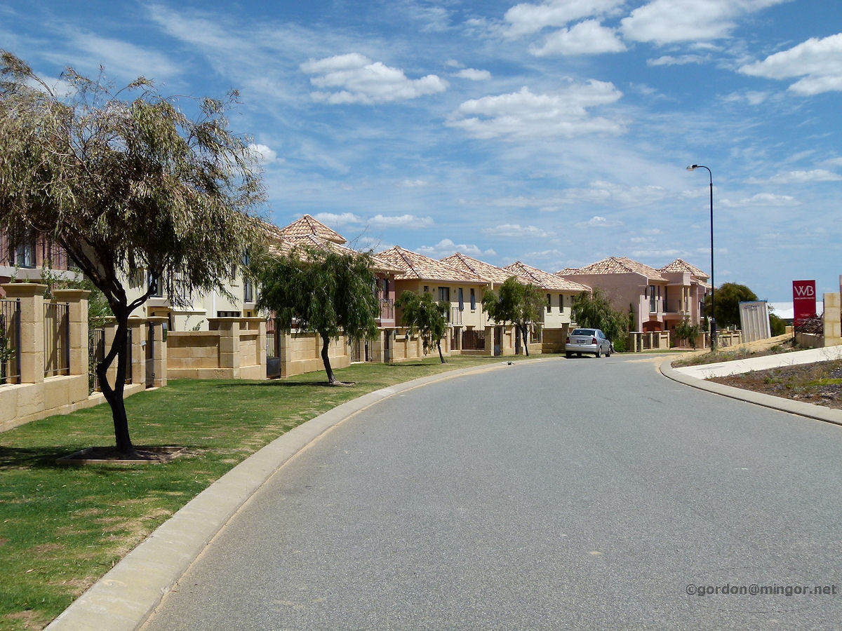 |
Dawesville - Houses Fine homes line this street which is right in the middle of the golf course. December 2011. Photos Ref: DAWS014 |
||
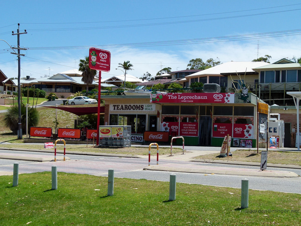 |
Dawesville - Leprechaun Tearooms On Estuary Road is the Leprechaun Tearooms which seems the only place of its type for quite some distance. December 2011. Photos Ref: DAWS015 |
||
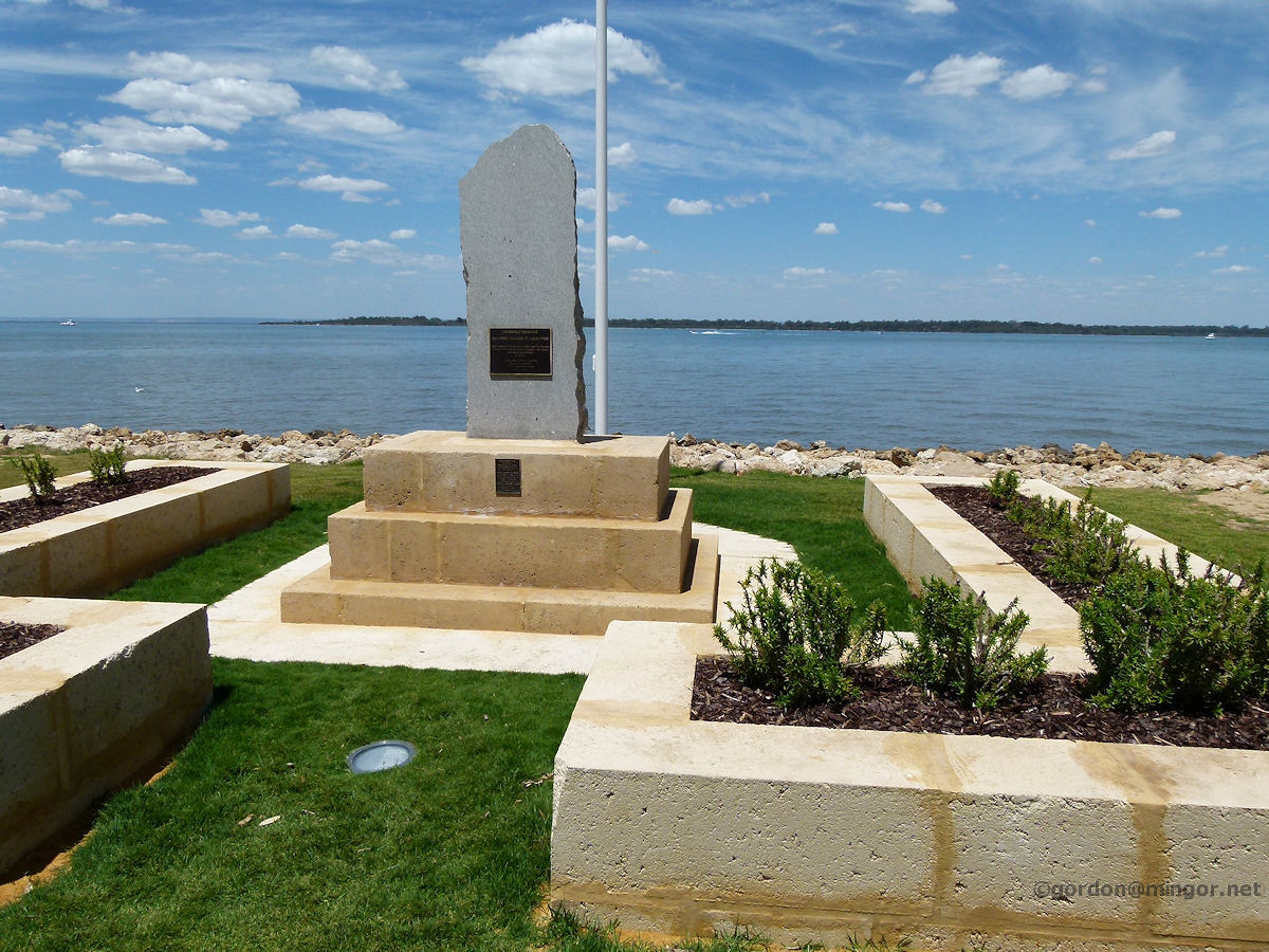 |
Dawesville - Memorial on Estuary Road The war memorial on Estuary Road. 'Our Freedom Came At A High Price'. December 2011. Photos Ref: DAWS016 |
||
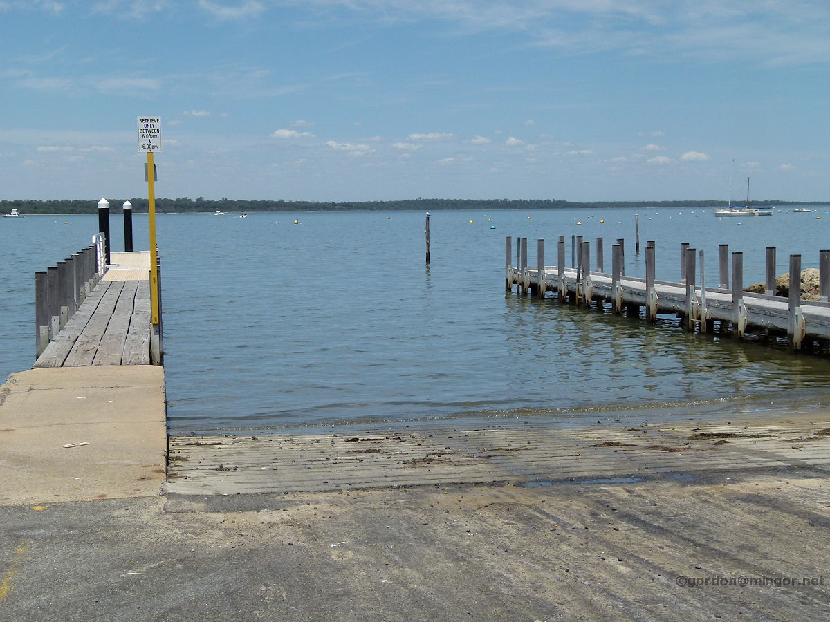 |
Dawesville - Boat Ramp on Estuary Road The boat ramp into the Harvey Estuary. This is on Estuary Road near Crocos Place. Across the water on the other bank in Point Grey. Beyond that is the Peel Inlet, and beyond that eventually is Pinjarra. December 2011. Photos Ref: DAWS017 |
||
All images published on this website are copyright © of the webmaster. See About section for clarification and special schools permission |
|||