| Photographs of Perth, Western Australia | |||
Lake Clifton- Photographs of Western Australia A small locality situated on the Old Coast Road, about 25 km south of Mandurah and just north of the Old Coast Road and Forrest Highway junction. The town is named after Marshall Clifton, an early Australind Settler. The town came about through the mining of a lime deposit by W.A. Portland Cement Co. here around 1920. There was a rail line to Waroona but this was removed in 1924. Proposed names included Leschenault, Fouracre and Garbanup |
|||
| North to Dawesville | South to Preston Beach | ||
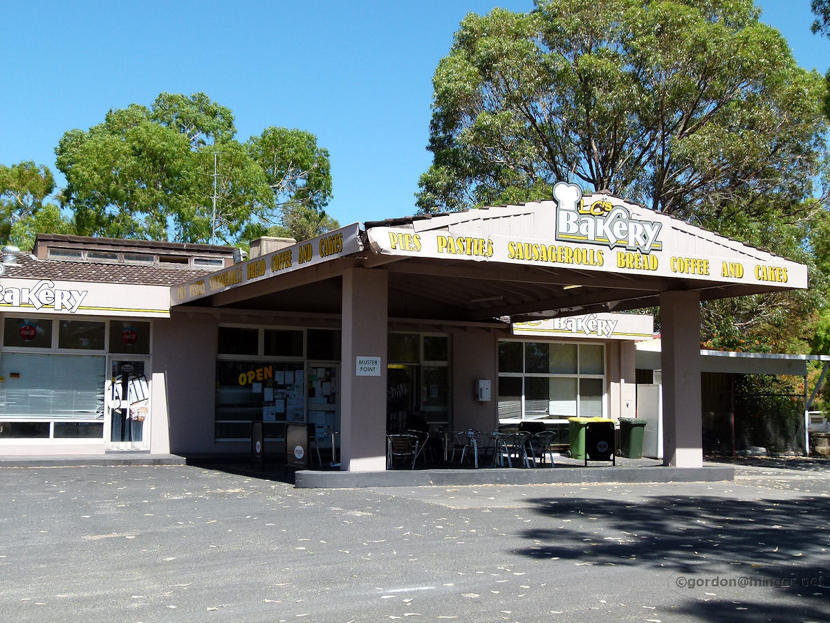 |
Lake Clifton - Bakery One time roadhouse with fuel and road-side services. Now that the new Forrest Highway has opened, passing trade has dwindling however they have re-invented themselves as a bakery with a brewery/motel to the rear and a caravan park off to the right. January 2012. Photos Ref: LKCL001 |
||
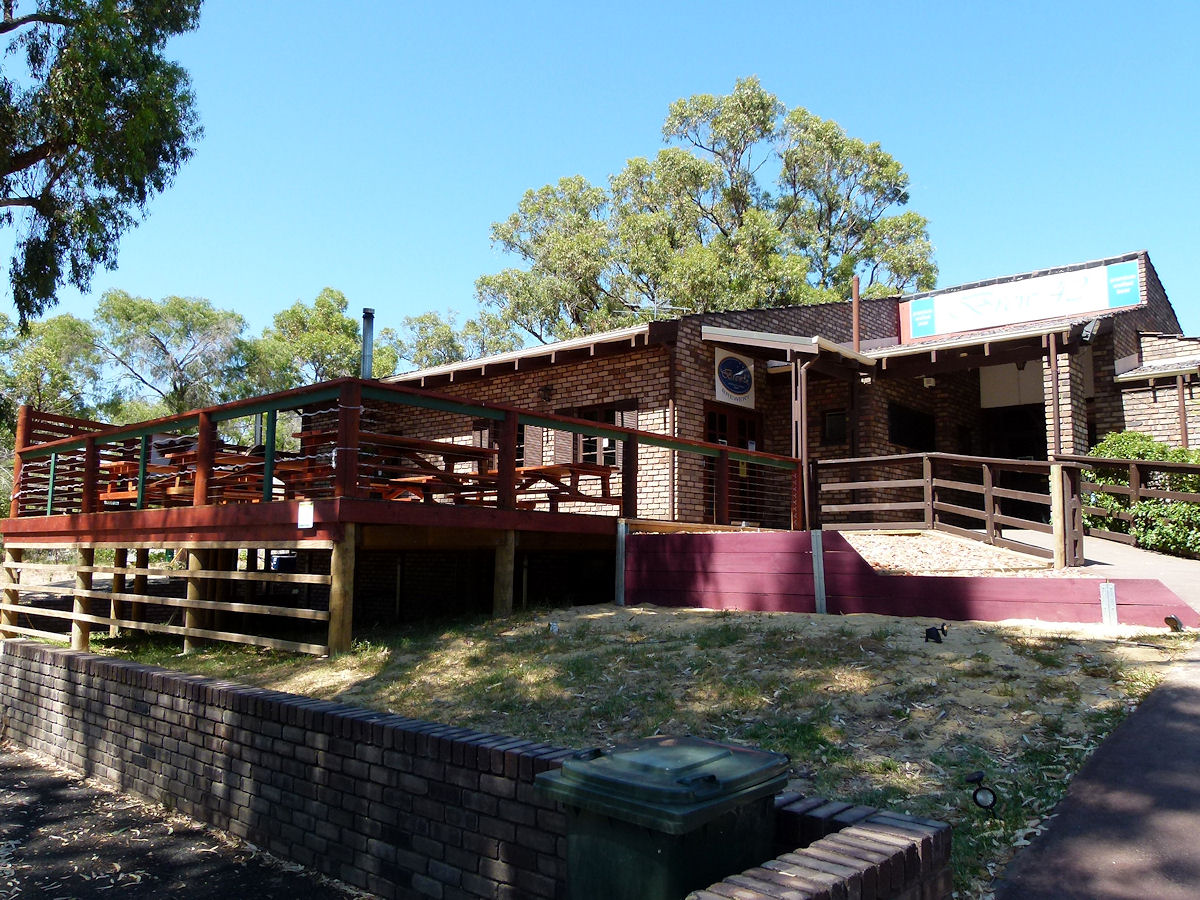 |
Lake Clifton - Lake Clifton Brew 42 This is the Lake Clifton Tavern and Motel which is located just behind and a bit to the left of the bakery. Up until 2014 this was known as the Brew 42 Brewery as signage in the photo indicates. January 2012. Photos Ref: LKCL002 |
||
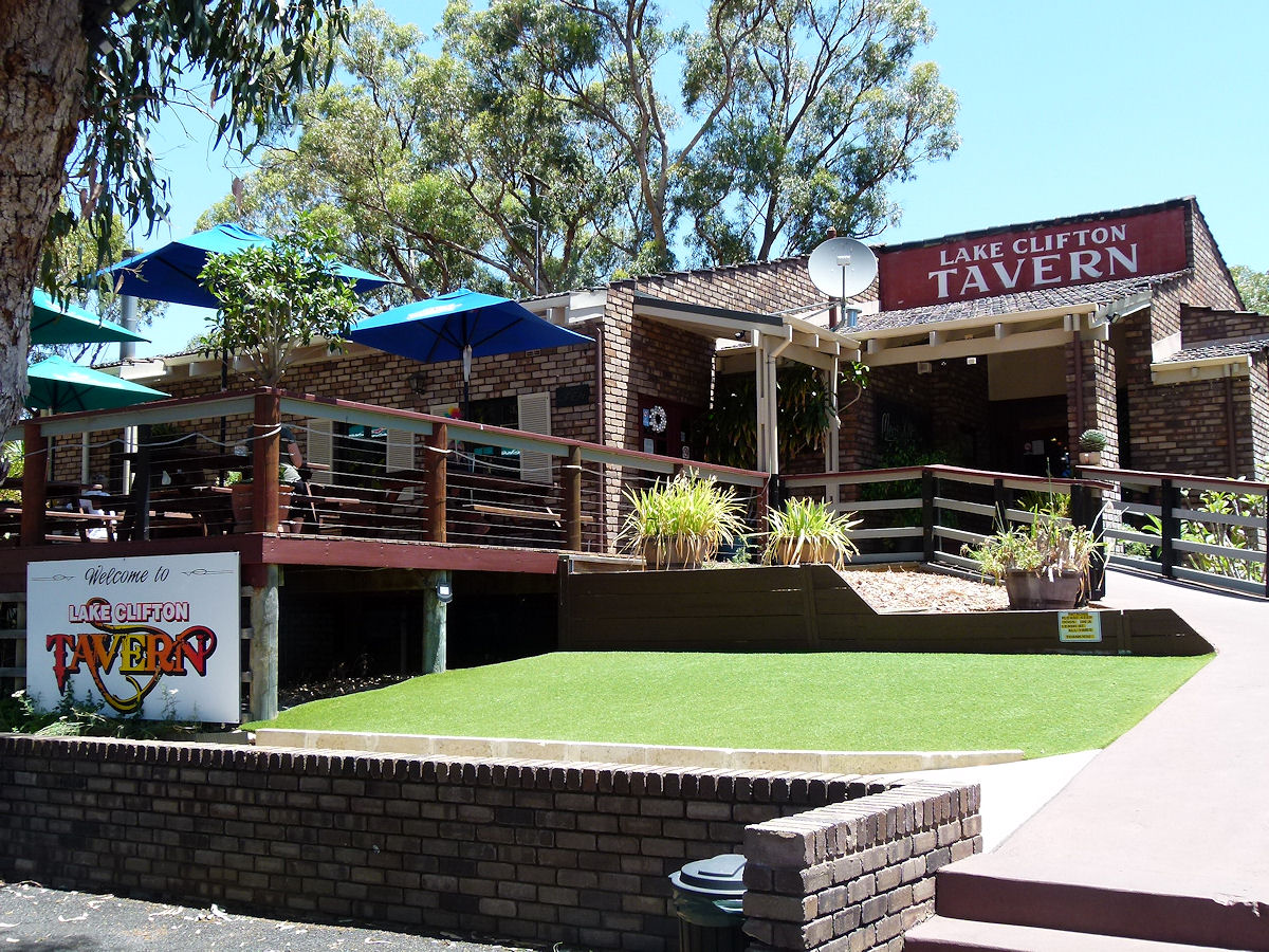 |
Lake Clifton - Lake Clifton Tavern This place has reverted to being a tavern again and how pleasant it was today sitting out on the back verandah with our meals, overlooking the tethered horses and the grass airstrip. December 2019. Photos Ref: LKCL003 |
||
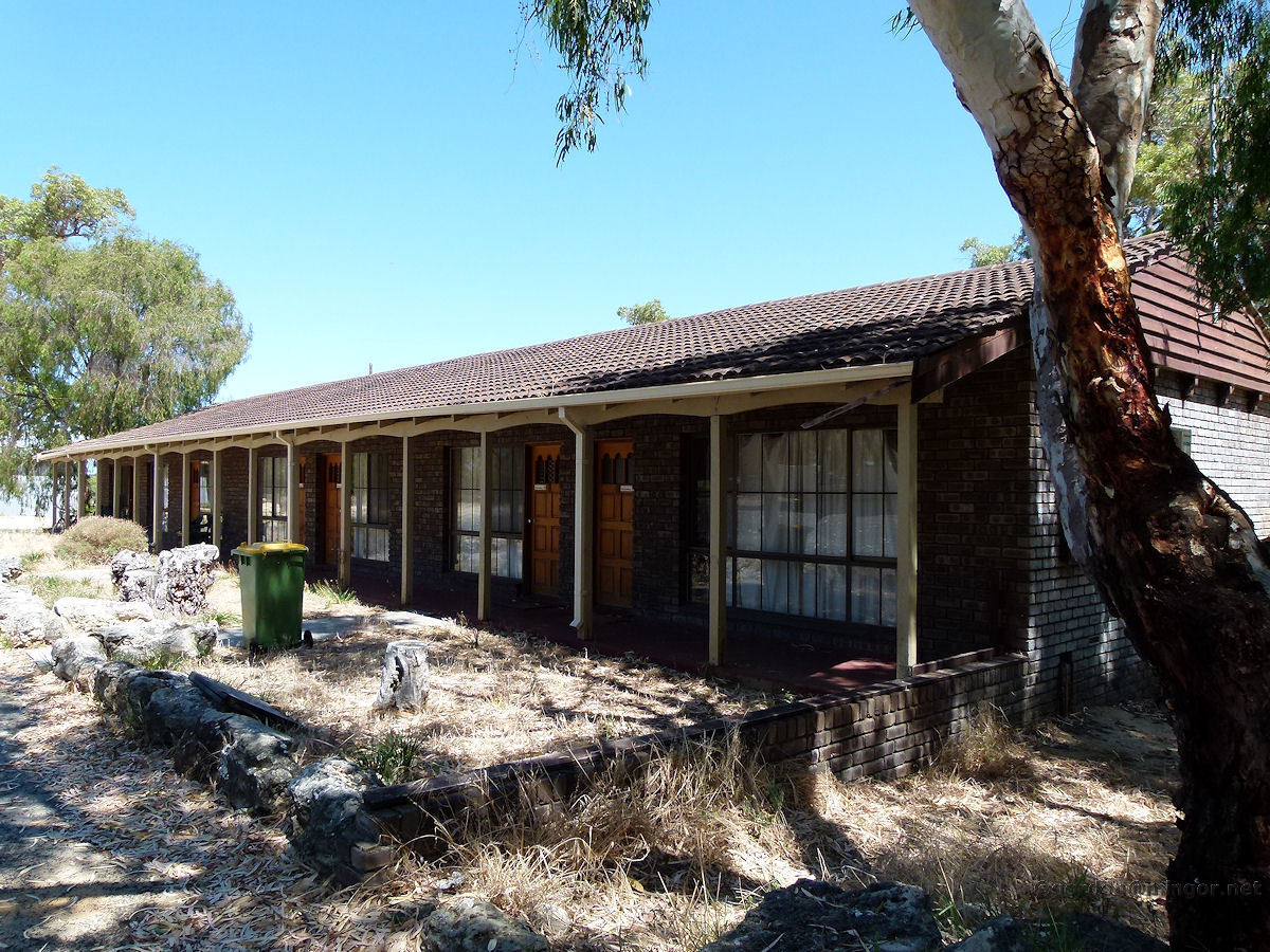 |
Lake Clifton - Motel Adjacent to and part of the Lake Clifton Tavern and Motel are these motel units. January 2012. Photos Ref: LKCL004 |
||
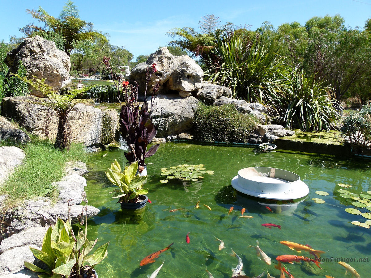 |
Lake Clifton - Caravan Park Pond Next to the bakery is a rather extensive caravan park. At the entrance is this l pond/waterfall creation. Dragonflies and bees were enjoying buzzing around and landing on the lily pads. Those fish in there are really quite big. January 2012. Photos Ref: LKCL005 |
||
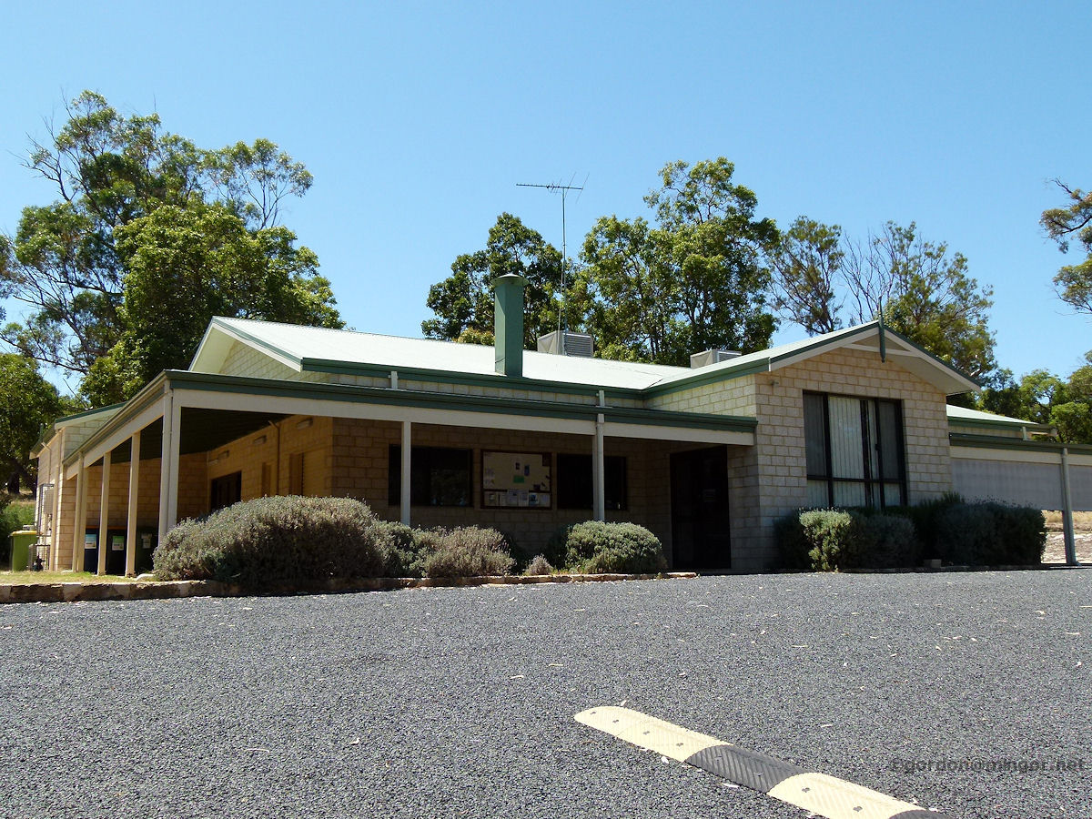 |
Lake Clifton - Community Hall Lake Clifton is more than just the old roadhouse complex, it is a locality in its own right with many fine properties just south of the old roadhouse, and off to the east. This is the Lake Clifton Community Hall on Tuart Grove Avenue. January 2012. Photos Ref: LKCL006 |
||
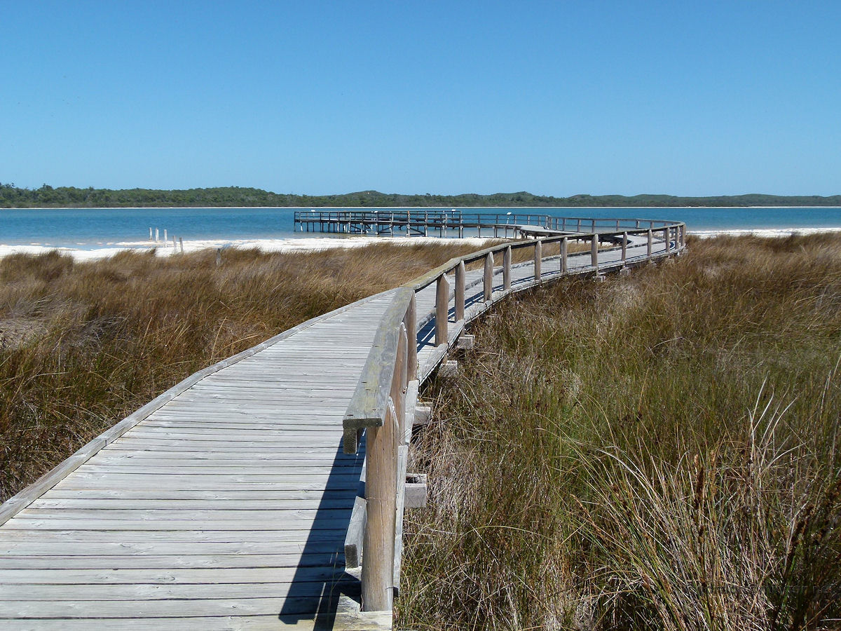 |
Lake Clifton - Thrombolites Viewing Walkway Lake Clifton is home to a substantial thrombolite colony. The colony is located on the eastern side of the lake a few kilometres north of the Lake Clifton Tavern and Bakery. To visit, take Clifton Downs or Mount John Road, and follow the signs. The pictured walkway would be less than 500 metres from the car park. January 2014. Photos Ref: LKCL007 |
||
 |
Lake Clifton - Thrombolites Viewing Walkway Standing on the jetty (or viewing platform) over the edge of Lake Clifton. You can see thrombolites in the water. January 2014. Photos Ref: LKCL008 |
||
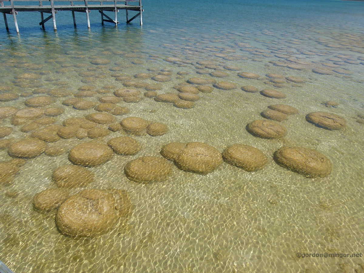 |
Lake Clifton - Thrombolites Thrombolites in the shallows enjoying a warm summer day. Whilst they might appear rock-like, they contain microbial communities which exist by photosynthesizing sunlight. The structures are formed by extracting calcium carbonate from the lake water. January 2014. Photos Ref: LKCL009 |
||
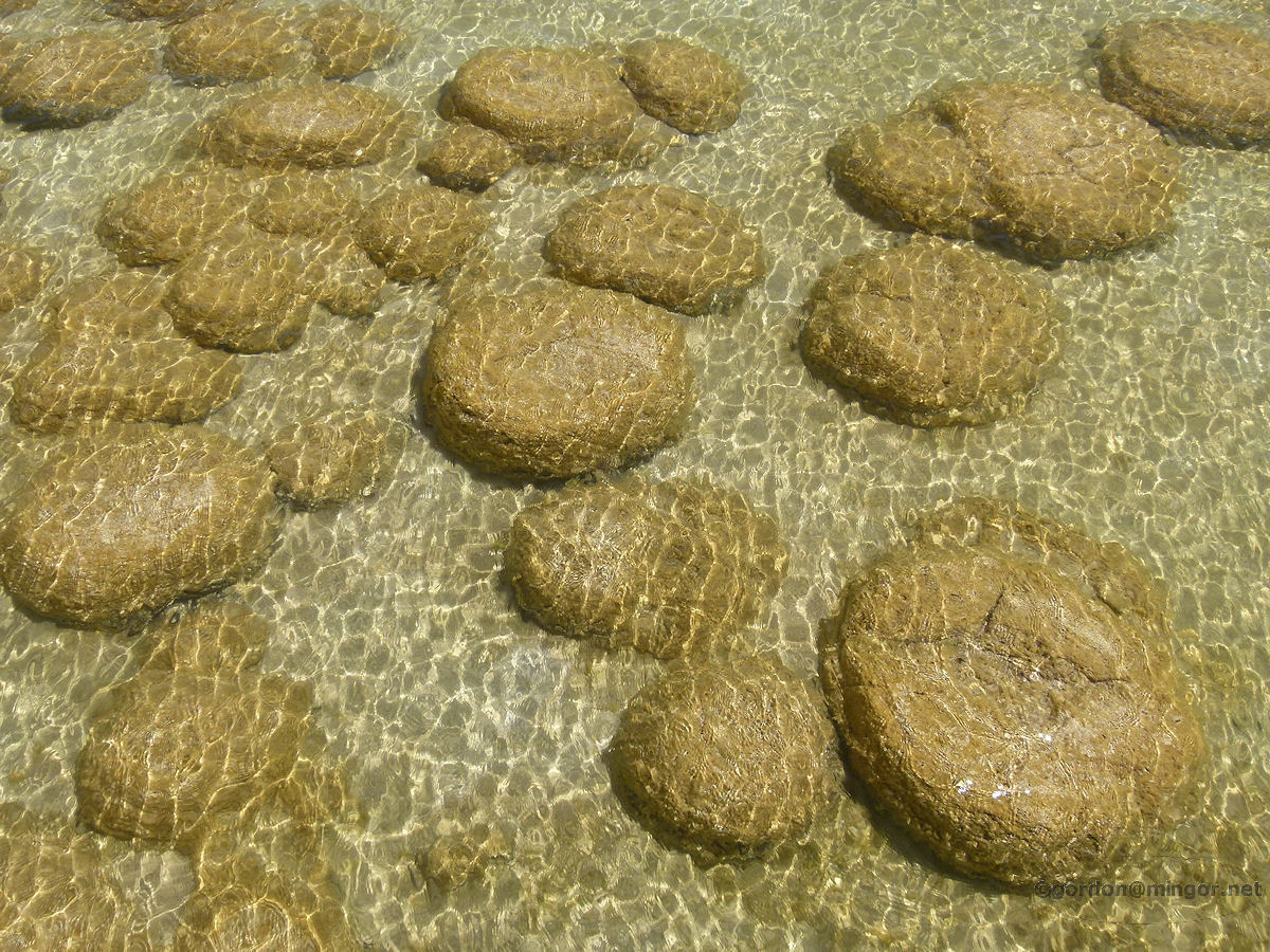 |
Lake Clifton - Thrombolites Thrombolites again. They are thought to be around 2,000 years old. The water in the lake is fed from the ocean subterraneanly. Over the centuries the lake level has dropped in tune with that of the sea. This trend could be starting to reverse. January 2014. Photos Ref: LKCL010 |
||
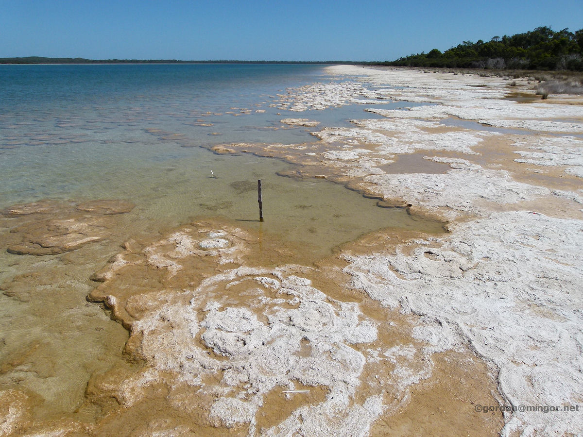 |
Lake Clifton - Lake View North The is a view looking north along the eastern edge of Lake Clifton from the viewing area. January 2014. Photos Ref: LKCL011 |
||
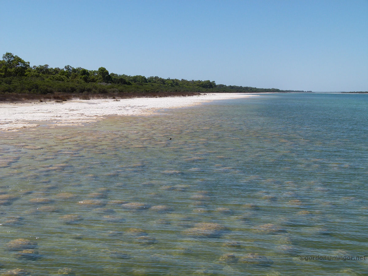 |
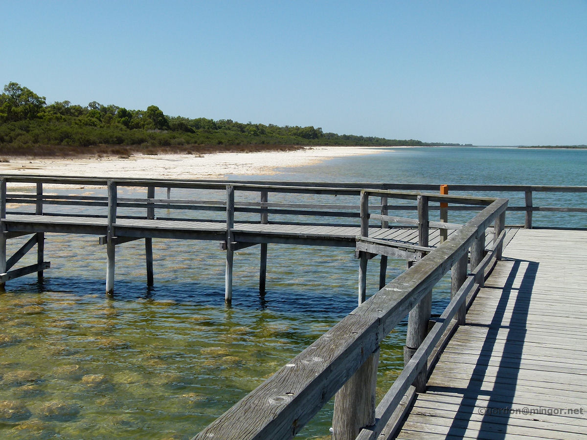
Lake Clifton - Lake View South This is looking south along the eastern edge of Lake Clifton from the viewing area. Many thrombolites can be seen in the water. January 2014. Photos Ref: LKCL012 |
||
All images published on this website are copyright © of the webmaster. See About section for clarification and special schools permission |
|||