| Photographs of Perth, Western Australia | |||
Nungarin - Photographs of Western Australia The town of Nungarin is located at the northern end of what is now known as the Merredin - Nungarin Road. It is about 40 kms north of Merredin and about 20 kms south-east of Kununoppin. The Goomalling to Merredin narrow-gauge rail line passes through town. A rail siding was proposed in 1910. The town was eventually gazetted as such in 1912. The town is named after the nearby Nungarin Rocks. Surveyors earlier recorded the town name as Noongorin |
|||
| North to Kununoppin | South to Merredin | ||
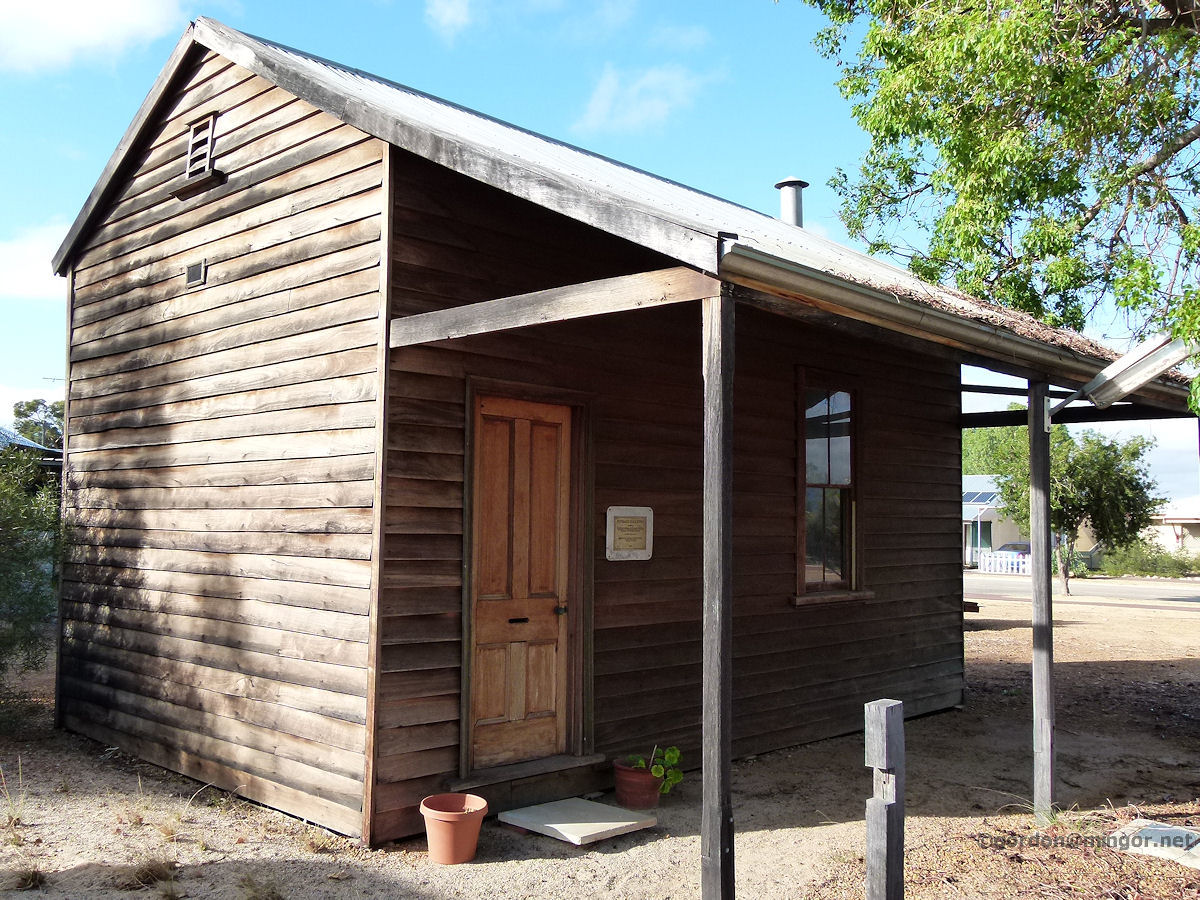 |
Nungarin - Road Board The former Nungarin Road Board Office, 1922 to 1936. The Board was founded in 1921. March 2015. Photos Ref: NUNG001 |
||
 |
Nungarin - Primary School A glimpse down a face of the Nungarin Primary School. March 2015. Photos Ref: NUNG002 |
||
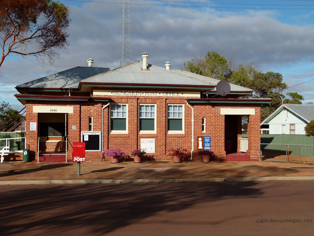 |
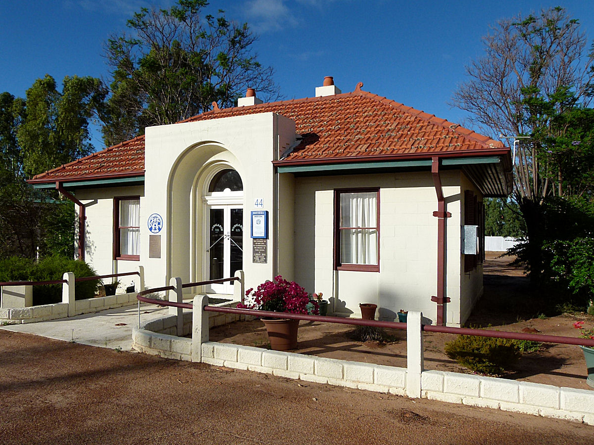
Nungarin - Post Office Nungarin Post Office, 6490. This was built in 1925. March 2015. Photos Ref: NUNG003 |
||
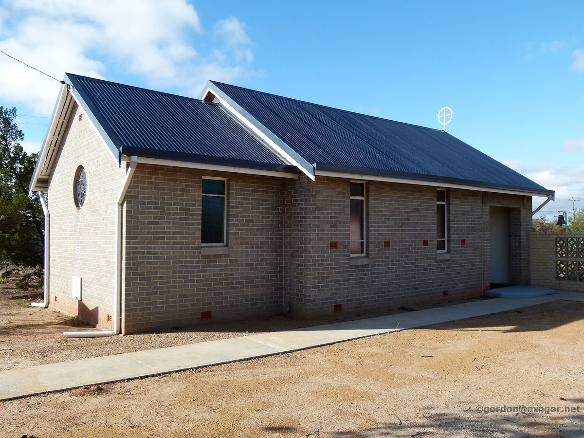 |
Nungarin - Anglican Church St Thomas the Apostle Anglican Church. This church was consecrated by The Most Reverend R. W. H. Moline on November 16th, 1955. March 2015. Photos Ref: NUNG004 |
||
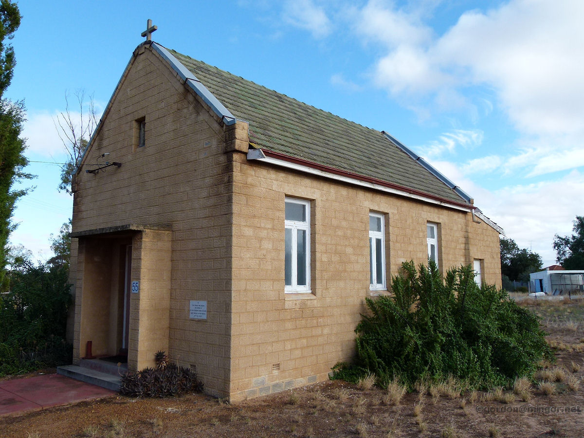 |
Nungarin - Catholic Church St Teresa's Catholic Church, Nungarin. There is no outward sign on or around the building stating this name. The Foundation Stone proclaims the church was opened and blessed by the Rt. Rev. Gregory Gomez, Abbot Nullius of New Norcia, on November 21st, 1954. March 2015. Photos Ref: NUNG005 |
||
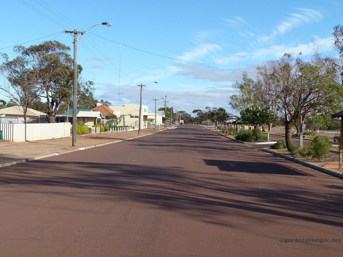 |
Nungarin - Railway Avenue A view from near the hotel looking north. The building with a dash of green up top is W.S. Waterhouse & Sons. March 2015. Photos Ref: NUNG006 |
||
 |
Nungarin - CWA Building The Nungarin C.W.A. building was opened on September 17th, 1936. The commemorative plaque was unveiled by J. Jolly Esq. March 2015. Photos Ref: NUNG007 |
||
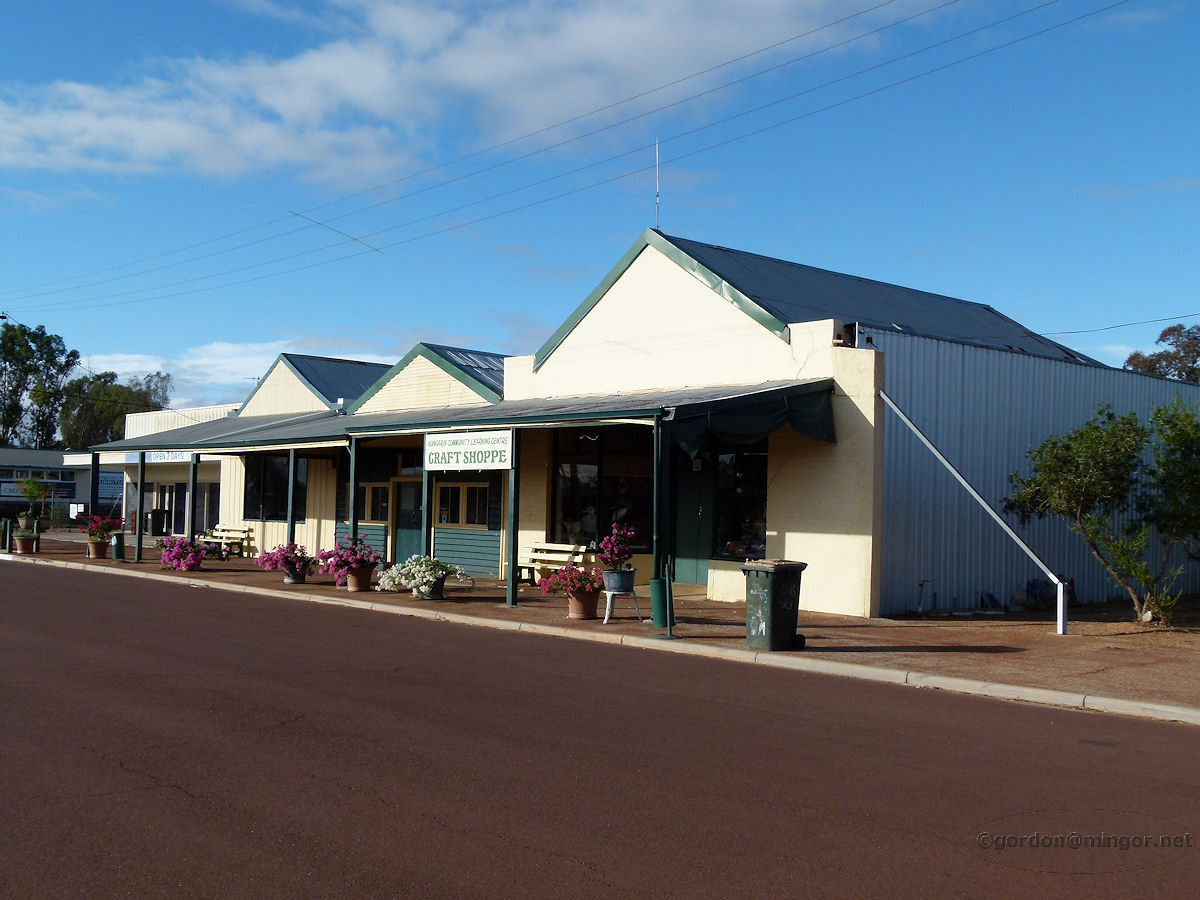 |
Nungarin - Craft Shoppe Nungarin Community Learning Centre Craft Shoppe on Railway Avenue. March 2015. Photos Ref: NUNG008 |
||
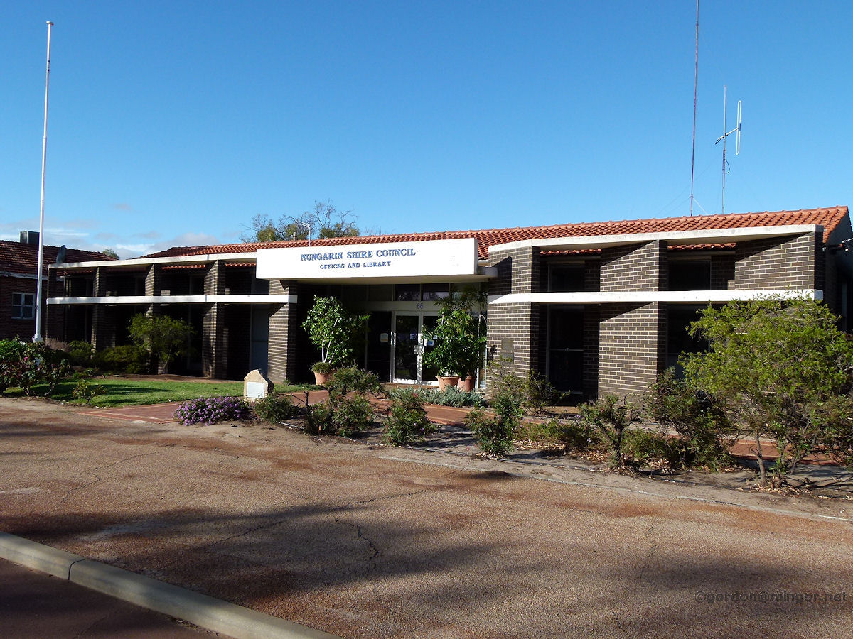 |
Nungarin - Shire Office The smart and modern Shire of Nungarin administration offices. This office and library were opened on December 12th, 1968 by Hon. L. A. Logan, Minister for Local Government. March 2015. Photos Ref: NUNG009 |
||
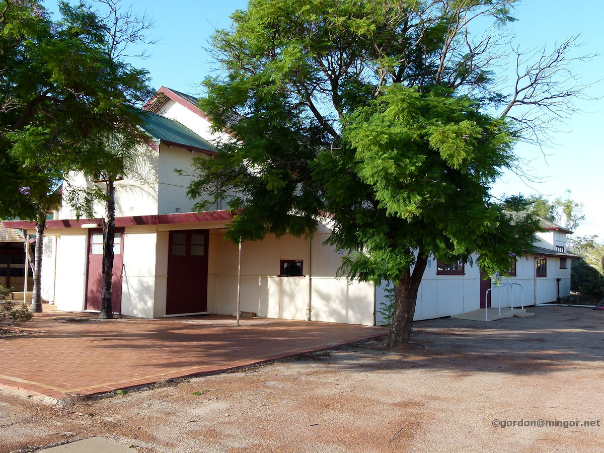 |
Nungarin - Agricultural Hall The old Agricultural Hall on Railway Avenue. This was constructed circa 1913 and probably extended and enhanced over the years. March 2015. Photos Ref: NUNG010 |
||
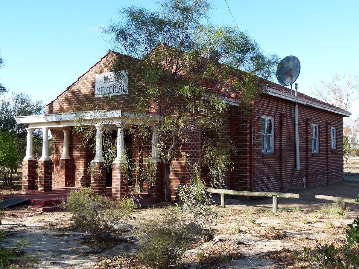 |
Nungarin - Memorial Hall The former Memorial Hall now home to the Natural Resource Management Office. The Hall was built in memory of those who died in the two world wars. It was opened on September 4th, 1957 by Sir Charles Gardiner, Governor. The building was erected by the Nungarin Sub Branch RSL, the Nungarin Masonic Lodge, and the Nungarin Scout and Guide Group. March 2015. Photos Ref: NUNG011 |
||
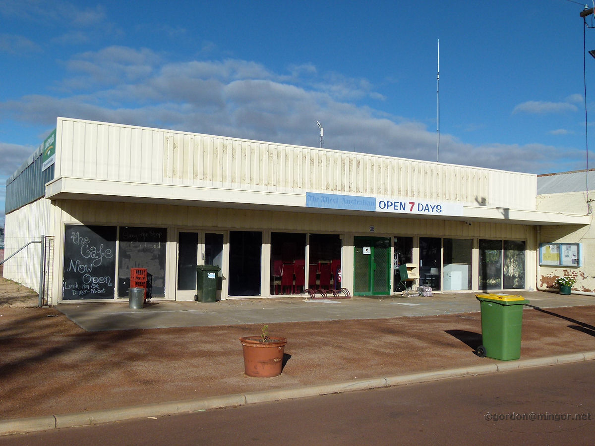 |
Nungarin - Fuel Depot The local cafe and fuel depot, open seven days, on Railway Parade. All locked up today so no fuel. March 2015. Photos Ref: NUNG012 |
||
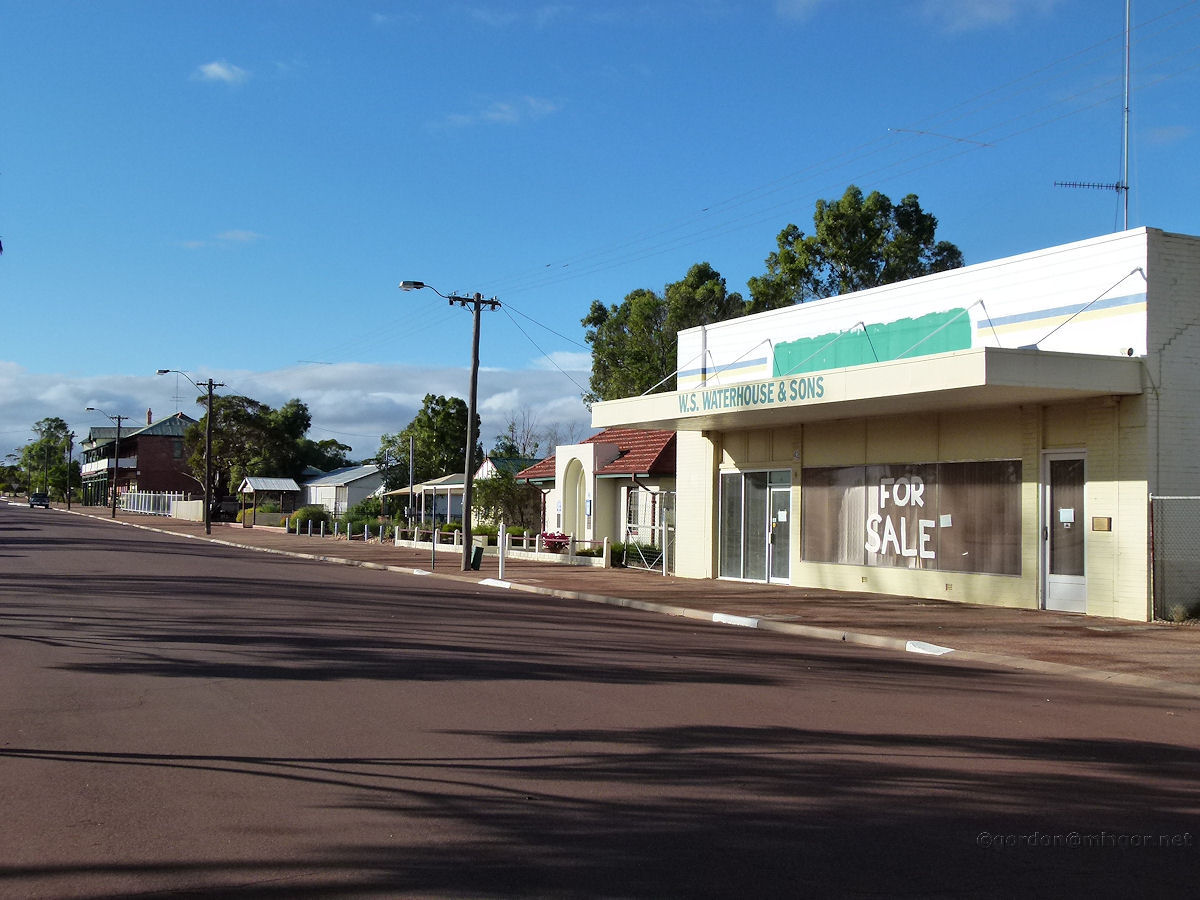 |
Nungarin - Railway Avenue A view looking south down Railway Avenue. Beyond W.S. Waterhouse & Sons is the C.W.A. building. The Woolshed Hotel is off to the left. March 2015. Photos Ref: NUNG013 |
||
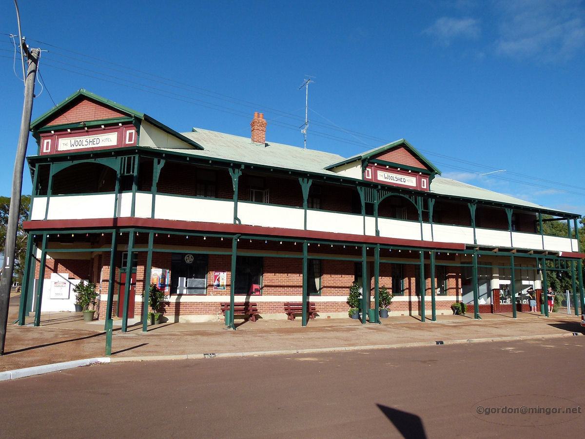 |
Nungarin - Woolshed Hotel The Woolshed Hotel on the Railway Avenue. This was erected in 1929 and was previously known as the Nungarin Hotel. March 2015. Photos Ref: NUNG014 |
||
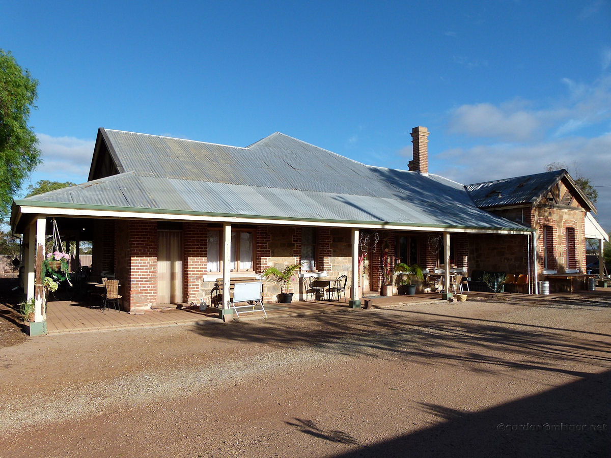 |
Nungarin - McCorry's Hotel McCorry's Hotel is a little north of town and about 1km east. The sign says "Old McCorry's Hotel, Bed & Breakfast, Deli, Takeaways, Caravan Park and Restaurant", followed by 9046 5187 if you'd care to call them. It was constructed in 1912 and was formerly known as St Lawrence House (or Inn). March 2015. Photos Ref: NUNG015 |
||
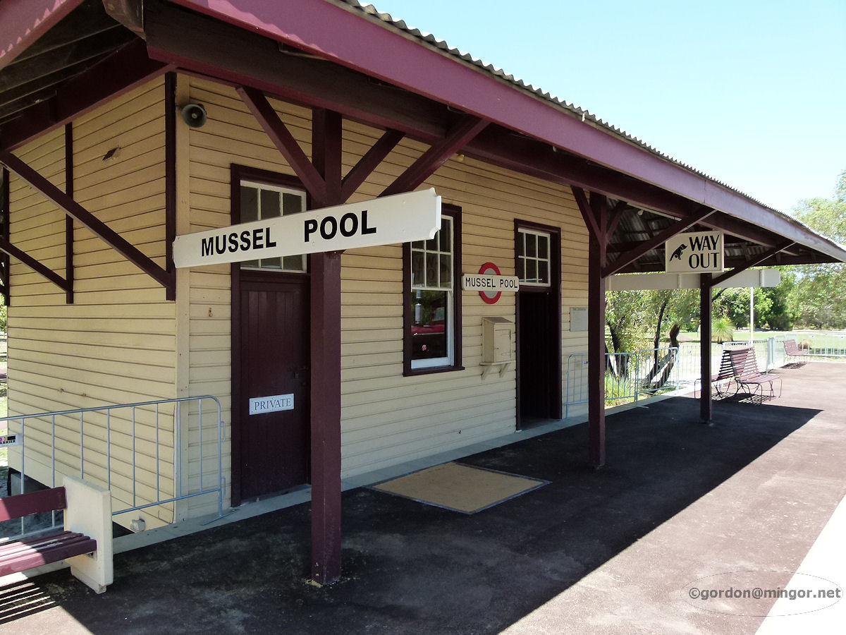 |
Nungarin - Railway Station The Nungarin railway station. This is now located in Whiteman Park, a suburb of Perth, on the Bennett Brook railway, along with the old Subiaco and East Perth station buildings plus various signal boxes from around the state. This station was built in Nungarin around 1943 and closed in 1973. December 2010. Photos Ref: NUNG016 |
||
All images published on this website are copyright © of the webmaster. See About section for clarification and special schools permission |
|||