| Photographs of Perth, Western Australia | |||
Waroona - Photographs of Western Australia Waroona is a medium-sized town on the South Western Highway between Pinjarra and Yarloop, 112 kms south of Perth. In 1893 the locality was named Drake's Brook when the southern rail line was built and was named after local landowner Mr Drake. Later this was shortened to Drakesbrook. In 1895 a timber mill was established 2 kms north of town and its rail siding was named McDowell's. This changed to Waroona in 1897 then the whole district in 1946 |
|||
| North to Coolup | South to Hamel | ||
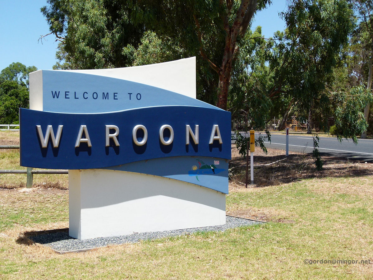 |
Waroona - Welcome Sign Welcome to Waroona, this sign proclaims, sitting alongside the South Western Highway on the north side of town. January 2014. Photos Ref: WARN001 |
||
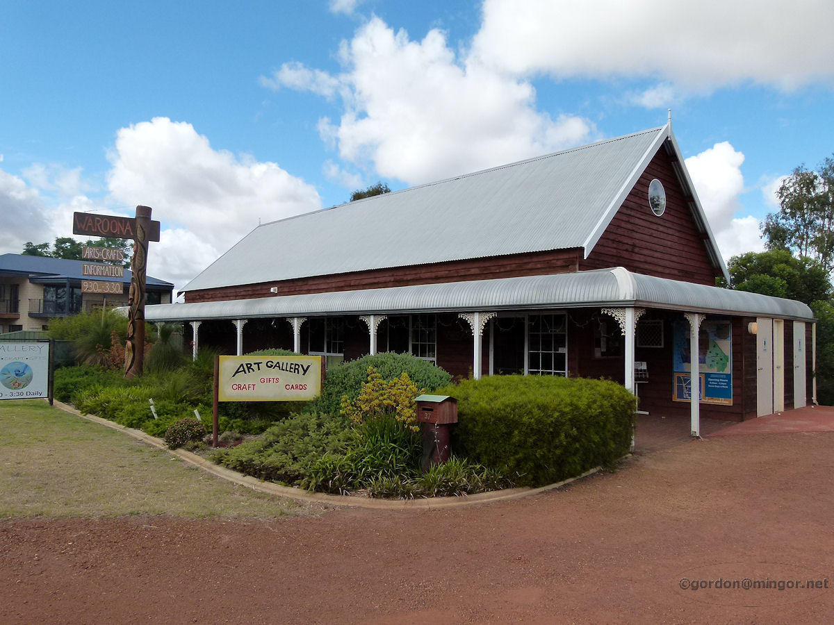 |
Waroona - Arts Centre One of the first buildings to be encountered when entering Waroona from the north is this rather attractive looking Art Gallery and Craft Centre. Undoubtedly build of local wood, perhaps re-cycled. December 2010. Photos Ref: WARN002 |
||
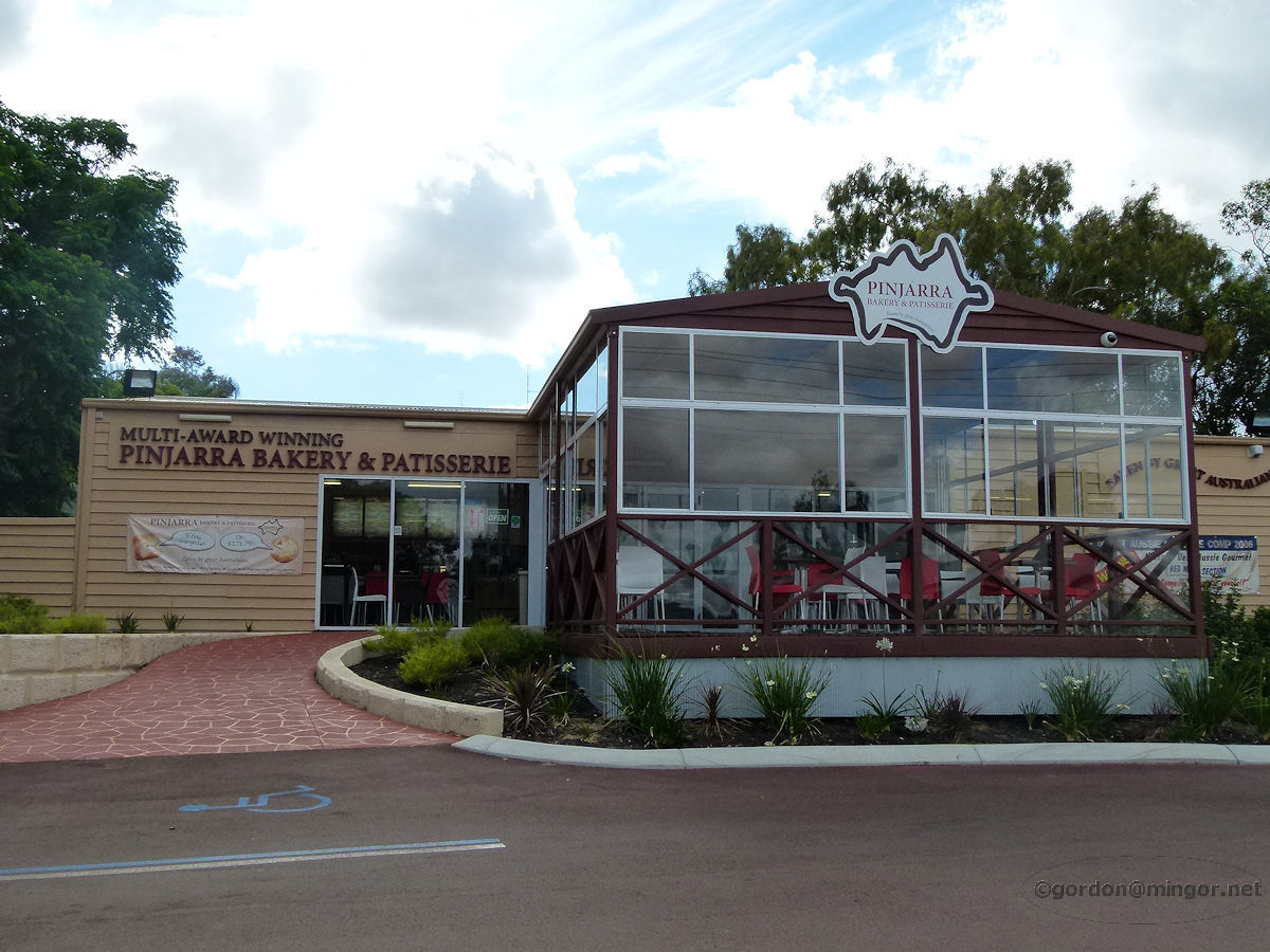 |
Waroona - Pinjarra Bakery The Pinjarra Bakery and Patisserie is next door to the Arts Centre. Pinjarra Bakery has three retails outlets. This one in Waroona, one in Pinjarra and another one in Maddington. December 2010. Photos Ref: WARN003 |
||
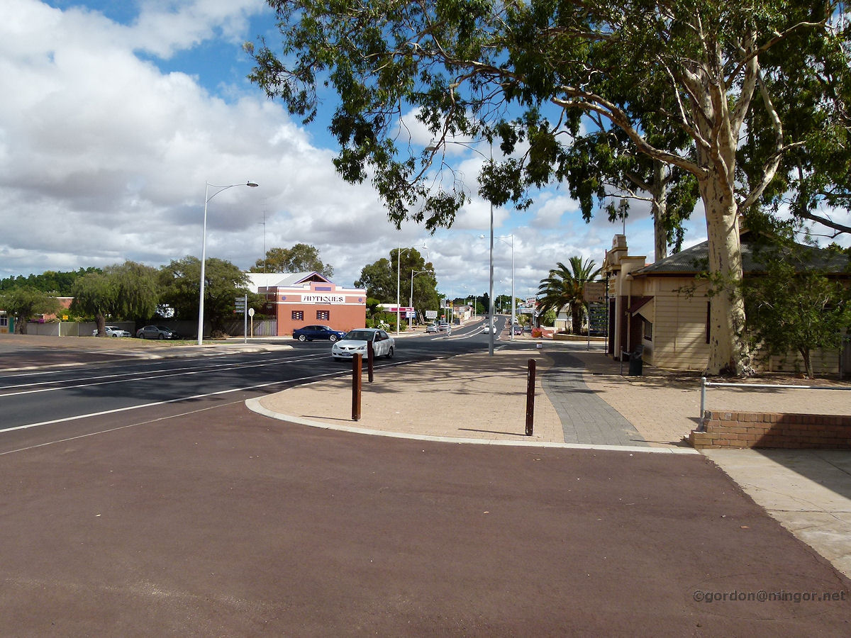 |
Waroona - Highway Looking North A section of the South Western Highway as it runs through Waroona. This view is looking north. December 2010. Photos Ref: WARN004 |
||
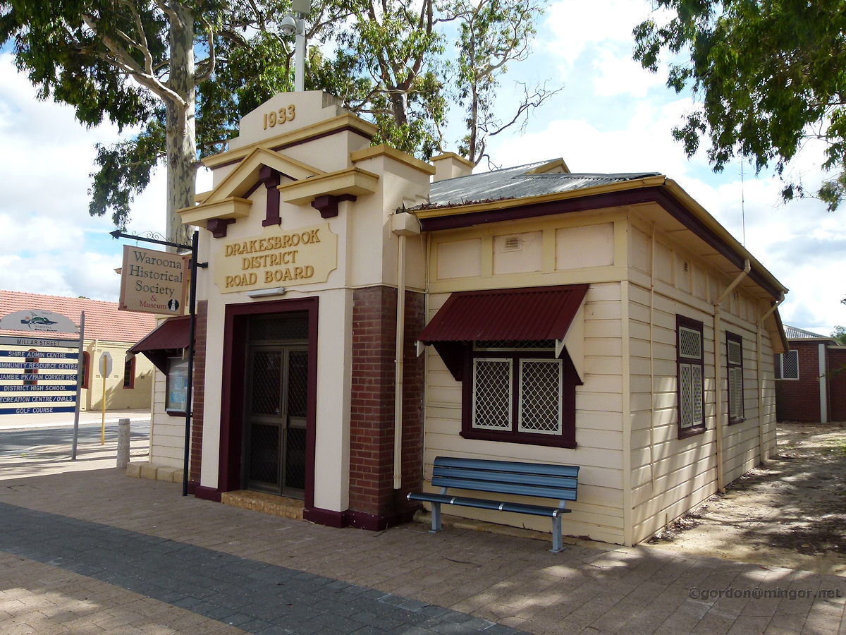 |
Waroona - Road Board Building Originally the Drakesbrook District Road Board, this is now the Waroona Historical Society and Museum. The first Road Board building was erected in Waroona in 1905. The current structure, erected in 1933, replaced the original building. From 1963 these premises were used as the local library for a number of years. December 2010. Photos Ref: WARN005 |
||
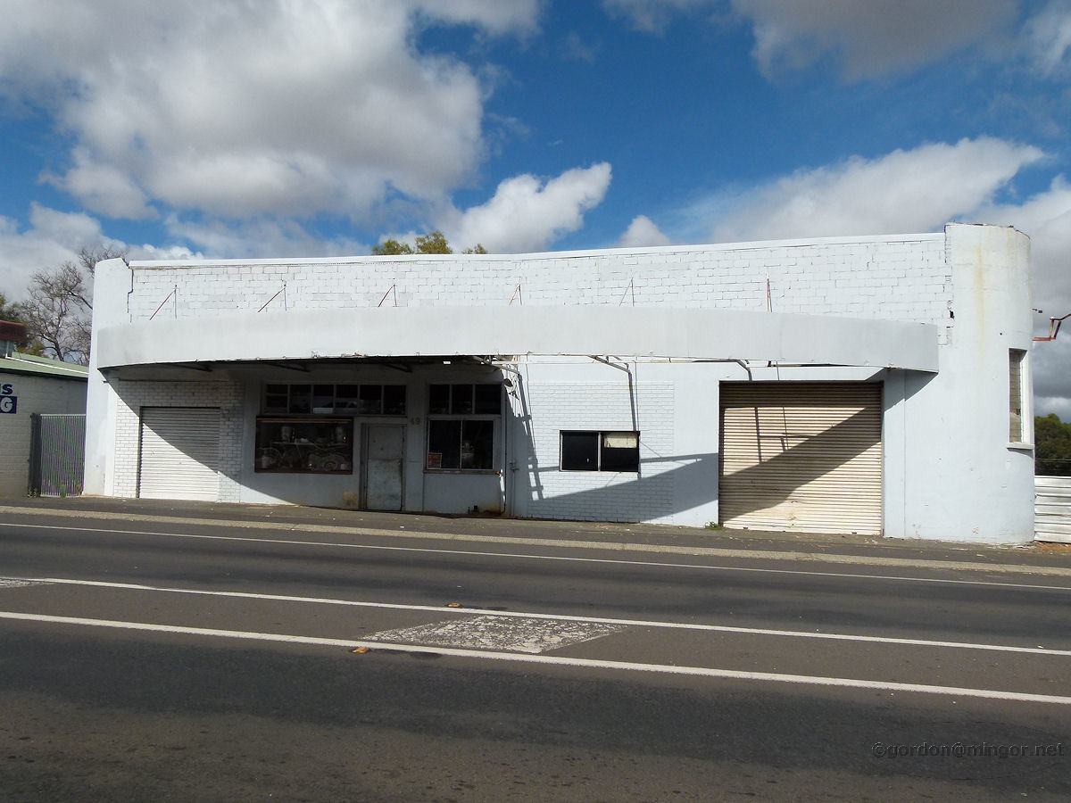 |
Waroona - Old Road House Dotted up and down the highway in most towns are abandoned road houses. Waroona has this one. December 2010. Photos Ref: WARN006 |
||
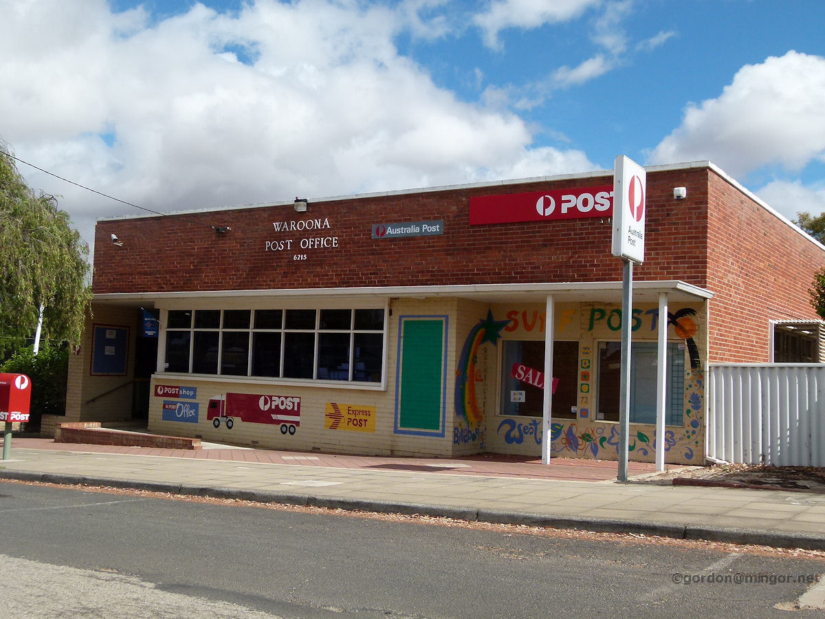 |
Waroona - Post Office The Waroona post office is a little more modern looking than its counterparts in other towns. Construction date is unknown but it looks of 1960's vintage or later. December 2010. Photos Ref: WARN007 |
||
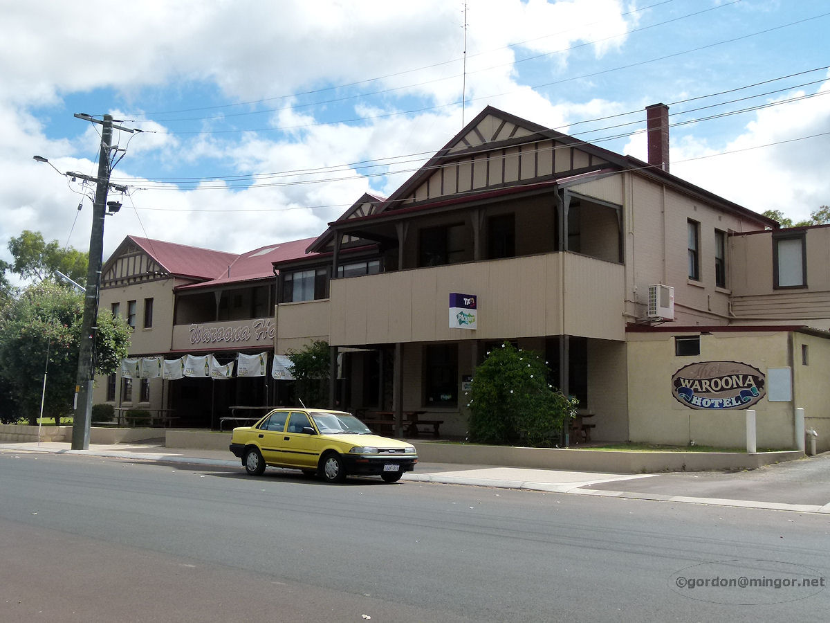 |
Waroona - Hotel The Waroona Hotel, the only hotel now in town. The hotel faces Fouracre Street not far from the railway line. This was constructed circa 1920 and was then known as the New Farmers' Arms Hotel. There used to be three hotels in Waroona, the last of the other two being demolished in the late 1960's. December 2010. Photos Ref: WARN008 |
||
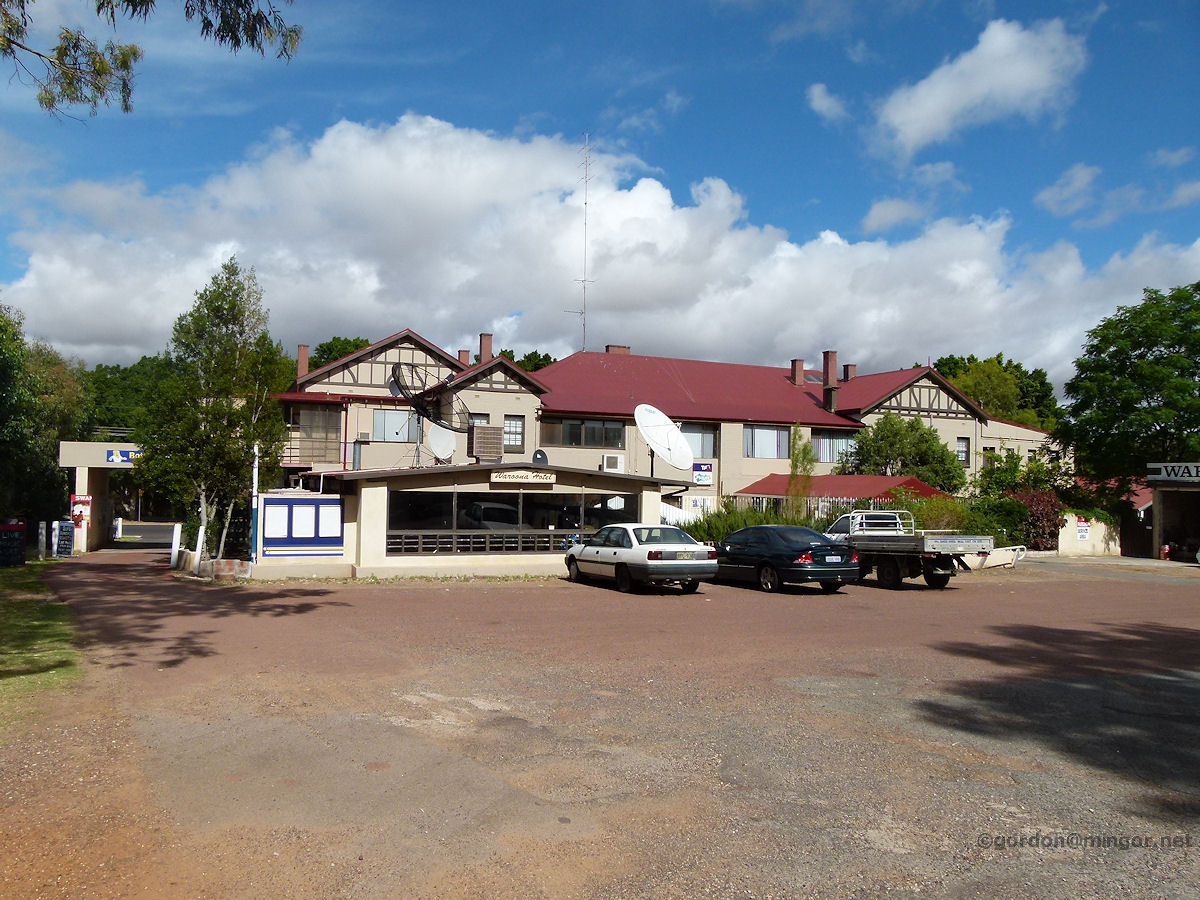 |
Waroona - Hotel A rear view of the Waroona Hotel. This is how it looks from up on the South Western Highway. December 2010. Photos Ref: WARN009 |
||
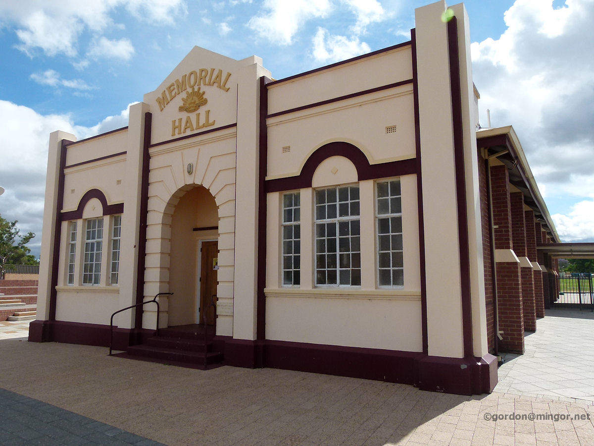 |
Waroona - RSL Memorial Hall The RSL Memorial Hall. This was built in 1932 and the Foundation Stone was laid by the then Premier, Ross McLarty. December 2010. Photos Ref: WARN010 |
||
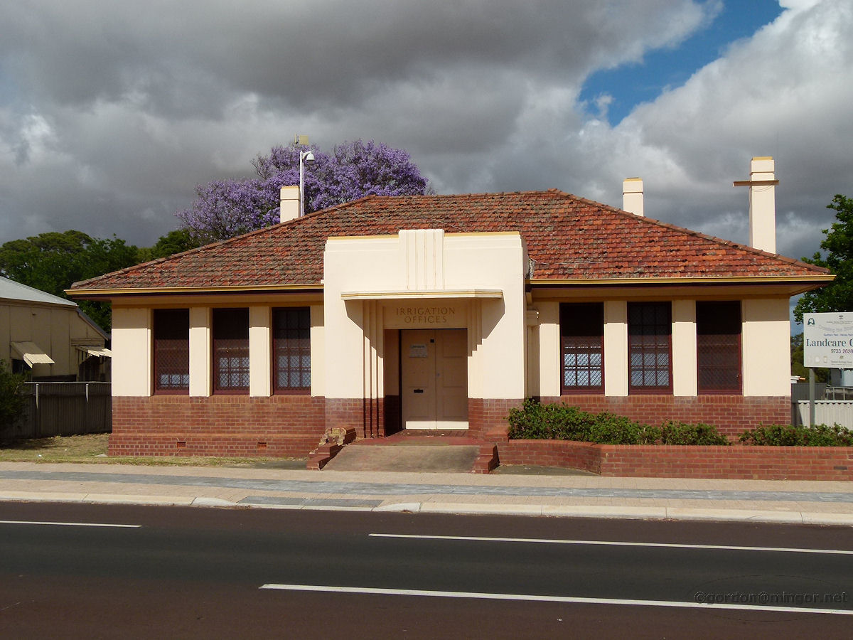 |
Waroona - Irrigation Office The Irrigation Offices on the main street. Irrigation for agriculture once proliferated in the Brunswick - Harvey - Waroona areas. Indeed the waters of Lake Navarino are still used as such. This building was erected in 1941. December 2010. Photos Ref: WARN011 |
||
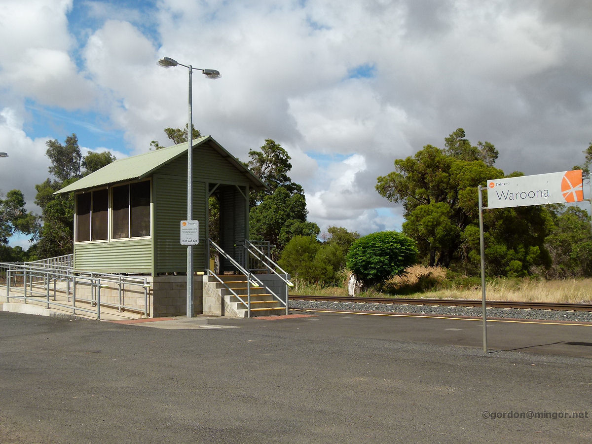 |
Waroona - Railway Station The current railway station at Waroona. Years ago there would have been a wooden station structure of somewhat larger proportions. December 2010. Photos Ref: WARN012 |
||
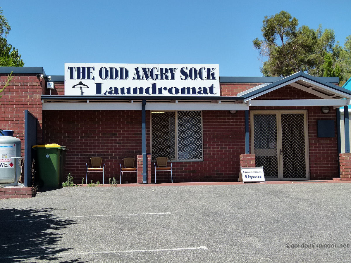 |
Waroona - Laundromat The Odd Angry Sock is the local laundromat, the name being a good pun. February 2011. Photos Ref: WARN013 |
||
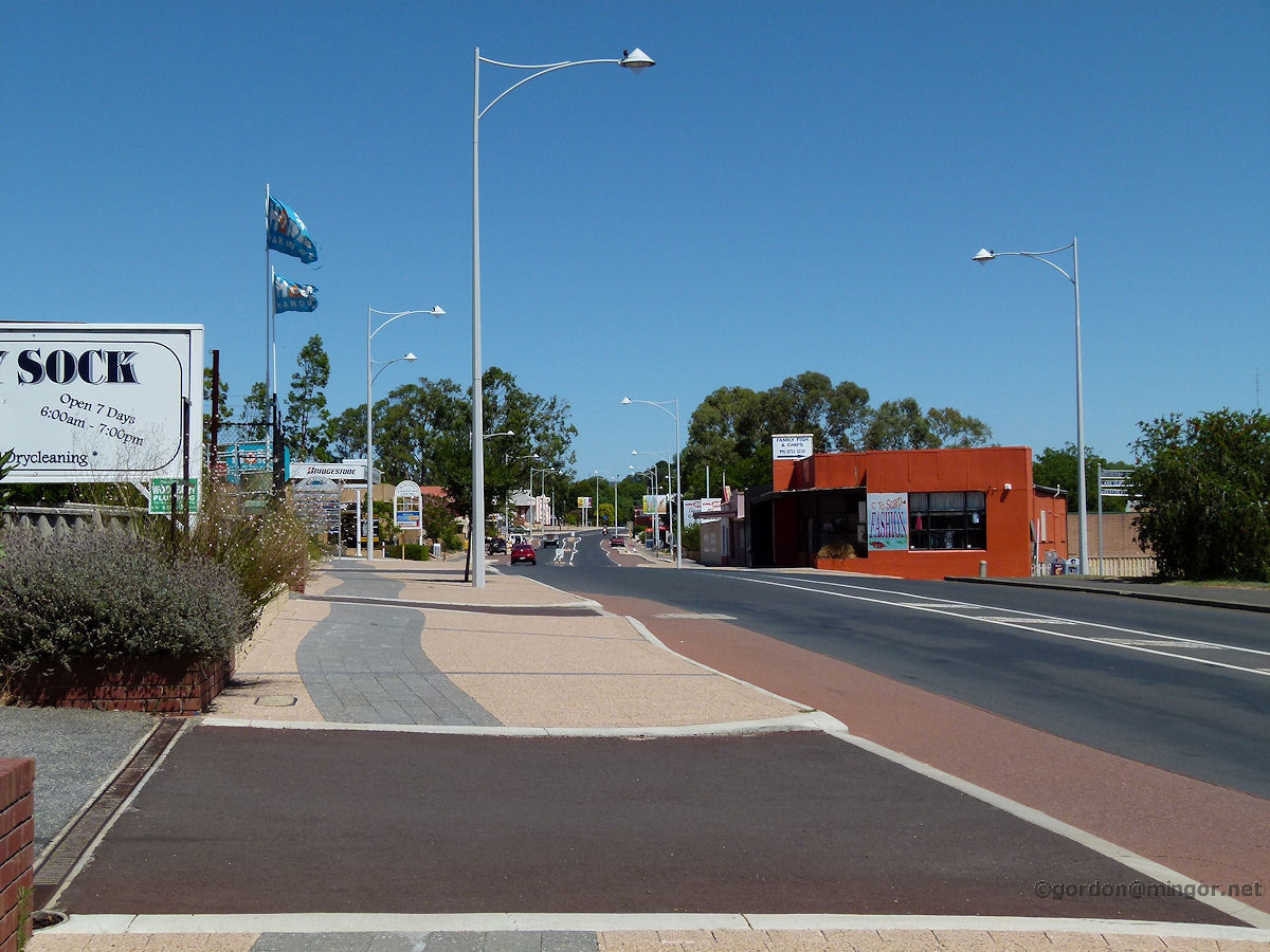 |
Waroona - Highway Looking South Here is the highway again, this time looking south. February 2011. Photos Ref: WARN014 |
||
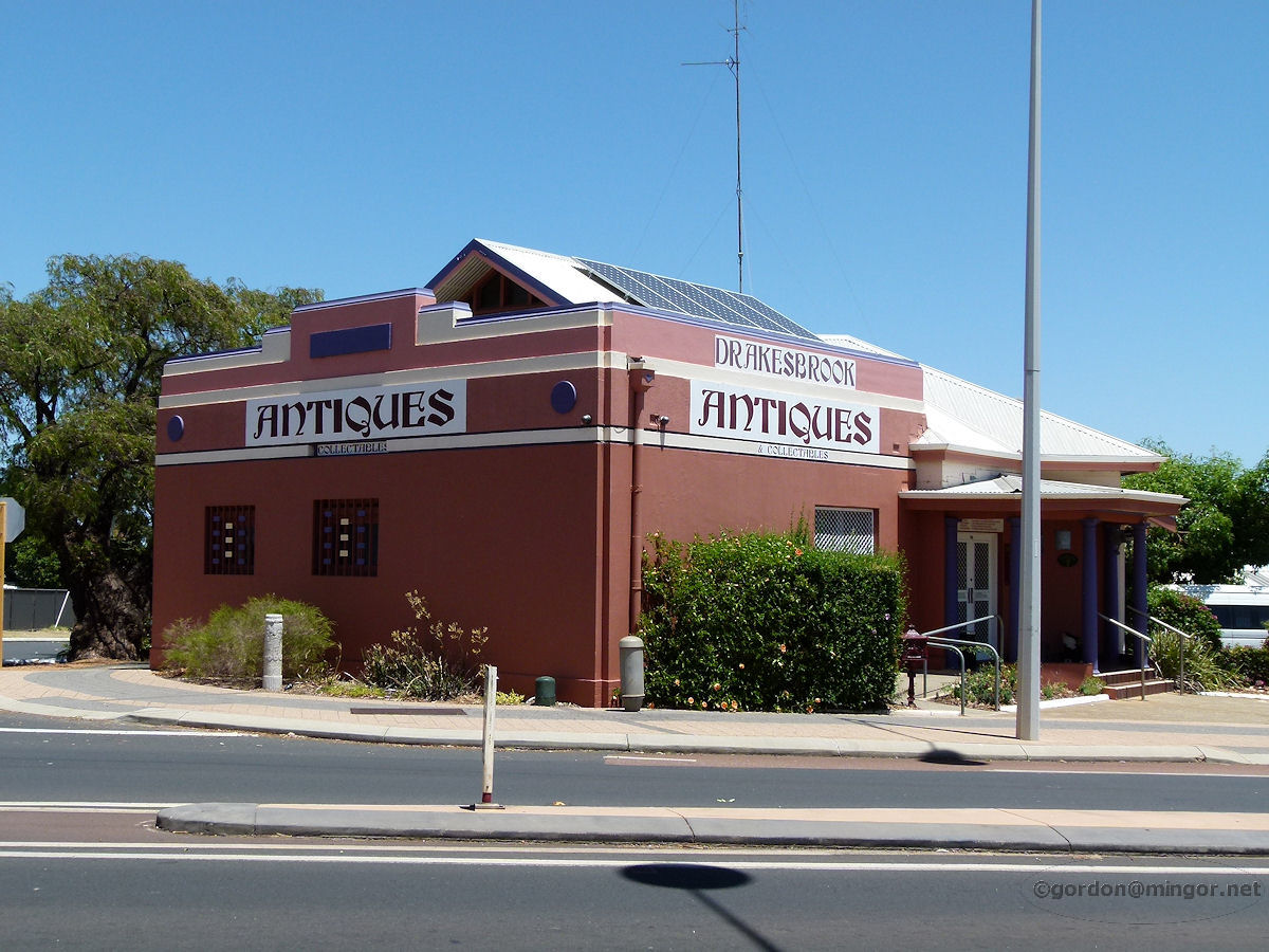 |
Waroona - Bank of New South Wales Building This building is the former Bank of New South Wales and was constructed in 1935. Now this is home of Drakesbrook Antiques and Collectables, purveyors of many fine products including Moorcroft china. January 2014. Photos Ref: WARN015 |
||
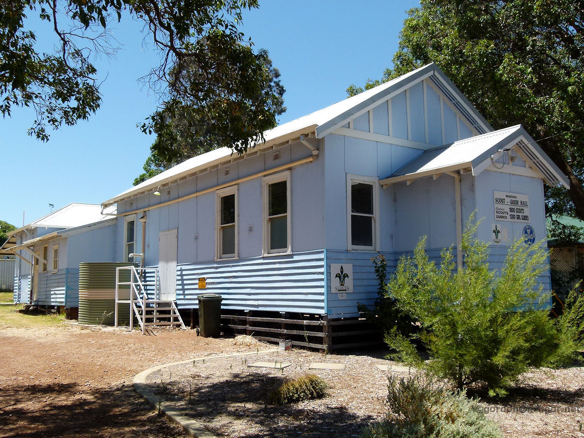 |
Waroona - Guides and Scouts Hall On Fouracre Street nearly opposite the railway station is this old wooden Guides and Scouts Hall. A Shire of Waroona Heritage Report (2001) suggests construction was in 1941 though it looks somewhat older. At one time this was a Salvation Army Hall, later a Baptist Church and from the 1970's it became the Guides and Scouts Hall. January 2014. Photos Ref: WARN016 |
||
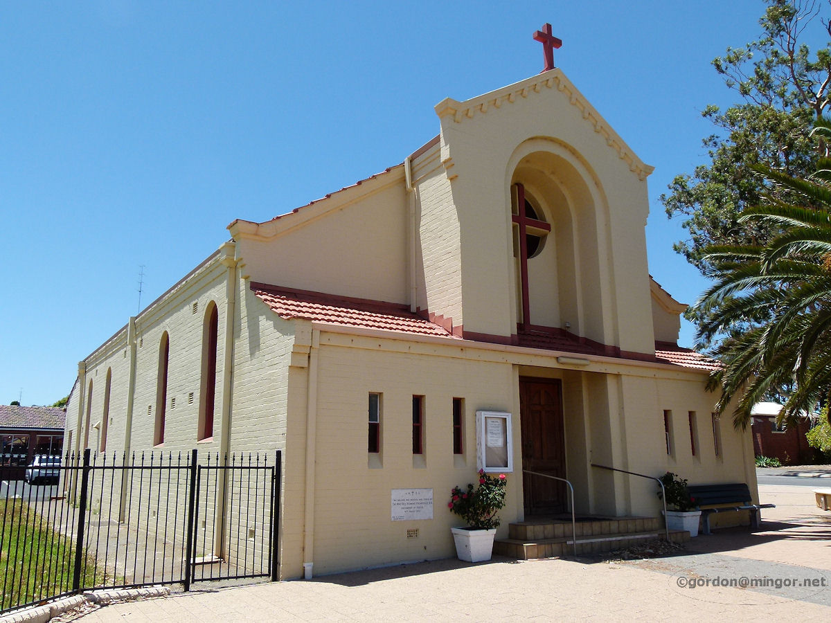 |
Waroona - Catholic Church St Patrick's Catholic church on the South Western Highway in the centre of Waroona. The Foundation Stone was laid by Most Rev. Redmond Prendiville, Archbishop of Perth, on 10th August 1941. January 2014. Photos Ref: WARN017 |
||
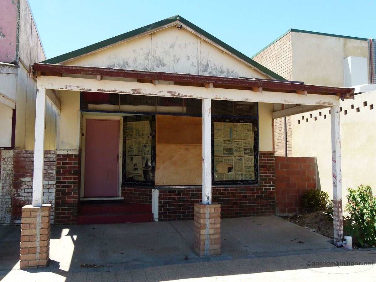 |
Waroona - Abandoned Shop An old, abandoned shop on Fouracre Street. It actually looks quite historic and has charm. The newspapers stuck to the windows are dated 2009 which may mean it's been a while since this building was used. January 2014. Photos Ref: WARN018 |
||
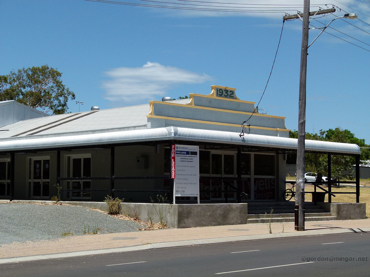 |
Waroona - Old Peel Laundry On Fouracre Street is the former Peel Laundry building which was constructed in 1932. January 2014. Photos Ref: WARN019 |
||
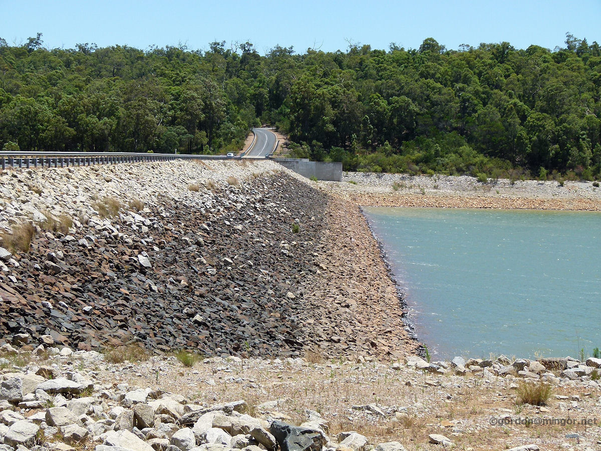 |
Waroona - Dam Wall The Waroona Dam. This was built in 1966 and collects water from Drakes Brook. As with many other dams up and down the country, the water level is pretty low. The reservoir formed by the dam is known as Lake Navarino. January 2014. Photos Ref: WARN020 |
||
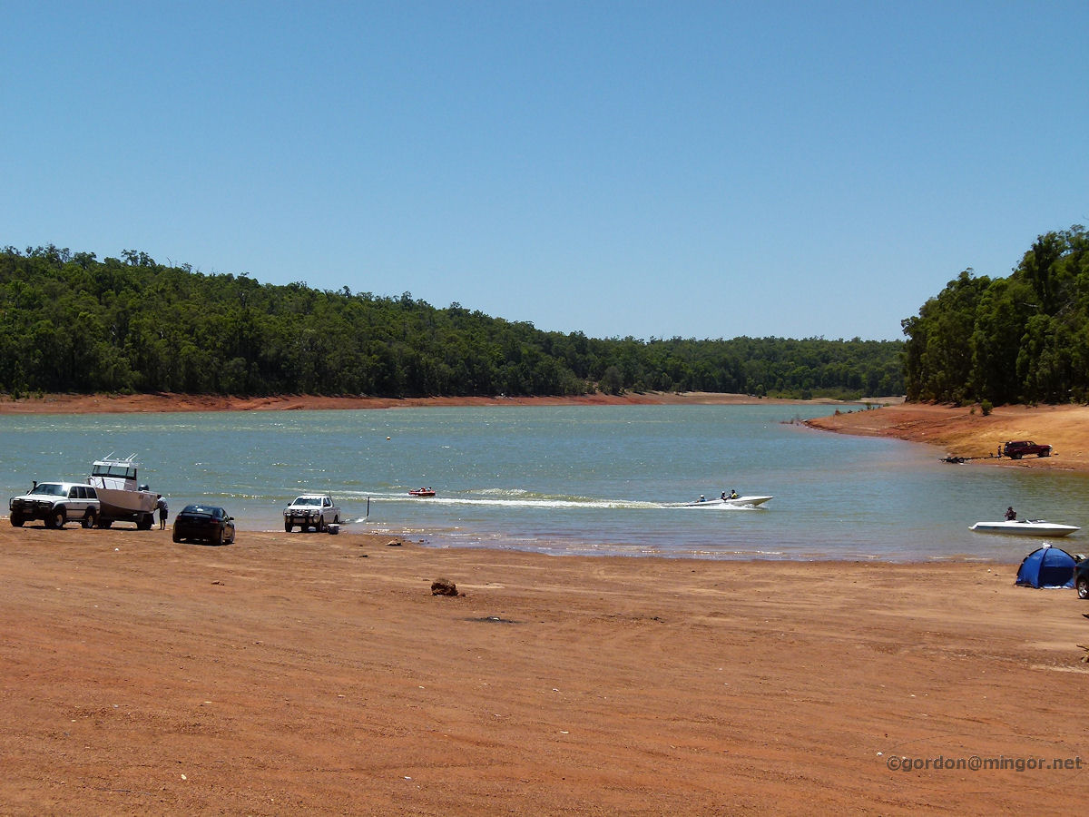 |
Waroona - Lake Navarino Since water from the dam is mostly used for agricultural irrigation, the lake can be used for recreational activities such as boating and water-skiing. There are a number of campsites along the lake which take advantage of the situation. Vehicles drive over the compacted former lake floor to reach the water. January 2014. Photos Ref: WARN021 |
||
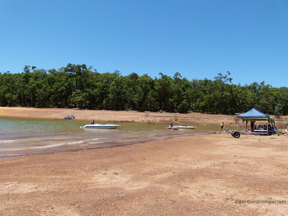 |
Waroona - Lake Navarino Holiday makers enjoying a day out at Lake Navarino. A great spot to be on a hot day. The fishing is supposed to be pretty good here too. Marron can also be caught here in season. January 2014. Photos Ref: WARN022 |
||
All images published on this website are copyright © of the webmaster. See About section for clarification and special schools permission |
|||